username
X
password
register
for free!
help
ArticlesGuidesRoutes
 
Photosets
 
 Comments
triplogs   photosets   labels comments more
South Fork Trail #46 - 19 members in 60 triplogs have rated this an average 3.3 ( 1 to 5 best )
1, 2, 3  Next
60 triplogs
login for filter options
Nov 08 2024
avatar

 Guides 59
 Routes 1,100
 Photos 1,191
 Triplogs 1,290

male
 Joined Jan 01 2023
 Arizona
South Fork - Gold Ridge LoopPayson, AZ
Payson, AZ
Hiking avatar Nov 08 2024
pseudalpineTriplogs 1,290
Hiking13.35 Miles 3,105 AEG
Hiking13.35 Miles   5 Hrs   22 Mns   3.02 mph
3,105 ft AEG      57 Mns Break
 
no photosets
1st trip
Partners none no partners
Route Scout Route Recorded  on Route Scout | Pop | Map | Popup | MapDEX
Pleasantly surprised by how good of shape Gold Ridge Trail is currently. The same can't be said about the return hike down South Fork. I doubt I'll hike either of these trails again unless my wife suggests it (unlikely). I'd go again with her on Gold Ridge, but I'd prefer to stay married, so South Fork would be a hard no. It's not really a trail anymore, more like a route involving >50% bushwacking, weird obscure bypasses and a bunch of downfall steeplechase. There were a few enchanting spots in South Fork, but mostly it's another forest bath with a bunch of bear poop along the route. Lots of hunters near the bottom and the top sections, but no deer sightings. I think they're all going to be disappointed with their hunts in this area.
foliage observationfoliage observationfoliage observationfoliage observationfoliage observation
Autumn Foliage Observation Substantial

water 1 out of 5water 2 out of 5water less than maxwater less than max Pigeon Spring Quart per minute Quart per minute
Numerous pools throughout South Fork.
  3 archives
Nov 30 2023
avatar

 Photos 15
 Triplogs 6

male
 Joined Nov 15 2023
 Pine, AZ
South Fork Trail #46Payson, AZ
Payson, AZ
Hiking avatar Nov 30 2023
BiotiteMTriplogs 6
Hiking6.60 Miles 783 AEG
Hiking6.60 Miles   3 Hrs   26 Mns   1.92 mph
783 ft AEG
 no routesno photosets
1st trip
Linked   none no linked trail guides
Partners none no partners
My hiking partner and I arrived at the Deer Creek trailhead just after 9 am, and only one other car was present.

Things were kicked off right at the beginning as we approached the trailhead sign. Off to our left (east), a covey of Gambel's Quail suddenly scattered out of the mesquite and scrub oak and flew about 40 yards away from the parking lot. About 30 seconds later, after our attention had already returned to the trail, panicked quail squawks made us do a double take. A singular male quail was in frantic flight, emitting rapid-fire spik calls as if pleading for his life. Right on his tail and seemingly with a missile lock tone was a Cooper's Hawk in hot pursuit. We watched as the quail dove into another chaparral thicket, and the hungry accipiter followed. Despite the sounds of crashing brush and more cries from the quail, we couldn't tell who won the contest.

The beginning of this hike was nice, of course, if you didn't mind the roar of Highway 87 off to the right. The trail rolled through a semi-desert grassland of Mesquite, catclaw, Hedgehog Cacti, and Prickly Pear, with the Mazatzals dominating the skyline to the left. About a quarter mile from the trailhead, the Gold Ridge Trail peeled off to the left. I couldn't quite tell which one of the badly eroded paths was the official trail.

After a gate and another quarter mile, the lefthand turnoff for South Fork #46 appeared and began descending to the South Fork of Deer Creek. Where the trail reaches the bottom of the valley, the creek was dry, and if it wasn't for the scattered Sycamores and Cottonwoods still recovering from the Willow Fire over a decade ago, one would have assumed this was just one of the many ephemeral washes in the southwest which only flows after heavy rain or snowfall.

One thing became quickly apparent on this hike. This was a trail for the cairn lovers. Even in places where the path was obvious, rock piles appear every 50-100 feet or so. I would advise caution following these, as we realized on the way back that contradicting cairns will lead you down unofficial paths and into tricky debris piles and stream crossings.

Despite the odd cairn placement, the first 2.5 miles of the South Fork trail was relatively easy for experienced hikers and would probably be considered moderate for the inexperienced. The terrain and plant community changed almost constantly. This is the naturalist's dream trail, and I could only imagine what it would be like in the spring and early summer with the creek running and the flowers blooming.

About 3 miles in was a lovely short gorge of bluish-gray rock where Deer Creek cascaded into a series of deep potholes. On our hike these cascades were dry, and I hope to return one day when they are running. Shortly after this cascade, the trail conditions took a turn for the worse, with us relying heavily on cairns, frequently pushing aside brush and branches.

Our stopping point was about 3.3 miles in at a small area where the creek was (barely) flowing probably with the help of perennial springs. As the creek splashed through some geologically incredible boulders, the floor and bank of the tiny brook was lined with some of the most brilliant emerald green moss I've ever encountered anywhere outside of the Pacific Northwest or Yellowstone National Park Thermal Areas.

The hike back was easy to retrace the trail, except for one spot where a poorly placed cairn sent us in the wrong direction, resulting in us scrambling up the side of the slope until we hit the trail.

Lots and lots of bear sign in this canyon as well.
foliage observationfoliage observationfoliage observationfoliage observationfoliage observation
Autumn Foliage Observation Moderate
Sycamores were on the way out, Ash and Cottonwoods were near peak.
wildflower observationwildflower observationwildflower observationwildflower observationwildflower observation
Wildflowers Observation Isolated
A few small flowers blooming. Everything else was in seed.
 
Nov 04 2023
avatar

 Guides 25
 Routes 377
 Photos 5,927
 Triplogs 347

40 male
 Joined Mar 01 2018
 Chandler, AZ
South Fork - Gold Ridge LoopPayson, AZ
Payson, AZ
Hiking avatar Nov 04 2023
John10sTriplogs 347
Hiking14.98 Miles 3,501 AEG
Hiking14.98 Miles   10 Hrs   15 Mns   1.59 mph
3,501 ft AEG      50 Mns Break
 
1st trip
Partners partners
TboneKathy
Route Scout Route Recorded  on Route Scout | Pop | Map | Popup | MapDEX
This was the third weekend out of the last four that I hiked in the Mazatzals...didn't plan it that way, but it's hard to beat great views and a relatively short drive. This was the first time either of us had started from Deer Creek Trailhead, and both trails on the South Fork-Gold Ridge loop were also new ones for us. There were a few vehicles and a hunter in the parking lot when we arrived ~7AM, and it was in the mid/upper-40s and pretty comfortable as we set out.

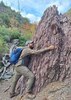
We hiked the loop clockwise, turning left off Deer Creek Trail to start up Gold Ridge Trail. As advertised, it was wide and well maintained and gained a lot of elevation, with some steep/loose sections on the way up...but it was efficient and didn't waste time with switchbacks :). A little over 3.5 miles in, I left the trail to go up to the "GOLD" benchmark on peak/hill 5776. It's only a quarter mile off the trail but pretty brushy getting up there. I pulled out the gloves and clippers again and picked up another round of Mazatzal scratches to add to the collection.

But it was a worthwhile detour--it's a unique "double gold" benchmark, both gold in color, which I'd never seen, and also stamped with the "GOLD" name. Plus it's set on a beautiful multi-colored rock outcropping. I found it hidden under a rock as FLYING FLIVER described in an old triplog, and I noticed it doesn't have a triangle symbol like most benchmarks...not sure if the triangle appears only on newer benchmarks, because this one was placed in 1926. Peak/hill 5776 isn't the highest point in the general vicinity, but the views are nice.

[ youtube video ]

I headed back down to the trail, and we continued along Gold Ridge to FR 3348 and crossed paths with a tarantula along the way. We followed 3348/201 past some nice campsites and started down South Fork Trail. Pigeon Spring had a pool of stagnant, algae-covered water near it, and the trail was hard to follow as we climbed over a lot of deadfall through the fire-damaged area around there. We eventually got down to the creek bed and picked up some cairns...it was slow going, but there was a lot of nice fall color along the creek. We saw occasional pools of water, but nothing too substantial after the dry year.

The loop is a tale of two halves...where Gold Ridge was wide, well-maintained, and extremely easy to follow, South Fork was the opposite--often hard to find, narrow, and overgrown. We climbed over and under a lot of deadfall along the way, and cairns made it easier to spot the trail further along, but the GPS often came in handy as well. The next few miles were a blur, following the trail as it alternated between following the rocky creek bed and climbing up onto one of the banks to bypass cliffs or large obstacles. There were a number of spots where the sloping, loose trail was very narrow as we passed some sheer drops--places where a slip would be very bad. After a few more years of erosion, some of those spots could get really interesting as the trail continues to wash out...

The cairn frequency increased as we got closer to the trailhead, and the canyon started to open up with ~2.5 miles remaining as the trail flattened out a little and became easier to follow, eventually crossing the wide wash and then leveling off to close the loop. We kept an eye out out for the old stone cabin mentioned in the guide but didn't see it...the guide is 20+ years old, so I'm guessing the cabin's not there anymore. Other than the hunter in the morning and a trail runner near the trailhead at the end of the day, we didn't see anyone all day. It was another fun one in the Mazatzals...lot of variety in the scenery, nice fall color and geology, and a double gold benchmark along the way.
 Geology
 Geology [ checklist ]
[ checklist ]  Jasper
 Meteorology
 Meteorology [ checklist ]
[ checklist ]  Autumn - Color Foliage
foliage observationfoliage observationfoliage observationfoliage observationfoliage observation
Autumn Foliage Observation Substantial
Lots of bright color along South Fork

water 1 out of 5water less than maxwater less than maxwater less than max Pigeon Spring Dripping Dripping
Stagnant, algae-covered pool near the wooden sign for the spring
 
Sep 30 2023
avatar

 Routes 4
 Photos 134
 Triplogs 19

54 male
 Joined Jan 07 2004
 Phoenix, AZ
South Fork Trail #46Payson, AZ
Payson, AZ
 Hiking avatar Sep 30 2023
louieTriplogs 19
 Hiking5.60 Miles 2,808 AEG
 Hiking5.60 Miles
2,808 ft AEG48 LBS Pack
 no routesno photosets
1st trip
Linked   none no linked trail guides
Partners none no partners
Did this as a little training hike for an upcoming Grand Canyon hike. It served its purpose well with enough up-and-down elevation to wear me out. The upper part of the trail could use some work. I always get sketched out when the trail has worn away to where it slopes steeply towards the downhill. About halfway up there is a magical shaded area with good water that even had a trickle to it. This seems like an area that would have water year-round. No good tent camping in this area, unfortunately. Although one might be able to figure out a way to hammock camp here. The most amazing part of this hike was Douglas firs at only 4500-foot elevation in the inner canyon. Where else in AZ can you find Douglas firs at such a low elevation? I was really confused about that as I expected to see ponderosas before Douglas firs, but I digress. I looked for the stone cabin Fritzski mentioned in the write-up for South Fork Gold Ridge Loop, but did not see it anywhere. It's been 22 years since that write-up, but if anyone knows what became of it I would be interested in the history of the structure. Got friendly with a stubborn rattlesnake camped on the side of the trail we had to move with a long stick. This was my first trip hiking this trail and thoroughly enjoyed it.
_____________________
Not all who wander are lost...
 
Apr 06 2023
avatar

 Guides 99
 Routes 1,487
 Photos 16,077
 Triplogs 1,377

male
 Joined Jan 07 2017
 Fountain Hills,
Mazzy Falls and Flowers, AZ 
Mazzy Falls and Flowers, AZ
 
Hiking avatar Apr 06 2023
DixieFlyerTriplogs 1,377
Hiking11.16 Miles 2,997 AEG
Hiking11.16 Miles
2,997 ft AEG
 
1st trip
Partners partners
SecretMtnLover
Route Scout Route Recorded  on Route Scout | Pop | Map | Popup | MapDEX
This was 2 different hikes in the Mazatzal Mountains to check out a waterfall and take a look at some wildflowers:
1) Rock Creek Trail to the falls
2) South Fork Trail

Rock Creek Falls
I had only been on the Rock Creek Trail once, on a hike to Peak 7571. This time I just went as far as Rock Creek Falls in order to check out the falls and see if there were any wildflowers blooming along the way.

From where I parked, the first 2.75 miles of the trail were in great shape, thanks to the efforts of @mazatzal , @sredfield , and others. The next 1/4 mile or so was slightly overgrown, but after that the trail was fairly brushy, but not impassable; and not too far from the falls.

There was some really good water flow at the falls, so the hike up was definitely worth it. If you ask me, I thought that these falls were better than Big Kahuna Falls on the Barnhardt Trail. We went a short distance past the falls to check out the view looking down on the falls -- this short trip was well worth it imho.

Wildflowers weren't great on the trail, but there were enough blooms to add some color to the hike.

I like the Rock Creek Trail -- it has good views both going up and coming back down, and there was sure a nice payoff on this trip. There is a good bit of elevation gain on the trail, so count on getting a decent workout.

South Fork Trail
A couple of years ago I did the Gold Ridge-South Fork loop, and there was a really nice wildflower showing on the South Fork Trail about 2 miles from the end of the hike. So we decided to start from the Deer Creek TH and hike a couple of miles up the South Fork Trail to check out the flowers. Unfortunately, the display this year was a bit underwhelming at this point. There were a number of flowers blooming, but I would call the display "moderate". The flowers were nice to look at, but I did not recommend going all the way out there to look at flowers -- there have been much better places to go this year.

Synopsis
Rock Creek Falls was the definite highlight of the day! The water flow is much better right now than it was last year at this time when I was there.

Distance and elevation gain for the 2 hikes are below. Stats above are the sum of the 2.
Rock Creek: 7.24 miles with 2,559 feet of AEG
South Fork: 3.91 miles with 438 feet of AEG
 Geology
 Geology [ checklist ]
[ checklist ]  Mazatzal Quartzite
wildflower observationwildflower observationwildflower observationwildflower observationwildflower observation
Wildflowers Observation Moderate
Wildflowers on the South Fork Trail were moderate; on the Rock Creek Trail I'd say that the flowers are lightly moderate.

water 1 out of 5water 2 out of 5water 3 out of 5water less than max Center Creek Medium flow Medium flow
There was a nice flow of water in the creek; some might describe the flow as "heavy" I suppose.

water 1 out of 5water 2 out of 5water 3 out of 5water 4 out of 5 Rock Creek Falls - Mazatzal Wilderness Heavy flow Heavy flow
There was a nice flow of water going over the falls; I would call it "heavy", but I am not certain how to distinguish "heavy" from "medium"
_____________________
Civilization is a nice place to visit but I wouldn't want to live there
  5 archives
Apr 11 2022
avatar

 Guides 99
 Routes 1,487
 Photos 16,077
 Triplogs 1,377

male
 Joined Jan 07 2017
 Fountain Hills,
South Fork - Gold Ridge LoopPayson, AZ
Payson, AZ
Hiking avatar Apr 11 2022
DixieFlyerTriplogs 1,377
Hiking13.80 Miles 3,427 AEG
Hiking13.80 Miles   7 Hrs   12 Mns   2.11 mph
3,427 ft AEG      39 Mns Break
 
Route Scout Route Recorded  on Route Scout | Pop | Map | Popup | MapDEX
I decided to do this loop to get a workout and to check out the wildflowers in the area.

I definitely got a workout going up the Deer Ridge Trail to Camp Grasshopper. There were quite a few flowers to see along the trail, and I also saw a gopher snake in the trail.

Going down the South Fork Trail was slow going. The trail is not easy to follow, but thankfully there were quite a few cairns which were helpful. There was water running along much of the South Fork, but the flow is less than what I have seen in other years. Wildflowers were nice in a one mile stretch of the South Fork Trail, about a mile from the TH. Owl clover is only about 3-4 inches high though.
 Fauna
 Fauna [ checklist ]
[ checklist ]  Gopher Snake
 Culture
 Culture [ checklist ]
[ checklist ]  Spring Box
wildflower observationwildflower observationwildflower observationwildflower observationwildflower observation
Wildflowers Observation Moderate
There were some nice flowers going up the Deer Ridge Trail; a section of the South Fork Trail about a mile from the TH was nice also.

water 1 out of 5water less than maxwater less than maxwater less than max Pigeon Spring Dripping Dripping
There was a pool of filterable water next to the sign for the spring, but the springbox was basically mud

water 1 out of 5water 2 out of 5water less than maxwater less than max South Fork Deer Creek Light flow Light flow
There was running water in many places in the creek, but the flow is not as great as I have seen it in the past
_____________________
Civilization is a nice place to visit but I wouldn't want to live there
 
Nov 06 2021
avatar

 Guides 94
 Routes 842
 Photos 22,068
 Triplogs 1,994

52 male
 Joined Sep 18 2002
 Tempe, AZ
Gold Fork Loop, AZ 
Gold Fork Loop, AZ
 
Hiking avatar Nov 06 2021
chumleyTriplogs 1,994
Hiking13.59 Miles 3,425 AEG
Hiking13.59 Miles   6 Hrs   19 Mns   2.27 mph
3,425 ft AEG      20 Mns Break
 no routes
1st trip
Partners partners
John9L
I had an evening event so this one made sense for a solid day that doesn't take too long and is close enough to get there and back without too much driving time. Caught a glimpse of an eagle as we drove over the Verde, which is always enjoyable.

A surprising number of vehicles at the trailhead to start, but we determined that they were all hunters, and as is not atypical, the parking lot is just about as far as they ever got.

Entirely out of the wilderness and easily accessed by roads at both ends, Gold Ridge has taken on some new life as a downhill mountain biking trail. Not that we encountered any, but the increased impact of fat tires in the dirt had the tread nicely worn and free from any of the usual Mazzy overgrowth. It is of course, as steep as always!

I think there's a new sign at South Fork. Downhill in the drainage was a bit overgrown as expected, but featured a lot more autumn color than I thought there would be. The creek was running nicely and we made good time down the hill.

I sort of forgot how long the bottom traverse across the grasslands are. The sun was a little warm and down here the summer rains have sprouted grasses that have almost completely engulfed the trail. There's tread under there but it took careful attention to stay on route.

It was grasshopper mating day and there were hoppers jumping at our feet for pretty much all 13 miles. Speaking of grasshoppers, when we arrived at the camp that bears his name, we had to put out the fire that whoever had slept there last night had left so hot it literally burst into flames while we were snacking nearby. This kind of feces doesn't even surprise me anymore.

Trailhead almost empty when we ended, and home so early there was time for a bonus nap! :y:
foliage observationfoliage observationfoliage observationfoliage observationfoliage observation
Autumn Foliage Observation Moderate
_____________________
I'm not sure what my spirit animal is, but I'm confident it has rabies.
 
Apr 03 2021
avatar

 Guides 99
 Routes 1,487
 Photos 16,077
 Triplogs 1,377

male
 Joined Jan 07 2017
 Fountain Hills,
South Fork - Gold Ridge LoopPayson, AZ
Payson, AZ
Hiking avatar Apr 03 2021
DixieFlyerTriplogs 1,377
Hiking13.50 Miles 3,406 AEG
Hiking13.50 Miles   6 Hrs   26 Mns   2.58 mph
3,406 ft AEG   1 Hour   12 Mns Break
 
I enjoy this hike in late winter or early spring, so I decided to do it today. The hike was not as enjoyable as normal due to high temperatures, lower than normal water flow in the south fork of deer creek, and almost no wildflowers.

On the plus side, the South Fork Trail was in pretty good shape, and was much easier to follow than on my prior hikes on the trail.

I went up the Gold Ridge Trail, stopped at Camp Grasshopper for a break, and then came on the South Fork Trail.

This hike is a good workout, and I enjoyed the hike even though the conditions weren't as good as normal.
wildflower observationwildflower observationwildflower observationwildflower observationwildflower observation
Wildflowers Observation Isolated
There were a few wildflowers here and there, but there was nothing to get excited about.

dry Pigeon Spring Dry Dry
The spring wasn't dry but it may as well have been: There was some stagnant water in it that was totally unsuitable for human consumption.

water 1 out of 5water 2 out of 5water 3 out of 5water less than max South Fork Deer Creek Medium flow Medium flow
The creek was much drier than normal, but there was decent water flow in some places.
_____________________
Civilization is a nice place to visit but I wouldn't want to live there
 
Mar 29 2021
avatar

 Guides 8
 Routes 70
 Photos 3,208
 Triplogs 273

59 male
 Joined Oct 07 2017
 Chandler, AZ
South Fork - Gold Ridge LoopPayson, AZ
Payson, AZ
Hiking avatar Mar 29 2021
YoderTriplogs 273
Hiking13.70 Miles 3,700 AEG
Hiking13.70 Miles   6 Hrs   46 Mns   2.30 mph
3,700 ft AEG      48 Mns Break5 LBS Pack
 no routes
1st trip
Partners none no partners
Monday morning, start at sunrise. Gold Ridge trail super easy to follow, and trail is well maintained. first 0.75 miles casual stroll and then for the next 2.5 mile quite steep climb. This eases off for the rest of the Gold Ridge let to the road at about 6 miles into the hike. Then follow the road for another 0.8 miles to the sign nailed to a tree indicating where the south-fork hike starts.

South Fork trail is faint and there is a bit of treefall to navigate around. but with GPS trail as a guide you can generally follow the trail. This progressively gets better as you go along. About a mile or two down the trail we ran into the first person of the day. Didn't catch his name, he was cutting a tree that was on the trail. Apparently he came up to do some trail maintenance and "Get some exercise!" More power to him! really appreciate guys like him and other who contribute to this website, makes life so much easer for the rest of us slackers!

As stated earlier, the trail is pretty easy to follow after about 1-2 miles although not in nearly as good of condition as the Gold Ridge is. Character of the South Fork is quite different from the Gold Ridge. Gold Ridge is a straight shot, while South fork has a bit of navigation around obstacles and multiple stream crossing (nothing difficult) as this trail generally is following the streambed.

About at mile 9 I was dragging and exhausted. We came across a nice little watering hole (there are quite a few) and I proposed to the wife we take a break. The water was cold, so I decided to jump in. It was Coooold :o , but I found it really braced me up and I felt much better and ready to take on the rest of the hike. :) The wife dipped her legs in the pool also, and she said it made her feel much better. Didn't realize this could help so much. I'll need to keep that in mind for future hikes if near cool water.

After the cool break, we continued on the hike that gets progressively easier to follow and the slope also progressively gets less aggressive. Finally arrived at the car at 12:45.

An exhausting hike, but really did enjoy it.

water 1 out of 5water less than maxwater less than maxwater less than max Pigeon Spring Dripping Dripping
Marshy
_____________________
J. Yoder
 
Mar 14 2021
avatar

 Guides 1
 Photos 355
 Triplogs 87

37 male
 Joined Jul 22 2003
 Scottsdale
South Fork Trail #46Payson, AZ
Payson, AZ
Hiking avatar Mar 14 2021
fairweather8588Triplogs 87
Hiking5.62 Miles 615 AEG
Hiking5.62 Miles   1 Hour   38 Mns   3.44 mph
615 ft AEG
 no routes
1st trip
Linked   none no linked trail guides
Partners none no partners
Easy trail, although I didn't complete it all because of time restrictions. After the snowfall and rain from the previous night it was a beautiful morning, caught the sunrise with the Mazatzals covered in snow. Overcast day kept it chilly and the dogs wandered at their pleasure
_____________________
No man should go through life without once experiencing healthy, even bored solitude in the wilderness, finding himself depending solely on himself and thereby learning his true and hidden strength

Kerouac
 
Nov 09 2020
avatar

 Photos 30
 Triplogs 5

34 male
 Joined Jul 23 2020
 scottsdale
Gold Ridge Trail #47Payson, AZ
Payson, AZ
Hiking avatar Nov 09 2020
skillporeTriplogs 5
Hiking5.50 Miles 2,820 AEG
Hiking5.50 Miles
2,820 ft AEG
 no routes
1st trip
Partners none no partners
Went out for some quail. Decided to take gold ridge which doesnt seem to be used much. Made it up in to the srcub which I came across a mule deer. Headed back down to south fork and into a little side canyon. Views were great and was sprinkled on alittle bit. Theres snow up on the ridgeline.
 
Nov 05 2020
avatar

 Routes 154
 Photos 1,505
 Triplogs 266

31 male
 Joined Jun 02 2019
 Phoenix, AZ
South Fork - Gold Ridge LoopPayson, AZ
Payson, AZ
Hiking avatar Nov 05 2020
LJWTriplogs 266
Hiking18.61 Miles 3,701 AEG
Hiking18.61 Miles   7 Hrs   35 Mns   2.72 mph
3,701 ft AEG      45 Mns Break
 
no photosets
1st trip
Route Scout Route Recorded  on Route Scout | Pop | Map | Popup | MapDEX
First time back into the Mazzies since spring, hopefully my last hike in the 90s for the year. Ended up road walking to Peeley to get a glimpse of the fall color up there and enjoy the breezy autumn weather in the pines.

Started around sunrise, first one there. Impressive herd mooed good morning and scattered into the hills. Gold Ridge in great shape, those mountain bikers do good work.

Camp Grasshopper only signs of human life on the day. Two tents, one pitched at the last campsite and one along the way. Road's clear and rerouted around the last deadfall.

Walked to S Fork upper TH and felt like maybe I'd take a shot at Peeley. Been nursing a heel injury for two weeks and decided against it. Ate lunch at the TH and admired the even turn of the oaks. One of the best oak showings I've seen. Gold in color, even turn all along the 201. Maple Draw prime maples with yellow oaks mixed in.

Real autumn show was South Fork. Good maples up and down; many were deep or dull red, and a lot were a cherry blossom pink. Bright gold oaks and riparian trees complemented nicely. Better than expected, good color pretty much all the way down. Flowing water for much of S Fork. Comes and goes but reliably there.

Saw no hikers on the day. Lots of cows, birds of terrific colors and songs, and a tarantula. Only car at DC start and finish.
foliage observationfoliage observationfoliage observationfoliage observationfoliage observation
Autumn Foliage Observation Moderate
Pretty constant. Terrific oak display from Grasshopper to Peeley. S Fork is the show, good maples and mix of colors. Cold snap coming soon and will wind autumn down quickly.

water 1 out of 5water less than maxwater less than maxwater less than max Pigeon Spring Dripping Dripping

water 1 out of 5water less than maxwater less than maxwater less than max South Fork Deer Creek Pools to trickle Pools to trickle
  5 archives
Mar 30 2020
avatar

 Guides 99
 Routes 1,487
 Photos 16,077
 Triplogs 1,377

male
 Joined Jan 07 2017
 Fountain Hills,
South Fork - Gold Ridge LoopPayson, AZ
Payson, AZ
Hiking avatar Mar 30 2020
DixieFlyerTriplogs 1,377
Hiking13.90 Miles 3,688 AEG
Hiking13.90 Miles   6 Hrs   46 Mns   2.32 mph
3,688 ft AEG      47 Mns Break
 
I did this hike 5 days ago and liked it so much that I decided to do it again. Last time I did the hike solo, but this time I met 3 friends at the TH. Normally we would have carpooled to the TH, but in this era of social distancing, we each drove to the TH.

The hike was similar to last week: the climb up on the Gold Ridge Trail was a tough one; break time at Camp Grasshopper was a winner; and the descent on the South Fork Trail was a lot of fun.

There was still a good bit of water running in the South Fork of Deer Creek, but it seemed to me to be a bit less than last week. Wildflowers on the lower portion of the South Fork Trail are amAZing right now!

We saw one person on the Gold Ridge Trail, and he was doing trail maintenance. On the South Fork Trail we met 2 people about 1.5 miles from the TH. Other than that, we had the trails to ourselves!
wildflower observationwildflower observationwildflower observationwildflower observationwildflower observation
Wildflowers Observation Moderate
Wildflowers were moderate on the Gold Ridge Trail; were close to non-existent on the upper portion of the South Fork Trail; but were substantial if not extreme on the lower portion of the South Fork Trail. The owl clover, stemless primrose, fleabane, and desert marigold were definite winners!

water 1 out of 5water 2 out of 5water 3 out of 5water less than max South Fork Deer Creek Medium flow Medium flow
_____________________
Civilization is a nice place to visit but I wouldn't want to live there
  1 archive
Mar 25 2020
avatar

 Guides 99
 Routes 1,487
 Photos 16,077
 Triplogs 1,377

male
 Joined Jan 07 2017
 Fountain Hills,
South Fork - Gold Ridge LoopPayson, AZ
Payson, AZ
Hiking avatar Mar 25 2020
DixieFlyerTriplogs 1,377
Hiking14.00 Miles 3,714 AEG
Hiking14.00 Miles   7 Hrs   17 Mns   2.22 mph
3,714 ft AEG      58 Mns Break
 
It had been about a year since I had done this hike, and it seemed like a good one to do in this era of "social distancing".

I encountered 3 people on the hike: a guy doing trail maintenance on the Gold Ridge Trail; and 2 people on the South Fork Trail not too far from the trailhead.

I did the hike by going up the Gold Ridge Trail, and then coming down South Fork. The first mile on Gold Ridge is at a relaxed uphill grade and is a good warmup; but the next 2.5-3.0 miles are a steep butt-kicker. The trail is in pretty good shape though and has mostly been well-maintained. I don't think that they have done any maintenance on South Fork recently, and it seemed in worse shape when I hike it last about a year ago. For me, the going was a bit slow for the first 4 miles or so on South Fork.

There was a good bit of water flowing on South Fork, which made that portion of the hike enjoyable.

I enjoy this hike, and right now is a good time of year to do it.
wildflower observationwildflower observationwildflower observationwildflower observationwildflower observation
Wildflowers Observation Moderate
In some sections of the hike I'd say that the wildflowers were "subtantial", but in other sections they were non-existent, which is why I rated it "moderate". There was a wide variety of flowers though.

water 1 out of 5water 2 out of 5water less than maxwater less than max Pigeon Spring Quart per minute Quart per minute
There was a good bit of water in the spring, but I really couldn't tell how much per minute there was.

water 1 out of 5water 2 out of 5water 3 out of 5water 4 out of 5 South Fork Deer Creek Heavy flow Heavy flow
There was a good bit of water flowing, and a few nice waterfalls.
_____________________
Civilization is a nice place to visit but I wouldn't want to live there
  1 archive
Feb 09 2020
avatar

 Guides 94
 Routes 842
 Photos 22,068
 Triplogs 1,994

52 male
 Joined Sep 18 2002
 Tempe, AZ
Golden Fork, AZ 
Golden Fork, AZ
 
Hiking avatar Feb 09 2020
chumleyTriplogs 1,994
Hiking14.09 Miles 3,266 AEG
Hiking14.09 Miles   6 Hrs   14 Mns   2.47 mph
3,266 ft AEG      32 Mns Break
 no routes
1st trip
Partners partners
BiFrost
Tough_Boots
trekkin_gecko
Solid gold. Good climb. I forgot it's really only 2,000 feet in 2 miles, and the other 4 miles are very enjoyable. A little breezy at the top made the otherwise nice temps a tit nipply at Camp Grasshopper.

South Fork is in pretty good shape. No problems finding the route at all, but still some lingering deadfall. Maybe 15 trees to cross on the descent? Well-cairned but could use some tread work on a few of the crossings that have a some steep and loose descents to the creek. Water flowing the whole way, top to bottom.

Busy day. Saw a solo backpacker and a friendly face with three pups.
_____________________
I'm not sure what my spirit animal is, but I'm confident it has rabies.
  1 archive
Feb 09 2020
avatar

 Guides 10
 Routes 673
 Photos 7,281
 Triplogs 4,660

67 female
 Joined Nov 17 2008
 phoenix, az
South Fork - Gold Ridge LoopPayson, AZ
Payson, AZ
Hiking avatar Feb 09 2020
trekkin_geckoTriplogs 4,660
Hiking13.74 Miles 3,396 AEG
Hiking13.74 Miles   6 Hrs   14 Mns   2.32 mph
3,396 ft AEG      19 Mns Break
 
1st trip
Partners partners
BiFrost
chumley
Tough_Boots
got an invite from chums to hike this loop
kyle and karl came along, too
all new trails for me, so it sounded great
especially the part about south fork having some maintenance done recently
got going mid morning
deer creek to gold ridge, then a sustained climb of 3k in 6 miles
topped out on 201 near camp grasshopper, where we took a break
down peeley road, then a drop into south fork
very scenic with flowing water the entire way
trail was flagged and cairned and easy enough to follow
a few creek crossings, a few downed trees, and some steep bits getting away from and back down to the creek
kept things interesting :)
but nice to have the last couple miles be easy ones
temps were good for this, although it was breezy up high
nicely sheltered in the creek
good to hike with chums, kyle and karl again, and meet lily - what a sweetheart
thanks for the invite, guys

water 1 out of 5water 2 out of 5water less than maxwater less than max Pigeon Spring Quart per minute Quart per minute
spring box had a layer of ice on top

water 1 out of 5water 2 out of 5water 3 out of 5water less than max South Fork Deer Creek Medium flow Medium flow
good flow the entire way
_____________________
hazhole
 
Feb 09 2020
avatar

 Guides 4
 Routes 491
 Photos 10,890
 Triplogs 1,257

55 male
 Joined Nov 20 2012
 Phoenix, AZ
Golden Fork, AZ 
Golden Fork, AZ
 
Hiking avatar Feb 09 2020
BiFrostTriplogs 1,257
Hiking14.09 Miles 3,266 AEG
Hiking14.09 Miles   6 Hrs   14 Mns   2.47 mph
3,266 ft AEG      32 Mns Break
 no routes
1st trip
Partners partners
chumley
Tough_Boots
trekkin_gecko
Solid uphill on Gold Ridge Trail #47 with some great views. We took a break near the top which was 20 degrees cooler than the lowlands below. First time on Gold Ridge trail and I was pleasantly surprised by the quality tread even though it’s quite steep in the middle section.

After the break we hiked over to the start of South Fork Trail #46 and headed down canyon. A few patches of snow at the very top to spice things up. Once in the drainage it was flowing and never let up all the way down. Some very nice pools along the way and on a warmer day a dip would have been a certainty. Lots of trail work has been done since my last trip into South Fork which made it much easier hike and follow. Kudos to the trail crew who put in the time and effort to bring back the trail!!
_____________________
  1 archive
May 11 2019
avatar

 Guides 99
 Routes 1,487
 Photos 16,077
 Triplogs 1,377

male
 Joined Jan 07 2017
 Fountain Hills,
South Fork - Gold Ridge LoopPayson, AZ
Payson, AZ
 Hiking avatar May 11 2019
DixieFlyerTriplogs 1,377
 Hiking13.80 Miles 3,420 AEG
 Hiking13.80 Miles   6 Hrs   32 Mns   2.53 mph
3,420 ft AEG   1 Hour   5 Mns Break
 
Partners none no partners
I had originally planned to hike up to Promontory Butte today, but with a weather forecast of likely rain and thunderstorms on the Rim, I instead decided to do this hike, which I had previously done about 15 months ago.

This turned out to be a great hike, and I liked it much better than when I previously did it.

We started the hike at the Deer Creek TH; took the Deer Creek for a short distance to the junction with the Gold Ridge Trail; went up the Gold Ridge Trail until it ended at FR 201; then we took FR 201 for a short distance to the junction with the South Fork Trail; then took the South Fork trail down to the junction with the Deer Creek Trail; then took the Deer Creek Trail back to the TH.

The Gold Ridge Trail has an AEG of about 3,000' over roughly 6 miles, and you get a good workout on the climb up. It is really green right now, and there are still several wildflowers blooming. There are really nice views along the trail.

The South Fork Trail was the highlight of the hike for me, and I enjoyed it much more than on my previous hike. The creek was flowing pretty good, and there were a number of waterfalls along the way. Joe and The_Eagle did this hike about 6 weeks ago and they reported that wildflowers were really prolific on their hike. I figured that the wildflowers would largely be gone, but I was pleasantly surprised to see that there were LOTS of wildflowers still blooming along the trail, which was an unexpected bonus! There are a fair number of downed trees along the way, but the deadfall was much less than on my previous hike. The deadfall was generally easy to get around, and I did not think that it was too bothersome. The trail is a bit difficult to follow in places, but there are lots of cairns and ribbons on tree branches that are helpful. Having a GPS track would be useful on the hike however.

This hike is a keeper imho, and I will definitely do it again sometime!
wildflower observationwildflower observationwildflower observationwildflower observationwildflower observation
Wildflowers Observation Substantial
There were still substantial wildflowers along the South Fork Trail. Wildflowers on the Gold Ridge Trail were more in the moderate/isolated category.

water 1 out of 5water less than maxwater less than maxwater less than max Pigeon Spring Dripping Dripping
I did not see how the water flow in the spring was, but the tank was full

water 1 out of 5water 2 out of 5water 3 out of 5water less than max South Fork Deer Creek Medium flow Medium flow
There was a good flow of water in the creek -- there were a number of waterfalls and clear water was in the pools. However, it was not a problem to get across the numerous creek crossings on the South Fork Trail.
_____________________
Civilization is a nice place to visit but I wouldn't want to live there
  3 archives
Mar 30 2019
avatar

 Guides 41
 Routes 1,627
 Photos 14,983
 Triplogs 2,762

69 male
 Joined Jan 20 2009
 Far NE Phoenix,
South Fork - Gold Ridge LoopPayson, AZ
Payson, AZ
Hiking avatar Mar 30 2019
The_EagleTriplogs 2,762
Hiking13.67 Miles 3,567 AEG
Hiking13.67 Miles   8 Hrs   34 Mns   1.86 mph
3,567 ft AEG   1 Hour   13 Mns Break14 LBS Pack
 
1st trip
Partners partners
joebartels
Perfect temps, a new trail and the chance for wildflowers was the impetus for this one.

I'd never done the Gold Ridge and most of the things I read did not give it high ratings. I enjoyed this climb. It didn't hurt that the flower show was pretty darn good in the 4,000' to 5,000' range. There were more types of flowers on this hike than I've seen on a single hike. Joe documented them well in his triplog. https://hikearizona.com/x.php?x=164563

No Grasshoppers had lunch waiting for us at the top of this one. We trudged on.

I'd been on South Fork before and the memories came back of all the downed trees. There has been major work to clear them... and there's more to go. We hit more fields of flowers on the way down while traversing the flowing South Fork of Deer Creek.
 Named place
 Named place [ checklist ]
[ checklist ]  Pigeon Spring
wildflower observationwildflower observationwildflower observationwildflower observationwildflower observation
Wildflowers Observation Substantial
Substantial to Extreme 4000' - 5000'

water 1 out of 5water 2 out of 5water 3 out of 5water less than max South Fork Deer Creek Medium flow Medium flow
_____________________
There is a very fine line between "hobby" and "mental illness."
Dave Barry 🦅
 
Mar 30 2019
avatar

 Guides 264
 Routes 2,798
 Photos 14,514
 Triplogs 5,895

55 male
 Joined Nov 20 1996
 
South Fork - Gold Ridge LoopPayson, AZ
Payson, AZ
Hiking avatar Mar 30 2019
joebartelsTriplogs 5,895
Hiking13.48 Miles 3,730 AEG
Hiking13.48 Miles   8 Hrs   33 Mns   1.84 mph
3,730 ft AEG   1 Hour   14 Mns Break6 LBS Pack
 
Partners partners
The_Eagle
Route Scout Route Recorded  on Route Scout | Pop | Map | Popup | MapDEX
Only my second loop with Gold Ridge Trail #47. I'm getting why I gave this 4 out of 5 stars in 2009. The masses will nitpic lack of switchbacks. A moderate badass ridge IMO that needs to be in the mix no less than bi-annual.

Heading up Gold Ridge we were pleasantly surprised to see and walk through dense poppies you only see mid way up. Up is the wise choice for footing. The patch of pines near the top before FR3348 is bomb diggity. Need to plan on that for future break spots.

South Fork Deer Creek #46 is cool and has received noticeable maintenance! Still needs a lot of work. I wouldn't hesitate to hike it again and again. That said I prefer [ Deer Creek Trail #45 ]

March 30th 2019 8:30 a.m. Bruce declared every living plant has a flower.
Note: get Angiosperm Kokopelli a bouquet of spruce, fern, moss and liverwort!
 Named place
 Named place [ checklist ]
[ checklist ]  South Fork Tank
wildflower observationwildflower observationwildflower observationwildflower observationwildflower observation
Wildflowers Observation Substantial
Mountain sides plastered in poppies on a few occasions. Bruce shed the poppy blinders repeatedly mentioning the most diverse variety he recalled.

Extreme
[ Narrow-Leaved Popcorn Flower ]
[ Dichelostemma capitatum ]
[ Desert/Mojave ceanothus ]
desert see-uh-no-thus was a wonderful fragrance all day

Substantial
[ Filaree ]
[ Owl Clover ]
[ Fiddleneck ]
[ Mexican Gold Poppy ]
Notably several of the deeper robust yellow. Thought Desert Poppies, no dice.

Moderate
[ Asian Mustard ]
[ Draba ]
[ Common Dandelion ]

Light
[ Indian Paintbrush ]
[ Purple Loco ]
[ Western Wallflower ]

Isolated
[ Desert Marigold ]
[ White Primrose ]
[ Doubting Mariposa Lily ]

water 1 out of 5water 2 out of 5water 3 out of 5water less than max South Fork Deer Creek Medium flow Medium flow
_____________________
- joe
 
average hiking speed 2.24 mph
1, 2, 3  Next

WARNING! Hiking and outdoor related sports can be dangerous. Be responsible and prepare for the trip. Study the area you are entering and plan accordingly. Dress for the current and unexpected weather changes. Take plenty of water. Never go alone. Make an itinerary with your plan(s), route(s), destination(s) and expected return time. Give your itinerary to trusted family and/or friends.

helpcommentissue

end of page marker