username
X
password
register
for free!
help
ArticlesGuidesRoutes
 
Photosets
 
 Comments
triplogs   photosets   labels comments more
Sonoran Preserve - Peak 2383 - 12 members in 59 triplogs have rated this an average 2.8 ( 1 to 5 best )
1, 2, 3  Next
59 triplogs
login for filter options
Apr 02 2025
avatar

 Guides 41
 Routes 1,626
 Photos 14,983
 Triplogs 2,760

69 male
 Joined Jan 20 2009
 Far NE Phoenix,
Union Dixie and one makes Three, AZ 
Union Dixie and one makes Three, AZ
 
Hiking avatar Apr 02 2025
The_EagleTriplogs 2,760
Hiking11.66 Miles 2,175 AEG
Hiking11.66 Miles   4 Hrs   8 Mns   2.96 mph
2,175 ft AEG      12 Mns Break
 
1st trip
Route Scout Route Recorded  on Route Scout | Pop | Map | Popup | MapDEX
9:15 start after dropping my GS off at school. Traveling CW I planned to hit 3 peaks along the way.
Breezy to begin with turning to 40mph winds to finish. I hit unnamed peak 2080 first and continued to Dixie. I saw a smattering of hikers and one biker (That I saw 3 times).

Next up was Union. I almost cut the hike short because of darkening skies to the west. After consulting the radar, it looked like it was going to stay west.

Down from Union (which is my favorite of the 3) I made my was back to the lot. I got sprinkled on a bit hiking and a light rain as I was driving away.
_____________________
There is a very fine line between "hobby" and "mental illness."
Dave Barry 🦅
 
Feb 01 2025
avatar

 Guides 21
 Routes 1,182
 Photos 36,858
 Triplogs 1,570

69 female
 Joined Feb 26 2004
 Phoenix, AZ
Tortoise Vista Wren GO Lasso, AZ 
Tortoise Vista Wren GO Lasso, AZ
 
Hiking avatar Feb 01 2025
tibberTriplogs 1,570
Hiking6.24 Miles 660 AEG
Hiking6.24 Miles   2 Hrs   2 Mns   3.09 mph
660 ft AEG      1 Min Break
 
1st trip
Route Scout Route Recorded  on Route Scout | Pop | Map | Popup | MapDEX
Needed to do some more practice hiking so picked this area which I always enjoy. I didn't feel like I had a lot in me so wasn't planning on any great elevation. However, I did go to the saddle of Union which I hadn't planned on doing. Quite a few people including families out hiking. The temp was pleasant, especially when I caught that breeze depending on what direction I was hiking.

I made a couple young girls laugh and an older lady complimented my shirt and a dog about ate my hand when he just meant to lick it :lol: . Celebrated my niece's 20th last nite and FYI discovered Maine lobster is much better than Caribbean.

Despite resetting my watch and phone, hikes are still being recorded as walks. But, I ordered a Galaxy 7 last nite at 70% off. WATCH (Galaxy 3) 2:49-4:51PM, 573 calories and 13,248 steps. Temp 71.5, 19% humidity and slightly breezy.
_____________________
For me, sometimes it's just as much about the journey as the destination.
Oh, and once in awhile, don't forget to look back at the trail you've traveled.
 
Dec 27 2024
avatar

 Guides 41
 Routes 1,626
 Photos 14,983
 Triplogs 2,760

69 male
 Joined Jan 20 2009
 Far NE Phoenix,
Union Peak, AZ 
Union Peak, AZ
 
Hiking avatar Dec 27 2024
The_EagleTriplogs 2,760
Hiking6.16 Miles 932 AEG
Hiking6.16 Miles   2 Hrs   3 Mns   3.03 mph
932 ft AEG      1 Min Break6 LBS Pack
 
1st trip
Route Scout Route Recorded  on Route Scout | Pop | Map | Popup | MapDEX
I needed a leg stretcher to burn off some holiday deserts, drinks and general overeating.

The weather was perfect and the trails were not too crowded. A dozen or so hikers and a few MTB'ers.

The brown cloud to the south allowed only the upper portion of South Mountain to be visible.
_____________________
There is a very fine line between "hobby" and "mental illness."
Dave Barry 🦅
 
Mar 09 2024
avatar

 Guides 21
 Routes 1,182
 Photos 36,858
 Triplogs 1,570

69 female
 Joined Feb 26 2004
 Phoenix, AZ
Dixie Mountain Loop and Peak, AZ 
Dixie Mountain Loop and Peak, AZ
 
Hiking avatar Mar 09 2024
tibberTriplogs 1,570
Hiking5.47 Miles 1,022 AEG
Hiking5.47 Miles   2 Hrs   8 Mns   2.67 mph
1,022 ft AEG      5 Mns Break
 
Route Scout Route Recorded  on Route Scout | Pop | Map | Popup | MapDEX
My elevation hike of the week. Bonus, getting to do it in the afternoon and the temp was just about right; especially when the sun hid a bit behind the clouds.

Oh the way up Hawk's Nest Trail, I stopped to say hello to the female owl, no babies that I could see. There was also the usual suspects of wildflowers scattered on each side of the trail. Once to the saddle I headed east (counterclockwise) on the Dixie Mountain Loop, as I went the other way the last time I was up here. The trail is wide and eventually goes up to give you a nice view to the valley and beyond.

I continued my way contouring the mountainside as I made my way closer to Dixie Peak. I gave thot to not doing it, but it came up faster than I expected so my feet said, "yes" and up I went. It's not a bad climb except for the last bit when you think you should have topped out and you have a little further to go. There were people on the summit so I didn't stay but a minute to get a picture. On the way up I noticed a lot of panels of some sort over by the TSMC plant; I zoomed to get a closer look.

And now down to continue my way. Here is where I usually run into a few lizards and today was no exception. One little guy was trying to race me, so cute. When I turned the corner and headed north there was more lupine along the trail and that would be the case for much of the hike. Heading west from the saddle I spotted a lot of poppies. They were scattered with only a few groupings so it made it hard to photograph. I noticed a lot more London Rocket, an additional invasive species with the Stinknet. And, of course, if you think wildflowers like rain, these species are even hardier :( .

Heading south I would encounter a lot more lupine and poppies so I enjoyed that as I made my way up to Cholla Saddle. The light was slightly filtered so I got some decent pictures. My legs were tired a little ways back but they were snapping out of their funk. That's been happening a couple times. This getting older really sucks. And now to tackle the last long hill. I seemed to do fine so that put a smile on my face. I encountered a few hikers at the saddle with Hawk's Nest, checked in on the owl and completed the hike. I could have added on but there was a beer waiting and it won out, the first "Huck It" of the season.

WATCH 5.11 miles, 2:32-4:43 burning 870 calories. Elevation 1644-2332. 131 avg bpm/161 max with 10% in Zone 4 Anaerobic (149-167 bpm), 39% Zone 3 Aerobic (131-148 bpm) and 49% Zone 2 Weight Control (112-130 bpm). TEMP was a lovely 69.8, filtered sun from time to time and 29% humidity.

Not quite the same as last year around this time as it was the superbloom when I was treated to a stunning show: [ triplog ] (has the videos too).
 Culture
 Culture [ checklist ]
[ checklist ]  Cag Shot
wildflower observationwildflower observationwildflower observationwildflower observationwildflower observation
Wildflowers Observation Moderate
_____________________
For me, sometimes it's just as much about the journey as the destination.
Oh, and once in awhile, don't forget to look back at the trail you've traveled.
 
Apr 19 2023
avatar

 Guides 21
 Routes 1,182
 Photos 36,858
 Triplogs 1,570

69 female
 Joined Feb 26 2004
 Phoenix, AZ
Dixie Peak - Valle - Cactus - Tortoise, AZ 
Dixie Peak - Valle - Cactus - Tortoise, AZ
 
Hiking avatar Apr 19 2023
tibberTriplogs 1,570
Hiking6.78 Miles 1,039 AEG
Hiking6.78 Miles   2 Hrs   40 Mns   2.71 mph
1,039 ft AEG      10 Mns Break
 
1st trip
Route Scout Route Recorded  on Route Scout | Pop | Map | Popup | MapDEX
Needed to do my 🦉 and baby 🐣 check up. It's still nice enough I can hang out at the house and have my coffee and do some work before heading out; so I'm taking advantage of the later start. I headed up the Hawk's Nest Trail thinking about my 6-nite backpack at Glacier in early July, hoping that I will be in good enough shape to do that. I got up to the owl nest and she was sitting up pretty tall but no evidence of a little one so I continued up. Off to the right I noticed a pretty cholla that had a Hedgehog blooming brightly right below it, made for a nice photo.

I hung a right at the Dixie Loop Trail. A lot of the cactus had buds, blooms and blossoms but I guess I expected them to be more bloomy. Although most Brittlebush were spent, there were still some blooming and it made for a few nice photos along with the cholla. The ocotillos had some fabulous blossoms and I liked that I could get close up with them. I shot more than my fair share of these plants and tried to include nice backdrops of the area and trail. And now it was to make my way toward Dixie Peak, being as Kelly has me on a roll in that regard :lol: .

I still am fighting a nasal cold that wants to drop down into my chest so that was a bit frustrating as I was trying to breathe getting up the peak. This peak has those little false summits that get me every time because just when you think you're done, there's one more. I did actually sit down for a moment or two and shot a couple photos of the TSMC plant. It's been interesting to watch the progress.

Down I went and I realized my toes were rubbing against the front of my shoe... so I may have to change to a thicker sock to see if that helps. My big toe nails are almost done recovering from several months ago from wearing too short of shoe. It's downhill from here to the northeast saddle. But just as I was enjoying the breeze and view, 🐍 buzzed me. It was off to the right and I'm glad I didn't over react like I want to do; and yes, I snapped a picture but was only able to get part of it. Needless to say, I started paying more attention to the trail in front of me. The worst thing is I would be coming back this way but hopefully it will have continued down the hill.

I hiked the east side where the Brittlebush is still blooming along part of the trail and there was also lupine. The lizards are also out enforce and they kept me company for most of the hike. I would see about ten hikers today, most of them couldn't get a "hello" out of their mouths :( . At the saddle, Alexa reminded mt to enroll for tomorrow's "Get Strong" class and headed back the way I came. Fortunately it was uneventful other than the few hikers I would see.

I headed down the Valle Vista Trail and enjoyed going thru this valley. The Teddy Cholla are starting to bud and bloom and there was other budding and blooming cactus. I ended up taking more pictures than I anticipated. I was glad that the breeze stayed with me as sometimes when I hike down here, the breeze seems to disappear. Because of that cooling breeze, I decided to stick with my original plan and continued to the Cactus Wren Trail. Here I was delightfully surprised to still see some Owl Clover and Lupine blooming so I got distracted by that. I finished this part of the hike to the GO junction and turned back.

The trail is very nice and leisurely as I retraced my steps and then it was on to the Desert Tortoise Trail. I did encounter a couple hikers here including a gentleman with a big camera. There is still blooming desert flora to shoot so hopefully he found some good subject matter; I know I found some great budding/blooming Buckhorn. And now it was just a matter of finishing off this hike but not before I got to see a bird catch something in its mouth, fly to a creosote and then lose it; still cool to see.
I headed back up the Hawk's Nest Trail to check on the owl. I did manage a couple pictures of her and a white feather ball baby. So it looks like both of my owls only had one baby.

WATCH 9:25AM-12:08PM, 6.73 miles, 1619-2304 elevation. 132 avg bpm/160 max. 28% Zone 5 max, 49% Zone 4 anaerobic, 22% Zone 3 aerobic burning 1084 calories. 68 and sunny and slightly breezy, 19% humidity.
 Fauna
 Fauna [ checklist ]
[ checklist ]  Great Horned Owl
wildflower observationwildflower observationwildflower observationwildflower observationwildflower observation
Wildflowers Observation Light
_____________________
For me, sometimes it's just as much about the journey as the destination.
Oh, and once in awhile, don't forget to look back at the trail you've traveled.
 
Feb 19 2023
avatar

 Guides 21
 Routes 1,182
 Photos 36,858
 Triplogs 1,570

69 female
 Joined Feb 26 2004
 Phoenix, AZ
Union Peak and Loop, AZ 
Union Peak and Loop, AZ
 
Hiking avatar Feb 19 2023
tibberTriplogs 1,570
Hiking7.74 Miles 1,069 AEG
Hiking7.74 Miles
1,069 ft AEG
 
1st trip
Route Scout Route Recorded  on Route Scout | Pop | Map | Popup | MapDEX
She's home, the owl that is. I wasn't able to get any good pictures as she was facing the wrong way. It was very crowded as I made my way up the Hawk's Nest Trail but after I took a right (east) at the top, the crowds thinned out quite significantly. I was glad I zipped off the bottom of my pants as the temperature was basically Tibberlocks perfect with a slight breeze.

It was green here but not quite like my Irish Lookout Mountain. It also has that same belly flower groundcover with the little white bloom. There was also the same wildflower fare and included some very large Scorpionweed, Fiddleneck and Narrow-Leaf Popcorn Flower. Once I got down to the Valley floor on the Valle Vista, I could feel the leprechauns were dancing among the cactus. Besides the grasses and green groundcover there was also smatterings of what I think is Gordon's or Arizona Bladderpod, which I would see for the rest of the hike.

I decided I would take advantage of the green desert and do extensive filming as we don't know when Ireland will touchdown again. Poppies were also starting to pop up but not in batches which is what I was hoping to find today. It always takes longer than I think to reach the Cactus Wren Trail; an interesing trail due to the history of the area. I would be by myself for the next few miles of my trek. It was really beautiful hiking through here today and the distant surroundings and clouds added to my enjoyment.

Wait, what the heck? I could see coming from the south a large aircraft... four propellers. I grabbed my ZS70 and zoomed into the very bad light. It took a bit for it to focus but I was able to get a few shots. Little did I know I would get two more stabs at filming this giant US Marines C-130 Hercules. And like I need any more distractions but then I came to a fork in the road that goes east and I've always wondered... so I followed it to the crest of the hill where you get a good view of the dam. I think a couple HAZers have taken part of this route GPS :: Sonoran Preserve to the Dam (but he didn't take any photos :cry: ). This is the first area where I saw some nice grouping of poppies.

I got back on the Cactus Wren Trail where I had some great views up Union Peak. The old road that the trail crosses a couple times is filled with the golden white grass and it goes pretty far up. Along the way I would see patches of poppies and as I hiked on the Great Horned Owl Trail. The desert floor was very green through here which made the cholla really stand out. As you proceed upward on this great grade of a trail, you pass through a large Teddy forest and they are all fat and happy right now. This is a pretty trail; especially when you take time to look around to the north and east. Maybe that's why the climb seemed so easy; stopping to look and enjoy; oh and take photos and movies.

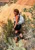
I encountered a hiker as I reached the junction with the UP Trail (Union Peak). I didn't even hesitate to go up. I guess my leisurely pace made this last climb up the peak even easier. I wish all peak climbs were like this one :) . And per usual, when you think you're on top, it's time for the roller coaster to the south side summit. I thot I was filming the first part but I wasn't (I do that occasionally). Anyway, I still filmed some up here and didn't stop to take a break since I was already on a somewhat leisurely pace... reminds me of my old days of hiking. I headed on down and did encounter two hikers and their dog.

I got back on the Great Horned Owl Trail and started hiking west when I hear a helicopter. Alas, another distraction as it was doing some sort of practice above a hill to the north of me. After I zoomed one of my photos, it appears to be a State Trooper helicopter. I filmed it as well. Well after that I continued on and rounded a corner to a complete stop. I think I found the motherlode... of poppies, :y: OMG! How am I going to shoot all these poppies? and they went all the way up the side of Union Peak. Well I managed to take my fill of pictures... I lie; I could have stayed there longer. The poppies and their surrounding flora was my first for the season so I was very HAPPY!

Ya, I even got the poppy-lined trail for a little bit. I couldn't wipe the smile off my face until I finally got to the junction with the Valle Vista Trail and I returned to the green desert floor with late afternoon light making everything glow. And it was like this all the way to and including the Desert Tortoise Trail. I finally got back to the normal desert hike as I reached the crest of the hill and made my way around the side of the mountain. Here it was just the occasional wildflowers and a few more people. I did film one of my favorite areas (the conglomerate alley) with a nice grouping of Compass Barrel Cactus.

I debated going to check on the owl but decided to take a zoom shot instead. As I got to the intersection with Hawk's Nest Trail it was back to the crowds. As I got to the desert floor near the trailhead, I admired the lower sun's glow on the flora and finished off my hike with a Huckleberry Beer. It really was a fabulous day in so many ways! I was certainly feeling refreshed.

I normally don't post my trip report and way too many photos until I get the movies done but I'm making the exception to let you know this is a good time to get out there. I won't have the movies ready for a couple days.... and I'm interuppting my Sedona trip to work on them. I can't wait to see them myself. I filmed the two aircraft too. I hope I have more hikes like today :) .

UPDATED 2-26-2023 Here they are and I think they turned out great. I do a lot of narration too and feel free to turn on closed captioning to see what I'm saying. It's rather interesting as it considers my footsteps Applause :lol: .
Hawks Nest and Valle Vista Trails - [ youtube video ]
Cactus Wren and Great Horned Owl Trails - [ youtube video ]
Great Horned Owl and Union Peak Trails - [ youtube video ]
Union Peak and Great Horned Owl Trails - [ youtube video ]
Valle Vista and Desert Tortoise Trails - [ youtube video ]

WATCH: 1:52-5:28PM, 7.28 miles, 3:35:48, 1635-2324 elevation. 129 avg bpm/ 175 max. 22% Zone 5 Max, 47% Zone 4 anaerobic, 28% Zone 3 aerobic burning 1390 calories. Temp 71.5, partly cloudy, 26% humidity

3 Hrs 36 Mns 2.25 mph 10 Mns Break 1,069 ft AEG
 Named place
 Named place [ checklist ]
[ checklist ]  Cave Creek Dam
wildflower observationwildflower observationwildflower observationwildflower observationwildflower observation
Wildflowers Observation Moderate
Poppy batches are on east Cactus Wren Trail and on west side of Great Horned Owl Trail. Occasional areas of Scorpionweed, Fiddleneck and Narrowleaf Popcorn Flower. Big batches of yellow Bladderpod throughout.
_____________________
For me, sometimes it's just as much about the journey as the destination.
Oh, and once in awhile, don't forget to look back at the trail you've traveled.
  2 archives
Dec 14 2022
avatar

 Guides 41
 Routes 1,626
 Photos 14,983
 Triplogs 2,760

69 male
 Joined Jan 20 2009
 Far NE Phoenix,
Sonoran Preserve - 3 Peaks, AZ 
Sonoran Preserve - 3 Peaks, AZ
 
Hiking avatar Dec 14 2022
The_EagleTriplogs 2,760
Hiking11.59 Miles 2,032 AEG
Hiking11.59 Miles   3 Hrs   38 Mns   3.22 mph
2,032 ft AEG      2 Mns Break8 LBS Pack
 
Route Scout Route Recorded  on Route Scout | Pop | Map | Popup | MapDEX
Mid day start waiting for it to warm up. Only a smattering of cars in the lot. I did a CW loop hitting the 2 of the 3 peaks before heading over to Union Peak for my 3rd peak. It'd been 7 years since I'd been up this one and I'd forgotten how enjoyable this climb is. Best views in the area
_____________________
There is a very fine line between "hobby" and "mental illness."
Dave Barry 🦅
 
Nov 20 2022
avatar

 Guides 21
 Routes 1,182
 Photos 36,858
 Triplogs 1,570

69 female
 Joined Feb 26 2004
 Phoenix, AZ
Dixie Loop Highpoints, AZ 
Dixie Loop Highpoints, AZ
 
Hiking avatar Nov 20 2022
tibberTriplogs 1,570
Hiking5.95 Miles 1,310 AEG
Hiking5.95 Miles   2 Hrs   20 Mns   2.63 mph
1,310 ft AEG      4 Mns Break
 
Route Scout Route Recorded  on Route Scout | Pop | Map | Popup | MapDEX
Clockwise. Got 'er done. Hike seemed to go fine and I didn't feel totally spent either so I think I'm making progress. It was a nice afternoon for the whole hike. A lot more people out on the trail than I thot I would see but it was a Sunday; only two lizards. Western Vista is the longer of the two peaks with the first half being the steepest. And then the rollercoaster of little hills as you make your way north and then east.

The level area as you head south was all in the shade and then you have a couple more rollercoaster hills before starting the switchbacky slightly steep ascent of Dixie Summit. However, the mileage is shorter than Western Vista. The top part always gets me with the false summit before it steeply goes up that last little bit. There was a mother, daughter atop having a nice time together.

Once I got back down the hill it turned into a hike for beer. I continued to encounter other hikers. I also noticed here the ocotillo still had their leaves vs the north Preserve. I also noticed the Teddy Cholla arms seemed pretty chunky so they must be enjoying the fall weather I guess.

WATCH: Interestingly, mileage matched up with RS the first 3 miles which doesn't happen very often. 1:57-4:17PM, 5.76 miles, 1652-2367 feet. 139 avg bpm (149 last March)/max 190 (188 last March). 54% Zone 5 Max, 28% Zone 4 anaerobic, 18% Zone 3 aerobic burning 1003 calories (929 last March). Starting Temp 71.5 and sunny with 16% humidity.
_____________________
For me, sometimes it's just as much about the journey as the destination.
Oh, and once in awhile, don't forget to look back at the trail you've traveled.
 
Oct 30 2022
avatar

 Guides 21
 Routes 1,182
 Photos 36,858
 Triplogs 1,570

69 female
 Joined Feb 26 2004
 Phoenix, AZ
Penance Hike - Union Hills Loop, AZ 
Penance Hike - Union Hills Loop, AZ
 
Hiking avatar Oct 30 2022
tibberTriplogs 1,570
Hiking7.05 Miles 933 AEG
Hiking7.05 Miles   2 Hrs   39 Mns   2.88 mph
933 ft AEG      12 Mns Break
 
1st trip
Route Scout Route Recorded  on Route Scout | Pop | Map | Popup | MapDEX
I ended up taking Tonto 3 out for a pre-sunrise spin on the 101 as I missed my ride to Ash Creek due to misreading the email's start time. The worst thing is it's already hard for me to get up that early and then to miss my ride; plus I had the scones, beer and snacks. You'd think at my old age, I would have learned to double check start times ](*,) . I gave thot to running up to Sedona but the West Fork Trail would be a zoo on a Sunday so I returned home to sulk and go back to bed after unpacking :lol: .

So today I decided to run up to the Phoenix Sonoran Preserve South. I was also trying out a new pair of shoes. They were a little tight initially so I loosened up the lacing and they seemed to fit better. It was a nice day with the slightly overcast sky that I had at the beginning. In fact, I got some dynamite photos. I've been watching videos on how to shoot with a phone camera to get better shots and today I was successful at that.

After I left the Desert Tortoise Trail I wouldn't see anyone except a bike rider on the eastern part of the loop of Union Peak. I enjoyed the grade up the eastern side of the peak on the Great Horned Owl Trail. Plus you go through a fabulous cholla hillside and today the backlighting was fabulous. Granted it's not the same as shooting maples but it's better than nothing. I had initially thot I wouldn't do the peak but I felt good enough to bag it :) . I think as peaks go, this one is not too hard as it has a couple flat areas on the way up.

Today I decided to actually sit on the top for a few minutes. The light was great so I tested out my 10x zoom on my Ultra 22. I wish I had known how to work this phone camera's lenses when I was in Montana. Now that I've watched a couple videos and read some articles, I have a better sense on working the 3x and 10x. Anyway, I had great views down to the dam structure and the dirt part of the dam. I also did a pano of the mountains to my east using the 10x and I'm very pleased with the results.

On my way down, I discovered my new shoes are too short so I'll have to take them back and exchange for a half-size bigger. Needless to say, my toes did not enjoy the rest of this hike and it did slow me down. The sun was out for the most part now but the temp didn't seem bad as there was a nice breeze this afternoon. There is still lots of green flora to enjoy. I was surprised I had already done six miles as I made my turn on the Desert Tortoise Trail. And here I also started seeing a few more hikers as I returned to the Trailhead.

I like this route. Oh, I did see a few lizards and of course, various birds today as well. I hit the drinking fountain and then enjoyed my Huckleberry Creme Ale from Laughing Dog Brewery, ID (the old can art).

WATCH: 1:59-4:38PM, 6.97 miles, 1641-2339 elevation. 136 avg bpm/170 max. 44% Zone 5 maximum, 43% Zone 4 anaerobic, 11% Zone 3 aerobic burning 1111 calories. Starting temp 73.3 with fair skies and 20% humidity.
My best October mileage yet, altho I've been running in the 40s for October the last two years.
wildflower observationwildflower observationwildflower observationwildflower observationwildflower observation
Wildflowers Observation Isolated
desert senna
_____________________
For me, sometimes it's just as much about the journey as the destination.
Oh, and once in awhile, don't forget to look back at the trail you've traveled.
  2 archives
Jan 16 2022
avatar

 Guides 2
 Routes 207
 Photos 93
 Triplogs 204

male
 Joined Aug 08 2020
 Phx az
Sonoran Preserve - Peak 2383Phoenix, AZ
Phoenix, AZ
Hiking avatar Jan 16 2022
ScaredyCatTriplogs 204
Hiking8.64 Miles 1,380 AEG
Hiking8.64 Miles   4 Hrs   1 Min   2.27 mph
1,380 ft AEG      13 Mns Break
 
no photosets
1st trip
Route Scout Route Recorded  on Route Scout | Pop | Map | Popup | MapDEX
Exit the I17 @ jomax and the signs will guide u to this TH. Lots of people here but many of them simply had a bottle of water. I can easily evade these peeps!

Starting on Hawks nest, u will soon turn right at the D sign. Then a right on Valle Verde Trail reduces the # of people. A 3rd right onto Cactus Wren & now they r gone 😎

The trail winds to the left before coming across the Great Horned Owl loop. Further in u will turn at the Up post. Aptly described. Only 1 other person at the top. No luck finding the Sierra Club geocache 😣

Back at the sign I turned the opposite direction to complete the lollipop loop. Arrived at TH @ noon, home 5 pm. Had to keep this outing reasonable after a going away party the previous night 🎉
 
Dec 30 2019
avatar

 Triplogs 72

41 female
 Joined Feb 14 2017
 Prescott Valley,
Union Peak Trail - Sonoran PreservePhoenix, AZ
Phoenix, AZ
Hiking avatar Dec 30 2019
sleepybear929Triplogs 72
Hiking6.25 Miles 265 AEG
Hiking6.25 Miles
265 ft AEG
 no routesno photosets
1st trip
Amazing views at the end. Not a bad hike, the only steep part was the climb to the peak but well worth it.
_____________________
 
Dec 10 2019
avatar

 Guides 47
 Routes 96
 Photos 850
 Triplogs 385

81 male
 Joined Dec 24 2005
 Phoenix, AZ
Sonoran Preserve - Peak 2383Phoenix, AZ
Phoenix, AZ
Hiking avatar Dec 10 2019
MEWhitemanTriplogs 385
Hiking8.29 Miles 1,309 AEG
Hiking8.29 Miles   3 Hrs   24 Mns   2.44 mph
1,309 ft AEG
 
Linked   none no linked trail guides
Partners none no partners
Haven't done this one in a while. Did Union Peak summit and the Great Horned Owl loop. The hike sure pointed out how out of shape I am.
_____________________
 
Feb 22 2018
avatar

 Guides 4
 Routes 52
 Photos 1,303
 Triplogs 75

female
 Joined Feb 04 2017
 Sun City
Union Hills LoopPhoenix, AZ
Phoenix, AZ
Hiking avatar Feb 22 2018
caragrueyTriplogs 75
Hiking5.80 Miles 1,530 AEG
Hiking5.80 Miles
1,530 ft AEG
 
no photosets
1st trip
Combined trails, hawks nest, dixie loop +summit trail, valle verde, to great horned owl, to peak 2383 aka union peak. Returned same way except took desert tortoise to trailhead. Nice hike for a nice Thursday. The Ocotillo are just starting to bloom.
wildflower observationwildflower observationwildflower observationwildflower observationwildflower observation
Wildflowers Observation Light
Ocotillo
_____________________
  1 archive
Dec 30 2016
avatar

 Guides 2
 Routes 25
 Photos 1,890
 Triplogs 604

41 male
 Joined Sep 13 2009
 Mesa, AZ
Great Horned Owl Trail - Sonoran PreservePhoenix, AZ
Phoenix, AZ
Hiking avatar Dec 30 2016
jochalTriplogs 604
Hiking10.70 Miles 1,327 AEG
Hiking10.70 Miles
1,327 ft AEG
 no routesno photosets
1st trip
_____________________
 
Sep 08 2016
avatar

 Routes 11
 Photos 260
 Triplogs 423

64 male
 Joined Mar 12 2011
 Cave Creek, AZ
Sonoran Preserve - Peak 2383Phoenix, AZ
Phoenix, AZ
Hiking avatar Sep 08 2016
Hiking_FoolTriplogs 423
Hiking5.86 Miles 600 AEG
Hiking5.86 Miles
600 ft AEG
 no routesno photosets
1st trip
Linked   none no linked trail guides
Partners none no partners
_____________________
 
Mar 25 2016
avatar

 Routes 173
 Photos 1,613
 Triplogs 285

50 male
 Joined Nov 11 2014
 Manchester, NH
Union Hills LoopPhoenix, AZ
Phoenix, AZ
Hiking avatar Mar 25 2016
JasonCleghornTriplogs 285
Hiking6.12 Miles 924 AEG
Hiking6.12 Miles
924 ft AEG
 
no photosets
Nice little Friday morning hike summiting Union Hills Peak and also found a geocache. Two things that I enjoy doing...
wildflower observationwildflower observationwildflower observationwildflower observationwildflower observation
Wildflowers Observation Light
_____________________
Follow me on Instagram: hikingjason
"It's not the mountains that we conquer, but ourselves"
  2 archives
Feb 20 2016
avatar

 Guides 1
 Routes 226
 Photos 1,675
 Triplogs 1,867

65 male
 Joined Oct 17 2008
 Phoenix, AZ
Desert Vista to Union Peak Sonoran Preserve, AZ 
Desert Vista to Union Peak Sonoran Preserve, AZ
 
Hiking avatar Feb 20 2016
rcorfmanTriplogs 1,867
Hiking11.11 Miles 1,355 AEG
Hiking11.11 Miles   3 Hrs   35 Mns   3.45 mph
1,355 ft AEG      22 Mns Break10 LBS Pack
 
1st trip
I arrived to a full parking lot at the Desert Vista trailhead but was still able to find a place to park. My plan was to find new geocache, Feeling Blue, just past the southeast end of the preserve. I took the Hawk's Nest trail then turned onto the Desert Tortoise trail which I followed to its end. I then turned south on the Valle Verde trail. When I reached the Cactus Wren trail, I turned left (east) unto it. I followed the Cactus Wren trail to its end at the Great Horned Owl loop trail which I took clockwise. Near the southeast side of the trail, I took an access trail off the preserve and into a wash which I followed a ways to reach the cache which I found after a short search. From there, I retraced my path back to the Great Horned Owl trail and continued following it around Union Peak. Eventually the trail starts ascending the peak and when I reached the Union Peak trail, I took it to the summit. On top, I stopped for a break where I had some food and drink before heading back down. I continued along the Great Horned Owl trail completing the loop back at the Cactus Wren trail where I headed back to the trailhead the way I came.

These trails are easy to walk on and it is easy to make good time on them. The weather was nice out and generally calm. Once I was off Hawk's Nest trail, I only saw a few people on the trails I followed.
wildflower observationwildflower observationwildflower observationwildflower observationwildflower observation
Wildflowers Observation Isolated
Penstemon and desert poppies are starting to bloom.
_____________________
Go find a LonelyCache
 
Jan 20 2016
avatar

 Guides 27
 Routes 61
 Photos 2,620
 Triplogs 700

69 male
 Joined Jan 23 2008
 Phoenix, AZ
Sonoran Preserve - Peak 2383Phoenix, AZ
Phoenix, AZ
 Hiking avatar Jan 20 2016
AZWanderingBearTriplogs 700
 Hiking6.10 Miles 968 AEG
 Hiking6.10 Miles   2 Hrs   56 Mns   2.63 mph
968 ft AEG      37 Mns Break
 no routesno photosets
1st trip
Short workout hike on a very nice day.
_____________________
All you have is your fire...
And the place you need to reach
  1 archive
Jan 08 2016
avatar

 Guides 110
 Routes 2,246
 Photos 8,982
 Triplogs 2,600

45 female
 Joined Dec 24 2007
 Ahwatukee, AZ
Sonoran Preserve - Peak 2383Phoenix, AZ
Phoenix, AZ
Hiking avatar Jan 08 2016
LindaAnnTriplogs 2,600
Hiking10.03 Miles 1,121 AEG
Hiking10.03 Miles   4 Hrs   13 Mns   2.57 mph
1,121 ft AEG      19 Mns Break
 
1st trip
Went for a nice hike with Larry today. I was actually cold!!! I'm happy I brought an extra jacket, since I wore it about half the time. I hadn't been on any of these trails before, so I basically just followed along. Tin Can Tank was really pretty, and mostly full. We had the trails almost entirely to ourselves, only seeing a few other people near the trailhead.
 Named place
 Named place [ checklist ]
[ checklist ]  Tin Can Tank
_____________________
Stop crying and just go do the hike.
 
Oct 11 2015
avatar

 Guides 41
 Routes 1,626
 Photos 14,983
 Triplogs 2,760

69 male
 Joined Jan 20 2009
 Far NE Phoenix,
The Union Hills, AZ 
The Union Hills, AZ
 
Hiking avatar Oct 11 2015
The_EagleTriplogs 2,760
Hiking10.54 Miles 1,748 AEG
Hiking10.54 Miles   3 Hrs   41 Mns   2.97 mph
1,748 ft AEG      8 Mns Break12 LBS Pack
 
no photosets
PuP yesterday.
This was a tester.
All is right with the world.
Cardinals need to get their act together
_____________________
There is a very fine line between "hobby" and "mental illness."
Dave Barry 🦅
 
average hiking speed 2.67 mph
1, 2, 3  Next

WARNING! Hiking and outdoor related sports can be dangerous. Be responsible and prepare for the trip. Study the area you are entering and plan accordingly. Dress for the current and unexpected weather changes. Take plenty of water. Never go alone. Make an itinerary with your plan(s), route(s), destination(s) and expected return time. Give your itinerary to trusted family and/or friends.

helpcommentissue

end of page marker