|
| | | |
| |
|
| Hiking | 6.10 Miles |
1,208 AEG |
| | Hiking | 6.10 Miles | | | |
| 1,208 ft AEG | | | | |
|
|
| |
| Partners |
|
[ show ]
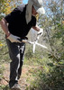
| partners | | I hadn't been to the Sierra Anchas since the Billy Fire last summer, and I'd been wanting to check out how bad the damage was while getting a hike in, and S agreed to join. As soon as we made the turn up 487, my heart sank seeing the damage firsthand. Workman Creek, all the way up, was highly burned with nearly all the pines destroyed. Multiple major washouts flowed into the creek, forever altering it. Above the falls was the same story; some scattered pines survived, but the majority of the area was roasted. Our initial plan was to park at the Moody TH, hike down Moody to the rim trail, and head over to the Devils Eye. After parking at the TH, the trail crossed the road for roughly 20 feet and disappeared into the black, so that was no longer a viable option. We decided to drive down to the Carr TH to see how this section of the trail fared. After about a quarter mile of recon in flip flops, it appeared there was burn around the TH, but the trail itself appeared in good shape from what we could see.
Parker Creek
Except for light damage near the TH, the fire avoided this trail all the way down to the junction with the Rim Trail, where we turned off onto it. The trail is in great shape all the way down to the junction with the maintenance done by AnchaGladtrailz the prior years still holding up nicely. As we made our way down, something caught my eye, and we ended up bushwhacking up a small hill through Manzanita, Locust, and other thorny brush to discover a pretty large area filled with sherds. The area was a pretty good size, and we literally came across at least a thousand pieces of sherds ranging in size, shape, and color. The ground was completely littered with them. It was an amazing area, so much so that we spent a good hour or more there exploring. We continued making our way up the hill looking for the origin of the sherds; however, the scratchy brush was so thick, and my legs were bleeding pretty badly, that we decided to head back down.
Rim Trail
As we made the turn onto the Rim Trail, the conditions were still good with no fire damage and a nice, wide open, carined trail. However, that was short-lived as the burn area appeared right before Trailside Spring, continuing for a bit before a brief area of non-burn before going back into the burn the rest of the way. Again, most everything is gone from the burn; however, there are some pines that survived up on the hillside. Tons of grass are growing in the burn, which made route finding a bit difficult at times; there are a good number of carins, which really helped. We did lose the trail for a bit while crossing one of the drainages, as the area was moonscaped and full of rocks, so carins were useless. However, we were eventually able to find the trail and continue. We made our way down to check out the window before taking a break in the shade of a juniper (this area was hit-or-miss with fire damage). We discussed heading back to the TH via the way we had just come or by climbing up to Moody Point from the area that we were at. It's no longer a bushwhack, as the only things that survived are a grove of locust near the top. We climbed up to Moody Point, surprisingly finding a couple of carins along the way, and made a stop at a couple of gated areas labeled 'Study Area' and another that housed a weather station before walking the road back to Carr.
Temps were near 80 degrees, but we had a nice breeze most of the day, so it was not too bad. The Billy Fire beat the hell out of the Ancha's (I can only imagine what Reynolds Creek looks like), and a lot of the trails are going to need major work to be hikeable again. I think it is going to be a couple of years before I head back, letting the wilderness heal, however, it will never be the same as it was. |
|
Wildflowers Observation Light
|
|
| _____________________
Hiking is just walking where it’s okay to pee.  |
| | |
|
|
|
 Route Editor