|
| | | Peak 3108 Ridgeline Plus, AZ | | | |
|
|
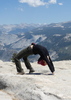
Peak 3108 Ridgeline Plus, AZ
| | |
| |
|
| Hiking | 8.20 Miles |
2,555 AEG |
| | Hiking | 8.20 Miles | 8 Hrs | | 2.03 mph |
| 2,555 ft AEG | 3 Hrs 58 Mns Break | | | |
|
|
| |
| Partners |
|
none
[ show ]
| no partners | | This was a fun hike in the underrated Goldfield Mountains that started and ended at the Meridian TH, at the north end of Meridian Road in Mesa/Apache Junction.
The hike consisted of 3 parts: The Peak 3108 Ridgeline; the South Bulldog Ridgeline; and the Peak 3004 Ridgeline. Most of the hike was totally off-trail and it included a bit of bushwhacking.
From the TH, I went north a short distance on the Bulldog Saddle Trail; but instead of going to Bulldog Saddle, I took a right and went east for almost 1.5 miles on the unsigned Meridian Mystery Trail. Then I went off-trail on a well-cairned use trail, heading north up toward the Peak 3108 Ridgeline. I made my way to a saddle on the Ridgeline, and then went NW along the top of the ridgeline. I enjoy hiking on this ridgeline -- the views are super, and are much better than the views on the Pass Mountain Ridgeline imho. I made to the summit of Peak 3108, and then went up to Temptation Peak (3,195'). It was an easy ascent on the south side of Temptation Peak, but the northside had some verticality to it so I descended on the east side and looped around to the north side, and then made my way up to Peak 3125 (fwiw, T. Tenny refers to this peak as Peak 3113). To get up Peak 3125 I did a little class 3 climbing up a chute, but it wasn't a bad climb.
After enjoying the views atop Peak 3125, I dropped down to the north and went to Peak 3163, aka Hippy Hill, on South Bulldog Ridge. My intention was to climb up the 3 peaks on the Ridge: Peak 3163, North Peak 3195 ( [ Peak 3195 Goldfield Mountains ] ), and Peak 3075.
Peak 3163 looked a bit daunting, but once there it was a short, easy class 3 climb to the top. I had set my hiking poles down before climbing up, so I had to descend the same way that I went up; otherwise I would have descended to the north going toward Peak 3195. After circling the east side of Hippy Hill, I made my way over to Peak 3195. There was only one obvious way to climb up Peak 3195, but I was out there by myself and the first part of the climb was a tad sketchy. Thus, with discretion being the better part of valor, I decided to wimp out and come back another day to climb up to Peak 3195. I wasn't too worried about the climb up, but I didn't really want to have to deal with finding footholds on the descent when I was there by myself.
I started to go over to Peak 3075, but time was getting away from me, so I decided to make my way over to the Peak 3004 Ridgeline and hike up to Peak 3004. This is the ridgeline that runs between Bulldog Saddle and Pass Mountain Saddle. From the base of Peak 3195, I could see a fairly easy route up to Peak 3004, so I did an off-trail bushwhack through a couple of canyons and made my way to the trail that loops around Peak 3004, and then did the off-trail climb up to Peak 3004. This was not a difficult way to get up there, although there was a bit of class 3 climbing near the summit. On the descent, I headed west over to Pass Mountain Saddle. There was a bit more up-and-down getting to Pass Mountain Saddle than I had envisioned; in retrospect, it would have been easier to go back the way that I came and go to Bulldog Saddle.
From the Pass Mountain saddle I just took that Pass Mountain Loop Trail back to the trailhead.
This was another great day of hiking in the Goldfield's. I will come back out another day and hopefully do the other 2 ascents on South Bulldog Ridge. |
|
Wildflowers Observation Substantial
There were quite a few flowers blooming, including: brittlebush, creosote bush, fairy duster, ocotillo, hedgehog cactus, buckhorn cholla, globemallow, and lupine |
|
| _____________________
| Civilization is a nice place to visit but I wouldn't want to live there |
| | |
|
|
|
 Route Editor


 . Was hoping wouldn't be as dramatic this time around.
 Takes me 50 minutes to reach this TH. Worth it. Approach is fairly straight forward. Then we figure out a path. Stopped seeing cairns so just scrambled up.