|
| | | |
| |
|
| Hiking | 7.25 Miles |
3,376 AEG |
| | Hiking | 7.25 Miles | 9 Hrs 50 Mns | | 0.74 mph |
| 3,376 ft AEG | | | | |
|
|
| |
| Linked |
|
none
[ show ]
| no linked trail guides |
| Partners |
|
none
[ show ]
| no partners | | If I had known ahead of time what I was about to get myself into, I would have stopped very early in my snowy trek and turned around. That would have been the smart decision, but not nearly as fun.
8 years ago is the last time I found myself at the top of the Flatiron walking ankle deep in snow. For all these years I've wanted another shot at it, but the timing just never worked out. The mountain has seen snow several times since 2011, but it seems like it would always happen on a day I was working, or I was going out of town, or I was hung over from a NYE celebration. I didn't want to wait a few days after the winter storm event either. I wanted fresh powder, less than 24 hours old.
On February 21-22, 2019, we experienced the storm of all Arizona winter storms with record snowfall in locations all across the state, and it did that just in time for the weekend. Wahoo! Clear my schedule, I'm going to the Flatiron.
I packed my gear the night before which included new snow spikes, waterproof neoprene gloves and a pair of boots. Also packed my Samsung phone/camera, Nikon P900 and Canon SLR cameras along with several lenses and a tripod. I was on the road by 5:45am and at the Hwy 88 trail head by 6:15. At this point, I decided, as I often do, to forego the typical Siphon Draw route and attempt a Reverse Flatiron via Praying Hands and the Canyon of Waterfalls. As I approached Praying Hands, I turned and admired the incredible views of snow covered peaks behind me. Four Peaks was white all the way to the foothills and the peaks were buried in clouds. Low hanging fog filled the valleys between the mountains and hills making for some moody photographs.
The first signs of snow appeared about a hundred yards short of Praying Hands. Nothing much, just palm size chunks that looked like it had already begun to melt. From Praying Hands to Canyon of Waterfalls was where my progress was forced to slow. Not much snow, but invisible ice spots forming on parts of the trail could have made for some early trouble. In retrospect this may have been a good place to try the snow spikes, I just wasn't sure how they would handle on all the slick rock sections.
I arrived at the Canyon of Waterfalls, set up some photo ops and enjoyed the amount of water rushing through the canyon. When it was time to move on, I realized that climbing my usual route up the waterfalls was going to be a dangerous idea. I started working my way up and around the canyon along the left cliffs. In some instances I was making big moves that I knew would prove a challenge going back down. I moved on anyway and arrived at the big finger spire. It was here that I decided I would either have to complete the Reverse Flatiron up to Peak 5024 or return down the canyon. I was already 3 hours into my trek. Wow! On a typical day I would have reached this point in just over 1 hour, but I was taking photos and taking a cautious slow approach. I would just have to speed things up a bit on the way up to Peak 5024. I threw on the snow spikes and started the off trail climb. Every step of my ascent would be in the snow from this point forward.
People have cairned the route, but there were no visible cairns. I really don't find them necessary anyway for this climb, so the fact that they were buried in white powder was no bother. Just stay on top of the ridges and proceed toward the peak. Also not visible were any small cactus such as the hedgehogs, prickly pear and chain fruit cholla along the way. I knew they were there somewhere. Somehow I managed to stay out of trouble.
I reached the junction in the two ridges which connect my route with the traditional Massacre Falls Reverse Flatiron route. The snow depth had advanced from ankle depth to mid-shin to just below the kneecap. I started to get a little concerned about how much deeper it might get, but now the prospect of turning around seemed much less appealing. I was 4 hours plus into this adventure and about 4000 feet elevation. I had to be beyond the half way point in my journey, but I knew there was still a solid 1000 feet elevation gain to go.
For the next several hundred feet of gain, snow depth was still below my kneecaps. I had to start developing strategies for each step. Sometimes a serpentine back and forth traverse worked out. Sometimes using my arms to dig out snow ahead of me so I could evaluate the next foot hold. Sometimes jamming both arms into the snow and trying to pull the snow toward me in a swimming motion while stepping forward. Sometimes only lifting my foot partly out of the postholes I was creating and then pushing it forward into the snow. I know that trying to lift each leg completely out of the snow was becoming quite exhausting and sometimes would only produce a 6 inch momentum zapping gain.
At just over 6 hours into the climb I had reached a set of spires that are just a couple hundred feet below Peak 5024. Anyone who has hiked back here, probably knows the ones I am talking about. From here I got my first view of the Superstition Ridgeline and surrounding mountains. It was snow, snow and more snow on every mountain out there as far as I could see. Awe-inspiring and a total boost to my motivation and energy. I needed it, because now most steps were sinking above my kneecaps. What a difference this makes. Movement becomes very restricted at this depth. Now I found myself frequently digging forward with my hands trying to remove the loose powder in front of me just to move forward.
Every now and then I would find myself in drifts that were now mid-thigh. I had to look at the landscape and try and figure out if there were any clues that would lead me on a path to something more navigable. In a couple spots I found myself just standing there facing a steep snow bank, and feeling defeated. I was so close though. So I just started digging and tossing snow behind me, finding footholds and handholds and pulling myself up. Soon enough the terrain started to level off and the snow depth retreated to knee depth.
I had arrived at Peak 5024. Looking down at the Flatiron I could see about 8-10 people congregating at the edge and/or making their way up a trail cutting through the snow. From where I stood, there were no footsteps, no signs of anyone having been up here after this storm. I was the first and only person to reach the peak up to this point. I took in the magnificent, pristine white, 360 degree views, I snapped some photos, ate some food and recharged for the descent.
Snow depth was still up to the kneecaps which meant the trail was completely hidden, but I know this route well and I found myself under the first rock tunnel and then under the next rock tunnel. If you've done it, you know what I'm talking about. At one point, I finally spotted the footpaths of others who had started towards the peak, but then retreated. Once I stepped into those footpaths, I felt a sudden rush of relief that the toughest work was now behind me. I could actually walk on the snow instead of plunging down into it.
The rest of the way down was handled slower than usual and with caution. I kept the snow spikes on and they worked great. I was back to the masses of people making their way up to the Flatiron. There they were in their shorts and sneakers with freezing cold hands ( no gloves ). Totally unprepared hikers, but moving on towards the goal, nonetheless.
I made my way down through the basin, onto drier land and over to the Crosscut trail and back to my car just under 10 hours before I had started this journey. I wanted nothing more than to stop at a convenience store and slam a Powerade. Immediate fortune would not be had however. It seems that the rest of the valley, like me, had also come to enjoy a day in the desert snow. My drive back home, usually about 20 minutes, took 1 hour and 15 minutes. I skipped the beverage stop and made a beeline for my happy home, the one with the always 103 degree hot tub waiting in the backyard. Aaaahhhhhhhh! |
| _____________________
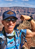
| This is my gym. I have to travel down a bumpy road to get there. There are no treadmillls, no machines, and no personal trainers. I walk..I run..I breathe the fresh air. I can go any time I want, as much as I want and there is no membership fee. |
| | |
|
|
|
 Route Editor