|
| | | Club Ranch via Barnhardt Trailhead, AZ | | | |
|
|
Club Ranch via Barnhardt Trailhead, AZ
| | |
| |
|
| Hiking | 26.24 Miles |
6,326 AEG |
| | Hiking | 26.24 Miles | 12 Hrs 21 Mns | | 2.33 mph |
| 6,326 ft AEG | 1 Hour 6 Mns Break | | | |
|
|
| |
| Partners |
|
[ show ]
| partners | | Despite our checkered past with these outings, I can't turn down a Joe Wish List hike, and Club Ranch was a new one for me, so I took a day off work and joined him. We took off from Barnhardt ~6:30AM and had partly cloudy skies most of the day. From the start, there was more water around than I expected--we could hear it flowing down in Barnhardt Canyon before we could see it, and Big Kahuna had some decent pools and small falls.
Past Big Kahuna, the trail was cleared so wide you drive a car through the manzanita tunnel. We continued onto Mazatzal Divide and checked out Chilson Spring before turning south on Brody Seep. Everything past that was new territory for me, down through Chilson Camp and onto Davenport Wash Trail, where we benefitted from Karl's recent trail work [ photoset ] . Joe didn't plan to go all the way to the ranch, so we parted ways with ~5 miles to go and planned to meet up somewhere around Chilson Spring when I got back.
I had good views of the west side of Mazatzal Peak along Davenport Wash as I dropped down toward the South Fork of Deadman. The trail transitioned from rocky to grassy, and it was tough to spot the large cairns in some spots through the dry prairie. South Fork had a little water, and the geology and scenery around there were among the highlights of the day. It was a steep climb up the other side before dropping another ~1,000' toward Club Ranch, passing through well-cleared manzanita and then another round of cairn-spotting in dry grass as my boots and socks collected foxtails.
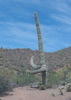
I reached the ranch just after noon, checked out the spring, and finally took a longer food/water break. Not much to see as far as structures at the ranch--the lone "standing" building is doing more leaning than standing these days and has mostly collapsed in on itself...going back through old photosets, it looks nothing like it did 20+ years ago [ photo ] .
[ youtube video ]
After ~20 minutes, I packed up and started back to rejoin Joe. Lots of uphill on the return, aside from the drop down to South Fork, where I took another break to eat and refill water. The trail seemed easier to spot through the steep grass going up the other side, but I learned later that's because it was--Joe had built up some of the cairns since I passed through earlier. Between that and snapping selfies while modeling the Spring '26 HAZ fashion line, he made productive use of our time apart. I found him waiting a little east of Chilson Spring, where he was setting up for a nap and was disappointed to see me return.
We kept a good pace on the hike out, and we'd almost made it through the day without seeing anyone else when we heard voices at Big Kahuna. We eventually got passed by a pack of shirtless teenage dudes who thought they'd hiked eight miles. I didn't bother telling them they were in the presence of greatness...if they only knew who'd named the waterfall they'd just visited.
We started and finished in daylight, a first for one of these longer Joe Wish List hikes. At ~12 hours, this one was roughly half of our previous outing. The whole experience was oddly drama-free: no medical emergencies, no hiking all night through catclaw, no investigating mysterious deaths. When we got back ~8PM, I mentioned to Joe that on our last hike, we were still nine hours from finishing at this time. It was good to get out for a longer hike in a new place and go clubbin' with Joe. Thanks for setting this up, and thanks to @BiFrost for preventing many, many scratches along Davenport Wash. |
  |
Garden Seep |
Dripping |
Dripping |
| | | Moist area long the Barnhardt Trail |
|
Hawaiian Mist |
Pools to trickle |
Pools to trickle |
| |  Stagnant pools, no flow Stagnant pools, no flow | | | |
|
|
|
 Route Editor


 As it was, we were anticipating a finish after dark (spoiler alert: the last mile and a half were completed with headlamps).