username
X
password
register
for free!
help
ArticlesGuidesRoutes
 
Photosets
 
 Comments
triplogs   photosets   labels comments more
South Kaibab Trail - 123 members in 698 triplogs have rated this an average 4.6 ( 1 to 5 best )
1, 2, 3, 4, 5 ... 35  Next
698 triplogs
login for filter options
May 17 2025
avatar

 Guides 1
 Routes 209
 Photos 1,231
 Triplogs 196

male
 Joined Mar 14 2015
 Phoenix, AZ
R2R North to South, AZ 
R2R North to South, AZ
 
Hiking avatar May 17 2025
astrobrewerTriplogs 196
Hiking23.12 Miles 5,380 AEG
Hiking23.12 Miles   11 Hrs   35 Mns   2.36 mph
5,380 ft AEG   1 Hour   47 Mns Break
 
1st trip
Linked   linked  
Partners none no partners
Route Scout Route Recorded  on Route Scout | Pop | Map | Popup | MapDEX
Rim to Rim! Scratch another one off the bucket list. Logistics of this always were daunting. But a friend suggested that we split into two groups and go opposite directions and meet in the middle. My group, two of us, drove to the North Rim and spent a night there. The other group, four people, went to South Rim. We had met for dinner the day before and swapped cars. We each left a bag of stuff we would need on the other side after the hike in the other car.

This was my first time at the North rim. The scenery on the drive up is spectacular. I am definitely coming back to spend more time up there. Accommodations at the North Rim were booked up so we stayed at the Jacob Lake Inn which was nice. I had my own little cabin. Jacob Lake is an hour drive from the Rim, so we left at 3:30am for a 4:30 start. Brutal.

The too tiny parking lot at the trailhead was full. There were a lot of people who had the same idea. I've never seen so many people at 4:30 in the morning. We parked out friends' car on the road about a quarter mile away.

The North Kaibab trail is great! The first 3 or 4 miles are fairly steep, but easy to walk. Mostly nice packed dirt trail. The last several miles to Phantom Ranch are much less steep and we were able to keep up a fast pace.

We met our friends at Phantom Ranch. We almost missed them because there were so many people. We exchanged info about where to find our cars. They also were unable to park in the lot near South Kaibab and ended up parking on the road a way past the lot.

After lunch at Phantom Ranch we tried of our water and started up South Kaibab. I knew from last year that I would need to stop and rest frequently. And I did. I hate steps! Many sections of the trail were deeply rutted from horses or mules. Took a break at the rest spot a mile and a half from the top and ate some snacks. The wind kicked up with really strong gusts while we were there. I put my long sleeve shirt back on because it was chilly.

Then the final push to the top. More steep steps. Then finally the switchbacks up the wall came into view. Yay. Then we were at the top. Walking on paved road to the car after the steep trail felt so easy. Out friends had left a cooler of refreshments for us. We toasted our successful hike with beers then headed to the hotel in Tusayan for an early dinner and bed after a great day in the Canyon.
 Fauna
 Fauna [ checklist ]
[ checklist ]  Rock Squirrel
_____________________
 
Apr 20 2025
avatar

 Routes 386
 Photos 49
 Triplogs 792

43 female
 Joined Jun 23 2015
 Phoenix, AZ
South Kaibab TrailNorthwest, AZ
Northwest, AZ
Hiking avatar Apr 20 2025
emilystardustTriplogs 792
Hiking14.34 Miles 4,018 AEG
Hiking14.34 Miles   12 Hrs   14 Mns   1.63 mph
4,018 ft AEG   3 Hrs   27 Mns Break
 
no photosets
1st trip
Linked   linked  
Partners none no partners
Route Scout Route Recorded  on Route Scout | Pop | Map | Popup | MapDEX
_____________________
 
Jan 03 2025
avatar

 Triplogs 2

male
 Joined Nov 29 2023
 Rochester, New Y
Bright Angel - Nankoweap Loop, AZ 
Bright Angel - Nankoweap Loop, AZ
 
Hiking avatar Jan 03 2025
zachbernstTriplogs 2
Hiking
Hiking
 no routesno photosets
1st trip
Trip report: Bright Angel - Nankoweap loop via the Butte and Vishnu faults, 12/25/2024 - 1/1/2025.

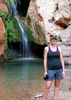
This was my second trip to GCNP, following last year’s Phantom-Crystal loop in the same Christmas-New Years week (a great time to be in the canyon!). For the second time, I’m left awe-struck by the canyon’s variety, and by how all of its different aspects are each, in their own way, beautiful and fascinating.

There’s a good bit of beta online about this route. Bill Ferris’s wonderful reports are so detailed as basically to serve as guides. Bob Bordasch has a good set of maps. I know of two GPS tracks for the off-trail portion: Peter Bakwin’s (from his trip with Buzz Burrell; see his report on HAZ), and the waypoints from Will Petty’s 2011 speed run (shared in the Grand Canyon Hikers Yahoo group). When they diverged, I tended to go with Petty’s: he had rehearsed the route extensively, and he also seemed to like it more the Bakwin and Burrell did, which suggested to me that he might have avoided some less pleasant bits.

12/25. South Rim Visitor Center to Cottonwood. The shuttle wasn’t running at 7am, and the cab service wasn’t picking up the phone on Christmas morning, so I began with the Rim trail. This proved a nice way to see the sunrise. The walk to Cottonwood was pleasant. I had the wildlife highlight of the trip when my campsite was ambushed by a pygmy owl just after dusk.

12/26. Cottonwood to Saddle Mountain trailhead. I hemmed and hawed over the Old Bright Angel vs the North Kaibab, and went with the latter; the deciding factor was that I could get water at the North Rim admin building, and I needed a lot since I was headed into a dry camp. I then hemmed and hawed some more about the Ken Patrick trail, and ended up taking the road to Point Imperial instead, mindful of the need to make it to Nankoweap creek by the following evening. The roadwalk was mentally taxing (the aspen groves are pleasant, but three hours of them was a lot), and I occupied myself by composing a limerick about our labradoodle. The rim-side sites at Saddle Mountain are stunning, but I took the forest site in the (forlorn) hope that I could protect myself from the wind. It was a frigid and mostly sleepless night, and my water was about half frozen in the morning.

12/27. Saddle Mountain to Nankoweap creek. The Supai traverse lives up to its reputation for exposure—I can’t think of a comparable named trail anywhere. But the exposed bits all have secure footing, so it never felt dangerous—just required focus. The descent from Tilted Mesa was a toenail-buster. I got to the creek in midafternoon and considered moving on, but wasn’t sure if I’d find a good campsite before Kwangut (which I wouldn’t be able to reach in daylight). As it turns out, there would have been plenty of good dry camping spots on the ascent to the saddle. But it was still nice to have a warm campsite by the creek.

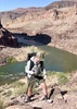
12/28. Nankoweap Creek to a site on the descent toward Sixty-Mile Creek. This was a big day, physically. I followed Petty’s route via a drainage a bit upstream from the end of the Nankoweap trail, rather than the more direct drainage Bakwin and Burrell used. This worked well, and the route showed signs of travel—including a nice hat someone dropped! (Let me know if it’s yours...) I descended to Kwangut following the drainage on the right, which had just a few minor obstacles to bypass. I picked up 8 liters at Kwangut. On the way up to the Kwangut-Malgosa saddle, I started by following the ridge Petty used, but it required boulder-hopping that was awkward with my heavy pack, so I dropped to the slope on the left. This was probably a mistake—the slope was loose and slow, and I couldn’t get back to the ridge. After the Kwangut-Malgosa saddle, route-finding through the Fault gets simpler: just follow the drainages through the fault and use the slopes on their sides when the drainages have obstacles or brush. The Butte Fault area is a huge rubble heap, and I sometimes wondered if I was missing better views on the river route—but it was very cool to see the faulting, and the Supergroup rocks underfoot were interesting and varied. In the context of the whole route, I’m glad I took the Fault for the contrast it provided (and I gather the river route has its own challenges). The coyotes in Sixty-Mile held a dinnertime conference call, just like the dogs in our neighborhood at home.

12/29. Sixty-Mile to upper Lava. A day with two distinct halves: hot and arid through Carbon, then lush and wet through Lava. There are pour offs in the descent from the saddle that require significant bypasses. I found the crossover to Lava unintuitive to navigate and ended up using GPS a bit. Lava was gushing all the way up to its source spring. I ended the day by visiting Juno ruins, a few minutes beyond the spring, and scoping out my route for tomorrow. My campsite had lots of wolf spiders … eek. I used my tent (just the bug net) for the only time on the trip.

12/30. Upper Lava to a site a little below the Freya-Vishnu saddle. The day began with the notorious Lava-Unkar saddle. While I haven’t tried the other routes people use, I’m very glad I followed Petty’s waypoints—I think he helped me avoid trouble others have run into. I began with the Tapeats break to the left of the abutment across from the ruins (I think most people use the wider break on the right). This is a steep and narrow slot, but it’s direct and not brushy, and though it looks tough from afar, it isn’t exposed and is just a stiff class 2 or easy class 3. I then contoured and descended over to the main drainage (perhaps descending too quickly), and turned uphill at about the 5000ft contour (others report turning at 5200ft), ascending straight into the Muav. All the way to the saddle, to borrow a formula of Steck’s, I went up when I could and left when I couldn’t. There was minimal brush during the ascent, and a deer trail helped during both the ascent and traverse. All in all, I didn’t find the ascent nearly as bad as I’d feared: a calf-burner, but not much of a thrash, and not dangerous. The descent to Unkar is easy. When I got to the main creekbed, I needed water, and found a very small trickle 10 minutes downstream from the junction. I dredged this out until I had a puddle large enough to scoop water from. (The situation amused me. Do my students imagine their professor spending his free time dredging a mud puddle?)

12/31. Freya-Vishnu to below the Redwall on the descent from the Wotan’s Throne-Angel’s Gate saddle. Today began with a boulder hop up to the Freya-Vishnu saddle. At the crux, where there are several options, I took the ledge on the left, which is a simple scramble and more protected than it seems from below. The initial descent is steep and loose. The traverse at the bottom of the Redwall is facilitated by a deer trail near the wall; staying high limited the feeling of exposure. The talus descent after the traverse is miserable: steep and very loose. I nervously tiptoed one step at a time. Vishnu had lots of water, including a convenient water-bottle refilling station: a spring that dripped directly into my bottles. The ascent up to Hall Butte-Wotan’s Throne saddle was, for me, the hardest feature on the route. It’s very steep and very loose. I went up way to the left and then zigzagged over to get around the Muav cliffs, but I’m not sure that’s a better option than a more direct route: it took ages to contour through all the loose terrain. The spectacular traverse to the Wotan’s Throne-Angel’s Gate saddle was a welcome reprieve. I occasionally tried to follow a use trail that comes and goes, but the terrain is easy enough that it didn’t matter if I wasn’t on it. The descent that follows is a hoot. It’s the most exposed portion of the route, including three 10-15ft pitches of down-climbing that will be easier if you lower your pack (30ft of webbing sufficed). While at times near-vertical, the rock is excellent, the route-finding straightforward, and the climbing is easy, no harder than climbing down a step ladder. I was hasty lowering my pack on one pitch and it slipped the last few feet, smushing a water bottle and soaking some warm clothes. Whoops! As a result of the mishap, it was a chilly night and I didn’t have enough water for coffee in the morning (mixing the grounds with my granola was a desperate mechanism for caffeine delivery).

1/1. To the South Kaibab trailhead. The Tapeats break into Clear Creek requires a bit of zigzagging to find ledges that connect. There was plenty of water in East Clear Creek. There were mule deer on the Clear Creek trail. I was tired and depleted as I started up the South Kaibab, but as I got moving and the temperature cooled, I was happy to be able to finally turn on the jets after days of painstaking tiptoeing. Blasting through the Muav in about five minutes, after spending a tough hour working that layer the previous day, was like riding a magic carpet. I topped out in 2:55, and in tears of gratitude. What a week it had been.
 
Nov 02 2024
avatar

 Guides 110
 Routes 2,246
 Photos 8,982
 Triplogs 2,600

45 female
 Joined Dec 24 2007
 Ahwatukee, AZ
South Kaibab TrailNorthwest, AZ
Northwest, AZ
Hiking avatar Nov 02 2024
LindaAnnTriplogs 2,600
Hiking20.61 Miles 5,119 AEG
Hiking20.61 Miles   11 Hrs   24 Mns   2.14 mph
5,119 ft AEG   1 Hour   47 Mns Break
 
Route Scout Route Recorded  on Route Scout | Pop | Map | Popup | MapDEX
Jill had Rim to River on her wishlist, so we’d picked this weekend back in April and booked a room for it. I’d done some training hikes with Jill & Janelle, but not as many as I’d hoped they’d get done. Jill had actually gone to Havasupai a couple of weeks ago, which was a good last minute bonus to her training.

We got started from S Kaibab around 0630. Cool and breezy, but nice. Tons of people, of course. A few characters kept us entertained on the way down. I probably wasn’t quiet enough with some of my commentary. Uneventful hike down to the river.

We stopped at Phantom Ranch for a snack break, Jill and Janelle got lemonades while I ate a sausage and egg burrito I had brought. While they ate, I wandered around and made friends with some construction workers. To avoid trail closures, we took SK back up to Tonto. This was the warmest part of the day, but the clouds helped. The clouds thickened as we walked west on Tonto, cooling temps a bit.

Another break at Indian Garden. Another sausage and egg burrito. Jill was getting tired around this point, so we kept the pace comfortable. Surprisingly few people on Bright Angel. We finished just after sunset, but it was still light enough to easily see. Both Jill and Janelle had fun, and this was their biggest day hike to date. Saw one bighorn below the Tipoff, but not much else.
_____________________
Stop crying and just go do the hike.
 
Sep 06 2024
avatar

 Guides 4
 Routes 491
 Photos 10,890
 Triplogs 1,257

55 male
 Joined Nov 20 2012
 Phoenix, AZ
Rim to Rim, AZ 
Rim to Rim, AZ
 
Hiking avatar Sep 06 2024
BiFrostTriplogs 1,257
Hiking48.47 Miles 12,320 AEG
Hiking48.47 Miles   12 Hrs   39 Mns   3.83 mph
12,320 ft AEG
 
Partners partners
slowandsteady
Back to the Grand Canyon for Rim to Rim with some luxury items. We were flexible and scored a last minute room at Phantom Ranch so we hiked down South Kaibab on Friday evening arriving about 9pm. Despite the late arrival we had a good nights sleep and had the 630am breakfast the next morning.

After breakfast about 730 we hiked up North Kaibab Trail with a full day in hand since we already had reservation on the North Rim for that night. With time on our side it was nice to enjoy the trail and have time for nice break at Ribbon Falls. Great spot to hang out and break up the hike. It was tough to leave the coolness of Ribbon Falls especially since things were starting to heat up.

Continued passing Cottonwood Camp and on to the Manzanita Pumphouse for the next break. Filled up on water and had some snacks for the final 5 miles to the North Rim. We contemplated how backloaded North Kaibab is with about 2/3 of the elevation in those 5 miles. Fortunately, it’s the best part of the trail IMO with best scenery of the whole trail. Finally made the North Kaibab TH about 430. Then the 1.7 miles to the North Rim lodge which is flat or somewhat downhill just before 5pm. Checked in to the plush accommodations :D and relaxed a bit before having an awesome dinner in the lodge. Great way to cap off the day!

Next morning, somewhat early start catching the shuttle back to the trailhead and 6am start. Given the heat from the day before it was downright cold at the start. We kept moving just to keep warm for the first 3 miles past Supai Tunnel and the bridge. Of course, didn’t take long to warm up below the redwall and made the Manzanita Pumphouse for the first break of the day.

After the break it was on to Phantom Ranch for next break. It was getting really hot through this section as expected but still tough stretch. Caught some shade through the Box and arrived at Phantom for a much needed lemonade break! Hydrated best we could and put down some calories for the upcoming hike out. After fairly long break it was time to go.

Of course we timed it perfectly for max heat starting up just before 2pm :sweat: Up the South Kaibab Trail with not many others on trail for good reason. However, as luck would have it just before hitting Tipoff the thunder clouds started to build and provided shade on the climb which was a lifesaver. Break at Tipoff and it actually started to sprinkle a bit. After the break continued on to Skeleton Point and next quick break with the clouds and threat of rain still providing welcome relief.

From Skeleton Point our pace slowed but we kept going and reached South Kaibab about 630pm. No speed records but we got it done and happy to catch the bus back to the Visitor Center parking and the vehicle!
_____________________
  3 archives
Apr 13 2024
avatar

 Photos 106
 Triplogs 88

53 female
 Joined Sep 06 2010
 Tucson, AZ
South Kaibab TrailNorthwest, AZ
Northwest, AZ
Hiking avatar Apr 13 2024
IHikeTriplogs 88
Hiking9.50 Miles 4,790 AEG
Hiking9.50 Miles
4,790 ft AEG
 no routesno photosets
Linked   none no linked trail guides
Partners none no partners
Last trip logged in HikeAZ was from 2013! I had one more backback from that year not recorded and tons of hikes since then but I have been out of the game. Was super stoked to log in and find my old triplogs still here! Thank you HikeAZ for that! Anyway in an effort to begin logging and writing about trips.... here I am. Met up with a group this weekend at the Canyon that was hiking rim to river to rim via South Kaibab. Not having hike the canyon in some time played it safe and turned back at the Tonto junction. As the usual gorgeous canyon scenery. Trail conditions were more worn than I remember with fairly deep ruts in some of the "stairs" in the upper sections. Lots of people on the trail as to be expected.
_____________________
 
Mar 02 2024
avatar

 Guides 1
 Routes 209
 Photos 1,231
 Triplogs 196

male
 Joined Mar 14 2015
 Phoenix, AZ
South Kaibab TrailNorthwest, AZ
Northwest, AZ
Hiking avatar Mar 02 2024
astrobrewerTriplogs 196
Hiking15.85 Miles 4,880 AEG
Hiking15.85 Miles   10 Hrs   21 Mns   1.91 mph
4,880 ft AEG   2 Hrs   3 Mns Break
 
1st trip
Linked   none no linked trail guides
Partners none no partners
Route Scout Route Recorded  on Route Scout | Pop | Map | Popup | MapDEX
The Grand Canyon has been on my bucket list for at least the last 10 years, but for the longest time I didn't have the confidence in my ability to hike down and back in a day. I also had lots of questions about the logistics of it as in where to stay, which trails to take, how to get to the trailhead. It seemed daunting and I might have let that keep me from doing it. Then a friend from work who I have hiked with told me that he and his wife like to hike the Canyon in winter when it's less crowded and cool at the river, and asked if I'd like to join them. Perfect! Sure! Why not! Let's do this!

The original plan was to hike down S. Kaibab trail and back up Bright Angel, but Bright Angel is closed for construction to replace water lines. So we would take S. Kaibab down and back again. The National Weather Service had issued a strong winds advisory for March 2nd starting at 6am for wind gusts over 50mph. Checking the hourly forecast the big winds wouldn't hit until at least 2pm. There was also 30% chance of rain for the day, but it wasn't expected until evening. So with any luck we would be back at the hotel before the weather hit.

We all stayed at the Grand Hotel in Tusayan just outside the park. We met in the lobby ad 6:15 am and drove to a small lot not too far from the South Kaibab Trailhead. We started hiking just before 7:00am. It was cold, but the trail was dry and free of snow and ice other than a few tiny patches on the first two turnouts that were easy to avoid. As we started hiking the sun came up and the views of the canyon in the morning light were spectacular. It was hard to keep going without stopping at every switchback to take pictures. I knew that the trail was going to be steep, and it was. This is definitely a trail that you want to watch where you put your feet because if you step of the trail it is a long way down.

Hiking down was easy enough. I wore my knee braces and I think they helped. No knee issues at all on the way down. Initially we didn't see a lot of people on the trail, but with our stopping to take pictures along the way a number of groups of hikers passed us. On the switchback section after Skeleton Point we saw a goat patiently hanging out just next to the trail to get his picture taken. Just past that were workers maintaining the trail. That involved a lot of digging and moving big blocks of stone around. Definitely very hard labor. But I have to say that they did a great job keeping the trail in fantastic shape. As we got close to the river a mule team passed us heading up the trail. That was the only mule team we saw all day.

Eventually after a long, long walk we reached the Black Bridge over the Colorado River. It was warm and sunny. Did not feel like winter at all. A couple of us headed up to Phantom Ranch just to see it. We bought some cookies at the Ranch store and then headed back to the river to join the rest of the group and eat lunch. We had a nice picnic bench and it was a pretty enough spot, but there was large construction equipment making a lot of noise the whole time. Not very peaceful. Oh well. I had wanted to cross back over the river at the Silver Bridge and then loop back to the Kaibab trail on the south side of the river, but the Silver Bridge was closed apparently due to some structural damage. Oh well. Back to the Black Bridge and up the trail.

Having just hiked down I knew very well that the trail was steep. But steepness takes on a whole new meaning when gravity is working against you. The mule team drivers told us that they typically make about 30 stops along the way to rest the mules. I quickly realized that I would need at least that. Within a mile from the bottom I felt my leg muscles starting to cramp. Not good. After a short rest they felt a lot better. I stopped and rested the legs whenever they felt crampy, which only happened over the first couple of miles. After that I had to stop regularly just to catch my breath. Being the old man of the group my hiking buddies let me set the pace which I appreciated. The switchbacks heading up to Skeleton Point and the long steep section getting to Cedar Ridge were challenging to say the least.

At Cedar Ridge we rested for a few minutes. From there on up it was very windy. Sometimes the wind was at our backs and helped push us up the hill. Other times strong gusts were in our faces and we had to lean into it to keep going. Keep going we did because there was beer waiting for us at the car. We felt a few drops hit us, but they were actually little solid white balls were apparently are called graupel. Luckily we were almost at the top and there wasn't much of it. Finally we reached the head wall below the trailhead which provided a brief relief from the wind for a few minutes until we got to the top. Once there we piled into the car to get out of the very cold wind and enjoyed celebratory beers.

One of the really nice amenities of our hotel is the jacuzzi which helped relax our sore legs after that grueling hike. They also have a nice restaurant to help us replenish all those calories we burned on the trail.

All in all a great day. We experienced all four seasons with the cold, crisp morning, the sunny warmth at the river, and the cold and windy on the return leg. The scenery along the trail was just spectacular and constantly changing at every turn. I now understand why people come here! Great hike. Apologies for a long triplog, but I'm still stoked from a fantastic (and sometimes grueling) day of hiking.
_____________________
  1 archive
Dec 23 2023
avatar

 Guides 4
 Routes 491
 Photos 10,890
 Triplogs 1,257

55 male
 Joined Nov 20 2012
 Phoenix, AZ
South Kaibab Trail - Phantom Ranch, AZ 
South Kaibab Trail - Phantom Ranch, AZ
 
Backpack avatar Dec 23 2023
BiFrostTriplogs 1,257
Backpack16.00 Miles 4,700 AEG
Backpack16.00 Miles2 Days         
4,700 ft AEG
 no routes
1st trip
Linked   linked  
Partners partners
slowandsteady
Quick overnight down to Phantom Ranch and had the luxury of staying at the cabin. Originally the plan was for 2 nights but the reservation got messed up so only had one night.

Since we didn’t need an early start we hiked down around noon. On the drive up to the South Rim in the morning it rained and snowed quite a bit. However, once we were at the visitor center all the precipitation had stopped. Took the shuttle bus over to South Kaibab trail and started the hike.

Started hiking just before 1pm with fair number of people on SK now that Bright Angel is closed for maintenance. Once below Skeleton Point it started to thin out so that was nice. We arrived at Phantom and checked into the cabin. It was pretty cold even for Phantom so was glad to be in a heated cabin. In the evening got another luxury and had the meal at the cantina followed by happy hour before calling it a night.

Next morning slow roll with the late 730 breakfast and took our time heading back up South Kaibab Trail. Not many people on trail below Skeleton so that was pleasant. Rest the hike was steady progress to the top and took the shuttle bus back to the visitor center.

Since we didn’t get the 2nd night at Phantom Kathy decided to really splurge and get us a night at El Tovar hotel with dinner on Christmas Eve. I had never stayed there and definitely the nicest accommodations on the South Rim. The dinner was fantastic and even if not staying at the hotel would recommend the menu if just looking for nice dinner options.

Next morning, Christmas Day we decided to hike down Bright Angel Trail to see where it was closed. The closure is ½ mile down past the first tunnel and at the first switchback corner. Great couple of days and Christmas at the Canyon!
_____________________
  2 archives
Dec 09 2023
avatar

 Guides 59
 Routes 1,100
 Photos 1,191
 Triplogs 1,290

male
 Joined Jan 01 2023
 Arizona
SK Popsicle, AZ 
SK Popsicle, AZ
 
Hiking avatar Dec 09 2023
pseudalpineTriplogs 1,290
Hiking13.22 Miles 4,976 AEG
Hiking13.22 Miles   5 Hrs   34 Mns   2.49 mph
4,976 ft AEG      16 Mns Break
 
1st trip
Route Scout Route Recorded  on Route Scout | Pop | Map | Popup | MapDEX
Twelve degrees leaving the car and 28° on the return. Descending the South Kaibab trail is always easy. IMHO, the damage to the fifty-year old transcanyon pipeline isn't too bad. Of course, there is rockfall, but the Bright Angel trail isn't any more unstable than the rest of the canyon. Rocks break loose from the cliffs occasionally. They should dynamite the boulders, duct tape the pipeline fractures and redo the trail. This would only take a few weeks and then we could all hike the best trail in the GC again. No kidding. Don't tread on me! I hate anything government, unless they do something that benefits me directly by using other people's money. :lol: : wink : :-k
 Fauna
 Fauna [ checklist ]
[ checklist ]  Bighorn Sheep
 Culture
 Culture [ checklist ]
[ checklist ]  Aircraft
  3 archives
Nov 29 2023
avatar

 Guides 2
 Routes 21
 Photos 64
 Triplogs 7

male
 Joined Oct 30 2024
 Kenilworth, NJ
Tonto Trail: South Kaibab to Bright Angel, AZ 
Tonto Trail: South Kaibab to Bright Angel, AZ
 
Backpack avatar Nov 29 2023
ckoss_Triplogs 7
Backpack16.87 Miles 3,841 AEG
Backpack16.87 Miles1 Day      54 Mns   
3,841 ft AEG20 LBS Pack
 
1st trip
The 3rd of 3 Grand Canyon backpacking trips for 2023.

Preface
Originally I planned to knock out the section of Tonto from Grandview to Bright Angel until my hiking partner and I caught a cold, so I salvaged the trip by taking a couple days recovering and keeping my reservation at Havasupai Gardens and a short section of the Tonto. This trip was 1 day before the first closure of Bright Angel from1/2 mile below TH and Silver Bridge due to the Trans-Canyon Waterline project.

Day 1
Late start at 2PM, but made it to the Tonto before 5PM. This was my first trip using a 360 camera, so that was exciting to use for the first time at sunset on Tonto. We were met with trail closure signs at the Tonto junction that took affect the next day. While traversing across Tonto after Pipe Spring / Creek, we were met with a group of several sets of glowing eyes to our right. We made it to the camping area at Havasupai Gardens around 7PM and it was ~ 40F. It was an eerie feeling that we were likely one of the last groups camping here for several months.

Day 2
Before hitting Bright Angel, I went and got another passport stamp at the day use area. I walked around some more and noticed several pieces of construction equipment such as 3 compact loaders and 2 mini excavators near the mule corral. Later on the trail well below 3mi resthouse I saw another loader and excavator. We left camp around 10AM and was immediately greeted by a mule deer with a large rack crossing the trail. Nearing the final 1/2 mile, we opened the construction gate (allowable for campers at the time). There was a light dusting of snow from overnight. We got to the TH before 3PM.
foliage observationfoliage observationfoliage observationfoliage observationfoliage observation
Autumn Foliage Observation Moderate

water 1 out of 5water 2 out of 5water 3 out of 5water less than max Burro Spring Gallon per minute Gallon per minute

water 1 out of 5water 2 out of 5water 3 out of 5water less than max Garden Creek Medium flow Medium flow

water 1 out of 5water 2 out of 5water 3 out of 5water 4 out of 5 Pipe Spring Gallon + per minute Gallon + per minute
  2 archives
Nov 02 2023
avatar

 Guides 2
 Routes 10
 Photos 42
 Triplogs 893

58 male
 Joined Jul 12 2012
 Oro Valley, AZ
Rim to RimNorthwest, AZ
Northwest, AZ
Hiking avatar Nov 02 2023
SpiderLegsTriplogs 893
Hiking44.50 Miles 11,000 AEG
Hiking44.50 Miles   15 Hrs   50 Mns   3.10 mph
11,000 ft AEG   1 Hour   30 Mns Break
 no routesno photosets
Partners none no partners
Third time's a charm. Absolutely perfect weather this year. Around 44 degrees to start and it stayed roughly the same temperature until just past Manzanita. Didn't shed any layers until the final climb up to the North Rim. Combined with zero wind it was a pleasant stroll. Made it to the North Rim in good time and tried a new strategy of just touching the rim and hightailing it back down. Then did our major rest stop at Manzanita for 20 minutes. Decided to pack an actual lunch and eating a sandwich, chips, pretzels and washing it down with a Coke did wonders for raising my spirits.

Next stop was Phantom Ranch and my options for cool beverages were either iced tea or lemonade, so I grabbed a glass of their famous lemonade. Didn't linger too long and hit the trail within 15 minutes. The cruise up the Bright Angel trail wasn't as bad as the last couple of R3's. Though the "Devil's Corkscrew" in the dark was enough to have me hating life for about 30 minutes.

Overall a great day. My template of a Wednesday-Saturday trip seems to work best for out of state guests. I scoop them up on Wednesday morning and have discovered that no matter where people are flying in from, it's possible for everyone to arrive between 8:30AM and 10AM. Drive through terminal four at 10AM, pick people up and we are at the Grand Canyon by mid-afternoon. Do the hike on Thursday, drive to Phoenix on Friday and then drop everyone off on Saturday morning. I was home by 7:45AM today.
_____________________
See my pics on Instagram @tucsonexplorer
 
Oct 29 2023
avatar

 Guides 59
 Routes 1,100
 Photos 1,191
 Triplogs 1,290

male
 Joined Jan 01 2023
 Arizona
Yaki to Shoshone via Cremation, AZ 
Yaki to Shoshone via Cremation, AZ
 
Hiking avatar Oct 29 2023
pseudalpineTriplogs 1,290
Hiking9.78 Miles 3,919 AEG
Hiking9.78 Miles   7 Hrs   20 Mns   1.72 mph
3,919 ft AEG   1 Hour   39 Mns Break
no photosets
1st trip
Linked   linked  
Partners partners
shelby147
  2 archives
Oct 29 2023
avatar

 Routes 5
 Photos 435
 Triplogs 119

female
 Joined Mar 26 2022
 Flagstaff, AZ
Yaki to Shoshone via Cremation, AZ 
Yaki to Shoshone via Cremation, AZ
 
Hiking avatar Oct 29 2023
shelby147Triplogs 119
Hiking9.78 Miles 3,919 AEG
Hiking9.78 Miles   7 Hrs   20 Mns   1.72 mph
3,919 ft AEG   1 Hour   39 Mns Break
 no routesno photosets
1st trip
Linked   linked  
Partners partners
pseudalpine
Pernell and I met up for a day hike into Cremation and out via Shoshone Point. The off-trail travel was pleasantly direct. The east arm of Cremation had flattened gravel and zero vegetation like it flashed recently - maybe that big storm in August. There was a good game trail switchbacking up the Redwall break. Here, it looks like the ravine goes from a distance but I suspect it's easier to follow the ridge until reaching the cliffband near the Redwall rim, then contour into the drainage. We saw another Redwall break opposite the Redwall saddle we ascended to, but it's less direct. From here, we found good breaks in the Supai and managed to stay on the ridge rather than sidehilling. The Coconino break is very cool. I enjoyed the scrambling, which felt secure, then was surprised to follow the ledge around the corner below the Moqui steps and suddenly have cliffs below and above me. The steps are such a neat bit of history. We reached the rim 10ft from the picnic tables.
 
Oct 28 2023
avatar

 Guides 3
 Routes 632
 Photos 8,235
 Triplogs 604

54 male
 Joined Apr 13 2011
 Gilbert, AZ
Rim to RimNorthwest, AZ
Northwest, AZ
Hiking avatar Oct 28 2023
ddgrunningTriplogs 604
Hiking50.31 Miles 13,812 AEG
Hiking50.31 Miles   18 Hrs   53 Mns   2.66 mph
13,812 ft AEG
 
Rim-to-Rim-to-Rim (aka Tri-Rim).

This has been on my bucket list for years. I've "done" it a handful of times, but always with the *asterisk of spending a night on the north rim between the two crossings. So, this time, the goal was to do it continuously. My friend was kind enough to organize the trip and extend an invite to me and several others. But, as time went on, the group dwindled down to the two of us.

We set out for the South Kaibab trailhead at 12:15 a.m. under a full moon, and promptly got lost ....
We couldn't park at the trailhead, so we parked close by but missed the turn off and ended up hiking almost a mile before we realized our error. We ended up hiking out to Yaki Point, when it became clear that this was not the SK trailhead (for some reason, I had in my mind that the SK TH WAS Yaki Point.) So, as if R2R2R is not long enough, we started out by adding 2 more miles before we got "started." Haha!

Thankfully, that was the last of our navigational challenges. From there, we enjoyed a beautiful night hiking under the full moon, and rarely needed to turn on the headlamps. Made it to the river around 3:15 am.

Wore my Tevas for the first 14 miles, but got a blister anyway, so switched to my trailrunners for the final 35-36 miles.

Weather was fantastic--not too hot in the canyon, not too cold on the rims.

Felt relatively good after arriving at our halfway point on the North Rim at 8200 ft., but was nervous about the return trip. But, with no other options, we plunged back into the deep for another 24 miles.
Intermittent cloud cover and a slight breeze kept us cool. Made it back to the river almost exactly 12 hours after we had first reached it, at 3:15 pm.

Then it was time to grind out elevation from 2,400 at the river to 6,800 at the south rim. Thankfully, the angle of the sun kept the river trail in the shade (and cast amazing evening light on the opposing Canyon walls), and by the time we turned up Pipe Creek, we enjoyed more shade.

I had a good second wind carry me to the top of Devil's Corkscrew (the first major climb), and then we slogged our way at a decent clip to Havasupai Gardens (fka Indian Gardens).

I often preach about the "carnage" that can occur from Havasupai Gardens to the rim, which involves climbing 3000 over the final 4.5 miles. Normally, I'm still feeling strong on this stretch in a "regular" R2R, but I was depleted and felt a much closer kinship to others who I have seen hit the wall hard on this section of the trail.

After a short break at HG, we began the final ascent, still marching along at a steady but slightly slower pace. With 2 miles to go, darkness set in and out came the headlamps, as the still full moon had not risen above the rim just yet.

The final 1.5 miles / 1000 ft of gain was painful, but I must have passed 40 other, headlamp-clad fellow sufferers over this stretch.

Reaching the Bright Angel trailhead at shortly after 7 pm, my elation at "crossing the finish line" after 50 miles and just shy of 19 hours of hiking, was quickly met with my body reminding me what I had been suppressing for several miles. I managed to keep all the cookies intact, but both my hiking partner and I were not feeling well at all.

We were very grateful to our friend who lives in Tusayan and graciously agreed to pick us up and shuttle us back to our car by the SK trailhead. He was a true lifesaver! While we waited for him to arrive, we were delighted to find out that the outdoor bathrooms at the BA trailhead were heated, so we locked ourselves in our respective stalls and tried to warm up, stop shivering, and keep our stomachs from rebelling!

Back at our motel, we grabbed some hot chocolate from the lobby, shuffled our way to our room, took showers and were out by 9 pm--nearly 22 hours from when we had last awoken.

A day later, I felt much refreshed and began enjoying the sense of accomplishment. When asked if I'd do it again, my response was: You don't ask a woman who just gave birth if she's ready to have another one! Give it some time, and "we'll see ....

Posting this now, a week later, I think the amnesia is already setting in, and I can see myself doing this again. :-)
_____________________
  1 archive
Oct 21 2023
avatar

 Guides 59
 Routes 1,100
 Photos 1,191
 Triplogs 1,290

male
 Joined Jan 01 2023
 Arizona
Grand Canyon Corridor LoopNorthwest, AZ
Northwest, AZ
Backpack avatar Oct 21 2023
pseudalpineTriplogs 1,290
Backpack47.16 Miles 10,311 AEG
Backpack47.16 Miles3 Days         
10,311 ft AEG
 
1st trip
Route Scout Route Recorded  on Route Scout | Pop | Map | Popup | MapDEX
Yaki Point to Cottonwood Campground, The Transept (lower), Upper Ribbon Falls, Old Bright Angel Trail (SRim), BM 3702 and The Battleship area.
 Named place
 Named place [ checklist ]
[ checklist ]  Ribbon Falls
  7 archives
Jul 30 2023
avatar

 Guides 2
 Routes 21
 Photos 64
 Triplogs 7

male
 Joined Oct 30 2024
 Kenilworth, NJ
R2r2r, AZ 
R2r2r, AZ
 
Backpack avatar Jul 30 2023
ckoss_Triplogs 7
Backpack54.16 Miles 11,311 AEG
Backpack54.16 Miles2 Days   9 Hrs   50 Mns   
11,311 ft AEG20 LBS Pack
 
1st trip
The 2nd of 3 Grand Canyon backpacking trips for 2023.

Preface
As college students, the best time for vacation was during the summer, which can be brutal in the canyon. My hiking partner was only available in late July for their first trip to GC. I previously did a R2R in 2017. We decided on South Kaibab - North Kaibab - Bright Angel with 2 nights at Cottonwood Campground. We had 2 interesting encounters in the early morning of Day 3.

Day 1 - Lemonade and Ribbon Falls
The first Hikers' Express shuttle arrived arrived at 4 AM to take us to the South Kaibab TH. Today was ~14 miles from the TH to Cottonwood. We topped off our water and headed down the canyon by headlamp. The shelter at the Tipoff enticed us to stop and have a quick break, followed by crossing the black bridge. We made it to the Canteen right at 8 AM and enjoyed a few cups of lemonade before entering the Box section of North Kaibab. We also collected out passport stamps at the Ranger Station. After an hour or so in the Box, we decided to cool off in the Bright Angel creek by laying down in a shallow section and it was very relieving to escape the intense heat. Around noon we crossed the creek to visit Ribbon Falls before arriving to camp. We thought about visiting Upper Ribbon Falls, but we were content with our time with the lower falls. We arrived at Cottonwood at 1 PM and collected our passport stamps and above us was a thermometer in the shade reading 102F. We spend the rest of the day eating food and enjoying the creek.

Day 2 - North Rim
The plan for today was to keep our tents and other non-essential gear at our campsite at Cottonwood as we ascend to the North Rim and visit the Visitor Center for the passport stamps. We started down the trail at 5 AM followed by a quick break at Manzanita to fill up water and sketch a doodle on the chalk board. We had to wait for the bathrooms to be finished cleaning before using them. It was fascinating seeing all of the equipment to perform the trail repairs due to the rock slides earlier that year. There were several steel cables spanning across the canyon nearby. We also spotted a fresh pipeline fracture across the canyon from North Kaibab trail where the water was gushing out spraying against the canyon wall. As we were nearing the final ascent to the Coconino Overlook, a nearby horse escaped a tour group and the wrangler shouted to us to grab it, which we were able to stop it! We made it to the TH at 11 AM and debated on stopping at the gas station store or just to proceed to the lodge and visitor center. There is no shuttle on the North Rim like the South Rim and we debated on asking to hitch-hike, but being from NJ we have never done that, so we just followed the path to the lodge. We collected our stamps, enjoyed the views, inhaled lunch at the deli, and started back down North Kaibab at 4 PM. I have not been to the North Rim since 2017 and I completely forgot the powerful moment of seeing the San Francisco Peaks above the South Rim. I thought it was interesting that visitation to Roaring Springs is off limits now as I remember in 2017 that we could take the side trail to the base of the springs. Luckily it was partly cloudy today so the temperature at Cottonwood was only 90F when we arrived back at 7 PM.

Day 3 - Strange Encounters
Since this was the first time for my hiking partner to visit the corridor trails, I splurged and reserved breakfast at the Canteen for late seating (6:30AM) so we woke up at 3 AM to complete the ~7 miles to make it on time. The moon was very bright and lit up the canyon, but we still hiked with headlamp. On the way to Phantom Ranch, we observed a skunk on the side of the trail, a first for me. Soon after, we had another encounter. This time, a woman in a white dress was approaching us in the opposite direction with no headlamp. When we crossed paths, she appeared to have no pack or gear. We were very confused and we asked if she was okay and where she was heading. We do not remember exactly recall, but I remember being confused because she said something along the lines of going to a meadow, which does not make sense to me. We arrived at the Canteen by 6AM, but the staff was able to feed us early since it was just the 2 of us for breakfast. My partner and I really enjoyed the meal and felt it was worth the money to receive all of the fresh food and calories considering our relatively aggressive itinerary for the time of the year. We crossed Silver Bridge at 7AM and making it to Havasupai Gardens before 10AM. Side note, we passed a mother/daughter descending North Kaibab on Day 2, they passed Cottonwood around 8PM with the plan to hike R2R through the night. We passed them again on the way to Havasupai Gardens and they looked exhausted. We took quick breaks at the 2 rest houses and made it to the TH at 2:30PM. Until next time in November.

water 1 out of 5water 2 out of 5water 3 out of 5water less than max Bright Angel Creek Medium flow Medium flow

water 1 out of 5water 2 out of 5water less than maxwater less than max Phantom Creek Light flow Light flow

water 1 out of 5water 2 out of 5water less than maxwater less than max Ribbon Falls Light flow Light flow

water 1 out of 5water 2 out of 5water 3 out of 5water 4 out of 5 Roaring Springs Gallon + per minute Gallon + per minute

water 1 out of 5water 2 out of 5water less than maxwater less than max Wall Creek Light flow Light flow
 
May 19 2023
avatar

 Guides 59
 Routes 1,100
 Photos 1,191
 Triplogs 1,290

male
 Joined Jan 01 2023
 Arizona
O'Neill ButteNorthwest, AZ
Northwest, AZ
Climbing avatar May 19 2023
pseudalpineTriplogs 1,290
Climbing5.10 Miles 2,422 AEG
Climbing5.10 Miles   9 Hrs      2.34 mph
2,422 ft AEG
 
Linked   linked  
Partners none no partners
 East Face 5.8Trad1 Pitch130 ft
 Northeast Chimney 5.9Trad2 Pitches130 ft
Route Scout Route Recorded  on Route Scout | Pop | Map | Popup | MapDEX
We started late from Yaki Point to try and time the shading of the east side of O'Neill Butte. We were at the base Juniper tree in an hour. During the hike, the sounds of thunder were rumbling from the North Rim, where thunderstorms were already active. Only a few cumulus were forming over the South Rim. We decided to climb the Northeast Chimney first because the East Face route was still sunny and hot. It took me a few tries to clear the overhanging crux and then we made faster time to the summit. After rapping back to the packs, we fueled up and Dave led the East Face route to the first set of anchors. I quickly followed and swapped leads to finish the second pitch. As soon as Dave starting climbing, we were drenched by sloppy hail. He followed with the rock dripping in some very intense wind. It was raining up, from below, for a few minutes. That was a first for me. We quickly rapped back to the packs where it was much dryer and warmer. clayncallaway recently quoted "Big clouds really make the landscape come alive". I agree, the hike out was beautiful and the South Kaibab trail was practically abandoned. This upcoming Memorial Day weekend starts my thirtieth year climbing in GC, so it was great to get on a new and challenging route!
  14 archives
May 03 2023
avatar

 Photos 268
 Triplogs 17

female
 Joined Mar 12 2021
 Seattle, WA
Clear Creek Trail - GCNPNorthwest, AZ
Northwest, AZ
Backpack avatar May 03 2023
rubywranglerTriplogs 17
Backpack
Backpack5 Days         
 no routes
1st trip
Partners none no partners
Now is a great time to visit the Clear Creek zone. All the falls are running including the ever elusive Cheyava! But the water level is dropping fast so go sooner rather than later... It will take me forever to edit the 484 photos I took with my camera so I’ll just add a few phone snaps here.

Day 1 - South Kaibab to Clear creek camping area
With 5 day packs - ugh, what a slog. We took the last hiker shuttle from the BIC at 7am and got to clear creek at ~7:30pm. A long break at Phantom and two lunch beers were a terrible (but also great) idea. Flowers are blooming like crazy. Saw a cute lizard on the big cairns at sumner point and a GC pink right alongside the trail a couple miles from camp. The first rattlesnake I've seen in >20 years and I came within inches of stabbing it with my trekking pole! No water/potholes along the clear creek trail.

Day 2 - Cheyava falls
Apparently rangers had/have been warning hikers against crossing clear creek but that was not the message I got... when I visited the BIC on Tues to check for updates, the ranger confirmed that the falls were running and suggested "tight slippers" for the creek crossings :-k My knock-off crocs were fine. The water was fast but not that deep (just above the knee at worst & I am only 5'4") and all crossings were doable. Poles required for me though. The first three crossings were hardest and the rest (10+) were pretty trivial. Cairns are a little scarce as the trail approaches the falls and it gets a bit hard to follow. But the side canyon that heads to Cheyava is so pretty and the falls were GUSHING. Spectacular!! We forgot to look for the ruins south of cheyava but checked out the Obi granaries on the way there and Gila pueblo on the way back to camp.

Day 3 - Ariel and Obi
Back across clear creek and up the wet arm. Many more creek crossings required and a few looked scary but they were all fine. Met another hiker and traded info; we told him about Ariel falls and he told us about some ruins he found. After lunch at the base of the falls we climbed to the top to see if we could find a high route over to the ruins (maybe possible, but didn't seem worth it; the slopes are steepish, plus snakes.) So we retraced our steps a ways and climbed back up to them. Found a nice big pottery sherd as well as a few more ruins that the other hiker hadn't mentioned. On the way out of this canyon we saw another large black and yellow snake hanging over the creek getting a drink - a very strange sight! On the way back to camp we took the short stroll up Obi to the pouroff there which is also running and quite pretty.

Day 4 - East clear creek
This was supposed to be a quick morning walk before starting the hike out but turned into a half day side trip because the canyon is so cool. Towering walls, a huge agave roasting pit and other detritus of ancient puebloans, tapeats narrows, a slabby watercourse with tons of pour offs and pools, amazing views of wotans throne, angels gate, Thor temple and other stuff! We were disappointed that we had to turn around where the canyon splits. Definitely a place worthy of more exploration. Packed up and hoofed it to camp at sumner point. Saw another pink on the trail.

Day 5 - Sumner point to south rim via BA
I had never been on the BA below havasupai gardens. It’s a nice section of trail so I’m glad we did it, but the mass of humanity was kind of overwhelming after visiting more remote parts of the canyon, as usual. I offended some young punk - er, guy - by suggesting he try headphones instead of blasting me with his goofy death metal :lol:
wildflower observationwildflower observationwildflower observationwildflower observationwildflower observation
Wildflowers Observation Extreme
 
May 02 2023
avatar

 Guides 8
 Routes 12
 Photos 1,918
 Triplogs 662

39 female
 Joined Dec 02 2009
 Grand Canyon
South Kaibab TrailNorthwest, AZ
Northwest, AZ
Hiking avatar May 02 2023
HippyTriplogs 662
Hiking3.10 Miles 1,200 AEG
Hiking3.10 Miles
1,200 ft AEG
 no routes
Linked   none no linked trail guides
Partners none no partners
Guide life.
Canyon was super smokey today from a Williams/Tusayan RX burn. Smelled sooooo delicious.
Lots of small wildlife out today. Warm enough to warrant ice in my nalgene but cool enough out to wear pants. I hate wearing pants.
_____________________
Canyon Freak Adventures!
 
Apr 10 2023
avatar

 Guides 2
 Routes 25
 Photos 1,890
 Triplogs 604

41 male
 Joined Sep 13 2009
 Mesa, AZ
South Kaibab - River - Bright Angel, AZ 
South Kaibab - River - Bright Angel, AZ
 
Backpack avatar Apr 10 2023
jochalTriplogs 604
Backpack17.50 Miles 6,200 AEG
Backpack17.50 Miles
6,200 ft AEG
 no routesno photosets
1st trip
Partners none no partners
Phantom Ranch cabin overnight. Down South Kaibab, up Bright Angel. Good weather, a bit on the warm side. We moved our breakfast time from late to early to try to stay out of the sun as best we could on the way back. We brought microspikes but didn't use them. Poles did help a lot with the slicker sections. I think if we'd been a day earlier, we might've used the spikes too.
_____________________
  1 archive
average hiking speed 2.11 mph
1, 2, 3, 4, 5 ... 35  Next

WARNING! Hiking and outdoor related sports can be dangerous. Be responsible and prepare for the trip. Study the area you are entering and plan accordingly. Dress for the current and unexpected weather changes. Take plenty of water. Never go alone. Make an itinerary with your plan(s), route(s), destination(s) and expected return time. Give your itinerary to trusted family and/or friends.

helpcommentissue

end of page marker