username
X
password
register
for free!
help
ArticlesGuidesRoutes
 
Photosets
 
 Comments
triplogs   photosets   labels comments more
1, 2  Next
25 triplogs
login for filter options
Sep 08 2012
avatar

 Photos 87
 Triplogs 25

53 male
 Joined Oct 18 2002
 Glendale, AZ
Sundance CanyonPayson, AZ
Payson, AZ
Canyoneering avatar Sep 08 2012
pfredricksTriplogs 25
Canyoneering1.50 Miles 850 AEG
Canyoneering1.50 Miles
850 ft AEG
 no routesno photosets
1st trip
Linked   none no linked trail guides
Partners partners
desert_boonie
Ken is back in great form. Did back to back Bear Canyon with Balaclava and Hansi Sexauer. Thanks for a great trip!
_____________________
"I'd feel better if we had some crampons. Oh, what the hell, let's go for it..." — Common climbing last words.
 
Aug 21 2012
avatar

 Photos 87
 Triplogs 25

53 male
 Joined Oct 18 2002
 Glendale, AZ
Wilbur CanyonPayson, AZ
Payson, AZ
Canyoneering avatar Aug 21 2012
pfredricksTriplogs 25
Canyoneering4.70 Miles 900 AEG
Canyoneering4.70 Miles
900 ft AEG
 no routesno photosets
1st trip
Linked   none no linked trail guides
Partners none no partners
Did with Balaclava and Mike. Awesome canyon, even better company.
_____________________
"I'd feel better if we had some crampons. Oh, what the hell, let's go for it..." — Common climbing last words.
 
Sep 04 2009
avatar

 Photos 87
 Triplogs 25

53 male
 Joined Oct 18 2002
 Glendale, AZ
Four Peaks Mother LodePhoenix, AZ
Phoenix, AZ
Hiking avatar Sep 04 2009
pfredricksTriplogs 25
Hiking7.80 Miles 4,060 AEG
Hiking7.80 Miles   14 Hrs   45 Mns   0.53 mph
4,060 ft AEG
 no routesno photosets
Linked   none no linked trail guides
Partners partners
desert_boonie
*****THE FIRST EVER completed Four Peaks "Ultimate" Motherload and first ever recorded night time four peaks ultimate motherload over and back(renamed MLDV)******** For years the four peaks motherload stood as one of the most challenging "hikes" in Arizona. Yet, Ken (desertboonie) and I wanted to make this fierce hike even more difficult. So, how did we do that? Well, neither of us can remember exactly how this hare-brained came up. But, we agree now that one of us probably suggested going across and back, then the other threw in that we should do it at night. Both were ridiculous ideas at the time, and I believe the ideas were said in jest as Ken and I both intimately know how challenging these peaks are. Well, somehow this crazy notion stuck. And pretty soon we were both planning and training to make it possible. At this time the thought of going across the four peaks and returning had never even been proposed. Certainly we did wonder if it could even be done safely. Ken and I both know the peaks very well and knew this was an unheard of undertaking. The planning that went into this was a several months long.

Anyway for this hike Desert Boonie and I agreed on the name: "Ultimate Motherlode- Lunarcy and Madness." The "Lunarcy" because we did it by moonlight (sort of); and Madness because once we finished the motherlode proper, we turned around and went back across the Four Peaks for a second run. (that seemed like complete madness). Start time was 5:40PM and finish was, I think 7:30 AM? I sort of lost track, Ken will have the right time.

Route: Amethyst trail to Brown's-across the peaks, turn around and go back the way you came.

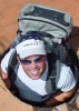
Desert Boonie and I have some "history" with the Four Peaks, each time we always say that's the last, but the peaks keep drawing us back. Like some kind of fetish we seem to have to keep making it more "perverse" to keep it interesting. That's just seems to be our kink and I can't explain it. I would also like to thank Ken for hiking this one with me. While we were tired and somewhat frazzled at times, there is no way that I would have attempted this with anyone but him. He is one of the strongest hikers imaginable and has the same passion for these Peaks as I do. He is fearless and determined and committed. His composure and knowledge of the Peaks kept us on course (mostly) and safe (we made it back anyway-LOL).

This night the Four Peaks offered just what one would expect and threw her usual set of obstacles at us. Ken got cliffed hard and had to make a leap of faith for the next foot hold and I lost my balance early in the night, fell and smashed my hand making it difficult to use. (Two weeks later a surgical procedure found that I had also "acquired" a 3/4 inch thorn in my hand during that fall-no wonder my hand didn't work right.) And on the peaks, it sure helps to have two working hands. I knocked a rock loose that smacked Ken right in his ribs. The full moon was mostly hidden in the clouds and provided little light which challenged our route finding.

While the Peaks did assert themselves, they also had some redeeming qualities. We were treated to some amazing lightning and thunderstorms which danced all around us-and delivered a reverberating echo of thunder for much of the night. This also kept us guessing about whether the lightning was headed our way. We could see the silhoutte of Camelback mountain parked in the midst of the city lights-very comforting. There was a moment of awe and peace sitting in the pale moonlight on the "reverse z."

The wildest thing for me was when a "mist" of clouds came out of the darkness from nowhere and blasted past our headlamps at an amazing clip-like some macabre kind of foreshadowing. The cloud blast occured, of course, while we were working our way up and on top of "razorback ridge" of peak 2. Not the ideal spot for the visually disorienting movement of clouds to rip by. But they did.

There were a few interesting things I noticed while doing this as a night hike. First, when rocks gave way and tumbled, they emitted pronounced sparks as they fell down the mountain. Secondly, the darkness distorted my sense of balance. Thirdly, for people like myself who like to plan their routes, the darkness takes that ability away. At night, one had to trust that a correct route would be chosen, little by little. For much of the night, we had to keep going on trust and assumption that we picked the right way. Sometimes we were right, other times not.

Finally, I would like to re-iterate that this is, in fact, not a hike at all. There are always a few moments that ones own life literally hangs on his or her ability to find or maintain their handhold. The challenges are many, especially if done purely, that is to say, without climbing gear- as we did.

All in all, this went better than either of us expected and we both felt pretty good afterwards. Thank again Ken for another great adventure!

Lastly, when completing the motherlode, we did drink the obligitory/celebratory 4 Peaks brewery beer. It was a little weird to be drinking it at 8AM, but very, very delicious anyway.

Also, saw many hikearizona.com member names in the logs on the peaks. Looked like bigracket1 was the last person to sign in on peak 2 on June 20, 2009.

Three of the biggest challenges with the four peaks is route finding, physical difficulty, and carrying enough water. Going both ways on four peaks, and doing so at night increases the three most challenging aspects of this adventure.
_____________________
"I'd feel better if we had some crampons. Oh, what the hell, let's go for it..." — Common climbing last words.
 
Aug 15 2009
avatar

 Photos 87
 Triplogs 25

53 male
 Joined Oct 18 2002
 Glendale, AZ
Pumpkin Trail #39Flagstaff, AZ
Flagstaff, AZ
Hiking avatar Aug 15 2009
pfredricksTriplogs 25
Hiking11.00 Miles 3,158 AEG
Hiking11.00 Miles   3 Hrs   30 Mns   3.14 mph
3,158 ft AEG
 no routesno photosets
1st trip
Partners partners
desert_boonie
Totals: Somewhere between 18.5-20 miles, elevation gain 5358, Hike time 7hours 40 minutes.

Desert Boonie and I combined the Pumpkin trail with the Bull Basin (BB) to make for a long over and back hike. Started at Pumpkin Trailhead (TH) at 8:05AM. Up Pumpkin trail to Kendrick Summit, then down BB trail to the BB TH.

Then, we turned around and headed right back to the Summit and eventually the Pumpkin TH on exactly the same route. Returned to Pumpking TH at 15:45PM

We had this one on the calendar for about 2 or 3 months and finally had a date to get it done! This fit the bill for a progressively more challenging sort of hike. If Humphries Summit via Inner basin is a "5", this blend of trails is similar in difficulty. This combinatin hike is longer and with more total elevation gain, but definitely not as high an altitude as Inner Basin.

Anyway, the hike went well better than anticipated. It was the perfect day, except for some extreme wind. The wind was whipping thru the trees creating many eerie sounds. The dead areas of forest along the BB should be renamed the "screaming forest." The charred trees which remain also contort into many fantastical, almost living like poses and were fascinating to study. Only saw one other group of hikers the whole day. The scant amounts of water available on the trail-whether filtered or otherwise don't look drinkable. They appeared to have a high likelihood of animal feces contamination.

In summary, had great company, a great hike, and plenty of cowbell. Looking forward to seeing Desert Boonie's pics. My camera went Kaput! ALso, of absolutely no relation to the hike, I got to drive my new Jetta TDI, which smells like Crayons. Left home 430 AM or so, back home in the valley around 5:30 or 6pm, I guess.

I wonder what Desert-Boonie has in store for next time.
_____________________
"I'd feel better if we had some crampons. Oh, what the hell, let's go for it..." — Common climbing last words.
  2 archives
Aug 09 2009
avatar

 Photos 87
 Triplogs 25

53 male
 Joined Oct 18 2002
 Glendale, AZ
Piestewa Peak Summit Trail #300Phoenix, AZ
Phoenix, AZ
Hiking avatar Aug 09 2009
pfredricksTriplogs 25
Hiking2.20 Miles 1,180 AEG
Hiking2.20 Miles
1,180 ft AEG
 no routesno photosets
1st trip
Linked   none no linked trail guides
Partners none no partners
I only wrote this one because it is significant that I went up with Wendy and watched the sunset and ran into Joe Bartels for the second time in a month or so. Hi again Joe!
_____________________
"I'd feel better if we had some crampons. Oh, what the hell, let's go for it..." — Common climbing last words.
 
Jul 25 2009
avatar

 Photos 87
 Triplogs 25

53 male
 Joined Oct 18 2002
 Glendale, AZ
Gavilan PeakPhoenix, AZ
Phoenix, AZ
Hiking avatar Jul 25 2009
pfredricksTriplogs 25
Hiking0.51 Miles 750 AEG
Hiking0.51 Miles
750 ft AEG
 no routesno photosets
1st trip
Linked   none no linked trail guides
Partners partners
desert_boonie
This is one of those little peaks that we drive by so often on I-17. Ken and I just wondered what was on top and "because it was there," we climbed it. The jumping cholla got me (see Desert boonie's pics). He pulled them out, I owe him for that. We went up the south chute and down the north side and veered back west.
If you get near the top and the climb looks to steep move laterally and you will find some easy ascents.

Anyway, this is a cool little climb that takes about an hour each way at an easy-easy pace. The views are great and the top has the biggest cairn I have ever seen. We packed out some trash and a burnt flag...there is a bit more to haul out if you get the chance, hint , hint!

Enjoy!
_____________________
"I'd feel better if we had some crampons. Oh, what the hell, let's go for it..." — Common climbing last words.
 
Jun 12 2009
avatar

 Photos 87
 Triplogs 25

53 male
 Joined Oct 18 2002
 Glendale, AZ
Humphreys via Inner BasinFlagstaff, AZ
Flagstaff, AZ
Hiking avatar Jun 12 2009
pfredricksTriplogs 25
Hiking15.80 Miles 4,400 AEG
Hiking15.80 Miles
4,400 ft AEG
 no routesno photosets
1st trip
Linked   none no linked trail guides
Partners none no partners
Returned to complete this solo after Ken and my mishap. I hate to leave something un-done. Still had several snow fields to cross...and it is June! Looks like Joe and a few others did this a day or two after me. Nice!
_____________________
"I'd feel better if we had some crampons. Oh, what the hell, let's go for it..." — Common climbing last words.
  1 archive
May 19 2009
avatar

 Photos 87
 Triplogs 25

53 male
 Joined Oct 18 2002
 Glendale, AZ
Algonquin Trail #225Prescott, AZ
Prescott, AZ
Hiking avatar May 19 2009
pfredricksTriplogs 25
Hiking
Hiking
 no routesno photosets
1st trip
Linked   none no linked trail guides
Partners none no partners
Very Nice! Thanks Boonie! Beware the Hemi!
_____________________
"I'd feel better if we had some crampons. Oh, what the hell, let's go for it..." — Common climbing last words.
 
Aug 19 2007
avatar

 Photos 87
 Triplogs 25

53 male
 Joined Oct 18 2002
 Glendale, AZ
Big Dipper - Castle Creek WildernessPrescott, AZ
Prescott, AZ
Hiking avatar Aug 19 2007
pfredricksTriplogs 25
Hiking3.20 Miles 1,008 AEG
Hiking3.20 Miles
1,008 ft AEG
 no routesno photosets
1st trip
Linked   none no linked trail guides
Partners none no partners
Okay, I have been on the algonquin trail twice in the last couple weeks..once I passed the turn off for the creek and it appears several others have as well....and after reading some of the comments....I will try to clear up some of the confusion so that everyone can find the water holes and trail head, etc.

The trail head is JUST before mile marker 25. If you reach MM 25, just follow the guardrail BACKWARD for about 100 yards, and when it ends, park there. There is an overlook and just to the right of that you can see a very faint trail begin. Follow that. The trail becomes a bit of a wash...you will pass a "wilderness boundry" post, a sign that says algonquin trial, later you will pass a sign-in/out box, then another sign stating "algonquin trail." Follow the algonquin. You can also see the trail going down the hillside in front of you from time to time.....so that you can see where you are heading.

Okay, so now you are on the trail. As you descend, you will begin to see a wash (streambed) in front of you. The wash goes down hill from RIGHT to left. Take a left at this big wash and it is as you reach the bottom of the hill-full of big boulders to scamper over. There was also be two big cairns marking this point-don't know if they will always be there. You want to turn left (at the cairns) and enter the streambed here...(moving down hill) The trail continues on and immediately turns left after you cross this wash-BUT, you don't want to follow it-again (this is the continuation of the algonquin), you want to start scrambing down the creek bed. [NOTE: In my previous trip..I continued on found an old building and a couple old pieces of equiptment and I believe this is the old Algonquin mine...I think this trail eventually takes you to horsethief basin...I'll find out someday] You can also tell you missed your turn into the wash if you find that you begin ascending from from creek bed and a bit later find that you can see a confluence on your left from the trail above the creekbed. You should actually be in that confluence and heading downstream!

Okay, so you made it into the wash and are heading down the stream bed...when you reach the next confluence (as described above), head left again (downstream) keep going for approx. 15 minutes of moderate to easy scrambling ( no real bushwacking) until you reach a water section that has fairly steep edges on both sides and a nice 40 yard or so section of water in the middle. I BELIEVE that this is what's called the Narrows- but I could well be wrong. It looked like a moderate scramble on the banks, but I didn't do that and why should you? You came to get in the water! It is a great place to finally get in and it was only chest deep (no guarantees). It was easy to wade thru and felt SO cold at first, but probably cause I was so hot-but nice after about 5 seconds. Just wade in and you won't regret it. Do NOT be tempted to stop your here! IF you scramble for ONLY about 5 minutes beyond the narrows you will come to what I understand is the Big Dipper. IT is about 50x more awesome than the previous pool. THere is about a 20 foot drop off sheer rock wall waterfall and a big pool below. Very, very kewl. See the others' pics. There was a very nice rope tied off on the left side-which looks pretty good and I used it-but don't endorse it necessarily. Be careful approaching the Big Dipper. The rock is polished smooth and Way slicker than it looks.. A VERY COOL place indeed. I showed an elevation drop/gain of approx 1100 feet (each way) for this excursion. The whole trip took 4 hours including a bit of swimming, eating and resting. Enjoy@!!(&#%U

I did a fair bit of research on this area. What I referred to here as "big Dipper" others have called Hell's hole. Can anyone answer this once and for all? I am not really sure....whatever you call it though...this was a neat destination! This is a trail only travelled approx. once per week or less on average-

Oh, and one more note. The area is thick with Arizona Black Rattlers. I did this one the first time at night and was inches from stepping on one that was all coiled up. And apparently, you can't hear their rattle, so keep yer eyes peeled! This is an great water destination hike. Very hot in the summer though, with no shade! Be prepared! Also, thank you AZ OUTDOORSMAN for answering my question!
_____________________
"I'd feel better if we had some crampons. Oh, what the hell, let's go for it..." — Common climbing last words.
  1 archive
Aug 05 2007
avatar

 Photos 87
 Triplogs 25

53 male
 Joined Oct 18 2002
 Glendale, AZ
Flume TrailCamp Verde, AZ
Camp Verde, AZ
Hiking avatar Aug 05 2007
pfredricksTriplogs 25
Hiking7.40 Miles 494 AEG
Hiking7.40 Miles
494 ft AEG
 no routesno photosets
Linked   none no linked trail guides
Partners none no partners
first time back to the flume trail in a long time.....recent rains made creek a bit of a dicey proposition to cross...
even less to look at now with most of flume removed....still some sections though....
even beginning of the fossil creek was over run with muddy water...no clear pools at this time.....

Joe Bartels is still my hero!
_____________________
"I'd feel better if we had some crampons. Oh, what the hell, let's go for it..." — Common climbing last words.
 
Oct 05 2005
avatar

 Photos 87
 Triplogs 25

53 male
 Joined Oct 18 2002
 Glendale, AZ
Four Peaks Mother LodePhoenix, AZ
Phoenix, AZ
Hiking avatar Oct 05 2005
pfredricksTriplogs 25
Hiking7.80 Miles 4,060 AEG
Hiking7.80 Miles
4,060 ft AEG
 no routesno photosets
Linked   none no linked trail guides
Partners none no partners
Just wanted to add this triplog, since I didn't include one from this hike when I did it the back in 2005. This trip was my second successful "motherlode"

Much better once the route gets figured out.
_____________________
"I'd feel better if we had some crampons. Oh, what the hell, let's go for it..." — Common climbing last words.
  3 archives
Jan 18 2004
avatar

 Photos 87
 Triplogs 25

53 male
 Joined Oct 18 2002
 Glendale, AZ
Hellsgate 37 ( North ) to Tonto CreekPayson, AZ
Payson, AZ
Backpack avatar Jan 18 2004
pfredricksTriplogs 25
Backpack14.10 Miles 3,200 AEG
Backpack14.10 Miles
3,200 ft AEG
 no routes
Linked   none no linked trail guides
Partners none no partners
Another great hikearizona.com crew. Tim knowingly went sans sleeping bag in order to pack in extra beer. Unfortunately, as we fished, most of the beers went floating by after he tried to cool them in the river. Brad and Slisk made unbelievable sacrifices with their vehicles for the common good of the group. I decided to give the group a guided tour of some of the trails around the hellsgate area. Some think that I was lost, but, really just wanted to show them alot of the area. Chef Mike cooked up some delicious grub, for his Fiancee as the fellows gathered round a salivated. Great to meet you all. til next time
-Pete
_____________________
"I'd feel better if we had some crampons. Oh, what the hell, let's go for it..." — Common climbing last words.
 
Dec 20 2003
avatar

 Photos 87
 Triplogs 25

53 male
 Joined Oct 18 2002
 Glendale, AZ
Four Peaks Mother LodePhoenix, AZ
Phoenix, AZ
Hiking avatar Dec 20 2003
pfredricksTriplogs 25
Hiking7.80 Miles 4,060 AEG
Hiking7.80 Miles   10 Hrs      0.78 mph
4,060 ft AEG
 no routesno photosets
Linked   none no linked trail guides
Partners none no partners
Four Peaks Mother Lode: The name "Four Peaks Mother Lode" is another Joe Bartels creation. This is simply his title for the attempt to summit each of the Four Peaks in one day. It is a fantastic physical and mental journey affording some spectacular views. On a clear day, one can see Roosevelt lake, the Superstitions, the Mogollon rim, Apache junction, Mt Humphries and so much more from a single spot. That alone is worth the trip and just plain cool.


Begin at the Lone Pine trailhead. Head up the
trail toward Brown's Peak until you reach the junction of the
Amethyst Trail going right. (Don't forget to mark this waypoint on your GPS) Looking at Brown's Peak, follow the
Amethyst to the right and proceed down the trail with
the peaks at your left until you reach the PRIVATE PROPERTY sign and gate. This is the world famous Amethyst Mine. Much of the best Amethysts in the world are mined from this site and helicoptered out. You must call ahead for permission. (480-994-4185) Continue on the trail and start ascending the staircase found just beyond the gate. Climbing the stairs, look left and notice the long, steep draw heading up the mountain . Ascending this will deliver you to the saddle between peaks 1(to the right) and 2(to the left). From there, you are pretty much on your own. Route finding is probably the most complicating factor. Be careful
to examine each peak from the different distances and
angles. After leaving the summit of Peak 2, it is probably worth a try scrambling to the left. The descent on the right is "do-able" but burns a lot of time and energy. Completing a day hike recon in anticipation of the full attempt is recommended. It is also advised to try one or two of the peaks before
committing to the entire mother lode. This will give some time to consider the approaches. A few things should be evaluated before deciding to tackle this beast. Fear of heights and comfort level with exposed climbs should be considered. Bushes, cactus,
jagged rocks are present throughout and will shred your arms and legs, so wear sleeves and pants. Also be careful to note the temperature of the rocks as you will be putting your hands on them all day. Small groups of 3-4 folks with equal ability are recommended. There are no water sources, bring plenty of water. Scrambling shoes advised. Getting lost in this park is very common-especially coming down from Brown's. The Sheriff's search and rescue folks visit this area often.

At first glance, the Four Peaks appear to be rolling, hiker
friendly hilltops. Don't kid yourself. Most people that start this hike, don't finish it. This thing isn't even actually a hike. Be prepared for anything. With that being said:Thrill seekers will LOVE it! Have a great time.
_____________________
"I'd feel better if we had some crampons. Oh, what the hell, let's go for it..." — Common climbing last words.
 
Dec 02 2003
avatar

 Photos 87
 Triplogs 25

53 male
 Joined Oct 18 2002
 Glendale, AZ
Bob Bear Trail #18 - Fossil CreekCamp Verde, AZ
Camp Verde, AZ
Hiking avatar Dec 02 2003
pfredricksTriplogs 25
Hiking8.00 Miles 1,391 AEG
Hiking8.00 Miles
1,391 ft AEG
 no routesno photosets
1st trip
Linked   none no linked trail guides
Partners none no partners
Dramatic changes due by December of 2004-.
I think camping will soon be forbidden at the area we now know as Fossil Springs. Dramatic changes to come
I havent done the trip from this side, but have from Flume side...... just wanted to pass this info along. Camp there now, cause you might not be able to again.
http://www.aps.com/my_community/StoryAr ... ve_18.html
and
http://www.epa.gov/fedrgstr/EPA-IMPACT/ ... i15092.htm
and
http://www.rmrs.nau.edu/lab/4302/fc/

I think this is what Riley was alluding to.
_____________________
"I'd feel better if we had some crampons. Oh, what the hell, let's go for it..." — Common climbing last words.
 
Nov 29 2003
avatar

 Photos 87
 Triplogs 25

53 male
 Joined Oct 18 2002
 Glendale, AZ
Flume TrailCamp Verde, AZ
Camp Verde, AZ
Hiking avatar Nov 29 2003
pfredricksTriplogs 25
Hiking7.40 Miles 494 AEG
Hiking7.40 Miles   3 Hrs      2.47 mph
494 ft AEG
 no routesno photosets
Linked   none no linked trail guides
Partners none no partners
This trip was offered up in the HAZ forum. Since there was a competing hike on the table for the same weekend, I was the only taker for the flume trail. I had once before tried to hike with this member. She literally wrecked her truck to get out of the hike. She was out of excuses to cancel on me. She graciously agreed to pick me up. (in her newSUV, of course) We met at Starbucks early Saturday (101&I-17) and made tracks for the TH. There was a brief stop at the Texaco in Camp Verde, where she smartly noted that the cashier was "not a morning person." Then it was on to the trailhead. Total drive time was only about 2hrs 30 minutes. We arrived at the parking lot and noted several piles of glass-presumably remnants of other hikers' smashed car windows. The parking lot also contained another hiker named Sam who decided to pop in for the hike. What a pleasant suprise edition to the trip. We each exchanged pleasantries then headed out. None of us were sure what to expect with the initial stream crossing. This day, it was a cinch. I would think this stream would be passable (either up or downstream) in all but the worst rains. This trail itself is simple. Cross the stream, and start heading up the hill, then follow the road to the right. Easy.
The hike to the Fossil Springs was like a stroll down a long, windy, county road with a couple of childhood buddies, with little scenery except the ever-present flume. The trail is totally exposed and would probably be a scorcher in the summertime. Forget the trail. Keep thinking of the springs. This is definitely a destination hike. This springs are fantastic! There were springs everywhere. I mean - water flowing out of cracks in the sides of the hill. There were trees and patches of rasberry bushes and fantastic emerald pools of water. However, even spectacular weather with temps in the mid 70's, couldn't coax us into swimming. That was the real disappointment of doing this trip in November. Sam gave it his all, but the cool water turned him back toward the shore at the predictable depth that most men make their swim/no swim decision.
We had a relaxing morning and returned to the TH by early afternoon. We all agreed that this trip would most likely be better via the Fossil Springs trail and definitely worth an overnight or two, if ya dont mind a little company. There were two groups of campers there. A couple of hikers suggested filling our water bottles in the springs. I still had plenty though, and I am not sure, but, I think mineralized water contains some stuff ya dont want to drink. Please let me know.
Both the coordinator and Sam are fantastic human beings, great hikers with many interesting conversations between them. Both are highly recommended hiking company and I look forward to hiking again with these new friends. Another plus is.... Sam carries a big pack. He asked me if there was anything that I wanted, and I said, "Sardines sound good." AND HE HAD SOME IN THERE!!!!!!!!! :lol:
As planned, the trio headed over to Verde Hot Springs for a relaxing soak and a cocktail or two. Sam drove his vehicle to VHS. The coordinator and I stopped briefly to do a little target shooting. She proved to be quite handy with my 9mm, showing no mercy on a defenseless can. I could have sworn that I heard her mutter under her breath, "I didnt bring you into this world, but, I can take you out." Maybe, I was hearing things. :twisted: After that, we drove over to VHS for the relaxation. That trip was a whole story unto itself. Maybe some other time. Probably not though. :roll:

It appears that this entire area is about to change DRAMATICALLY!
The Forest Service has some dramatic proposals for the area.
READ THESE:

http://www.aps.com/my_community/StoryAr ... ve_18.html
and
http://www.epa.gov/fedrgstr/EPA-IMPACT/ ... i15092.htm
and
http://www.rmrs.nau.edu/lab/4302/fc/
_____________________
"I'd feel better if we had some crampons. Oh, what the hell, let's go for it..." — Common climbing last words.
 
Sep 28 2003
avatar

 Photos 87
 Triplogs 25

53 male
 Joined Oct 18 2002
 Glendale, AZ
Willow ValleyPayson, AZ
Payson, AZ
Hiking avatar Sep 28 2003
pfredricksTriplogs 25
Hiking6.50 Miles 760 AEG
Hiking6.50 Miles
760 ft AEG
 no routes
1st trip
Linked   none no linked trail guides
Partners none no partners
I cannot claim to have hiked this canyon- but for those that want to ...I want to pass on a little tip. FR81 is 7 miles down hiway 3 from clints well....not about 10. Also FR81A is not the same as FR81.
This was originally intended as a group hike. Everyone cancelled except for matt, who I was incommunicado for the last couple days before this hike-Never did see him. Everything pointed to not doing this hike. Sometimes, one needs to read all of the signs. I ah......was reading them and ignoring them. Woopitup, got in an accident preventing her from going...totalled her SUV, two others cancelled........one at the very last minute.
I showed up late to meet Matt at CLint's Well because there was a delay due to an accident on the I-17. I had talked a friend into going, literally at 10pm the night before from a cell phone call to her at the club. Well, she called at 5am to tell me that her daypack was missing. I loaned her one of my camelbacks- but later realized that the bite valve was missing. Had to use a pen cap to plug the hole. Okay, then after not finding Matt at Clints Well, headed down forest hiway 3, but my friend and I were chatting it up and didnt notice to look for fr81 till mile 10.5 (supposed to be about 10 miles in). We Doubled back for 2 miles....no fr81, thought maybe we hadnt gone far enough, so doubled back the other way again, drove 7 miles......hmmmmmm, doubled back again....found FR81A, about a block from where we doubled back in the first place. Well, I have a amry and drove 81A for as far as I could........which was until I knocked the exhaust system loose on my car. Then I parked about (what I thought was ) 4.8 miles from the beginning of Willow Valley. WE hiked for several miles and found a nicely smooth gravel road and did not find the route to be as described. The trail description did not make any sense as we hiked it. I secretly wondered if whether we were on the right trail and if the A on 81A had anything to do with it. Hiked back to the car that was now sounding like an exhaustless VW bug. After a few bumpy/bottom dragging miles on 81A we made it back to hiway 3. We turned onto it and started to drive back to Clints Well (time is now noon) ....About two blocks down hiway 3 toward Clints well was FR81. F**&%$#@*!!!!!! That smooth road we hiked to was the correct road in the first place. I sacrificed my car for nothing!!!!!! We had mistaken FR81A for FR81. TAKE FR81!!!!!!!Well, I just HAD to find this Willow Valley, so I took FR81 as I should have in the first place. Later, I found out that
even FR81 gets a little bumpy for a passenger car about 1 mile from the Maxwell Tank. (by the way, a tank is a pond) So, at 12:45 we made it to the tank. My friend just HAD to be back by 3:30 for a party. WE hiked down the side canyon to the canyon proper, took a few pictures and headed back. The walls were much higher and more narrow than I expected. Now get this....the canyon was laughing at me, because it was nearly two and we had to turn around. The nerve of some canyons. So, I will bag this canyon yet.
Lastly, we got stuck in a traffic jam due to the same accident returning to phoenix, but ONLY delayed us about 60 minutes.
Home around 6pm.
_____________________
"I'd feel better if we had some crampons. Oh, what the hell, let's go for it..." — Common climbing last words.
 
Sep 24 2003
avatar

 Photos 87
 Triplogs 25

53 male
 Joined Oct 18 2002
 Glendale, AZ
Humphreys Summit Trail #151Flagstaff, AZ
Flagstaff, AZ
Hiking avatar Sep 24 2003
pfredricksTriplogs 25
Hiking9.00 Miles 3,313 AEG
Hiking9.00 Miles   6 Hrs      1.50 mph
3,313 ft AEG
 no routes
1st trip
Linked   none no linked trail guides
Partners none no partners
Talk about planning. Never had in inkling that I was going to do this trip today. In fact, I had done a killer squat routine at the gym the day before. Let me recommend against that. Anyway, got up at 6am, put on my work clothes, grabbed some coffee and started driving. An impulse and a phone call later, I was back on my way home. yeeehaaa. Grabbed a few things and off to Flagstaff I went. Hit the TH @ 1140AM. Hike started off nice, up and up through wooded switchbacks. I carried about 20 lbs of supplies on my back figuring I might be the only one there, boy was I wrong. There were twenty or more people I ran into on the trail. Once you get out of the treeline near the peak, it is about an hour more of scrambling, and faux peaks. I do have to admit that last part was a kicker. I had to take my time, the altitude made my legs a little slow and I kinda had slow thoughts , but, I had prayed to the mountain gods this day and they smiled brightly upon me. Spent about 1/2 hour on top-no bugs noted by the way. There was a guy that was at the summit when I was, it took him five hours to go up and it looked like it would take him at least that to get down and we left the summit at 345P He immediately fell way behind. He was only carrying a fanny pack, so I dont think he had a light, or clothing, or food, and from our conversation, he also had very little experience as a hiker. I started doing some math and I estimated at best his return time to be 845 PM IF he could even see where he was going. I called Flagstaff PD to let them know, but, it shows how things could get bad in a hurry. Made it back to PHX by 8pm. Great hike, great views, can't wait to go back.
_____________________
"I'd feel better if we had some crampons. Oh, what the hell, let's go for it..." — Common climbing last words.
 
Jul 08 2003
avatar

 Photos 87
 Triplogs 25

53 male
 Joined Oct 18 2002
 Glendale, AZ
Mesquite Canyon Trail - White Tank MountainsPhoenix, AZ
Phoenix, AZ
Hiking avatar Jul 08 2003
pfredricksTriplogs 25
Hiking2.60 Miles 900 AEG
Hiking2.60 Miles
900 ft AEG
 no routesno photosets
1st trip
Linked   none no linked trail guides
Partners none no partners
I sure wish that I didnt have to pay $5 to go in here, and that they didnt close the gates at night. Hey, I did this trail a few times before, and I dont really remember any mesquite trees-maybe there were, but not many, i dont recall. This is a nice loop if done with goat camp. Crowds arent too bad- certainly not like flatiron.
_____________________
"I'd feel better if we had some crampons. Oh, what the hell, let's go for it..." — Common climbing last words.
 
Jul 08 2003
avatar

 Photos 87
 Triplogs 25

53 male
 Joined Oct 18 2002
 Glendale, AZ
Goat Camp / Mesquite LoopPhoenix, AZ
Phoenix, AZ
Hiking avatar Jul 08 2003
pfredricksTriplogs 25
Hiking6.60 Miles 1,662 AEG
Hiking6.60 Miles
1,662 ft AEG
 no routesno photosets
1st trip
Linked   none no linked trail guides
Partners none no partners
Did this trip several times-dont really remember when- but a nice trail- oh, and also, my GPS (not that you need one) twice did this thing where it was trying to lead me to about 1/2 mile south and west of the TH. I repeated it weeks later and it did the same exact thing. Maybe it is the radio towers? IF any others experience this I would be very interested to know. I dont trust my GPS anymore. It was kinda freaky to almost convince myself to wander off the trail at night to follow the GPS lead. (I didnt) But you can really second guess yourself in complete darkness.
_____________________
"I'd feel better if we had some crampons. Oh, what the hell, let's go for it..." — Common climbing last words.
 
Jun 21 2003
avatar

 Photos 87
 Triplogs 25

53 male
 Joined Oct 18 2002
 Glendale, AZ
Woods Canyon - SedonaFlagstaff, AZ
Flagstaff, AZ
Hiking avatar Jun 21 2003
pfredricksTriplogs 25
Hiking14.00 Miles 2,485 AEG
Hiking14.00 Miles
2,485 ft AEG
 no routes
1st trip
Linked   none no linked trail guides
Partners none no partners
It was a nifty excursion. The others said 'nuf.
_____________________
"I'd feel better if we had some crampons. Oh, what the hell, let's go for it..." — Common climbing last words.
 
average hiking speed 1.32 mph
1, 2  Next

WARNING! Hiking and outdoor related sports can be dangerous. Be responsible and prepare for the trip. Study the area you are entering and plan accordingly. Dress for the current and unexpected weather changes. Take plenty of water. Never go alone. Make an itinerary with your plan(s), route(s), destination(s) and expected return time. Give your itinerary to trusted family and/or friends.

helpcommentissue

end of page marker