|
| | | Skull Mesa from Cave Creek TH, AZ | | | |
|
|
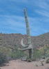
Skull Mesa from Cave Creek TH, AZ
| | |
| |
|
| Hiking | 20.04 Miles |
4,132 AEG |
| | Hiking | 20.04 Miles | 10 Hrs 42 Mns | | 2.04 mph |
| 4,132 ft AEG | 53 Mns Break | | | |
|
|
| |
| Partners |
|
[ show ]
| partners | | I’ve had this hike on my radar since December, but kept getting distracted from actually getting it done, so I invited Kelly along so I couldn’t back out of it on yet another weekend.
Got to the Cave Creek TH just after 0700 and got started. Some cloud cover to start, but unfortunately it didn’t last too long. Got to the creek pretty quickly, and the water was low enough to cross easily.
Once on the other side, we headed up to Skunk Tank trail and headed west. Generally easy walking on the old road, although it is rocky in places.
At the junction with Quien Sabe trail, we headed south on Quien Sabe, again on a good trail/old road. After a steady uphill, we started dropping down and the road turned to just an old trail and faded somewhat after a while. It got easy to spot again as we continued heading downhill, but was once again rocky. After crossing a dry wash, the trail immediately headed back uphill, still vague in places.
We reached the junction with Skull Mesa Trail and took the south, then west. Again, a vague trail, but we had an idea of where we wanted to be and headed that direction, eventually finding the trail again and it steeply climbed the east slope up to Skull Mesa. Having at least an old trail bed to follow was a big help. Once atop the mesa, we headed over to the highpoint, then meandered off in the direction of the ruins. We weren’t too concerned with finding a trail, avoiding prickly pear was the main objective and as long as we were heading in generally the right direction, we were good.
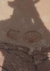
As we got onto the peninsula leading to the ruins, we followed the obvious track. One scramble through the rocks, and a steep climb over the last little hill before the ruins. Some catclaw, but most easily avoided. We looked around the lower ruins, then headed up to the ruins at the top, where we had lunch. There were three other hikers up top, the only people we saw all day.
After we looked around and took plenty of pics, we headed back the way we came. At the little steep hill, Kelly spotted a trail leading around the southwest side of the hill. It completely avoided the steep climb up and over, so that is my new favorite detour.
Again a meander across Skull Mesa as we headed back east. We tried to follow cairns at times, but it turned into more of a scenic walk, which was fun to look around as we made our way over to where we drop off the mesa. After that, we retraced our steps all the way back to the trailhead, finishing up around sunset.
Great day, and a fun hike. While heading to the ruins from Spur Cross is certainly easier, this was a nice way to do something a little different. As always, good to hike with Kelly again. |
| _____________________
| Stop crying and just go do the hike. |
| | |
|
|
|
 Route Editor