username
X
password
register
for free!
help
ArticlesGuidesRoutes
 
Photosets
 
 Comments
triplogs   photosets   labels comments more
Pinal County Highpoint - 5 members in 6 triplogs have rated this an average 3 ( 1 to 5 best )
6 triplogs
login for filter options
Feb 20 2020
avatar

 Guides 99
 Routes 1,484
 Photos 16,072
 Triplogs 1,374

male
 Joined Jan 07 2017
 Fountain Hills,
Rice Peak - Pinal Co Hi Point - Silly Mtn, AZ 
Rice Peak - Pinal Co Hi Point - Silly Mtn, AZ
 
Hiking avatar Feb 20 2020
DixieFlyerTriplogs 1,374
Hiking10.60 Miles 3,415 AEG
Hiking10.60 Miles
3,415 ft AEG
 
1st trip
I have had the Pinal County High Point on my Radar screen for a while, so I decided to head towards Tucson and add Pinal County to my AZ County High Point list. I have now done 10 of the 15 AZ county high pointers, and hope to get at least 4 of the 5 done in the coming months. I still have to figure out what to do about Mount Graham.

I drove down and took FR 29 from Peppersauce Campground for about 1.5 miles and parked. As it turned out I could have driven another 3/4 mile or so and parked at the junction with 29-4472-4475. I was fine with parking where I was to make a more legitimate hike out of it. I think that a 2WD vehicle with decent clearance could go about a mile from the campground, but if you went much further than that it would be better in a 4WD vehicle.

My route on the way up went from FR 29 to FR 4472 to FR 4483, which led up to Rice Peak. Then I did an easy off-trail descent down the north slopes of Rice to the Pinal County High Point. I then retraced my steps back up to Rice Peak and then back to FR 4483. This time, when I got the 4483-4475 junction, I took FR 4475 just to take a different route back. I believe that @chumley drove up this road when he bagged the Pinal Hi Point, and there were some steep, steep sections of the road, which would for sure make for an adventurous drive.

On my way back into town I was driving through Gold Canyon and decided to stop off and bag Silly Mountain, since I had never done it. There is actually a decent trail system through there with lots of trails -- where else can you do a 1.8 mile hike and be on 7 trails? I did a short loop and bagged Silly Mountain, and there were a number of other trails that I did not go on.

The mileage and AEG for the 2 hikes are as follows:
Rice Peak/Pinal Co High Point: 8.8 miles with an AEG of 2,949'
Silly Mountain: 1.8 miles with an AEG of 466'

The stats above are the sum of these two.
 Fauna
 Fauna [ checklist ]
[ checklist ]  Ladybug beetle
 Geology
 Geology [ checklist ]
[ checklist ]  Quartz
wildflower observationwildflower observationwildflower observationwildflower observationwildflower observation
Wildflowers Observation Moderate
There were a few wildflowers in bloom on Silly Mountain -- quite a few brittlebush and globemallow, and a few creosote bush and Dichelostemma capitatum.
_____________________
Civilization is a nice place to visit but I wouldn't want to live there
 
Apr 26 2016
avatar

 Guides 94
 Routes 840
 Photos 22,055
 Triplogs 1,993

52 male
 Joined Sep 18 2002
 Tempe, AZ
Pinal County HighpointTucson, AZ
Tucson, AZ
Hiking avatar Apr 26 2016
chumleyTriplogs 1,993
Hiking1.45 Miles 762 AEG
Hiking1.45 Miles      54 Mns   2.07 mph
762 ft AEG      12 Mns Break
 
1st trip
Linked   linked  
Partners none no partners
The Approach:

After a quick morning in Sacaton, I decided to head for Mt. Lemmon. I've driven the back road off Lemmon to Oracle once before, but it was years ago, and I've never hiked on this side of the Catalinas. I know very little about the area.

With the goal of reaching the Pinal County Highpoint and the nearby Rice Peak, I did some quick HAZ research and saw some big climbs from the Peppersauce area. I also saw that there's actually a road all the way to Rice Peak that is open to all vehicles according to the FS MVUM. I had read online that the road can get a little bit rough near the top but my day had taken longer than planned and a 10+ mile hike was not in the cards with the amount of daylight remaining. So I decided to cut some of the mileage by driving the road.

Holy crap what an unexpected adventure! If you're into jeep roads, this one is a beaut! There is minimal rock crawling or climbing shelves or obstacles, but overall the road is ridiculously steep with some tippy exposure, and covered what is best described as scree. Loose rock that provided little firm traction and left my truck unable to ascend in 4-low without engaging the locker :)

I went down one hill so steep that I became concerned I wouldn't be able to get back up. There was a switchback so tight I had to perform a 7-point turn 100 yards ahead of it and approach it in reverse, only to continue uphill going forward. :)

Hiking, schmiking! This was a great drive! :y:

I finally reached the ridgeline (FR 4483) and the AZT. I drove up the ridge a bit before reaching a spot that I decided not to proceed beyond. It could have been done, but I would have preferred a spotter and another support vehicle. At this point, I was close enough to the peak it didn't justify anything riskier than I had already done.

The Hike:
With just under a mile to Rice, I started hoofing it up the road at about 4:30. Wow is this a steep section of road/trail! Finally above the switchbacks, the grade moderated before the final push to the summit of Rice, which is also very steep.

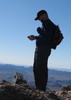
I found the benchmark, and then checked my GPS to make my way toward the county high point on the north slope. I followed an obvious use path to the northeast for a short distance before it disappeared and then had to cut back toward the ridge that would obviously be the highest point that crosses the county line. Checking the GPS frequently, I got close to where I thought it should be. Sure enough, about 30 feet to the north, I spotted a large pile of rocks with a bright red can housing a register sitting nicely on top! :y:

I looked at the register, and saw only one HAZ name in it... from 2005. A comment from one of the signers said "If only Rice Peak was in Pinal County! The efforts we go to reach COHPs is amazing!" :lol:

I was happy to find the cairn, signed the register, and then contemplated the route back to the road. I opted to head downhill rather than backtracking to Rice, and had managed about 20 feet before I decided to zip on my pant legs due to the obvious mess I was about to endure. Not more than 20 feet after moving again, I stumbled upon an old road cut that descended steeply down the ridge. I followed this down a while before realizing this old road was not going to get me back to my truck. At the correct contour, I turned west and traversed over to the main Ridge and my waiting truck. I was happy to have my pant legs on as pushing through the thick brush was difficult and very stabby. I don't recommend this to anybody.

Back at the truck, I skipped the summit beer with apprehension for the descent ahead of me. After studying topo maps carefully, I decided to choose a different route down (I'd almost always rather choose the known over the unknown, but the route I had taken up was one I didn't wish to return on). The ridgeline route on FS4483 was a better choice. By no means easy, pleasant, or other rosy adjective -- just a better choice than the road I had taken up the mountain (FS 4475).

A quick stop at Peppersauce Campground (nice place!) and I was on my way back to Oracle. Stopped at the Tom Mix Memorial, and still don't know who the guy was or why he has a memorial in the middle of absolutely nowhere! :-k

All in all, a pretty good day! :)
 Named place
 Named place [ checklist ]
[ checklist ]  Rice Peak
_____________________
I'm not sure what my spirit animal is, but I'm confident it has rabies.
 
Mar 31 2012
avatar

 Guides 1
 Routes 148
 Photos 9,924
 Triplogs 3,652

63 male
 Joined Apr 02 2005
 Mesa, AZ
Oracle Ridge - AZT #12Tucson, AZ
Tucson, AZ
Hiking avatar Mar 31 2012
Tortoise_HikerTriplogs 3,652
Hiking27.20 Miles 4,550 AEG
Hiking27.20 Miles   12 Hrs   19 Mns   2.21 mph
4,550 ft AEG
 no routes
1st trip
Another outing on the Arizona Trail.Bruce had all the logistics figured out and picked me up and then Dave. The Father set up a car at one end.Then he had a friend(Fred)take us up Mount Lemmon.Thanks Dave, Fred,and Bruce.A locked gate added an extra 1.5 miles to the days hike.This hike was a challenge with lots of different terrain.There was some snow at the top but not much.The first half with the pines,boulders,streams was pretty nice and the climb didn't seem that bad although it felt a little warm.We ate our lunch in Summerhaven then headed out.It seemed a little erie going through the dead zone on Oracle Ridge.Some great views though.Below Rice Peak it got better with some grassland and greener vegetation.I thought we would be hot as we got lower but the late afternoon hours really made the temps nice.The sunset was a nice one and we did our last hour with headlamps.This was my first AZT I haven't done at least once with Joe.We really missed his signing,jokes,encouragement,wealth of knowledge,etc.... :( Get well my friend,get well.We will help you make this one up.Thanks Bruce and Dave, you rock! 38 passeges down and 5 to go! :y:
 Named place
 Named place [ checklist ]
[ checklist ]  Oracle Ridge
wildflower observationwildflower observationwildflower observationwildflower observationwildflower observation
Wildflowers Observation Isolated
_____________________
Tortoise Hiking. Stop and smell the Petrichor.
 
Mar 31 2012
avatar

 Guides 16
 Routes 81
 Photos 1,269
 Triplogs 1,144

51 male
 Joined Apr 30 2008
 Tucson, AZ
Oracle Ridge - AZT #12Tucson, AZ
Tucson, AZ
Hiking avatar Mar 31 2012
azdesertfatherTriplogs 1,144
Hiking27.93 Miles 4,659 AEG
Hiking27.93 Miles   12 Hrs   19 Mns   2.65 mph
4,659 ft AEG   1 Hour   46 Mns Break
 
1st trip
Started the day on top of Lemmon. Friend of mine, Fred, graciously gave us a ride to the top. Only made it as far as the gate next to the Iron Door Restaurant. The gate wasn't open, which meant our trip got an extra mile and a half in length. We hiked to the outhouse by the electrical substation, where we needed to start, and the guys needed all needed a potty break, so I took a quick jog to the top of Lemmon and back...then after these two little hikes, the hike REALLY began!

On the way up in doing segment 11 we took trail #5, so this time we took trail #5A back down to the Lemmon Trail. First time on the Wilderness of Rocks trail, really nice. Then to Marshall Gulch and up the road to Summerhaven for lunch. Denny and I decided to cheat and get a soda and candy bar before heading out ... nice!

After lunch in town we headed to the Oracle Ridge Trail, where things turned pretty scarred and ugly. Amazing after all this time, it is not bouncing back...not even grass coverage or anything on the ground, just all dead. Nice views on the ridge though, incredible views! The further down the trail we went, the better things looked though.

One nice thing about today is that I started the day climbing the highest peak in Pima County and that afternoon we all scaled the highest point in Pinal County, Rice Peak. The peak itself is still in Pima County, but the edge of the mountain is still higher than any other place in Pinal...so the day was a two-fer!

Denny was a little nervous about us hiking out in the dark, but we didn't need lamps until we turned onto the Cody Trail, and all went well.

And the most exciting thing about the day is that when we arrived at American Flag Trailhead, the 3 of us had the Arizona Trail finished from Mexico to the North Rim of the Grand Canyon completed!!! Awesome.

Surprised by seeing virtually no wildflowers all day. The only place we really started to hit even a few was on the Cody Trail...we saw them in our headlamps.

We're nearing the end boys...just 5 segments to go!
 Culture
 Culture [ checklist ]
[ checklist ]  Benchmark
wildflower observationwildflower observationwildflower observationwildflower observationwildflower observation
Wildflowers Observation Isolated
_____________________
"I went to the woods because I wished to live deliberately, to front only the essential facts of life, and see if I could not learn what it had to teach, and not, when I came to die, discover that I had not lived." — Henry David Thoreau
  1 archive
Dec 12 2005
avatar

 Triplogs 129

64 male
 Joined Dec 17 2004
 Gilbert, AZ
Rice PeakTucson, AZ
Tucson, AZ
Hiking avatar Dec 12 2005
azpeavyTriplogs 129
Hiking9.10 Miles 2,502 AEG
Hiking9.10 Miles   3 Hrs   46 Mns   2.42 mph
2,502 ft AEG
 no routesno photosets
1st trip
Linked   linked  
Partners none no partners
Two points satisfy obtaining HP; one is the intersection of Oracle Ridge and the Pinal/Pima county line and the other is a small knoll located 1325 ft. NNE of Rice Peak.

My Trailhead: 0.6 miles west of Mt. Lemmon Highway on FR29 in Peppersauce Canyon (approximately 10 miles south of Oracle).

Followed FR29 to FR29C to FR4472 to FR4483. Left FR4483 at switchbacks, headed off-trail east to ridge and located cairn (GPS elev. 7305). Continued off-trail to the knoll (GPS elev. 7257). Returned by heading off-trail west to meet back with FR4483. Hike elevation gain: 2502 ft.
_____________________
  3 archives
Apr 09 1995
avatar

 Routes 36
 Photos 2,658
 Triplogs 1,347

67 male
 Joined Jul 28 2004
 Scottsdale, AZ
Rice PeakTucson, AZ
Tucson, AZ
Hiking avatar Apr 09 1995
mazatzalTriplogs 1,347
Hiking8.80 Miles 3,951 AEG
Hiking8.80 Miles
3,951 ft AEG
 no routesno photosets
Partners none no partners
This was our third attempt to reach Rice Pk due to private land issue and heavy brush the previous times. Success this time.
[Back then the only trail was the old one described in the description. The current track/AZT alignment did not exist, the old alignment passed the county highpoint]
_____________________
  1 archive
average hiking speed 2.34 mph

WARNING! Hiking and outdoor related sports can be dangerous. Be responsible and prepare for the trip. Study the area you are entering and plan accordingly. Dress for the current and unexpected weather changes. Take plenty of water. Never go alone. Make an itinerary with your plan(s), route(s), destination(s) and expected return time. Give your itinerary to trusted family and/or friends.

helpcommentissue

end of page marker