username
X
password
register
for free!
help
ArticlesGuidesRoutes
 
Photosets
 
 Comments
triplogs   photosets   labels comments more
Brins Mesa Trail #119 - 48 members in 124 triplogs have rated this an average 3.8 ( 1 to 5 best )
1, 2, 3, 4, 5 ... 7  Next
124 triplogs
login for filter options
May 17 2025
avatar

 Guides 2
 Routes 127
 Photos 1,478
 Triplogs 129

male
 Joined May 07 2019
 Tempe, AZ
Sedona sunset or not, AZ 
Sedona sunset or not, AZ
 
Hiking avatar May 17 2025
mikemcgTriplogs 129
Hiking5.36 Miles 1,404 AEG
Hiking5.36 Miles   2 Hrs   47 Mns   2.38 mph
1,404 ft AEG      32 Mns Break
 
1st trip
Partners none no partners
Route Scout Route Recorded  on Route Scout | Pop | Map | Popup | MapDEX
Second hike of 2025! My hiking partner has been busy with nursing school and work, so we haven't done any hiking in over 4 months. Now she has summer break, so we were excited to go north and enjoy the outdoors.

We spent the afternoon at Flagstaff Extreme, climbing around on ropes, bridges, swinging logs, and ziplines. The gusts of wind made some of the later obstacles pretty precarious, but we survived.

Then we journeyed to Soldier's Pass cave to enjoy the sunset. We started at Brin's Mesa Trailhead to avoid the shuttles, and headed along Cibola Pass, enjoying the views and the music of the many birds. It was overcast when we started around 1800, but clearer skies were moving in our direction.

There were only 2 other vehicles at the trailhead, nobody along Cibola Pass, and we only saw 5 people total returning on Soldier's Pass Trail (none of whom were aware that there was a cave). The Seven Sacred Pools were full, and we enjoyed the vibe there, before proceeding to the cave. The sky cleared up for about 3 minutes, but then became mostly cloudy and we never actually saw the sunset, but there was just enough light to illuminate the inside of Soldier's Pass Cave. We spent some time climbing around the cave and taking beauty shots, then headed back.

It was my first time to the Sacred Pools and the cave, both of which were better than I expected. Dinner at Rascal's Diner was perfect after a day of extreme climbing and exploring.

water 1 out of 5water 2 out of 5water 3 out of 5water less than max Seven Sacred Pools Medium flow Medium flow
  3 archives
Jun 08 2024
avatar

 Routes 257
 Photos 8
 Triplogs 263

54 male
 Joined Feb 19 2015
 Phoenix
Brins Mesa Soldier & Cibola Loop, AZ 
Brins Mesa Soldier & Cibola Loop, AZ
 
Hiking avatar Jun 08 2024
bjonsonTriplogs 263
Hiking9.41 Miles 1,636 AEG
Hiking9.41 Miles   2 Hrs   36 Mns   3.79 mph
1,636 ft AEG      7 Mns Break
 
no photosets
1st trip
Partners none no partners
Route Scout Route Recorded  on Route Scout | Pop | Map | Popup | MapDEX
_____________________
 
May 09 2024
avatar

 Guides 93
 Routes 397
 Photos 5,002
 Triplogs 4,151

50 male
 Joined Jun 20 2003
 Tucson, AZ
Sedona Three Pass Loop, AZ 
Sedona Three Pass Loop, AZ
 
Hiking avatar May 09 2024
fricknaleyTriplogs 4,151
Hiking20.00 Miles 4,131 AEG
Hiking20.00 Miles   8 Hrs   42 Mns   2.78 mph
4,131 ft AEG   1 Hour   30 Mns Break14 LBS Pack
 no routes
1st trip
Finally did a big loop i have wanting to do for years. Probably more than i am ready for at the moment, but the time was right nonetheless so i just did it anyway. :lol:

started at wilson mountain TH and went CCW. i had premier weather for the day and on a gorgeous thursday in sedona i saw about 10 people all day. all of the trails are in great shape with the highlights for me being wilson mountain and sterling pass, as well as dropping down brins mesa but really the whole thing is pretty awesome (except the short death defying walk up 89A between N wilson mountain and sterling pass. :o )

Delightful day and happy to finally knock this one off my list
_____________________
hi
  1 archive
Apr 26 2024
avatar

 Guides 10
 Routes 683
 Photos 7,454
 Triplogs 4,710

67 female
 Joined Nov 17 2008
 phoenix, az
Soldier Pass Trail #66 - SedonaSedona, AZ
Sedona, AZ
Hiking avatar Apr 26 2024
trekkin_geckoTriplogs 4,710
Hiking6.22 Miles 1,301 AEG
Hiking6.22 Miles   3 Hrs   31 Mns   2.01 mph
1,301 ft AEG      25 Mns Break
 
Partners partners
tibber
Route Scout Route Recorded  on Route Scout | Pop | Map | Popup | MapDEX
@tibber and i spent thursday night in flagstaff
had dinner at beaver street brewery with angela's glacier national park friends
it was nice to meet all of them
i highly recommend the chicken pot pie
friday morning we drove down 89a to sedona and set off from jim thompson trailhead around 0930
cibola pass, jordan, soldier pass trails
lots of people on the trails
we saw the sinkhole, the seven sacred pools and then took the use trail to the arches
climbed up to the ledge and wandered around a bit
lots of people up there
nice to see this unique landmark in spite of the crowds
continued to the pass, then returned on brins mesa trail
went up to the little knob on brins mesa, which i hadn't done before
it was quite windy today, and more overcast as the day went on
this is a great loop with several landmarks and beautiful scenery
i like hiking in sedona, although there are too many people in town and on the trails
nice trip, angela, thanks for inviting me!
 Named place
 Named place [ checklist ]
[ checklist ]  Devil's Kitchen  Seven Sacred Pools
_____________________
hazhole
  1 archive
Apr 26 2024
avatar

 Guides 21
 Routes 1,186
 Photos 37,013
 Triplogs 1,574

70 female
 Joined Feb 26 2004
 Phoenix, AZ
Cibola-Jordan and Soldier-Brins Mesa Loop, AZ 
Cibola-Jordan and Soldier-Brins Mesa Loop, AZ
 
Hiking avatar Apr 26 2024
tibberTriplogs 1,574
Hiking6.12 Miles 1,296 AEG
Hiking6.12 Miles   3 Hrs   31 Mns   1.93 mph
1,296 ft AEG      21 Mns Break
 
1st trip
Partners partners
trekkin_gecko
Route Scout Route Recorded  on Route Scout | Pop | Map | Popup | MapDEX
After a fun nite with the Glacier Chatters, good nites sleep, breakfast and a beautiful drive on 89a to Sedona, we were at the TH. The road to the Jordan TH is pretty rough the last 1/4 mile or so but doable in a sedan; need to take it easy though. The TH seemed full but there are actually spots on the north end that don't have any No Parking signs so we picked one of those.

We had cloud cover most ot the day and the wind would pick up as we went up the pass. There would be quite a few people until after coming down from the Arches. I have to say, that's the most people I've ever seen when I've hiked there, which has only been two times; I thot I had hiked it three times. The scenery hits you in the face the minute you head north on Cibola Pass Trail looking at the Mitten Rock formation landmark. I remembered there was a bit of elevation gain to Cibola Pass. Fortunately, I had to stop and take a few pictures including of some pretty Paintbrush.

We hiked around and on some bedrock below the Sphinx and Morning Glory Spire to the Devil's Kitchen sinkhole of the 1880s. There were all sorts of people here. It is quite a marvel though. We spent a few minutes walking around it and observing. Continuing on the Soldier Pass Trail, next up, via lots of people and one red jeep, we made our way over to the Seven Sacred Pools that actually had water in them. The water looked dirty but photographed fairly nicely. Lots of people were taking it all in. Sadly, you really can't see the seven all at one time without trying to find a higher viewpoint and the right angle.

From there we headed through some forest with lots of AZ Cypress; love those trees. I didn't mark the Arches junction, but figured with all these people we should find it okay. Well it's not actually marked except for a sign that says trail and I think that's for the main trail. I did remember the big slab of bedrock (saw on satellite view) that you hike up on to start the rather rugged and somewhat dicey hike to the Arches. However, all sorts of people of all sizes and shapes were hiking it. Fortunately it is a not too long of an up, but there are also lots of people to navigate.

I took a different path than Kelly and I think it was better as it took you to the most northern alcove/arch first. It was really a cool geologic feature :) . Kelly came down from where she was and went up in the alcove. Next we headed up and over to the main attraction, eventually climbing up to the ledge. I did need a boost as one rock was really hard to get up and I have a bum right leg. I asked a gal behind to give my behind a push and I was finally able to get up. It was worth the trouble and Kelly and I made our way to the other end. I got one really awesome photo among the several I took. The Arches were crowded, but everyone was kind.

And now to make our way back down through the continous line of people still coming up. I think going here in the late afternoon would probably be the best light and maybe less people. We headed up the trail and the wind really picked up. I even had trouble getting my jacket on. I was worried that it would be even windier on the mesa where we wouldn't get any protection, but it wasn't too bad.

Once on the Brins Mesa Trail, we only saw two other people on the mesa itself. The trail is rocky from time to time and there is a slight rise. I usually do the hike over to the Knob. Kelly hasn't so she hiked on over while I found a comfortable seat on a downed tree from the fire of 2006. We finished off the mesa and started the trek down. There are about 3 steep and slightly slippery sections involving large step-offs. Luckily, there is plenty of scenery to enjoy. You just can't walk and gawk until you get to the bottom where the tread becomes much more reasonable.

We enjoyed our beers inside the warm comfort of Tonto 3 before heading to Sedona for lunch at the Pumphouse; but it was closed until dinner so we ate at Colt. We love the chairs there and the food is good too. I had a "I'll be your Huckleberry" but it wasn't very huckleberryish.

WATCH 5.41 mi, 9:32AM-1:03PM burning 1281 calories, 4612-5299 elevation. 124 avg bpm/157 max. Temp was a cool and windy 57.9 under cloudy skies and 48% humidity.
 Fauna
 Fauna [ checklist ]
[ checklist ]  Spotted Towhee
_____________________
For me, sometimes it's just as much about the journey as the destination.
Oh, and once in awhile, don't forget to look back at the trail you've traveled.
 
Sep 16 2023
avatar

 Guides 25
 Routes 401
 Photos 6,370
 Triplogs 371

41 male
 Joined Mar 01 2018
 Chandler, AZ
Chuckwagon to Secret Canyon Arch, AZ 
Chuckwagon to Secret Canyon Arch, AZ
 
Hiking avatar Sep 16 2023
John10sTriplogs 371
Hiking13.47 Miles 1,547 AEG
Hiking13.47 Miles   7 Hrs   41 Mns   2.06 mph
1,547 ft AEG   1 Hour   8 Mns Break
Partners partners
TboneKathy
We planned to do this hike in June but had to find an alternative that day because of the Miller Fire closure in the area. Our main destination was Secret Canyon arch--I was here almost two and a half years ago but didn't have time to go up to the arch that day, and it looked like a nice one from below.

We arrived around 8AM and were fortunate to find parking amongst the Birthing Cave crowds near Long Canyon Trailhead. We even managed to get started without anyone asking us for Birthing Cave directions--in June, the count was two before we set foot on the trail. It was a beautiful morning as we set out on Chuckwagon and continued on FR 152 to Secret Canyon Trailhead...no traffic on 152 and no vehicles at the trailhead.

I'd forgotten a lot the details of the trail since the last visit, but it's mostly flat, easy hiking north through plenty of great Sedona landscape. Past the David Miller intersection, we continued on Secret Canyon Trail as it turned west into the canyon and started dodging poison ivy...that part I remembered well. The trail is faint and overgrown in places, but someone had tied orange ribbons at some of the less obvious points.

The arch came into view, and I took off into the brush. I've seen maps that show a trail leading up there, but if there was any sign of a trail, I missed it. Gloves and clippers were handy on the way up, but at least there wasn't any poison ivy to avoid once I left the creek bed. I broke free of the brush at the base of the red rock below the arch and looked for a way up from the front, but that didn't go well in boots with worn treads and some chunks falling off the soles. I worked my way up two levels and still had two more to go, maybe 20-30 feet directly below the arch, before I abandoned that plan. With better treads, better climbing skills, and a little more courage/stupidity, it might've worked...

I figured I'd check out the back side of the formation, so I worked my way around the base of the cliff and found that much easier--a few somewhat steep sections, but flatter than the front side and with much better footing. It's one of the nicer arches in Sedona, with plenty of shade and room to sit down and enjoy the views...looking down Secret Canyon with the afternoon shadows made for a nice spot to take a break.

[ youtube video ]

As I packed up to start down, I saw two people coming up the back side...it looked like they'd followed a trail through the brush. We passed each other on my way down, and I tried following their route to see if I could find a less brushy option back to the main trail. There were a few cairns and a faint trail, but I ended up following a creek bed that eventually connected with Secret Canyon Trail. It was less direct than the straight shot I took on the way in...less brushy, but more poison ivy, and a few steep drops to navigate. It still seems like whatever trail was there has mostly grown over.

We weren't going to have time to hike to the end of Secret Canyon, and we knew from experience that the canyon only gets narrower and the poison ivy thicker farther back, so we made that our turnaround spot, and it was a comfortable, pleasant hike out. We'd only seen two bikers and four hikers all day...lots of solitude with great scenery and weather, and it was nice to escape the Phoenix area for the first time in a few months, see something different, and get a closer look at the arch. I-17 traffic wasn't too bad until some closures on the north side of Phoenix, but there was a great sunset as we got back into the valley.
 Culture
 Culture [ checklist ]
[ checklist ]  Memorial
 Named place
 Named place [ checklist ]
[ checklist ]  Camelback Mountain  Secret Canyon
 Meteorology
 Meteorology [ checklist ]
[ checklist ]  Sunset
 
Apr 02 2022
avatar

 Guides 2
 Routes 2
 Photos 557
 Triplogs 33

female
 Joined Oct 05 2019
 
Brins Mesa Trail #119Sedona, AZ
Sedona, AZ
Hiking avatar Apr 02 2022
wanderingtrailsTriplogs 33
Hiking3.60 Miles 541 AEG
Hiking3.60 Miles
541 ft AEG
 no routesno photosets
1st trip
Linked   none no linked trail guides
Partners none no partners
This trail provides much needed solitude, as it is way less busy than most Sedona trails. There are quite a few wildflowers along the trail and there’s actually a decent amount of shade on the portion of the trail near Dry Creek. Hiking all the way up to the mesa of course gets warm, but I highly recommend if you’re looking for some solitude in Sedona.
 
Mar 18 2022
avatar

 Guides 9
 Routes 33
 Photos 780
 Triplogs 4,638

male
 Joined Nov 25 2008
 Scottsdale, AZ
Jordan TrailSedona, AZ
Sedona, AZ
Hiking avatar Mar 18 2022
BoonemanTriplogs 4,638
Hiking6.80 Miles 1,552 AEG
Hiking6.80 Miles   3 Hrs   23 Mns   2.01 mph
1,552 ft AEG
 no routesno photosets
1st trip
Partners none no partners
I met my sister and her husband at the Brins Mesa trailhead and we hiked a loop of the Jordan, Soldier and Brins Mesa trails. Beautiful morning to hike the red rocks. My brother in law is a geologist, so it was geeking out over the sinkhole and surrounding landscape as you might imagine. Busy morning with spring break, but we had some solitude further out from the trailhead.
_____________________
 
Nov 20 2021
avatar

 Guides 99
 Routes 1,516
 Photos 16,173
 Triplogs 1,406

male
 Joined Jan 07 2017
 Fountain Hills,
Vultee Arch, AZ 
Vultee Arch, AZ
 
Hiking avatar Nov 20 2021
DixieFlyerTriplogs 1,406
Hiking14.90 Miles 2,058 AEG
Hiking14.90 Miles   5 Hrs   34 Mns   3.18 mph
2,058 ft AEG      53 Mns Break
 
Partners none no partners
I was looking for a hike to do and decided to head to Sedona and hike to Vultee Arch since I had not been there in 3 years.

I wanted more distance than you get from starting on the Sterling Pass Trail, so we did an out-and-back hike starting on the Brins Mesa Trail from the Jim Thompson TH.

It was a nice day for a hike, and this one was an easy hike on trails and Dry Creek Road. Nobody else was at the arch, which was surprising for a Saturday. We did not see anyone else hiking until we were going back to the TH on the Brins Mesa Trail.

This is a good workout hike that has some nice views along the way.
 Culture
 Culture [ checklist ]
[ checklist ]  Memorial
 Named place
 Named place [ checklist ]
[ checklist ]  Brins Mesa  Vultee Arch
_____________________
Civilization is a nice place to visit but I wouldn't want to live there
 
May 25 2021
avatar

 Guides 21
 Routes 1,186
 Photos 37,013
 Triplogs 1,574

70 female
 Joined Feb 26 2004
 Phoenix, AZ
Brins Mesa Loop, AZ 
Brins Mesa Loop, AZ
 
Hiking avatar May 25 2021
tibberTriplogs 1,574
Hiking5.58 Miles 1,071 AEG
Hiking5.58 Miles   2 Hrs   50 Mns   2.26 mph
1,071 ft AEG      22 Mns Break
 
1st trip
Partners none no partners
Route Scout Route Recorded  on Route Scout | Pop | Map | Popup | MapDEX
Ambika and Guru had to work today so I took out on one of two hikes by myself while in Sedona. I last did this in 2012 (May 19th). I also missed one of the photos that I took in 2012 that I wish I had gotten this time as well [ photo ] . I should learn to re-read my trip reports when I re-do a hike so many years later.

Anyway, I was one of the last vehicles to get a parking spot. There was a line when I arrived; I had forgotten about that too. I started hiking on the Soldier Pass Trail which I think is the easier way to do the "up" part of this Loop. As usual I made the touristy stops at the Devil's Kitchen and Seven Pools. I had forgotten that the rock formation hovering over the Kitchen was called the Sphinx that is also part of the Morning Glory Spire.

Once past the pools there weren't many folks at all. I saw where the Teacup Trail intersected with this one as it is kind of part of the big Thunder Mountain Loop one can take. It was nice hiking in and out of the trees with their limited shade and of course, it smelled great. As I got closer to the turn off for the caves/arches, there were quite a few more people. I would like to get up there someday but I think the ideal time would be when the sun is more to the south and west... for lighting purposes.

I continued on and would mostly be by myself except for 3 other people and their dog. They didn't really have a plan so I told them what I was doing which they eventually ended up doing as well; however, they got ahead of me. The views are just wonderful in every direction really and the climb is gradual except for that last little piece at the end. The mesa is great and is filled in quite a bit more with scrub, mostly manzanita. There are a few fir trees on the north side but the rest has little tree growth that I could see (per the 2006 fire).

I went over to what I call the Blonde Bench rock and hung out there for awhile. There had been others on the bench earlier but I was by myself. The 360 up here is pretty impressive. Brins Ridge/Butte was particularly nice looking today; maybe it's filled in more during the last nine years. Once back over to the trail, it becomes more of a road as you make your way SSE. Once I started down the hill I would start encountering a lot more hikers. It was a little warm so I was glad to be going down this hill altho I was looking into the sun so that wasn't the best for photos. It did seem like each leg of my journey featured a pretty agave and the hill was no exception.

As I reached the bottom the trail widened significantly and the tall trees thickened. Once I made the turn for Cibola Pass the trail narrowed as I made the gradual trek up the Pass. It is worth a glance back to see the rock formations to the east but I couldn't get a decent picture as the light was wonky. Also, my phone camera said it was too hot to take any more photos. I had been taking video also and I think it also didn't like being stuck in the inside of my waist pack rather than the outer pocket.

I headed down the pass and would once again start encountering more people as I made my way over to the TH. There is this one junction with the Jordan Trail where I almost went south instead of north. The sign for Soldiers Pass TH is no longer there. Another couple was a little confused as well but we all figured it out and continued over to the TH. There was now parking spaces available.

I actually did some videos and managed to take three movies full. I have to once again state that the stabilizer on this Ultra 20 phone is outstanding. It's so nice not to have to stabilize the videos like I have to do with my camera.

Part 1 featuring Soldiers Pass [ youtube video ]
Part 2 to the Bench [ youtube video ]
Part 3 from the Bench [ youtube video ]

I have one more report to do from my week in Sedona about my Thunder Mountain Loop high points hike but I'm off to Idaho Montana Idaho. Sadly the only hiking on this trip is picking up the decorations from the three cemeteries around Cottonwood, ID altho I might try to get some walking done around the homestead in MT.
wildflower observationwildflower observationwildflower observationwildflower observationwildflower observation
Wildflowers Observation Isolated
Agaves budding. Prickly Pear and about three different flowers in isolated areas I couldn't ID
_____________________
For me, sometimes it's just as much about the journey as the destination.
Oh, and once in awhile, don't forget to look back at the trail you've traveled.
  1 archive
May 15 2021
avatar

 Guides 25
 Routes 401
 Photos 6,370
 Triplogs 371

41 male
 Joined Mar 01 2018
 Chandler, AZ
Chuckwagon to Secret Canyon, AZ 
Chuckwagon to Secret Canyon, AZ
 
Hiking avatar May 15 2021
John10sTriplogs 371
Hiking16.12 Miles 1,224 AEG
Hiking16.12 Miles   7 Hrs   43 Mns   2.30 mph
1,224 ft AEG      43 Mns Break
 
Partners partners
TboneKathy
Route Scout Route Recorded  on Route Scout | Pop | Map | Popup | MapDEX
I always enjoy exploring new spots in Sedona, and this was my first visit to Secret Canyon. We weren't sure about the road conditions on FR 152--it sounds like it's deteriorated a lot in recent years--so we planned to park at Long Canyon Trailhead and hike Chuckwagon/Brins Mesa/FR 152 to the Secret Canyon Trailhead, which would add ~3 miles each way to the hike. It was sad to drive down Dry Creek Road in the morning and see the predictable mass of Insta-tourists already swarming toward Devil's Bridge at 7:30AM. Every time I visit Sedona, it seems like the crowds grow exponentially and show up earlier and earlier...more cars lined the street than I'd ever seen there, and most of the parking was taken near Mescal and the alternate routes to Devil's Bridge. How people find it appealing to "hike" in what is essentially a four-mile line to get the same "unique" Instagram photo that hundreds of people take every day remains a mystery...

We were lucky to get a spot at Long Canyon--that's becoming overrun by Birthing Cave Insta-tourists--and we had relative solitude on Chuckwagon once a few groups of mountain bikers passed us. It was fast, easy hiking to Brins Mesa and on FR 152, and the Secret Canyon parking lot was empty as we started on the trail. The scenery along the first few miles was fantastic, with classic Sedona views of red spires and towering white cliffs. The geology along the first part of Secret Canyon Trail looks a lot like Boynton and Long...not surprising, I guess, since they're right next door.

We encountered a little water near H.S. Canyon, but that was one of just a handful of spots we saw any along the route. Once the trail turned west at the intersection with David Miller Trail and the canyon walls closed in, the landscape changed and looked more like West Fork with the dense foliage. There was a lot of poison ivy as we got farther back in the canyon, to the point that avoiding it entirely was impossible, and all we could do was minimize how often we came into contact with it. We needed to keep a good pace if we were going to reach the narrows in the back of the canyon beyond the end of the trail, but the poison ivy and general overgrowth in the canyon slowed us down. Even with the GPS, there were spots where it was tough to spot the trail, and it looks like there's been little to no maintenance done recently, with downed trees and logs completely obscuring the path in some spots.

There were a few informal campsites with fire rings in some of the clearings, and those spots tended to have more open views of the red canyon walls. We passed the smaller narrows area but didn't hike back in there since time was going to be tight. Further in, Secret Canyon Arch looked impressive high up on the canyon wall, and we decided we'd look for a route up there on the way out. We ended up coming up short the narrows and the official end of the trail when we reached our turnaround time--by that point, we were just following the creek bed and couldn't see the trail. Or maybe the creek bed was the trail...it was tough to tell with the overgrowth.

We headed back and spent a little time looking for a path up to the arch. One map we'd looked at actually showed a numbered trail leading up to it, but we didn't see any sign of a route. It looked like the best option would be to follow a drainage in that direction, but it was choked with boulders and brush, and it was clear that getting up there was going to take more time than we had today, so that'll have to wait for another visit.

We saw two other hikers on the way out, but those were the only people we saw along the trail all day aside from mountain bikers on Chuckwagon. We came up a little short on the goals we'd set to reach the narrows at the end of the canyon, to make it up to the arch, and to find some cliff dwellings we'd heard about, but it was a very enjoyable intro to Secret Canyon. We could've done without all the poison ivy, but the weather and scenery were fantastic, and the trail offers a nice variety--a combination that feels like part Boynton, part West Fork...definitely worthy of anther visit to see some of those specific landmarks we didn't catch this time.
 Geology
 Geology [ checklist ]
[ checklist ]  Natural Arch
 Culture
 Culture [ checklist ]
[ checklist ]  Memorial
 Named place
 Named place [ checklist ]
[ checklist ]  Secret Canyon

water 1 out of 5water less than maxwater less than maxwater less than max H S Canyon Pools to trickle Pools to trickle
water report recorded in the field on our app Route Scout One small, stagnant pool just off of Secret Canyon Trail

dry Secret Canyon Dry Dry
water report recorded in the field on our app Route Scout
 
Apr 04 2021
avatar

 Guides 69
 Routes 37
 Photos 3,010
 Triplogs 2,390

56 male
 Joined Oct 24 2010
 Phoenix,Az
Brins Mesa Trail #119Sedona, AZ
Sedona, AZ
Hiking avatar Apr 04 2021
mt98dewTriplogs 2,390
Hiking15.28 Miles 541 AEG
Hiking15.28 Miles   4 Hrs   26 Mns   3.45 mph
541 ft AEG
 no routesno photosets
1st trip
Linked   none no linked trail guides
Partners none no partners
Early morning hike in Sedona. As I was driving to the TH I discovered that my Red Rock pass had expired so I ended up parking at the Chuck Wagon/Girdner TH. (This is just off of Dry Creek Rd). No fee is required for parking here and there is enough room for 5 vehicles. Went in on Chuck Wagon trail. Great little trail! Nice single track that does a lot of twisting and weaving as it plays across the iconic red rocks and juniper pines that provide decent amounts of shade. Going this direction you are typically losing more elevation than you are gaining so it is a nice way to start a hike. Definitely better than taking the forest road in. I was saddened to see that the manzanita near the Brins Mesa TH are suffering from something. It is an even mix of brown and green, but something is attacking them :( . First time on this part of Brins Mesa. The west in my opinion is much nicer than the east end. It is a solid single track that is bordered by hills and mountains that can be glimpsed between a variety of pines that shade the trail. The trail gains elevation slowly, except for one short steep hill just prior to the Soldier Pass junction. It was still relatively early and I was surprised to find myself somewhat chilly in this area. Went off trail a couple of times while I was on the Brins, following user trails, hoping to discover a hidden gem. Neat little trails, though they tended to fade away or cross over with a multitude of other trails. Alas, no hidden gems :( And I actually had to backtrack .5 miles to cover the part of the Brins that I missed by wandering off trail. From the top of Brins Mesa down is a rough descent. Hard on my knees. Much steeper than the backside. More exposed. Offering some nice views, but minîmal shade. Took Cibola next. Fun little up and over trail. Met a caravan of 10 that slowed me down some. Keep trying to. get my wife to do this trail with me, but no luck so far. Next Jordan trail. Another great trail. Text book Sedona trail...trees, red rock, great views! Brought me to Devil’s Sink. From here I hopped on the Tea Cup trail. Starts off as a road, but quickly transitions into a single and gains more elevation than I remember. It accomplishes this with a lot of sweeping switchbacks that forested so it is not too bad. Passed a 6 person yoga class splayed out on one of the larger rock formation....only in Sedona :) Next, I was briefly on the Sugarloaf trail. There is more to this trail than what I did. I was using it more as a connector trail to reach Thunder Mountain trail. Cool trail. It gains more elevation than you’d think and ironically not as much as you want. It gains enough elevation where you can get some good views, though you do have some average looking homes nestled on million dollar property. Today was kind of hazy, so even the distant views weren’t quite as sharp as I’ve seen. Very little shade on this trail. Next I came to Chimney Loop. It brought me around the north facing of one of Sedona’s more iconic rock formations. I gained a decent amount of elevation on this guy in a short amount of time. A lot of effort was put into constructing this trail....a lot of stairs! Finally connected to the Lizard Head trail to take me home! I want to say this is one of the “newer” trails in the Sedona system (10-15 years old?) and it has not weathered its time well. There are some abrupt ups and downs as it makes its way around Capitol Butte and the stairs that were there even two years ago have washed away. There are some intriguing user trails that head up into the mountain that bears exploring. Briefly hopped back on the Chuck Wagon to return to a full TH (6 cars) and a street liiinnnneedddddd with cars. It’s crazy how busy this area gets!!
_____________________
 
Mar 07 2021
avatar

 Routes 7
 Photos 273
 Triplogs 234

54 male
 Joined Jul 16 2011
 Phoenix, AZ
Brins Mesa Trail #119Sedona, AZ
Sedona, AZ
Hiking avatar Mar 07 2021
EartheistTriplogs 234
Hiking5.81 Miles 841 AEG
Hiking5.81 Miles   3 Hrs   37 Mns   1.61 mph
841 ft AEG
 no routesno photosets
1st trip
Partners none no partners
Brins Mesa-Soldier Pass loop. Soldier pass TH was full so went to Jordan TH, got the last spot 👍. Perfect weather, awesome hike, not too hard, not too easy
wildflower observationwildflower observationwildflower observationwildflower observationwildflower observation
Wildflowers Observation Isolated
_____________________
 
Dec 23 2020
avatar

 Guides 37
 Routes 564
 Photos 10,923
 Triplogs 1,060

male
 Joined Jan 21 2013
 AZ
Brins Mesa Trail #119Sedona, AZ
Sedona, AZ
Hiking avatar Dec 23 2020
FOTGTriplogs 1,060
Hiking6.00 Miles 600 AEG
Hiking6.00 Miles
600 ft AEG
 no routes
1st trip
Partners none no partners
I took the dogs up to Sedona for a long walk on Wednesday.

This was my first time on all of these trails and I found them to be generally scenic and pleasant. I don’t want to say too much though, wouldn’t want this area to get too popular. The conditions were perfect for hiking and the trails were in excellent shape. I started on Brins Mesa Trail and looped counter clockwise back to the trailhead. Brins-Soldiers-Jordan-Cibola.
_____________________
  2 archives
Oct 25 2020
avatar

 Routes 61
 Photos 1,008
 Triplogs 224

44 male
 Joined Aug 19 2009
 The Basin
Thompson Brins Soldier, AZ 
Thompson Brins Soldier, AZ
 
Hiking avatar Oct 25 2020
survivordudeTriplogs 224
Hiking11.96 Miles 1,634 AEG
Hiking11.96 Miles   5 Hrs   38 Mns   2.62 mph
1,634 ft AEG   1 Hour   4 Mns Break
 
1st trip
Route Scout Route Recorded  on Route Scout | Pop | Map | Popup | MapDEX
Wanted to do the whole Wilson Mnt loop, but time restraints made it a shorter lasso instead. Started at the Wilson Mnt TH and then the Jim Thompson trail, which was super easy and flat as it curves around the contour of Steamboat Rock. After a couple miles, it goes down away from the hills and into a very dense juniper forest. Only saw one other hiker until I got to the Brins Mesa TH. After almost zero elevation change in the last hour, this was my favorite part of the hike. Up on top of Brin's Mesa was a real nice grassy area that rolled out to red rock spires in every direction. Coming down Soldier's Pass, there was a lot of traffic. Climbed up a few different hills to check some caves but didnt see much of anything and being by myself (kind of) decided on not going any further up. Seven Sacred Pools was a cool feature but didnt want to wait in the Instagram line to take any pics without anyone posing in the pools. Devils Kitchen was rad geology to check out. Saw some climbers rappelling off Steamboat on the way back. So much for time saving as there were a couple wrecks on the 17 and it was a 3 1/2 hour "drive" back to Phoenix anyway.
_____________________
“There is nothing that exists outside the thought of the immediate moment.”
 
Jun 22 2019
avatar

 Triplogs 72

42 female
 Joined Feb 14 2017
 Prescott Valley,
Soldier Pass Trail #66 - SedonaSedona, AZ
Sedona, AZ
Hiking avatar Jun 22 2019
sleepybear929Triplogs 72
Hiking2.00 Miles 585 AEG
Hiking2.00 Miles
585 ft AEG
 no routesno photosets
1st trip
Partners none no partners
Make sure you get there early. Parking is limited to about 10 cars. We didn't start till 11 so had to go to the Jordan Trailhead parking lot (it holds a LOT more cars, has bathrooms and is a nice area). Started off on the Cibola Pass trail to the Jordan trail to Soldier Pass to Brins Mesa trail. It started off hot but by the time we reached Brins trail it was sprinkling. It started thundering halfway through Brins Mesa. The rain really cooled off the hike and made everything smell wonderful. The views were amazing. Love this hike.
_____________________
 
Jun 01 2019
avatar

 Guides 264
 Routes 2,812
 Photos 14,624
 Triplogs 5,909

male
 Joined Nov 20 1996
 
Wilson Mountain LoopSedona, AZ
Sedona, AZ
Hiking avatar Jun 01 2019
joebartelsTriplogs 5,909
Hiking18.94 Miles 4,576 AEG
Hiking18.94 Miles   9 Hrs   32 Mns   2.33 mph
4,576 ft AEG   1 Hour   24 Mns Break14 LBS Pack
 
1st trip
Route Scout Route Recorded  on Route Scout | Pop | Map | Popup | MapDEX
One of my favorite Sedona loops that is tough to get takers. A mile of scarce shoulder highway between Sterling Pass Trail #46 and North Wilson Mountain Trail #123 is the issue.

I suggested 6 hikes and Bruce selected this loop. Figured with an early start knocking out the hwy first, it might not be so dangerous. We lucked out. Dave was returning home from a multi-day trip up north. Shuttle plus classic Dave one liners as a bonus!

North Wilson Mountain Trail #123
Typically I prefer the spectacular Autumn foliage display. Late spring green after the better than average rainfall since January was a nice change of scenery.

Wilson Mountain Trail #10
We passed 3 or 4 little groups heading down from Wilson Bench. Tread could use a rake crew.

Jim Thompson Trail #124
Bumping this from 2 stars to 3. Easily higher if weren't for all the nearby world class options.

Cibola Pass & Jordan Trail
Arizona Cypress is one of my favs. Red Rock backdrop makes it sing.

Soldier Pass Trail #66
World class trail packs a mean punch. Never gets old for me. Not busy as the mercury rises. Shockingly had Soldier Arches to ourselves for the majority of lunch until a friendly mother and daughter arrived.

Brins Mesa Trail #119
Not my fav. Highlight was helping out a happy foreign tourist family.

Vultee Arch Trail #22
Abundant rainfall this year has this one feeling like a jungle. Shade in the late afternoon makes ccw favorable.

Sterling Pass Trail #46
Rocks hard IMO. Steep both sides but the views are worth it.

[ youtube video ]
 Named place
 Named place [ checklist ]
[ checklist ]  Devil's Kitchen  Seven Sacred Pools
wildflower observationwildflower observationwildflower observationwildflower observationwildflower observation
Wildflowers Observation Light
Very nice variety throughout the loop
_____________________
- joe
 
Jun 01 2019
avatar

 Guides 42
 Routes 1,677
 Photos 15,238
 Triplogs 2,805

69 male
 Joined Jan 20 2009
 Far NE Phoenix,
Wilson Mountain LoopSedona, AZ
Sedona, AZ
Hiking avatar Jun 01 2019
The_EagleTriplogs 2,805
Hiking18.26 Miles 4,116 AEG
Hiking18.26 Miles   9 Hrs   30 Mns   2.38 mph
4,116 ft AEG   1 Hour   50 Mns Break14 LBS Pack
 
1st trip
Dave Joined us and since he was meeting us there, we could set up the mini shuttle, avoiding the 1 mile road walk between Trailheads.

Up the North Wilson Trail, we notice quite a bit of recent trail maintenance. So recent, it was from the previous day as noted by @mt98dew in his triplog.

North Wilson Mountain Trail #123 is a much better option in getting to the top of Mt Wilson IMHO. Prettier, more cover, less traffic and a steady climb.

Plenty of flora still Flora-ing all around this loop today.

Down Wilson Mountain Trail #10 on the southside, is a bit rocky at the top. We saw our first groups of hikers on this trail.

Cutting in front of Steamboat Rock, on the Jim Thompson Trail #124, was a first for me. Easy trail and great views. You did not have to concentrate on where you were walking and could enjoy the scenery.

Cibola Pass and the Jordan Trail got us over to the Devils Kitchen sinkhole. From here we headed up the Soldier Pass Trail #66, to our next destination. We surprisingly had had Soldier Arch to ourselves for lunch.

We exited the arch through the top and made our way to the "Eye in the Sky" and then hitting the Brins Mesa Trail #119. This trail has a few interesting areas, mush-so-more that the FR152C road walk. This was the hottest part of the day.

The Vultee Arch Trail #22 was in decent shape, up to the turn to the Arch and had much needed tree cover.

Past this point is the Sterling Pass Trail #46. It is a bit "Thick" from all the spring moisture, but it only lasts a 100yds or so. The climb starts gradual and goes to butt kicker up to the pass. From here, it drops even steeper and rockier down to 89a.

A good hike. In the direct sun with no wind, bordering hot for me. Luckily, we had a decent breeze and tree cover for the bigger climbs. Good seeing Dave again. Joe was there too. :D It'd been a few weeks.
wildflower observationwildflower observationwildflower observationwildflower observationwildflower observation
Wildflowers Observation Moderate

dry Secret Canyon Dry Dry

water 1 out of 5water less than maxwater less than maxwater less than max Seven Sacred Pools Pools to trickle Pools to trickle

water 1 out of 5water less than maxwater less than maxwater less than max Sterling Canyon Pools to trickle Pools to trickle
_____________________
There is a very fine line between "hobby" and "mental illness."
Dave Barry 🦅
 
Mar 03 2019
avatar

 Guides 12
 Routes 192
 Photos 863
 Triplogs 356

42 male
 Joined Nov 30 2015
 Phoenix, AZ
Wilson Mountain LoopSedona, AZ
Sedona, AZ
Run/Jog avatar Mar 03 2019
ShatteredArmTriplogs 356
Run/Jog19.40 Miles 3,876 AEG
Run/Jog19.40 Miles   5 Hrs   39 Mns   3.43 mph
3,876 ft AEG
 
1st trip
The "3 Passes" loop in Sedona is one that has gotten somewhat popular in the trail running community. I was looking for something around 20 miles, and with Sedona having received significant snow the weekend prior, I thought this would be a good opportunity to check it out.

This guide is the closest thing I could find to 3 Passes - I believe the only difference is this goes directly up Brins Mesa instead of going up Soldier Pass trail.

I started from Jordan TH and went clockwise, so as to do the three passes in order from shortest to highest.

Everything was pretty normal until I topped out on Brins Mesa, where it was extremely muddy, and I tried my hardest to avoid the soft areas in order to avoid ruining the trail. Probably wasted effort, since everybody else was just going through the mud. The descent down the canyon on the north side was beautiful, which the creek flowing about as much as one can expect, and some snow still on the ground.

Heading up Dry Creek road was unremarkable other than having to zigzag around to avoid the small ponds on the road.

Vultee Arch trail was new to me; I have to say it was in top form. Beautiful canyon, and when I hit Sterling Pass trail it was all icy snow. There was no sunlight in this area, so this made the ascent a bit sketchy in places, very slow, but still a lot of fun. Saw a couple of hikers at the top. The east side was a bit better, although there were 2-3 really icy spots on steep slopes.

The mile or so on the 89 was by far the worst part of the route, and it was especially bad with snow banks on the shoulder. Basically had to run on the lane stripe. This was motivation to keep moving.

North Wilson trail was fantastic. It was actually more clear of snow than Sterling Pass, and on the way up, I noticed a huge temporary waterfall across the canyon. Probably a rare sight. The bench at the top was muddy with lots of freshly melted (i.e., cold) snow that was up to six inches deep in places. I had hiked up Wilson Mtn to the North Wilson junction the previous weekend (the day after the snow fell), and it's definitely a little easier going without waist-deep snow up there...

Once past Wilson Canyon (where I missed the Jim Thompson turn and ended up almost going to Midgely Bridge), I was just ready to be done. That last couple miles was a bit of a slog, but it was a small price to pay to see Sedona in top form.
_____________________
 
Dec 27 2018
avatar

 Guides 27
 Routes 681
 Photos 12,245
 Triplogs 865

56 male
 Joined Jul 05 2006
 Mesa, AZ
Brins Mesa Trail #119Sedona, AZ
Sedona, AZ
Hiking avatar Dec 27 2018
DarthStillerTriplogs 865
Hiking10.10 Miles 1,775 AEG
Hiking10.10 Miles   5 Hrs   50 Mns   1.73 mph
1,775 ft AEG
 
1st trip
Partners partners
JimmyLyding
This turned out to be a really nice hike. Jim wanted to do a hike in Sedona during his visit to AZ over the holiday. He suggested Wilson Mt., but I had already done that in 2005, before the fire. I did some cursory research and saw the Brins Mesa was centrally located, and gave access to several other trails I've never done. In particular, the Lost Canyon hike looked very intriguing. We decided to hike up to Lost Canyon from the lower end of the Brins Mesa Trail, and then complete the Brins Mesa-Soldier's Pass Loop on our way back.

When we got to the parking lot, there was only one other vehicle, a semi creepy looking white van that was unattended. We agreed to ignore this and got ready for the colder than normal temps for Phoenix we were about to encounter.

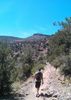
I think the first mile I hiked was the fastest I did all day, about 20 minutes. I was still a little tired, but the cold weather was motivation to keep moving to warm up. By the time we got to the high point on Brins Mesa, I had removed my hoodie and gloves. This lasted until about 300 yards later as we started to descend and the cold began to bite back quickly. The direct sunlight didn't hit us much due to some cloud cover, but on the top of the mesa, there were great views to the north.


We got to the end of the Brins Mesa Trail in under 2 hours, and then headed up the Lost Canyon trail. That quickly became steep and required some effort to get up. At one point I decided to take a rest and turned around to see some really stunning views. Once we got to the level section, the views were even better, expanding from the north to the west and southwest. It was also where the canyon begins to narrow and the trail threads the wall and cliff. On our way in, we spotted a whitetail buck, which was very quickly spooked by our presence and bolted past us up high above the trail with no problem. Jim and Jamie both got pictures, I was too slow on the draw.

As we got to the end of the canyon, and the end of the trail (probably), we spotted the lower ruins, which are actually way below the trail. There was only one ruin we could spot, and to get a decent view of it, you had to get uncomfortably close to the rounded edge of the cliff, which also had scree.

After we got our views of the lower ruin, we decided to head up to the upper ruins, which you can see from the trail. It looks fairly easy to get to, but is actually just a bit more difficult than it looks in a couple sections, especially coming back down. The upper ruins were a bit underwhelming, but it was still nice to do some scrambling and make a bit more of an adventure out of it. We didn't stay long as a storm was rolling in and we couldn't tell whether to expect rain or snow. Just before our descent, we noticed the first few snow flurries of the day.

On the way back on the Brins Mesa Trail, we took the Soldier's Pass Trail, and from there the hordes were en masse. Even saw some mountain bikers that were probably in wilderness area. The Devil's Kitchen as the junction of the Soldier's Pass and Jordan Trials was very interesting to see, and not expected. the Cibola Pass Trail gave us an unexpected and not very welcome additional 200' of AEG, but soon after we were at the trailhead, with some snow flurries rolling in.

We had hoped to have a late lunch at the Oak Creek Brewery and Grill on our way back, but the traffic and crowds were insane. We made a cursory check of the parking lot and found Costco-like conditions, so we decided on Plan B, which was the Verde Brewing Company in Camp Verde. Decent enough food and good beer. Got home before sunset, rarity in late December on a long road trip and hike.
_____________________
 
average hiking speed 2.18 mph
1, 2, 3, 4, 5 ... 7  Next

WARNING! Hiking and outdoor related sports can be dangerous. Be responsible and prepare for the trip. Study the area you are entering and plan accordingly. Dress for the current and unexpected weather changes. Take plenty of water. Never go alone. Make an itinerary with your plan(s), route(s), destination(s) and expected return time. Give your itinerary to trusted family and/or friends.

helpcommentissue

end of page marker