username
X
password
register
for free!
help
ArticlesGuidesRoutes
 
Photosets
 
 Comments
triplogs   photosets   labels comments more
Miller Peak via Miller Canyon - 15 members in 31 triplogs have rated this an average 4.1 ( 1 to 5 best )
1, 2  Next
31 triplogs
login for filter options
May 24 2025
avatar

 Guides 3
 Routes 632
 Photos 8,235
 Triplogs 604

54 male
 Joined Apr 13 2011
 Gilbert, AZ
Sky Islands Summit Challenge, AZ 
Sky Islands Summit Challenge, AZ
 
Hiking avatar May 24 2025
ddgrunningTriplogs 604
Hiking20.43 Miles 5,916 AEG
Hiking20.43 Miles   8 Hrs   32 Mns   2.51 mph
5,916 ft AEG      23 Mns Break
 
1st trip
Route Scout Route Recorded  on Route Scout | Pop | Map | Popup | MapDEX
During a work meeting earlier in the week with an individual from Sierra Vista, the topic of hiking came up, and she encouraged me to look at the Huachucas for some great hiking opportunities. As I was looking through HAZ resources and Googling, I came across this event and realized it was scheduled to take place that weekend.

Of course, registration had long since closed, but on a lark, I decided to email the organizers and see if there was a chance to still register. To my surprise, I received a phone call later that day, and on Wednesday signed up for the event.

The challenge is capped at 250 entrants and offers three levels: One Summit (Carr Peak--9,230 11.2 miles), Double Summit (Carr Peak and Miller Peak--9,465 ft, 15 miles), or Elite Triple Summit (Carr, Miller, and Pat Scott Peak--8,517 ft, 18.1 mi.). We, of course, signed up for the Triple. :D

Drove down to Sierra Vista after work on Friday and made it just in time for the bib pick up, which was at the golf course and included dinner and the opportunity to hit some balls on the driving range. It was a beautiful evening with the setting sun lighting up some clouds over the mountains to the west.

Bibs and swag bag secured, we headed to our motel for a few hours of shut eye.

Bus departure for the Triple was a 4:20 am, with a scheduled start at the Ramsey Canyon Nature Preserve at 5 a.m. Predawn light offered limited visibility of wild turkeys high up in the trees squawking rather loudly.

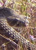
Over half of the entrants were signed up for the triple. While billed as a hike (rather than a trail run), there were several trail runners signed up and they took off up front. The first half mile or so is road width as you head through the preserve past a couple of historical cabins and some huge maple trees and other foliage which I'm sure make for a fantastic fall colors hike. The wide road at the start also helped with sorting folks out into hiking speeds. At that point, we arrived at the Hamburg trail proper, and the trail was reduced to a single track. So, passing was a little more difficult, but it never felt particularly crowded. That said, I took fewer photos than usual because I didn't want to pass and then have to re-pass folks.

Past a look out point, the trail descends back to and along the creekbed, which only had pools given the dry winter (but would be fun and more beautiful in wetter years).

At the turn off for the Pat Scott Canyon trail, the Triples hung a right, while the Single and Doubles continued on Hamburg. From there, any congestion was basically done for the day.

5 miles and over 3K in elevation gained, we arrived at peak #1--Pat Scott Peak (which is on a different high point than the erroneously noted location on the topo map). There is no official trail to the peak itself, so the final climb to the summit involved a relatively steep but short off-trail scramble, from which our two other peaks on the day came into view. After a short break and a stamp in our summit "passport" book, we descended back to the Crest trail and wound back around to reconnect with terminus of the Hamburg Trail where we rejoined the Single and Double hikers.

The next section along the Crest Trail offered our first open views of the valley floor to the west an south into Mexico. Somewhere along this section, my phone must have pinged from a Mexican cell tower prompting a text from Verizon welcoming me to Mexico. :lol:

At the Carr Peak trail, we hung a left and contoured/climbed an open bowl area up to a switchback climb to the summit of peak #2--Carr Peak. This section offered the best views of Miller on the day. The Carr Summit provided panoramic views down to Sierra Vista and off to the northern edge of the Huachucas. It was also pretty windy on the summit, but the breeze was generally welcome and kept any heat in check.

Then we backtracked to Crest and continued a short distance to Bathtub Spring, where we hung a right for our final peak. The trail here starts out with a gradual contouring climb, which made the elevation manageable. It steepens at the final spur to the summit, but wasn't as bad as I was anticipating.

Peak #3--the Miller summit is the high point of the range and is a beautifully shaped peak with a solid green carpet of aspens on its north-east facing slope. Great views into Mexico and all around from the top. I didn't realize that Miller is in the top 10-15 peaks in Arizona in terms of elevation (depending on how many of the SF peaks you "count")--higher than Mt. Lemmon or Wrightson, and cracks the top 10 in terms of prominence. However ranked, it's a lovely peak.

At the Miller summit, our climbing was more or less done for the day, with total AEG approaching 6,000. And while we were glad to be going down, the downhill grind also exacts its own price. :sweat:

The lower part of Miller Canyon had lots of greenery, which I'm sure I'd enjoy more if not for the prior 17+ miles of work. But as is typical in most long hikes, the last 2 miles are always 5 miles long. : wink : Add to that the increasing temperatures (upper 80s/lower 90s at the TH), and we were glad to hit the finish line around 1:40 pm, where a shuttle bus ferried us a mile or two down the dirt road to where the busses could pick us up.

We bussed back to the start where our bibs gained us "free" entry into the wine/spirits festival with free drinks included. We don't drink, but most others on our bus were excited for some celebratory beers.

We planned to stay Saturday night as well, so we headed back to our motel for a well-deserved shower an nap. Then we hit dinner at Texas Roadhouse and decided to take in the newly released Mission Impossible movie. I generally like the series and it was worth a watch, but not as good as I was hoping. The movie was interrupted at a critical moment (when global electricity is shut down and the screen goes dark) when the fire alarm in the theater went off. For a while, we thought it was part of the movie/release schtick, but turned out to just be your regular teenagers pulling the alarm. After the FD came and restored order, we went back in and finished the show.

Having been up since 3:30 that morning, we crashed hard after the movie and awoke for a leisurely drive back to the Valley Sunday morning.

I'm not usually drawn into paying for hiking events, but this was pretty fun and certainly allowed us to see more of the Huachucas in one trip than we would have been able to do otherwise.
_____________________
 
Sep 01 2024
avatar

 Guides 4
 Routes 491
 Photos 10,890
 Triplogs 1,257

55 male
 Joined Nov 20 2012
 Phoenix, AZ
Miller Carr Peak, AZ 
Miller Carr Peak, AZ
 
Hiking avatar Sep 01 2024
BiFrostTriplogs 1,257
Hiking15.62 Miles 4,772 AEG
Hiking15.62 Miles   10 Hrs   3 Mns   1.83 mph
4,772 ft AEG   1 Hour   32 Mns Break
 
1st trip
Partners partners
slowandsteady
Started from Miller Canyon Trailhead about 615. The temps seemed fairly cool on the ascent which is good because it's a steep trail especially on the top half before reaching the crest trail. Also, on the ascent there were multiple blood hounds I'm assuming from the ranch near the trailhead that had some wildlife up a tree. Never really could see what they had up the tree but they never stopped barking all way to the crest trail and Bathtub Spring.

Took a break at the spring and was happy to see that the water was in good shape...nice and clear with no floaties. After the break we continued on the crest trail towards Miller summit. Really enjoy this section on the crest trail...great views between Miller and Carr Peaks. Eventually reached the Miller summit and had an excellent break with it all to ourselves!

Once off the summit we hiked back on the crest trail to Bathtub Spring. Then hiked up to the Carr Peak trail junction and followed that out towards Carr. Ran into a few more people on the day but that was it. Easy hike out to Carr Peak and another relaxing break on the summit. The storm clouds were also staying away so no rush to exit the highpoints.

After Carr Peak we hiked back to Bathtub Spring one more time and then back down Miller Canyon Trail. This time no bloodhounds with quiet hike back to the trailhead.

water 1 out of 5water 2 out of 5water 3 out of 5water less than max Bathtub (Tub) Spring Gallon per minute Gallon per minute
nice clear water with no floaties
_____________________
  3 archives
Jun 05 2023
avatar

 Guides 93
 Routes 397
 Photos 4,984
 Triplogs 4,124

49 male
 Joined Jun 20 2003
 Tucson, AZ
Miller Peak via Miller CanyonTucson, AZ
Tucson, AZ
Hiking avatar Jun 05 2023
fricknaleyTriplogs 4,124
Hiking11.50 Miles 3,745 AEG
Hiking11.50 Miles   5 Hrs   14 Mns   2.35 mph
3,745 ft AEG      20 Mns Break10 LBS Pack
 no routes
Partners none no partners
had the day off so i scooted down to Sierra Vista to get up in the huachucas.

decided on miller peak and opted for miller canyon as my approach since i hadn't been up this way in years and i was pretty sure it offered some shade. Great choice. hardly saw anyone. still some water running in the canyon. took a break at bathtub spring on the way up and down. great day and nice to be back in one of my favorite southern AZ ranges :)
_____________________
hi
 
Mar 19 2022
avatar

 Guides 1
 Routes 1
 Triplogs 24

45 male
 Joined Feb 27 2012
 Cochise County
Miller Canyon Trail #106Tucson, AZ
Tucson, AZ
Hiking avatar Mar 19 2022
AndrewAZTriplogs 24
Hiking11.83 Miles 4,630 AEG
Hiking11.83 Miles   6 Hrs      1.97 mph
4,630 ft AEG
 no routesno photosets
My first time going up Miller Canyon trail. Quite the steep one. The gentle gain on the Crest Trail was a relief in comparison. Sunny and warm, but still a decent amount of ice/mud in the Crest Trail in places (which I'm sure was doubled by the storm a few days later).

I met a trio of women who were hiking the AZT (or at least a big chunk). One went up Miller Peak while the other two kept going. I know some people hike that way, but I've always found it odd to separate by big distances during the day. And the two who didn't head up to the peak missed out.
_____________________
 
May 14 2021
avatar

 Guides 73
 Routes 176
 Photos 10,174
 Triplogs 2,324

46 male
 Joined Sep 08 2006
 
Miller Peak via Miller CanyonTucson, AZ
Tucson, AZ
Hiking avatar May 14 2021
JimTriplogs 2,324
Hiking10.00 Miles 4,052 AEG
Hiking10.00 Miles   5 Hrs   45 Mns   1.74 mph
4,052 ft AEG
 no routes
1st trip
Linked   linked  
Partners none no partners
First time down in the Huachuca Mountains. I can finally die contented. This because after 7 years, I have managed to do what I never did when I lived in Marana before: make the drive to visit the other Sky Islands south of I-10 outside of the Tucson area.

Road in to the TH is in good shape except right at the beginning. The trail is also in good shape. There is no surface water, but you can hear it in the pipe in the canyon bottom, headed to a town nearby. Views to olde Mexico are enjoyable.

I can't be sure, but it seems like no one ever mentioned the orchard near the TH. Why? Anyway, this was a highlight of the trip for me, and even though I intend to hike other trails in the range, I also intend to return here to purchase fruit. Peaches, Apricots, Plums, Apriums, Cherries, and 30 varieties of apples are in the orchard. Some of my favorite varieties are to be found from Albemarle Pippin to Winesap. Must be a good spot for this sort of venture, as Winesap requires 800 chill hours. Unlike the ratty orchards in the Sierra Ancha and probably the Superstitions, this one is managed and actually produces on pretty nice trees.

water 1 out of 5water 2 out of 5water less than maxwater less than max Bathtub (Tub) Spring Quart per minute Quart per minute
_____________________
🍭
 
Feb 15 2021
avatar

 Routes 174
 Photos 471
 Triplogs 184

51 male
 Joined Mar 16 2019
 Phoenix
Miller Peak via Miller CanyonTucson, AZ
Tucson, AZ
Hiking avatar Feb 15 2021
AugustWestTriplogs 184
Hiking11.84 Miles 4,020 AEG
Hiking11.84 Miles   5 Hrs   15 Mns   2.42 mph
4,020 ft AEG      22 Mns Break
 
1st trip
Partners none no partners
Route Scout Route Recorded  on Route Scout | Pop | Map | Popup | MapDEX
Left the valley at 10 am because of kid and dog logistics. Made it to a pretty full parking lot at 1 PM. Ran into 4 or 5 people pretty close to the trailhead and then maybe another 4-5 throughout this hike. Temps were in the mid 50's at the TH.

Miller Canyon is stunning and steep.The variety and mix of flora and fauna is pretty fascinating with some of the largest Douglas Fir's I have seen in Arizona, while on the other sunnier side of the same canyon are more desert oriented plants.

I somehow ended up in the canyon bottom about 2 miles in on the way up. To my credit there were some orange ribbons and flags that kept me pushing through undergrowth unnecessarily. I learned on the way down that this very well constructed and maintained trail high banks the southern exposed slope through almost the entire canyon. The entire trail is clear of brush, deadfall and is incredibly easy to follow if you are paying attention ](*,)

At the junction of the crest trail things get really snowy. There is probably between 4"-6" of snow up there right now. The path has been compacted by hikers so it can be slippery in spots. Nothing is too bad, but it did slow me down some. The views from the crest trail are really beautiful especially down Miller's Canyon. Things were cold up on the ridge but nothing like the climb to Miller's Peak.

It has been a while since I have felt the wind blow as hard as on my final ascent up to Miller's Peak. Probably blowing 50 mph or more. The sun was shining but it was cold!! Even Luna wanted off and she is crazy! I took a few pictures, signed the log and boogied down the mountain.

It is strange to be so close to Mexico and experience the weather, snow and flora of the Huachuca's. Like the Chiricahua's this area has me excited for further exploration, but maybe in a month or so when things warm up some.

water 1 out of 5water less than maxwater less than maxwater less than max Bathtub (Tub) Spring Dripping Dripping
Tub was full and 2/3 iced over.
_____________________
Wildflower seed in the sand and wind
May the four winds blow you home again
  1 archive
Oct 17 2020
avatar

 Guides 1
 Routes 269
 Photos 613
 Triplogs 1,360

50 male
 Joined Dec 22 2003
 Tucson, AZ
Miller Peak, AZ 
Miller Peak, AZ
 
Hiking avatar Oct 17 2020
RedwallNHopsTriplogs 1,360
Hiking13.00 Miles 3,800 AEG
Hiking13.00 Miles   7 Hrs   20 Mns   1.77 mph
3,800 ft AEG
 no routesno photosets
1st trip
Needed a workout plus wanted to see if there were any fall colors. a bit of aspen color on the Crest trail, and a teeny bit of maple color in Miller Canyon but it's a couple weeks away from peak. good to get back to this trail. It's been at least 10 years.
wildflower observationwildflower observationwildflower observationwildflower observationwildflower observation
Wildflowers Observation Light
_____________________
 
Sep 07 2020
avatar

 Routes 30
 Triplogs 186

37 male
 Joined May 15 2015
 Tucson
Miller Peak via Miller CanyonTucson, AZ
Tucson, AZ
Hiking avatar Sep 07 2020
jrousoshammondTriplogs 186
Hiking10.00 Miles 4,052 AEG
Hiking10.00 Miles
4,052 ft AEG
 no routesno photosets
Linked   none no linked trail guides
Partners partners
MSimmons
Hot in the sun near the trailhead, but otherwise perfect weather. Only 2 other parties. Some water down in the canyon about 2 miles in, and Bathtub Spring is full (a welcome cool-down spot).

Not as many flowers as when we did this a few years ago, but still quite a few. The Crest trail and Miller summit are really hard to beat...

Unfortunately the nearest Popeye's appeared to be on-base, but Culver's sufficed.
_____________________
 
Jun 14 2020
avatar

 Routes 137
 Photos 1
 Triplogs 105

44 female
 Joined Oct 21 2016
 Tempe, AZ
Carr PeakTucson, AZ
Tucson, AZ
Hiking avatar Jun 14 2020
MAPTriplogs 105
Hiking12.80 Miles 3,742 AEG
Hiking12.80 Miles   6 Hrs   22 Mns   2.08 mph
3,742 ft AEG      12 Mns Break
 
no photosets
1st trip
Partners none no partners
Wow. The Miller Canyon Route is the way to go! So many unique birds with crazy colors, so many waterfalls, it was a completely different world in that canyon! In this case, I would recommend an out-and-back in Miller Canyon. I did a loop up Miller and down Carr (but I missed the Sawmill Canyon turnoff so I had to walk the road longer then anticipated) but Miller was where the "wow" was at. Also the temperature would have been fine if I had cut the loop. I think it was around 95 deg when I got back to my car around 1:30 pm and I was feeling it big time. I parked at the Miller Canyon Parking but camped further down Miller Canyon Road the night before. It's super nice that you can camp anywhere on those lower canyon roads. I started around 6 am and there were already birders further up the trail. They must wake up really early! Everyone was super friendly. Met a couple backpackers up at Bathtub Spring too. The Huachuca Mountains are really special and I seem to fall in love with a different area every time I visit.

water 1 out of 5water 2 out of 5water less than maxwater less than max Bathtub (Tub) Spring Quart per minute Quart per minute
_____________________
 
May 23 2020
avatar

 Guides 99
 Routes 1,484
 Photos 16,072
 Triplogs 1,374

male
 Joined Jan 07 2017
 Fountain Hills,
Miller Peak and Carr Peak, AZ 
Miller Peak and Carr Peak, AZ
 
Hiking avatar May 23 2020
DixieFlyerTriplogs 1,374
Hiking15.20 Miles 5,020 AEG
Hiking15.20 Miles   7 Hrs   52 Mns   2.35 mph
5,020 ft AEG   1 Hour   24 Mns Break
 
no photosets
1st trip
This was the first day of 3 days hiking in the Huachucas and Chiricahuas.

We started and ended the hike at the parking area for the Miller Canyon Trail.

The Miller Canyon Trail is a steep uphill climb for about 4 miles up to bathtub spring. In the first 2 miles on this trail you gain about 500' in elevation per mile; in the second 2 miles you gain about 900' in elevation per mile.

It was a cool morning so the hike up to bathtub spring wasn't bad. Once on the Crest Trail, we went over to Miller Peak first. It was very windy up on Miller, and we had to hunker down behind some rocks to break the wind and make it tolerable on the summit.

We then descended Miller, went back to bathtub spring, and then headed over to Carr Peak. It was a little breezy on the way to Carr, but surprisingly it wasn't windy at the summit -- so we hung out at the summit for a while and enjoyed the views.

We then went back to bathtub spring, and then descended on the Miller Canyon Trail back to the TH.

This is a great hike -- the views on both summits are awesome and the trails are good.
_____________________
Civilization is a nice place to visit but I wouldn't want to live there
  1 archive
May 05 2019
avatar

 Guides 10
 Routes 673
 Photos 7,281
 Triplogs 4,660

67 female
 Joined Nov 17 2008
 phoenix, az
Miller & Carr, AZ 
Miller & Carr, AZ
 
Hiking avatar May 05 2019
trekkin_geckoTriplogs 4,660
Hiking14.70 Miles 4,768 AEG
Hiking14.70 Miles   7 Hrs   43 Mns   2.17 mph
4,768 ft AEG      56 Mns Break
 
1st trip
during our pinal hike three weeks ago, it came up that miller peak was on my wish list
linda just hit miller a few weeks ago, but she didn't get carr peak at the time
the combo was on
left town at 0430 and were hiking shortly after 0730
miller canyon features flowing water with maples leafing out nicely
a solid ascent of 3,000 feet in four miles
took a short break at bathtub spring, then headed for miller peak
this section of the crest trail is beautiful
ponderosa and aspen, views on both sides of the ridgeline, pine needle covered trail :)
another uphill to miller peak
saw seven other people on this section of trail and only two others as we started out in miller canyon
nice views of the huachuca range, surrounding sky islands, sierra vista and into mexico
took a break then went back to pick up carr peak trail
more open terrain on this part
i had been on carr several years ago with @rwstorm and it was nice to be up here again
better views to the north and west and into miller canyon
took a longer lunch break and enjoyed the perfect day
the descent passed quickly on good trail with plenty of shade and some high clouds
good mileage and elevation gain on this worthy combo
headed back with some car snacks
thanks for driving, linda, and for being willing to come up here again so soon
it's a great hike
*using linda's mileage as my phone doesn't seem to record enough points to capture all the switchbacks
 Geology
 Geology [ checklist ]
[ checklist ]  dike (igneous)
_____________________
hazhole
  1 archive
May 05 2019
avatar

 Guides 110
 Routes 2,246
 Photos 8,982
 Triplogs 2,600

45 female
 Joined Dec 24 2007
 Ahwatukee, AZ
Miller & Carr Peaks - Huachucas, AZ 
Miller & Carr Peaks - Huachucas, AZ
 
Hiking avatar May 05 2019
LindaAnnTriplogs 2,600
Hiking14.72 Miles 4,628 AEG
Hiking14.72 Miles   7 Hrs   45 Mns   2.20 mph
4,628 ft AEG   1 Hour   4 Mns Break
 
1st trip
Route Scout Route Recorded  on Route Scout | Pop | Map | Popup | MapDEX
We got started around 7:30 and headed up Miller Canyon. Still some water flowing, but not as much as a few weeks ago. Saw three people in the first mile, but then nobody else the rest of the way up. All the trees are leafed out now though, and there was green everywhere. The trail up the canyon is in mostly good shape, with a few brushy spots here and there. The last mile to the top has less shade, and seemed warm despite the cool temps and breeze.

Quick break at the spring, then we headed south on the Crest Trail over to Miller Peak. We saw two deer eating alongside the trail, and they were not particularly scared of us. We got pretty close before they finally moved off to the side a little. All the snow from a few weeks ago is long gone, and it was a nice hike over to Miller Peak trail. Walking through the aspen grove was a highlight of this section.

Once we turned onto Miller Peak, we saw five hikers on their way back down, then two more at the summit. Didn't see anyone else the rest of the day. Views were hazy in all directions, but we could still discern plenty of landmarks. Snack break at the top, then we headed back down, veering off to the rocks at the south end of the peak to get some better views that direction. After that, it was a quick hike back to the spring.

At the spring, we stayed on the Crest trail up to the junction with Carr Peak trail. That mile of Carr Peak trail was in the best shape of three of four times I have hiked it. It was easy to spot the turn to head up to Carr Peak, because there's a fallen tree across the trail just a few feet from the turn. It was windy heading up to the top, and I had forgotten there were aspen trees up near the top of Carr too. We took a longer snack break on Carr, then headed back down and retraced our steps back to Miller Canyon and back down. Uneventful, and quick, hike back down to the trailhead, and we finished around 3:15.

Great hike for the day, and it's interesting to see from the various vantage points that all the ground we covered was never really that far from the parking area. Both peaks sort of wrap around at the top, so you're never really all that far, as the crow flies, from the trailhead. This is definitely a hike I don't mind repeating.
 Flora
 Flora [ checklist ]
[ checklist ]  Yellow Columbine
wildflower observationwildflower observationwildflower observationwildflower observationwildflower observation
Wildflowers Observation Isolated
A couple of columbines. Lots of little yellow flowers. Hopefully this summer has a good wildflower show up there.
_____________________
Stop crying and just go do the hike.
 
Jun 17 2018
avatar

 Guides 94
 Routes 840
 Photos 22,055
 Triplogs 1,993

52 male
 Joined Sep 18 2002
 Tempe, AZ
Lutz Miller Carr, AZ 
Lutz Miller Carr, AZ
 
Hiking avatar Jun 17 2018
chumleyTriplogs 1,993
Hiking16.08 Miles 4,897 AEG
Hiking16.08 Miles   6 Hrs   32 Mns   2.74 mph
4,897 ft AEG      40 Mns Break
 
1st trip
As always, the Huachucas deliver! :y: I put together a loop of two trails I hadn't hiked, Lutz and Miller canyons, with the obligatory visits to Miller and Carr peaks. The cool weather was enjoyable, and yesterday's inch of rain was evident in the soft soil, but I was a bit disappointed not to find any running water. It's been so dry, that even an inch of rain produced no runoff and was just absorbed into the dry soil. Nonetheless, the forecast called for temps in the upper 60s along the crest and that sounded ideal to me. The southwesterly wind was even a bit chilly on the peaks, but you won't find me complaining about that in mid-June!

Bathtub spring was cold and clear, until Chloe decided to stir up the sediment while cooling herself off. We did a quick out-n-back to Carr before heading down Miller Canyon. I was disappointed not to find any running water in the upper stretches as I've seen it running here in summer before. We encountered another hiker at the mine site before continuing down this steep trail that cuts through a thickly vegetated canyon. There were two places where the water surfaced, but both would have been a challenging side trip to reach. It appeared there was quite a bit of mining history here and it would be easy to spend more time here exploring some of the side trails to historic sites.

Near the bottom of Miller Canyon, we crossed over on the Hunter Canyon Trail, where the afternoon sunshine and lack of tree cover began to take it's toll despite being only about 80 degrees. With 4.5 miles of road walking to complete a loop, and almost 15 miles in the book already, I summoned an Uber from Sierra Vista. It took about 20 minutes to arrive and in that time we had already covered a mile of the road walk, but it was money well spent and I was happy to get a ride back to the Jeep and save about 45 minutes or so of shade-free road walking (though JJ opted to keep hiking, because, well, he's JJ :) ).

Tacos in Tucson and a quick trip home. World Cup replays capped a damn good Sunday! :)
 Fauna
 Fauna [ checklist ]
[ checklist ]  Ladybug beetle

water 1 out of 5water 2 out of 5water less than maxwater less than max Bathtub (Tub) Spring Quart per minute Quart per minute
Full tub. Clear and cold. Dripping from the pipe.

dry Lutz Canyon Dry Dry

dry Miller Canyon Dry Dry
Two short sections along the Miller Canyon trail had running water. Otherwise it was dry and there was no water at any trail crossing.
_____________________
I'm not sure what my spirit animal is, but I'm confident it has rabies.
  5 archives
Jun 17 2018
avatar

 Routes 596
 Photos 9,604
 Triplogs 2,400

58 male
 Joined Jan 30 2011
 Chandler, AZ
Lutz Miller Carr, AZ 
Lutz Miller Carr, AZ
 
Hiking avatar Jun 17 2018
JuanJaimeiiiTriplogs 2,400
Hiking16.08 Miles 4,897 AEG
Hiking16.08 Miles   6 Hrs   32 Mns   2.74 mph
4,897 ft AEG      40 Mns Break
 no routes
1st trip
I got an invite to go along with Chulmley, 9L, and Carrie Jane on Saturday night. I didn't have anything concrete planned so a trip back to the Huachuca's sounded pretty good. I met John and Chums at a little after 6am in Chandler and we were off. We picked up Carrie Jane and her dog Chloe in Tucson off of Orange Grove (Nick's favorite) in Tucson. About 9am we started our hike up the Lutz Canyon Trail. It was a perfect day in terms of weather. It had rained just enough the day prior to cool things off and make the ground damp but not muddy. There are some old mining relics at about the 2.25 mile spot and then shortly thereafter there is a huge mine tunnel. It must go back 500-600 feet. Based on the truck loads of debris inside this was or still is a stop over point for migrant travel. Water bottles, blankets, discarded backpacks, and metal food cans litter the floor. If large garbage bags were used to clear it, it is hard to say how many loads it would take to remove all the debris. I would guess this was the last stopping point for several who made a long journey in hopes of finding a better life.

On we went after exploring for 10 to 15 minutes and before long we were up on the Crest Trail. From there our first destination was Miller Peak. The trail in the canyon and on top is in great shape so we made good time. The views into Mexico and of the surrounding area are always spectacular from Miller. We kicked back up top and Chumley revealed that Mexico had just beat Germany in the World Cup.

Onward to our next destination which would be Carr Peak. Carr also delivers great views and on this occasion the one looking back at Miller was especially good. The shadows from the clouds above gave it a cool and inviting look. Our stay on Carr wasn't as long as Miller however it was long enough to really enjoy it as well. Then we backtracked towards Bathtub Spring and then descended down Miller Canyon. This was my first time on this trail and it didn't disappoint. I think it is pretty hard to go wrong with anything in the Huachuca's. Finally we took the Hunter Canyon trail over to our exit point. From here we road walked for about a mile to where Chumley had an Uber pick him up and shuttle him the last 3.5 miles back to the Jeep. He returned to pick us all up and our enjoyable journey through the Huachuca's came to an end.

It was great seeing John and Chumley again and nice to finally meet Carrie Jane. Oh yeah and Chloe too! Good times!
wildflower observationwildflower observationwildflower observationwildflower observationwildflower observation
Wildflowers Observation Isolated
_____________________
  10 archives
Jun 17 2018
avatar

 Guides 6
 Routes 183
 Photos 5,612
 Triplogs 1,647

male
 Joined Mar 12 2004
 Scottsdale, AZ
Lutz Miller Carr, AZ 
Lutz Miller Carr, AZ
 
Hiking avatar Jun 17 2018
John9LTriplogs 1,647
Hiking16.08 Miles 4,897 AEG
Hiking16.08 Miles
4,897 ft AEG
 no routesno photosets
1st trip
Met up with Chumley, JJ & Carrie for a fun hike in the Huachucas. Chumley, JJ & myself met in Chandler and made the drive down and picked up Carrie in Tucson. From there we made the drive to the Lutz Canyon TH and started hiking around mid-morning.

The Lutz Canyon Trail makes a steady and solid climb as it heads for the crest trail. It was a relatively cool day for mid June after some rain fell the previous day. Along the climb up we stopped to explore a mine shaft that was littered with garbage left by migrants. From there we grinded up the final mile to the Crest Trail where we took a short break. After that we continued on and topped out on Miller Peak. We took a short lunch break here and enjoyed the views.

After Miller we continued north along the Crest Trail and took another short break by Bathtub Spring. We debated our options and decided to head for Carr Peak and I'm glad we did. The short detour took about an hour and this is another quality peak with excellent views! After Carr, we returned to Bathtub Spring and headed down Miller Canyon. The top part of this trail had some downed trees but it didn't last for long. Overall, this trail is in good condition. We eventually connected onto the Hunter Trail and were soon back on road. Once we hit the road, Chumley called an Uber. It took a few minutes to arrive but was well worth the wait. Chumley retrieved JJ's jeep and then played roundup. After that it was back to Tucson for dinner and then back to Phoenix.

This was a really great hike with a fun group! I really enjoy the Huachucas and hope to make an annual return. It's a hearty drive from Phoenix but well worth the time. Thanks JJ for driving and thanks Chumley for organizing!
_____________________
 
Feb 17 2018
avatar

 Guides 110
 Routes 2,246
 Photos 8,982
 Triplogs 2,600

45 female
 Joined Dec 24 2007
 Ahwatukee, AZ
Miller & Carr Peaks via Miller Canyon, AZ 
Miller & Carr Peaks via Miller Canyon, AZ
 
Hiking avatar Feb 17 2018
LindaAnnTriplogs 2,600
Hiking14.35 Miles 4,820 AEG
Hiking14.35 Miles   8 Hrs   1 Min   2.05 mph
4,820 ft AEG   1 Hour    Break
 no routesno photosets
1st trip
Daniela and I got started up the Miller Canyon trail, and were immediately caught up with a group of about 20 folks from Fort Huachuca. They started out fast, but within the first two miles, we had passed all but 4 of them. We had a snack at the bathtub, then headed over to Miller Peak. Lots of fog obscured our views on the way up, but the temps were pleasant.

The 4 guys we hadn't caught up to yet were at the peak. They asked if we had seen the rest of their group, and we said we'd passed the last of them halfway up the canyon. After chatting for a minutes, we discovered that 2 of the group were Army, all the rest were Marines, and most of them were from North Carolina and not enjoying hiking at the higher elevation. I pointed out Carr and said that's where Daniela and I were headed next. The 4 seemed to catch their second wind, and decided to tack that on to their hike as well. On our way over there, we passed the rest of the group, who were still making their way over to Miller.

Short break on Carr, as the wind was getting colder. It was nice to get back down into the canyon again and out of the wind. The hike back down was a little tough on the knees through the rockier parts, but a nice hike for the day.
_____________________
Stop crying and just go do the hike.
 
Sep 03 2017
avatar

 Photos 4
 Triplogs 62

37 male
 Joined Jan 30 2016
 Tucson, AZ
Miller Peak via Miller CanyonTucson, AZ
Tucson, AZ
Hiking avatar Sep 03 2017
MSimmonsTriplogs 62
Hiking10.00 Miles 4,052 AEG
Hiking10.00 Miles
4,052 ft AEG
 no routesno photosets
1st trip
Linked   none no linked trail guides
Partners partners
jrousoshammond
My first trip to the Huachucas did not disappoint. The first few miles are nothing to call home about, although there are some bits where the trail runs 50 or 100 feet above the creek but still beneath the trees, which makes for nice strolling. It gets awesome when you start to climb out of the canyon and the views of Miller and the crest open up. We rested in the shade at the bathtub where the water was clear and plentiful. The crest trail - through pine, aspen, and brilliant flowery meadows - was a breeze. We expected the final push to be a killer but it ended up being pretty painless 8) .

One unusual and persistent feature of the hike was the DHS radar balloon - could almost make a guy paranoid :scared: .

The drive down from Tucson (through Sonoita and Rain Valley) was also a beaut: pastoral ranchlands; morning mist; a number of very enticing small mountains...
_____________________
  1 archive
Sep 03 2017
avatar

 Routes 30
 Triplogs 186

37 male
 Joined May 15 2015
 Tucson
Miller Peak via Miller CanyonTucson, AZ
Tucson, AZ
Hiking avatar Sep 03 2017
jrousoshammondTriplogs 186
Hiking10.00 Miles 4,052 AEG
Hiking10.00 Miles
4,052 ft AEG
 no routesno photosets
Linked   none no linked trail guides
Partners partners
MSimmons
Virtually had a sky island to ourselves on Labor Day weekend - didn't see a single person on the Crest, and only a few in the canyon below. It was a little humid and buggy in the canyon, but once the trail really started going up it was perfect. Tons of wildflowers on the Crest and up all the way to the summit, along with plenty of butterflies and bees there for the show. Water can be found in spots and Bathtub Spring looks nice and clear.

I guess this hike is just about Wrightson-sized, but it felt a bit harder - kind of like a shorter Rincon. I'd love to come back down here for Carr or AZT1.
_____________________
 
Aug 23 2016
avatar

 Guides 1
 Routes 136
 Photos 22,415
 Triplogs 1,041

77 male
 Joined Feb 28 2003
 Tucson, AZ
Miller Canyon to the Bathtub, AZ 
Miller Canyon to the Bathtub, AZ
 
Hiking avatar Aug 23 2016
rwstormTriplogs 1,041
Hiking9.12 Miles 3,708 AEG
Hiking9.12 Miles   8 Hrs   14 Mns   1.62 mph
3,708 ft AEG   2 Hrs   37 Mns Break
 
1st trip
Partners none no partners
It's still Killer Miller

Decided to visit this old favorite, since it has been a couple years. The last time I made it all the up to the Crest Trail Junction was back in 2011, right after the Monument Fire. Back in the 1980's when I would occasionally hike up to Miller Peak (the fire lookout building was still up there then), I would usually go up via Miller Canyon. My goal today was to get to Bathtub Spring, which would provide a serious workout. I had no idea how I would do, since I couldn't even make it to Carr Peak earlier in the month. I have had some serious fatigue issues this year for some reason. Usually it is problems with my right knee that keeps me sidelined, but this year it's fatigue. Unbelievably, I had no fatigue issues and felt fine! What a relief. I even did some bushwhacking for awhile on the way up, which included some fairly serious scrambling in one place, as I attempted to improvise a way back to the main trail without backtracking. Given how steep and tough the hike is in this flood blasted canyon, I was overjoyed by how strong I felt. :D

I took a nice long break up in the green bliss by the bathtub, refilling my water bottles for the trip down. It was quite breezy up there with a chill in the wind as the Pacific trough that has shut down the thunderstorms temporarily passes through. I stayed completely on trail for the uneventful descent. This really is a steep and deep canyon. Very impressive. I didn't take a side trip over to where the Tombstone water works are located in the lower canyon, but I had recently read that they had removed the chain link fencing by the intakes. As I passed by on the trail, I didn't see any sign of fencing. I'll check next trip. There is one decent sized black plastic pipeline that was audibly carrying water in the canyon from an intake further upstream. More than likely it is part of the Tombstone operation. Also, there had been horses on the trail all the way to the Crest, so perhaps there was a BP horse patrol that went through.

This was a tough love kind of day: I didn't take any beer along, so none was waiting for me at the vehicle at hike's end. :o Not to worry, I decided to stop at Ricardo's, not too far from Miller Canyon along highway 92. I ate at this restaurant with my mom about 30 years ago. I have always known about their mediocre reviews. The original place burned down in the Monument Fire, but they rebuilt. Well, if you are thinking about hitting this place for good Mexican food, don't bother...it sucks. But, at least I enjoyed my Negra Modelo. ;)

Stopped at Circle K for gas and picked up a six pack of beer. Took the scenic way back home: headed west from Mustang Corners to Sonoita, then on toward Green Valley via Box Canyon Road. Pulled off at a nice spot along the road and enjoyed a cold one as the light faded in the western sky. :)
 Flora
 Flora [ checklist ]
[ checklist ]  Oyster Mushroom
 Culture
 Culture [ checklist ]
[ checklist ]  Old Rusty Stuff
wildflower observationwildflower observationwildflower observationwildflower observationwildflower observation
Wildflowers Observation Substantial

water 1 out of 5water 2 out of 5water less than maxwater less than max Bathtub (Tub) Spring Quart per minute Quart per minute
_____________________
 
Dec 31 2015
avatar

 Routes 7
 Triplogs 11

43 male
 Joined Mar 18 2017
 Dallas, TX
Miller Peak via Miller CanyonTucson, AZ
Tucson, AZ
Hiking avatar Dec 31 2015
zlewisTriplogs 11
Hiking14.50 Miles 4,539 AEG
Hiking14.50 Miles   9 Hrs   8 Mns   1.59 mph
4,539 ft AEG
 
no photosets
1st trip
Partners none no partners
Miller then Carr on New Years Eve. I was circled repeatedly by a light aircraft in the early AM, then enjoyed the view of the surveillance blimp once out of the canyon. Spooked a roadrunner around 9000ft on Carr. My third P5K in 11 days.
_____________________
"He who climbs Mt. Fuji is a wise man; he who climbs it twice is a fool." - Japanese proverb
  4 archives
average hiking speed 2.13 mph
1, 2  Next

WARNING! Hiking and outdoor related sports can be dangerous. Be responsible and prepare for the trip. Study the area you are entering and plan accordingly. Dress for the current and unexpected weather changes. Take plenty of water. Never go alone. Make an itinerary with your plan(s), route(s), destination(s) and expected return time. Give your itinerary to trusted family and/or friends.

helpcommentissue

end of page marker