|
| | | |
| |
|
| Hiking | 3.67 Miles |
1,778 AEG |
| | Hiking | 3.67 Miles | 3 Hrs 38 Mns | | 1.27 mph |
| 1,778 ft AEG | 45 Mns Break | | | |
|
|
| |
| Linked |
|
none
[ show ]
| no linked trail guides |
| Partners |
|
none
[ show ]
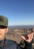
| no partners | | This peak and ridge always caught my eye when driving out to the lake. Finally decided to check it out. Leftover fog from rain the previous day made for a nice experience. The first (and last) half of this route is not the funnest with loose rock and some unstable footing. But once up on the “ridgeline,” it is more enjoyable. And worth the views. Originally I thought 2811 to be the next similar elevation but not-as-steep peak just southwest of actual 2811. From a distance, 2811 looked too steep all around to be doable. But when you get closer, the route is fairly easy to follow and not too sketchy.
Amazing 360 views. Four peaks was obscured by clouds. As was the Superstition ridgeline. But Castle Dome, Geronimo Head, Malapais, Battleship Mtn, Bluff Spring, Weaver’s, etc. we’re coming in clear. |
| _____________________
| | |
|
|
|
 Route Editor


 Just a thought.
 . And I saw a pair of Peregrine Falcons swirling near the east end of summit where I presume they were nesting.
 But too quick for my photography skills.


 I ran out of daylight. Nighttime finish. I’m glad I own a headlamp.


