username
X
password
register
for free!
help
ArticlesGuidesRoutes
 
Photosets
 
 Comments
triplogs   photosets   labels comments more
Cave Canyon Trail #149 - 14 members in 42 triplogs have rated this an average 4.2 ( 1 to 5 best )
1, 2, 3  Next
42 triplogs
login for filter options
Sep 21 2024
avatar

 Guides 59
 Routes 1,100
 Photos 1,191
 Triplogs 1,290

male
 Joined Jan 01 2023
 Arizona
Santa Rita Ramble, AZ 
Santa Rita Ramble, AZ
 
Hiking avatar Sep 21 2024
pseudalpineTriplogs 1,290
Hiking13.23 Miles 4,286 AEG
Hiking13.23 Miles   8 Hrs   31 Mns   2.06 mph
4,286 ft AEG   2 Hrs   6 Mns Break
 
1st trip
Route Scout Route Recorded  on Route Scout | Pop | Map | Popup | MapDEX
Nice loop to both Wrightson and Ian with the Desperados. A Twin Spotted was on the trail a couple hundred feet below the summit of Wrightson. It's obvious some bears wander the Cave Canyon Trail.
  6 archives
Mar 09 2024
avatar

 Guides 1
 Routes 262
 Photos 864
 Triplogs 266

51 male
 Joined Mar 24 2021
 Tucson, AZ
Wrightson via Gardner Canyon, AZ 
Wrightson via Gardner Canyon, AZ
 
Hiking avatar Mar 09 2024
JackluminousTriplogs 266
Hiking13.28 Miles 3,740 AEG
Hiking13.28 Miles   8 Hrs   7 Mns   2.08 mph
3,740 ft AEG   1 Hour   43 Mns Break
 
Route Scout Route Recorded  on Route Scout | Pop | Map | Popup | MapDEX
Wifey, LE, and I attempted to camp in Gardner Canyon Thursday through Saturday. Thursday was very rainy all day. The campsites were covered in hailstones when we arrived, the ground was muddy, and it was cold. We drove into Sonoita, had dinner while the rain abated, then went back to the campsite after dark. We would up sleeping in the cars. It was fine for me, since my 1st gen CR-V makes into a bed and I converted it into a sweet camper. Wifey thought she'd be more comfortable in the Soob, so she and LE slept in there. Sadly wifey woke up feeling pretty terrible.

It was still a bit rainy on Friday, cold, and not fun for wifey, so she took LE back home Friday. I stuck it out, since our family friend Eric was being delivered Friday night. I enjoyed a quiet afternoon and evening, and Eric showed up with his dad just before bedtime. I'd set up a hammock for Eric, so he crashed there while his dad drove home.

Saturday morning we set off for Wrightson via Gardner Canyon. Eric had never done a strenuous hike before, but he did great. We started seeing a fair bit of snow early on. By the time we approached Super Trail there was at least 6" to 12" in places, but someone had passed before us with a dog, making the trail easy to follow. About halfway to Baldy Saddle, though, our intrepid predecessor turned back, and the snow at that point was about a foot deep or more. I could see Baldy Saddle, and the trail looked fairly visible enough, so we soldiered on.

We had a late lunch at Baldy Saddle, enjoying the view. We then decided to attempt Wrightson. There was a good trail, well-compacted, all the way to Wrightson Spring. There it abruptly ended, and proceeding would have required some steep climbs through deep snow and navigating a rather precipitous route, so we decided discretion was the better part of valor.

On the way back, just past Baldy Saddle, we encountered three teen boys headed for the saddle. Their passage further developed the trail we blazed, so getting back to Gardner trail was much easier.

We made it back to camp just before dark, packed up, and headed home. It was a delightful day.
 
Nov 04 2023
avatar

 Guides 170
 Routes 148
 Photos 5,914
 Triplogs 2,097

48 male
 Joined Apr 12 2004
 Tucson, AZ
Cave Canyon Trail #149Tucson, AZ
Tucson, AZ
Hiking avatar Nov 04 2023
PrestonSandsTriplogs 2,097
Hiking12.20 Miles 3,680 AEG
Hiking12.20 Miles
3,680 ft AEG
 no routes
1st trip
Met Brian and Jim on the east side of Tucson and then we hopped in Brian’s van for the trip to the trailhead. Started hiking a little after 10 am on the Cave Canyon Trail. Pretty pine forest on this canyon was quite enjoyable. As we started climbing out of the upper canyon onto more exposed terrain, we cleared a fallen tree from the trail. Lots of young yet good sized pines growing just below Florida Saddle. Checked out a little high point with Jim and then we took a lunch break at the saddle.

We had some amazing views and some aspen color on the Crest Trail, where temps felt refreshingly cool. Passing Baldy Saddle and its group of backpackers, the temperature dropped significantly as we approached Baldy Spring (dry), and noticed ice crystals along the edge of the trail.

The sun was getting low in the sky as we turned onto Gardner Canyon Trail. We stopped to admire the view of Wrightson from the ridge top, and witnessed a large black bear walking across the slope from us, where we had just been. The mighty beast worked its way up the mountain side and soon disappeared from sight. We continued down Gardner, watching the sun turn the distant hills a deep orange as it set. We hiked by headlamp below the Walker Basin Trail junction, into (from what I could see) was a beautiful forested canyon. We stopped to admire the stars and Milky Way before making the final leg of the journey on the Link Trail back to the van. Great hike, and lots of beautiful country seen and memories made. My first hike on the eastern slope of the Santa Ritas.
 Flora
 Flora [ checklist ]
[ checklist ]  Arizona Pine
foliage observationfoliage observationfoliage observationfoliage observationfoliage observation
Autumn Foliage Observation Light
_____________________
"…you never know when a hike might break out" -Jim Gaffigan
 
Nov 04 2023
avatar

 Guides 73
 Routes 176
 Photos 10,174
 Triplogs 2,324

46 male
 Joined Sep 08 2006
 
Cave Canyon Trail #149Tucson, AZ
Tucson, AZ
Hiking avatar Nov 04 2023
JimTriplogs 2,324
Hiking11.10 Miles 3,550 AEG
Hiking11.10 Miles
3,550 ft AEG10 LBS Pack
 no routes
1st trip
A counter-clockwise loop hike with Preston, Brian, and myself. Brian drove his van, and we did just fine accessing the trailhead with RWD. It does have good clearance, but a skilled Honda Civic driver could likely get there, too. Creek crossings were nothing, this day.

Cave Canyon Trail is nice, but not one I would want to hike in summer. It was great in the shade, yet quite hot with the sun on that south slope. Despite what I read on a certain omni site for trails, at no point is Cave Canyon over grown or remotely thick. The trail east of Florida Saddle had a lot of asters with seed and that brickle bush with thorns, or whatever it is called, but going to the hill to the east of the saddle was still fine. We did clear a down tree from the trail, but it is gone.

Preston and I checked out the hill to the east of Florida Saddle and then the Apache Pine just to the east of that. Both look nice. That hill really is a nice backpack or resting spot.

After lunch at the saddle, we proceeded up the Crest Trail. All of the down trees have now been cleared from the trail! One hopes this winter does not produce a new cohort for next year. Virtually all of the down trees this year were not dead when they blew over in a wind. As always, the views are excellent. Great to rest at the top of the trail just below Mt Ian.

After Baldy Saddle we started down the Super Trail where the shade was quite cold and some trail side frost was present. It looked to be soil moisture that froze overnight on detritus and remained frozen all day, on that north aspect. We observed no bears on the Super Trail, but one may have observed us.

The Upper Gardner Canyon Trail was the highlight of the day. Starting down the trail, the mix of remaining large old Arizona pines with some ponderosa pine and mostly Arizona pine reproduction, is quite nice. We stopped on a ridge in a mature pine grove to relax and enjoy the view. I counted some pine leaves and made an interesting "discovery" of 6 leaves per fascicle. So, while Arizona Pine can have it's leaves in bundles of 3, 4, and 5, it turns out that rare specimens of this species can also have 6 leaves per fascicle. I don't think I have ever read about that, before! Brian and Preston also counted this, and I took a photo of one of them as held open, by Preston. Most probably aren't super into that, but it excited me!

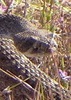
More people would probably be excited by the bear! We certainly were. While chatting, I happened to be looking back up towards Wrightson and noticed a good sized black bear traversing the slope not too far above us, and potentially he was walking right along the trail, most likely the Super Trail. We were able to get some fuzzy photos. He walked up over the hill and probably went towards the slopes of the Old Baldy Trail as it starts up to the summit. Ironically, we observed no poop in that area, while there was a ton of it lower down on both Cave and Gardner Canyon trails.

It was then great views and an increasingly cold hike down as dark approached.
 Meteorology
 Meteorology [ checklist ]
[ checklist ]  Inversion Layer
foliage observationfoliage observationfoliage observationfoliage observationfoliage observation
Autumn Foliage Observation Light
Left over ash and aspen. With the wind forecast this Tuesday, they won't last.

dry Baldy Spring Dry Dry
_____________________
🍭
 
Mar 18 2023
avatar

 Guides 1
 Routes 262
 Photos 864
 Triplogs 266

51 male
 Joined Mar 24 2021
 Tucson, AZ
Cave Canyon to Rock Candy Mtn Mine, AZ 
Cave Canyon to Rock Candy Mtn Mine, AZ
 
Hiking avatar Mar 18 2023
JackluminousTriplogs 266
Hiking5.83 Miles 892 AEG
Hiking5.83 Miles   4 Hrs   11 Mns   1.93 mph
892 ft AEG   1 Hour   10 Mns Break
 
1st trip
Linked   linked  
Partners none no partners
Route Scout Route Recorded  on Route Scout | Pop | Map | Popup | MapDEX
Did a day hike from car camping on Gardner Canyon Road. Lots of campers over the weekend, probably because it's spring break for a lot of people. That and the weather was beautiful; partly cloudy and cool but not cold, and not too windy either.

I had LE and her friend Rose with me, so we just did a short jaunt to the Rock Candy Mountain mine and explored the area. We found lots of tailings piles and collapsed entrances, though only one really looked like a mine entrance. It was flooded.

Lots of water in the creek, which made most of the creek crossings fun. Trail conditions were excellent. There is one large tree fallen across the trail after the mine, but it was easy to climb over.

water 1 out of 5water 2 out of 5water 3 out of 5water less than max Middle Cave Creek - Santa Ritas Medium flow Medium flow
Plenty of water. Creek crossings a moderate challenge.
 
May 08 2022
avatar

 Triplogs 4

male
 Joined Nov 02 2021
 tucson
Cave Canyon Trail, AZ 
Cave Canyon Trail, AZ
 
Hiking avatar May 08 2022
jim3141Triplogs 4
Hiking7.14 Miles 2,157 AEG
Hiking7.14 Miles   4 Hrs   25 Mns   1.75 mph
2,157 ft AEG      20 Mns Break
 
no photosets
1st trip
Linked   linked  
Partners none no partners
Route Scout Route Recorded  on Route Scout | Pop | Map | Popup | MapDEX
 
Apr 23 2022
avatar

 Guides 99
 Routes 1,484
 Photos 16,072
 Triplogs 1,374

male
 Joined Jan 07 2017
 Fountain Hills,
Mount Wrightson - Mount Ian, AZ 
Mount Wrightson - Mount Ian, AZ
 
Hiking avatar Apr 23 2022
DixieFlyerTriplogs 1,374
Hiking13.78 Miles 4,303 AEG
Hiking13.78 Miles   7 Hrs   2 Mns   2.28 mph
4,303 ft AEG   1 Hour    Break
 
1st trip
Route Scout Route Recorded  on Route Scout | Pop | Map | Popup | MapDEX
I have been wanting to hike Mount Ian for some time, and finally decided to get it done. I got the idea for this route from a similar hike that @lindaAnn did a couple of years ago.

Starting from the Cave Canyon TH, I did a CW loop basically going up the Gardner Canyon Trail and coming back down the Cave Canyon Trail. Along the way I did an out-and-back from Baldy Saddle to Mount Wrightson, and then went off-trail from the Crest Trail to and from Mount Ian.

Mount Ian has an amazing view of Mount Wrightson, and I enjoyed taking a lunch break there.

Trails that I hiked on were all in good shape, although the Cave Canyon Trail could stand to have a little trim work done.

The temperature at the TH was 40 when we started and 70 when we returned. There is a decent amount of sun exposure on this hike, and I would not want to hike it if it was any warmer.

I enjoyed this hike, although it is more difficult to get to the TH than it is to start in Madera Canyon.

dry Baldy Spring Dry Dry
dry as a bond

water 1 out of 5water 2 out of 5water 3 out of 5water less than max Middle Cave Creek - Santa Ritas Medium flow Medium flow
There was lots of water within 1.5 miles of the TH
_____________________
Civilization is a nice place to visit but I wouldn't want to live there
 
Apr 09 2022
avatar

 Guides 1
 Routes 262
 Photos 864
 Triplogs 266

51 male
 Joined Mar 24 2021
 Tucson, AZ
Mt Wrightson Cave Canyon Gardner Canyon Loop, AZ 
Mt Wrightson Cave Canyon Gardner Canyon Loop, AZ
 
Hiking avatar Apr 09 2022
JackluminousTriplogs 266
Hiking13.29 Miles 4,183 AEG
Hiking13.29 Miles   7 Hrs   43 Mns   2.32 mph
4,183 ft AEG   2 Hrs    Break
 
no photosets
1st trip
Route Scout Route Recorded  on Route Scout | Pop | Map | Popup | MapDEX
I’d been wanting to do this loop for a long time but never had space in the schedule till some friends arranged a car camping trip to Gardner Canyon. A couple friends tagged along till Florida Saddle but weren’t up for the whole loop, so I pressed on solo while they returned down Cave Canyon.

There were tiny pockets of snow here and there, and no water along the Crest. Collected some in the drainage for Gardner Canyon off Super, which was flowing well.

dry Baldy Spring Dry Dry
water report recorded in the field on our app Route Scout Broken

water 1 out of 5water 2 out of 5water 3 out of 5water less than max Gardner Canyon - Santa Ritas Medium flow Medium flow
water report recorded in the field on our app Route Scout Large pools

water 1 out of 5water 2 out of 5water 3 out of 5water less than max Middle Cave Creek - Santa Ritas Medium flow Medium flow
water report recorded in the field on our app Route Scout Delightful!

dry Upper Cave Creek - Santa Ritas Dry Dry
water report recorded in the field on our app Route Scout Not bone dry but no pools or trickle either. More like a seep. Nothing to filter or collect here.

water 1 out of 5water 2 out of 5water less than maxwater less than max Upper Gardner Canyon - Santa Ritas Light flow Light flow
water report recorded in the field on our app Route Scout A bit dicey to get down the drainage but plenty of flow from snow melt.
 
Apr 03 2022
avatar

 Guides 12
 Routes 192
 Photos 863
 Triplogs 356

42 male
 Joined Nov 30 2015
 Phoenix, AZ
Cave / McCleary / Gardner, AZ 
Cave / McCleary / Gardner, AZ
 
Run/Jog avatar Apr 03 2022
ShatteredArmTriplogs 356
Run/Jog14.66 Miles 4,234 AEG
Run/Jog14.66 Miles   4 Hrs   25 Mns   3.36 mph
4,234 ft AEG      3 Mns Break
 
no photosets
1st trip
Decided to go down and join the Tucson folks for some camping/running in the Santa Ritas. Explored some mines, etc. on Saturday afternoon before an evening of beer and campfire...

Hiked up Cave Creek in a group of 3-4 to Florida Saddle, then a couple of us peeled off and picked up another for a side trip to McCleary Peak, which I had never been up before. Water coming down the drainage east of Armour Spring, but none at the spring, as usual. The traverse over to the peak was fun, but it was cold and windy, so we didn't spend much time there.

Took Four Springs to the ridge, and followed the ridiculously steep connector trail (another new one for me) back up to Crest trail. Once back on Crest, we encountered a nice stretch of snow. Short break at Baldy Saddle before heading down.

Nice cruising down Gardner Canyon trail, the lower stretch (below Walker Basin junction) was new to me, and unexpectedly nice until the road. Pretty enjoyable loop, lots of water in the lower drainages, and nice to check off some of the last stretches of trail I hadn't yet seen in the Santa Ritas.
_____________________
  2 archives
Mar 18 2022
avatar

 Guides 1
 Routes 262
 Photos 864
 Triplogs 266

51 male
 Joined Mar 24 2021
 Tucson, AZ
Cave Canyon Trail #149Tucson, AZ
Tucson, AZ
Hiking avatar Mar 18 2022
JackluminousTriplogs 266
Hiking8.63 Miles 2,284 AEG
Hiking8.63 Miles   5 Hrs   11 Mns   2.00 mph
2,284 ft AEG      52 Mns Break
 
no photosets
1st trip
Linked   none no linked trail guides
Partners none no partners
Route Scout Route Recorded  on Route Scout | Pop | Map | Popup | MapDEX
Cave canyon to Florida Saddle
 
Feb 21 2022
avatar

 Guides 1
 Routes 262
 Photos 864
 Triplogs 266

51 male
 Joined Mar 24 2021
 Tucson, AZ
Wrightson via Gardner Canyon, AZ 
Wrightson via Gardner Canyon, AZ
 
Hiking avatar Feb 21 2022
JackluminousTriplogs 266
Hiking12.36 Miles 3,850 AEG
Hiking12.36 Miles   7 Hrs   8 Mns   2.17 mph
3,850 ft AEG   1 Hour   27 Mns Break
 
Route Scout Route Recorded  on Route Scout | Pop | Map | Popup | MapDEX
Day hike to summit Wrightson with my buddies Keith and Philip. Keith turned back about a half mile short of Super Trail… too steep for him.

Plenty of snow on Super, around Baldy Saddle, and up Wrightson. The clouds were low and fast. Visibility at the summit was not much.

Reconnected with Keith at the end of the old road section of Gardner, at the one time trailhead.
 
Nov 11 2021
avatar

 Guides 1
 Routes 1
 Triplogs 24

45 male
 Joined Feb 27 2012
 Cochise County
Gardner Canyon Trail #143Tucson, AZ
Tucson, AZ
Hiking avatar Nov 11 2021
AndrewAZTriplogs 24
Hiking13.40 Miles 4,000 AEG
Hiking13.40 Miles   11 Hrs      1.22 mph
4,000 ft AEG
 no routesno photosets
1st trip
Cave Canyon TH --> Link Trail --> Gardner Canyon --> Super --> Crest --> Cave Canyon Trail

Did this hike with a friend who wasn't quite ready for the distance or elevation gain, so we took a leisurely pace. I added Gardner Canyon to my mental list of places where it's hard to believe one is in southern Arizona. We passed on summiting to make sure we finished in the daylight.

The Crest Trail from Baldy Saddle to Florida is breathtaking. The views and the forest are both amazing. A stunning 2.5 miles that I'll definitely repeat at some point.

The descent down Cave Canyon was steep with loose footing. I had gotten ahead of my friend, so I missed out on the black bear that he saw. That's my punishment for being that far ahead.
_____________________
 
Mar 19 2021
avatar

 Routes 8
 Photos 2,243
 Triplogs 204

38 male
 Joined Mar 07 2009
 Colorado Springs
Cave Canyon Trail #149Tucson, AZ
Tucson, AZ
Hiking avatar Mar 19 2021
ultrazonaTriplogs 204
Hiking13.00 Miles 3,832 AEG
Hiking13.00 Miles
3,832 ft AEG
 no routesno photosets
1st trip
Easy to navigate snow up high. Trails in good condition. Minor blow down. Some blowdown removed via handsaw during hike.
_____________________
  1 archive
Feb 27 2021
avatar

 Guides 13
 Routes 38
 Photos 1,651
 Triplogs 577

60 male
 Joined Nov 15 2005
 Jackson, CA
Florida Canyon Trail #145Tucson, AZ
Tucson, AZ
Hiking avatar Feb 27 2021
toddakTriplogs 577
Hiking22.00 Miles 8,500 AEG
Hiking22.00 Miles   12 Hrs      1.83 mph
8,500 ft AEG
 no routes
1st trip
Partners none no partners
All day up/down/out/back route. Up FC145 to the saddle > down CC149 to the end of the road > back up to the saddle > down ESC146 > continue on GV79 > turn around at the wilderness boundary > back up to the saddle > back down FC145 to the start. Quality trails - upper FC has a few downed trees, upper ESC is moderately overgrown, CC and GV are in great shape. Very dry out there, just thin snow patches up high, only useful water at Sawmill Spring.

Topping off a great day, at dusk while descending along a small drainage with a trickle of water in it, saw a big, long-tailed brown cat streak up and out the other side of the drainage and vanish in about 2 seconds - mountain lion sighting!!
 Culture
 Culture [ checklist ]
[ checklist ]  HAZ Food
 Named place
 Named place [ checklist ]
[ checklist ]  Sawmill Spring

water 1 out of 5water 2 out of 5water 3 out of 5water less than max Sawmill Spring Gallon per minute Gallon per minute
_____________________
 
Oct 03 2020
avatar

 Photos 117
 Triplogs 23

48 male
 Joined Apr 25 2017
 Phoenix, AZ
East Sawmill Canyon Trail #146Tucson, AZ
Tucson, AZ
Hiking avatar Oct 03 2020
desertadaptedTriplogs 23
Hiking12.00 Miles 3,100 AEG
Hiking12.00 Miles
3,100 ft AEG
 no routes
1st trip
Linked   linked  
Partners none no partners
I've been trying to explore some of the trails in the Santa Rita's (Wrightson) lately. Some weeks back I went up the Florida Canyon Trail which, at the Florida Saddle, connects with Sawmill and Cave Canyon (Cave Creek) trails. I put together a loop that combined both. Unfortunately, a good bit of road walking is involved. I started on Cave Canyon. Like a number of trails in the area, it starts off well-forested and riparian. It then shifts to steep switchbacks in an exposed burn area. Although there are some pines coming back, most of the exposed terrain is covered by the scratchy mix of bushes you'd expect. Cave Canyon is excellently maintained for all that, and the views were great. After Florida Saddle, I continued up a bit through the overgrown sections of Sawmill, which then dips down steeply.
Sawmill Spring has plenty of great water (looks perennial) and I startled some deer who had the same idea.
I was able to fill up my water again at the official start of Sawmill, at a stream crossing.
Unfortunately, to make the hike a loop, the remainder needed to be road walk. Until I reached FR92, there wasn't much traffic.
The highlight of Sawmill is Sawmill Spring, but as between it and Cave Canyon, I'd choose the latter. I would definitely recommend Cave Canyon as an alternative route to the summit, but would not at all suggest replicating my loop hike. Too much road for not enough trail.

water 1 out of 5water 2 out of 5water less than maxwater less than max Sawmill Spring Quart per minute Quart per minute
Box of cool, clear, tasty water. And plenty of it.
_____________________
 
Sep 13 2020
avatar

 Guides 1
 Routes 269
 Photos 613
 Triplogs 1,360

50 male
 Joined Dec 22 2003
 Tucson, AZ
Gardner Canyon/Cave creek loop, AZ 
Gardner Canyon/Cave creek loop, AZ
 
Hiking avatar Sep 13 2020
RedwallNHopsTriplogs 1,360
Hiking13.00 Miles 4,314 AEG
Hiking13.00 Miles
4,314 ft AEG
 no routesno photosets
1st trip
Partners none no partners
up Gardner/down cave canyon. Summitted Wrightson
_____________________
 
Sep 05 2020
avatar

 Guides 2
 Routes 10
 Photos 42
 Triplogs 893

58 male
 Joined Jul 12 2012
 Oro Valley, AZ
Cave Canyon - Wrightson - Gardner Loop, AZ 
Cave Canyon - Wrightson - Gardner Loop, AZ
 
Hiking avatar Sep 05 2020
SpiderLegsTriplogs 893
Hiking13.25 Miles 4,100 AEG
Hiking13.25 Miles   5 Hrs   6 Mns   2.60 mph
4,100 ft AEG
 no routesno photosets
1st trip
Had a bigger day planned in the mountains to do our shake down cruise in prep for Mt. Whitney in a couple of weeks, but with the high temp advisory for the weekend cut the hike short. Camped out along Gardner Canyon Road in order to get an early start and hit the trail with our headlamps by 5:30 AM.

Started up Cave Canyon under glorious temps in the mid-60's and low humidity. Stayed this way until the Crest Trail. Once we hit the saddle just below Wrightson the wind was gusting and frankly pretty annoying. So put aside plans for eating breakfast on the summit and ate on the saddle, with plans to simply touch the summit and head straight back down as soon as we got up there. Pretty brisk on the summit and the wind was still blustery, touched the summit and quickly turned back down.

From there hit Super Trail down to Gardner Trail, hit the Link Trail back to the car. This is where we decided that an early start and shorter route was the best plan. It got pretty toasty in this section. I'm starting to notice birds along the trail and we found a couple of Montezuma Quail along Gardner Trail.

Great day overall in the mountains. Our group is gelling and psyched about meeting again in California in 10 days.
wildflower observationwildflower observationwildflower observationwildflower observationwildflower observation
Wildflowers Observation Isolated
_____________________
See my pics on Instagram @tucsonexplorer
 
May 16 2020
avatar

 Guides 110
 Routes 2,246
 Photos 8,982
 Triplogs 2,600

45 female
 Joined Dec 24 2007
 Ahwatukee, AZ
Wrightson - Florida, AZ 
Wrightson - Florida, AZ
 
Hiking avatar May 16 2020
LindaAnnTriplogs 2,600
Hiking14.36 Miles 4,577 AEG
Hiking14.36 Miles   8 Hrs   52 Mns   1.83 mph
4,577 ft AEG   1 Hour   2 Mns Break
 
1st trip
Route Scout Route Recorded  on Route Scout | Pop | Map | Popup | MapDEX
Parked at the end of Gardner Canyon Rd. The road is in very good shape, only two short rocky spots and one spot of water.

Headed up Link Trail, then up Gardner Canyon trail. I like Gardner Canyon, the pine trees are nice. The trail is generally in good shape, although the upper half is steep and not much shade. The other bonus is that it doesn't seem to get much use.

Once we reached Super Trail, we headed north and made our way up to Baldy Saddle, where we took a short break. After that, we headed up to Wrightson. The mile or so from the saddle to the summit was very crowded with other hikers, as expected. Out of the entire day, this was the only section where we saw anyone else. Quick stop at the summit to take a few pic, but it was very buggy (as was the majority of the day) so we kept moving.

Another break at the saddle, then we continued north on Crest Trail. Again, the sections with pines are very pleasant. Some spots of the trail are brushy and I was glad I wore pants instead of shorts. At Florida Saddle, we got onto East Sawmill and headed over towards Florida Peak. Sawmill is very overgrown, and is kind of a hassle to hike. The short offtrail up to Florida was actually a relief, although we didn't hang around on the summit since it was buzzing with insects.

Once back at Florida Saddle, we headed down Cave Canyon trail. Once again, I really liked Cave Canyon. The trail is steep in the upper half, but in nice shape, and not overgrown. There was a good amount of water flowing in the lower half. Very pleasant hiking, although not much breeze so it felt warm.

I wasn't feeling all that great, so the hike was more of a grind than it should have been, but it was still enjoyable. Within the first mile of the hike, I'd actually had the thought that I would have turned around if I hadn't just driven nearly three hours for this. That was really the only reason I went through with the hike. The heat and insects were also two negatives of the day. Still, it was good to get out there, and even better to only have to deal with other hikers for less than two miles of the entire loop. I think next time, I'll skip the Florida Peak part, and make the loop a little shorter. We each went through just under 4 liters of water.

dry Baldy Spring Dry Dry

water 1 out of 5water less than maxwater less than maxwater less than max Gardner Canyon - Santa Ritas Pools to trickle Pools to trickle
A couple of pools. Didn't look great.

water 1 out of 5water less than maxwater less than maxwater less than max Middle Cave Creek - Santa Ritas Pools to trickle Pools to trickle
Plenty of water in the pools and for the first 1.5 miles of Cave Canyon trail.

_____________________
Stop crying and just go do the hike.
 
May 10 2020
avatar

 Routes 30
 Triplogs 186

37 male
 Joined May 15 2015
 Tucson
Cave Canyon Trail #149Tucson, AZ
Tucson, AZ
Hiking avatar May 10 2020
jrousoshammondTriplogs 186
Hiking9.40 Miles 3,030 AEG
Hiking9.40 Miles   4 Hrs   26 Mns   2.14 mph
3,030 ft AEG      3 Mns Break
 
no photosets
1st trip
Linked   linked  
Partners none no partners
At first I parked before the creek crossing, but after over a mile of pleasant road and several more miles to go, I decided to walk back to my car and just try to make it to the TH. It worked out fine- as long as the water isn't too deep, a small car does the job.

The actual trail up to Florida Saddle is great. The Sawmill trail over to Florida Peak is a lot better than I expected, so much so that I followed it too far down to the right expecting it to lead to a pleasant route up the peak. In reality it's best to just stay on top of the ridge and just head straight up. I also went over to the northern summit just in case, since my GPS seemed to think that it was the actual summit...

The plan was to loop with Gardner and possibly hit Wrightson, but I got hailed on pretty good not long after I got on the Crest trail. I heard two big thunders after I called it quits and was heading back down Cave Canyon. The storm headed north so I probably would've been fine, but the Crest trail isn't the ideal place to screw around with lightning.

Definitely a worthwhile trip.
_____________________
 
May 09 2020
avatar

 Guides 12
 Routes 192
 Photos 863
 Triplogs 356

42 male
 Joined Nov 30 2015
 Phoenix, AZ
Florida Saddle lollipop, AZ 
Florida Saddle lollipop, AZ
 
Run/Jog avatar May 09 2020
ShatteredArmTriplogs 356
Run/Jog22.64 Miles 6,558 AEG
Run/Jog22.64 Miles   7 Hrs   47 Mns   2.95 mph
6,558 ft AEG      6 Mns Break
 
no photosets
1st trip
Headed down to the Santa Ritas to check out a couple more trails. We started off at Florida Canyon TH in order to shorten the drive (although adding on Florida Canyon trail clearly adds to the overall time and effort). It felt pretty warm early on, but that may be because of the exertion it takes to get up to that saddle. I was doubting at that point whether it would be a good idea to do the full route.

We headed onto Sawmill trail, and I suggested that while we're up there, we might as well bag Florida Peak. So we did, and the view was worth it. We tried to reconnect with Sawmill by sticking to the east side of the ridge, but that turned out not to be a time saver.

The descent down Sawmill had lots of variety; some really scratchy shrubs up high, nice mature ponderosa pine forests, and a dense thicket of young pines that will probably have to be thinned out at some point. The spring was flowing, with a nice clear pool, so I mixed up more electrolyte drink and grabbed an extra bag of water just in case. Below the spring, Sawmill Canyon had water off and on all the way down to the road.

The forest road section (which happens to be part of the Old Pueblo 50 course) was a little miserable. Cloud cover was increasing, and it alternated between hot and exposed, and nice and cool, based on whether there was a cloud overhead. When we got down to the main road, the crossing at Cave Creek was dry, so grabbing extra water at the spring turned out to be a good decision. A couple miles up the road, the creek had water.

Cave Creek trail was fairly enjoyable, with the lower section along the creek being at a very reasonable grade. We stopped for one last water fill about a quarter mile before the wilderness boundary - and at the wilderness boundary the creek had dried up again.

Around this time, we heard the first thunder, with one flash of lightning being probably within a mile. The rest of the way up to Florida Saddle there was occasional thunder - nothing close, but enough to motivate me to get up and over as fast as possible. In retrospect, the storm clouds provided some much needed coolth and even saved me up to half an hour!

The run back down to the TH was a nice cruise; either I had some adrenaline left from the lightning, or actually taking in enough electrolytes had an impact... Managed to get down from Florida Saddle in about 55 minutes.

Good day overall, but I don't know if I'd do this loop again, just because of the forest road section...

water 1 out of 5water 2 out of 5water 3 out of 5water less than max Aliso Spring Gallon per minute Gallon per minute
Plenty of water in the creek at the end of the Jeep road.

water 1 out of 5water 2 out of 5water less than maxwater less than max Florida Spring Quart per minute Quart per minute
Hard to tell how much the actual spring has; flow could be heard in the creek from the trail. There is a pipe crossing the trail that is dripping.

water 1 out of 5water 2 out of 5water 3 out of 5water less than max Middle Cave Creek - Santa Ritas Medium flow Medium flow
Good water about a mile before the end of the road. Couple of dry stretches along the trail, but mostly flowing almost to the wilderness boundary.

water 1 out of 5water 2 out of 5water less than maxwater less than max Sawmill Spring Quart per minute Quart per minute
Decent flow, nice clear water in the pool.
_____________________
 
average hiking speed 2.08 mph
1, 2, 3  Next

WARNING! Hiking and outdoor related sports can be dangerous. Be responsible and prepare for the trip. Study the area you are entering and plan accordingly. Dress for the current and unexpected weather changes. Take plenty of water. Never go alone. Make an itinerary with your plan(s), route(s), destination(s) and expected return time. Give your itinerary to trusted family and/or friends.

helpcommentissue

end of page marker