username
X
password
register
for free!
help
ArticlesGuidesRoutes
 
Photosets
 
 Comments
triplogs   photosets   labels comments more
Bobcat Trail - Sonoran Preserve - 9 members in 27 triplogs have rated this an average 2.4 ( 1 to 5 best )
1, 2  Next
27 triplogs
login for filter options
Aug 11 2024
avatar

 Guides 69
 Routes 37
 Photos 3,010
 Triplogs 2,387

55 male
 Joined Oct 24 2010
 Phoenix,Az
Bobcat Trail - Sonoran PreservePhoenix, AZ
Phoenix, AZ
Hiking avatar Aug 11 2024
mt98dewTriplogs 2,387
Hiking6.11 Miles 86 AEG
Hiking6.11 Miles   1 Hour   38 Mns   3.74 mph
86 ft AEG
 no routes
Linked   none no linked trail guides
Partners none no partners
Early morning hike at Sonoran South Preserve. I did an in and out on the Hawk Nest, Dixie Mine and Bobcat. Took the shortest route in doing it. Balloons were putting on a show. Thought one of them was going to land in the middle of the preserve. Decent number of users for an early Sunday morning . Met 11 hikers, 2 bikers and 1 runner. Wildlife included some rabbits, quail and a rattler. Always nice communing with nature :)
_____________________
 
Jan 04 2022
avatar

 Guides 21
 Routes 1,182
 Photos 36,858
 Triplogs 1,570

69 female
 Joined Feb 26 2004
 Phoenix, AZ
Tortoise Valle Dixie Bobcat Hawks, AZ 
Tortoise Valle Dixie Bobcat Hawks, AZ
 
Hiking avatar Jan 04 2022
tibberTriplogs 1,570
Hiking8.72 Miles 1,257 AEG
Hiking8.72 Miles   2 Hrs   54 Mns   3.11 mph
1,257 ft AEG      6 Mns Break
 
1st trip
Route Scout Route Recorded  on Route Scout | Pop | Map | Popup | MapDEX
What better way to start the new year then finishing off all the trails of the Phoenix Sonoran Preserve South (had trouble deciding which then to use, time vs comparison so went with time). I just had one trail left: Bobcat. I had a delayed start as the neighbors were out talking and I had to see what they were talking about which led to conversation about the upcoming HOA voting.

Anyway, I put on my warmer shirt as it was still only in the low 60s according to Alexa. I started on the Desert Tortoise, passed by a female hiker and then had the trail to myself until toward the top of the Valle Vista. I hung a right, north, and felt good enough to even hit Dixie Peak. I just love it when I actually complete a plan and don't come up with an excuse to avoid a peak, ha! I am having trouble with my right leg again; it wants to give out.

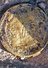
I got up the somewhat shaded side of Dixie Peak, it's a short little climb with these cutesy little switchbacks. The summit itself is really pretty small. I did happen to notice the benchmark so got a picture for @FLYING_FLIVER as it's not a picture I normally take but happen to think of him. It looks like someone has scratched it up so that's unfortunate. The views were mostly clear altho there was a slight haze in the far south and west distances.

I headed back down to the Dixie Mountain Loop where I would encounter only two more hikers for the next several miles. Part of the trail on this north side was in shade. I came upon the Bobcat and hung a right, north, for my new adventure out here. The rain has caused the ground cover to turn bright green in this area. I felt quite alone, it was quiet, at least until 1/2 mile in when I encountered a bike rider. I tried to figure out where the trail terminus/beginning was; ended up being more to the west, almost directly across from the new plant construction on the west side of I-17 as I could see the cranes for a short bit. It is a very slight downhill.

On the way back on Bobcat I encountered another bike rider and the hiker I had passed on the Desert Tortoise Trail, still looking at her phone. As I continued south back on the Dixie Mountain Loop, the shade would engulf the trail from time to time so it was on/off with the sunglasses. The chollas were aglow so yes, I stopped for a couple photos. One of these times, I am going to walk through that and NOT take a picture; I know I can do it. I saw about 1/2 dozen hikers between here and the Hawk's Nest Trail.

I was tempted to go back via Valle and Tortoise but I had a beer waiting and with the later start, I didn't want to be too late so I just walked to the next post and came back and down Hawks Nest. I was also getting a little hungry. But I have no doubt I could have done those last 2-2 1/2 miles; I just needed a little more time on the clock. I continue to kick lots of rocks off the trail and am getting quite good at it. Well Happy New Year everyone, let's make it a good year!

WATCH: 8.74 miles (heh, that's never happened before - the watch gave me more miles!) . Starting temp 62.5 with 26% humidity finishing at 4:59PM. High point 2330, low 1618. Avg bpm 135, max 164 (13% at Zone 4 anaerobic, 45% aerobic, 42% Zone 2 burning 1207 calories)
_____________________
For me, sometimes it's just as much about the journey as the destination.
Oh, and once in awhile, don't forget to look back at the trail you've traveled.
 
Nov 02 2021
avatar

 Guides 264
 Routes 2,797
 Photos 14,494
 Triplogs 5,894

55 male
 Joined Nov 20 1996
 
Hawk's Nest - Western Vista View - Bobcat, AZ 
Hawk's Nest - Western Vista View - Bobcat, AZ
 
Hiking avatar Nov 02 2021
joebartelsTriplogs 5,894
Hiking7.24 Miles 1,210 AEG
Hiking7.24 Miles   3 Hrs   19 Mns   2.31 mph
1,210 ft AEG      11 Mns Break
 
1st trip
Route Scout Route Recorded  on Route Scout | Pop | Map | Popup | MapDEX
Desert Vista Trailhead facilities are the original modern wave sweeping Phx Preserves. Including the filtered water station that hit Telegraph, Piestewa, etc, but a few years before based on notable wear. Prior to the full door stall design too, just Men's/Women's single tank flush with a laminated note to wait three seconds. Horse trailer parking.

Desert Vista Trailhead starts everyone on Hawk's Nest Trail. My initial thought was, better than anticipated because there is no mundane flat access on the edge of the hills.

A lowkey hurrah comes quickly in a dip through a ravine where paloverdes canopy. As expected, the tread is easy to moderate for mtn bikes and 3 to 6 ft wide. Basalt is notable in areas heading west on Dixie Mtn Loop.

If you have an ounce of tibber-mode in ya, the sunrise hour might throttle down the pace to a crawl. It's vista city. The western edge of Dixie Mountain Loop is like Piestewa Circumference but nicely elevated above the desert floor. Near and distant mountain ranges stand out.

Western Vista Trail
Would be considered steep by most. The footing is pretty good. A touch loose. A Paloverde tree semi-canopying the trail is fantastic in the morning light. Halfway up a small line of basalt surfacing. Better than expected views across I-17 and back across the Sonoran Preserves.

Two button cute college girls summitted just as I was turning around with bubbly hellos. The needle screeched across the bliss record passing a gangster sporting a movie prop-sized lollipop, blaring music. Pocket the judgment, a friendly hello too... The conservative dad-shirt with readers on the neckline gets 'em every time!

Bobcat Trail
Everything you'd expect in an access trail. Mildly interesting pile of smooth boulders. Imagine this stretch is a good place to keep your head buried in your cell phone starting or finishing.

All-in-all
The air seems cleaner vs Piestewa/SoMo. 100% hellos on two-three dozen passing. No clue if it's common but the mixed bag of hellos had a neighborhood vibe.
 Flora
 Flora [ checklist ]
[ checklist ]  Desert Senna
 Named place
 Named place [ checklist ]
[ checklist ]  Black Mesa  Piestewa Peak
wildflower observationwildflower observationwildflower observationwildflower observationwildflower observation
Wildflowers Observation Isolated
2
_____________________
- joe
 
Feb 12 2020
avatar

 Guides 69
 Routes 37
 Photos 3,010
 Triplogs 2,387

55 male
 Joined Oct 24 2010
 Phoenix,Az
Bobcat Trail - Sonoran PreservePhoenix, AZ
Phoenix, AZ
Run/Jog avatar Feb 12 2020
mt98dewTriplogs 2,387
Run/Jog6.16 Miles 86 AEG
Run/Jog6.16 Miles   1 Hour   15 Mns   4.93 mph
86 ft AEG
 no routes
Linked   none no linked trail guides
Partners none no partners
Did this jog as an out and back. Went in on the Hawk Nest, took the western loop the Dixie Mine to the Bobcat and then Bobcat out to the street. Returned the way I came. Always hate running the Hawk Nest. For me it is a hard way to start a run. Otherwise really enjoy this track, kind of boring, but makes for a nice run. Trails were busy today encountered 18 hikers a biker and a trail runner. Chipmunk and some quail were the only wildlife I saw.
_____________________
 
Jul 24 2018
avatar

 Guides 69
 Routes 37
 Photos 3,010
 Triplogs 2,387

55 male
 Joined Oct 24 2010
 Phoenix,Az
Bobcat Trail - Sonoran PreservePhoenix, AZ
Phoenix, AZ
Hiking avatar Jul 24 2018
mt98dewTriplogs 2,387
Hiking6.01 Miles 86 AEG
Hiking6.01 Miles   1 Hour   30 Mns   4.01 mph
86 ft AEG
 no routes
Linked   none no linked trail guides
Partners none no partners
After work hike/jog. Did an in and out via Hawk Nest - Dixie Mine Loop (west portion) - Bobcat and then back out. Started out with a slow jog and did about 5 miles before I ended walking the rest of the way. I like to think that the heat doesn't bother me, but I guess it does :? . I was out there when it hit 115 and I have to admit it felt pretty toasty. Had the trails to myself, but there was one other car at the TH when I left. No wildlife.
_____________________
 
Mar 05 2017
avatar

 Photos 281
 Triplogs 222

45 male
 Joined Aug 03 2008
 Chandler, AZ
Dixie Mountain Loop - Sonoran PreservePhoenix, AZ
Phoenix, AZ
 Hiking avatar Mar 05 2017
knmurphyTriplogs 222
 Hiking7.75 Miles 575 AEG
 Hiking7.75 Miles
575 ft AEG
 no routesno photosets
Partners partners
Dookieshoes
_____________________
 
Dec 26 2016
avatar

 Guides 2
 Routes 25
 Photos 1,890
 Triplogs 604

41 male
 Joined Sep 13 2009
 Mesa, AZ
Dixie Mountain Loop - Sonoran PreservePhoenix, AZ
Phoenix, AZ
Hiking avatar Dec 26 2016
jochalTriplogs 604
Hiking7.70 Miles 1,300 AEG
Hiking7.70 Miles
1,300 ft AEG
 no routesno photosets
1st trip
_____________________
 
Mar 31 2016
avatar

 Guides 4
 Routes 51
 Photos 1,545
 Triplogs 348

86 male
 Joined Sep 24 2004
 Phoenix, AZ
Bobcat Trail - Sonoran PreservePhoenix, AZ
Phoenix, AZ
Hiking avatar Mar 31 2016
black_toesTriplogs 348
Hiking6.57 Miles 1,202 AEG
Hiking6.57 Miles   3 Hrs   51 Mns   2.28 mph
1,202 ft AEG      58 Mns Break
 
1st trip
Partners none no partners
Had not hiked the Bobcat and to make it longer than the 2-mile roundtrip, I started on the south side of the Preserve at Desert Vista TH, walking more than 3 mi N to the end at a large housing development at Sonoran Desert Dr near Paloma Pkwy. The Bobcat was of course the last mile on the N. It is a pleasant trail, clean and clear and flat and would probably be a wildflower heaven most years. Just not this one which has been disappointing on the trails I've covered.

Saw the nest of a Great Horned owl with Mama and 3 kiddos snuggled in the cradle of a Saguaro. A park ranger told me this was the 5th year Fish & Game has tracked the Mama owl to the same spot, and she has had 2-3 babies each year. A jogger, seeing me bent over a camera shooting a blooming Teddy Bear Cholla, stopped to tell me about the owl. He said it had two babies last year and three the year before.

The Teddy Bear blooms were the first I've ever photographed. Cactus flowers are all but gone on the S up to the end of the Hawk's Nest Tr. But once in the middle of the Preserve, there are plenty of Buckhorn blooms, ditto the Compass Barrel. But blooms of the dominant tree, the Palo Verde, have peaked and losing glow fast.

Enjoyable hike though a bit windy and cool once out of the protection of the mountains. Glad I did the Bobcat but unless I'm going out to Circle Tank or adventuring on some of the faint jeep roads, I likely won't be back there for a while.
wildflower observationwildflower observationwildflower observationwildflower observationwildflower observation
Wildflowers Observation Isolated
_____________________
  2 archives
Mar 12 2016
avatar

 Routes 189
 Photos 7,244
 Triplogs 1,742

57 male
 Joined Apr 25 2011
 Goodyear, AZ
Circle Tank Loop, AZ 
Circle Tank Loop, AZ
 
Hiking avatar Mar 12 2016
NightstalkerTriplogs 1,742
Hiking15.70 Miles 2,296 AEG
Hiking15.70 Miles   6 Hrs   28 Mns   2.71 mph
2,296 ft AEG      40 Mns Break16 LBS Pack
 no routes
1st trip
Last night I was trying to figure out where I was going to hike today. All my regular hiking partners were not available, so I was on my own. I was desperately searching Hike Arizona maps for some inspiration. I was checking out South Mountain, but nah. Maybe do a big loop out of Apache wash, nah. And then I saw Widowmaker's Circle Tank Loop and bang!, I was in! I've been dying to check out the arch dam and Circle Tank so transferred the track over to my GPS and I was ready to head out. Started up Hawk's Nest trail and stopped to take some pictures of the giant owl, who was hanging out in his nest. Next stop, Dixie Summit Trail for a great vantage point overlooking the valley. Out Bobcat a ways and then bushwacked my way east to Circle Tank. Followed an old jeep road south to Cave Creek Dam. Built in 1923, the dam is a barrel arch design, which is pretty cool stuff! From the dam I headed west on a combination of old jeep roads and bushwacking until I got on the eastern portion of the Great Horned Owl Trail. Follow this south to the unnamed trail that ascends the south face of Union Peak. This was the 12 mile mark for me, I had to decide if I had the energy to climb the super steep back side of Union Peak. Well, I'm right here, why not? There were two couples on top when I popped up out of no where, they looked confused. I said howdy and headed back to the parking lot, I was starving! Great loop. Perfect weather for a valley hike. I feel awesome!
wildflower observationwildflower observationwildflower observationwildflower observationwildflower observation
Wildflowers Observation Moderate
Spring is here!
_____________________
  1 archive
Jan 25 2016
avatar

 Guides 69
 Routes 37
 Photos 3,010
 Triplogs 2,387

55 male
 Joined Oct 24 2010
 Phoenix,Az
Bobcat Trail - Sonoran PreservePhoenix, AZ
Phoenix, AZ
Hiking avatar Jan 25 2016
mt98dewTriplogs 2,387
Hiking6.29 Miles 86 AEG
Hiking6.29 Miles   1 Hour   13 Mns   5.17 mph
86 ft AEG
 no routes
Linked   none no linked trail guides
Partners none no partners
First time to the Sonoran Preserve South this year. Did an in out involving Hawk's Nest, Dixie Mine Loop and the the Bobcat Trails. Went in on the Hawk and took the western portion of Dixie to the Bobcat and then followed that to the paved street. Looks like the pave street which was a dead end where the trail came out is in the process of being extended. Don't know if there will be any future parking from that side, but as of now the street still has no parking signs posted throughout. Did a little side trail exploring at that end then joined back up to the Bobcat and returned the way I came. Found a side trail that provided gated access to the preserve about .25 miles from where the Bobcat ends. (The Sonoran Preserve South is fenced on its most northern border so accessing the preserve can be tricky if you are not following a trail. It was weird finding that kind of a gate allowing entrance into the preserve). Parking lot was crowded. Saw about 15 cars and saw about 7 hikers on the trails. No wildlife.
_____________________
 
Jun 24 2015
avatar

 Guides 69
 Routes 37
 Photos 3,010
 Triplogs 2,387

55 male
 Joined Oct 24 2010
 Phoenix,Az
Bobcat Trail - Sonoran PreservePhoenix, AZ
Phoenix, AZ
Hiking avatar Jun 24 2015
mt98dewTriplogs 2,387
Hiking6.07 Miles 86 AEG
Hiking6.07 Miles   1 Hour   41 Mns   3.61 mph
86 ft AEG
 no routes
Linked   none no linked trail guides
Partners none no partners
After work hike. Got started a little after 4pm. Went in on the Hawk's Nest, then took the western portion of the Dixie Mine Loop and then took Bobcat to where it connected to a surface street. Went back the same way I came in. Jogged in to the end, but hiked out. Didn't see anyone until I as approaching the TH where I passed a hiker and a couple of bikers. Probably close to 110 again, very little breeze and a few Cirrus clouds high above. No wildlife.
_____________________
 
Jun 14 2015
avatar

 Guides 27
 Routes 670
 Photos 12,111
 Triplogs 857

56 male
 Joined Jul 05 2006
 Mesa, AZ
Sonoran Preserve-South Area, AZ 
Sonoran Preserve-South Area, AZ
 
Hiking avatar Jun 14 2015
DarthStillerTriplogs 857
Hiking10.60 Miles 1,759 AEG
Hiking10.60 Miles   4 Hrs   9 Mns   2.55 mph
1,759 ft AEG
 no routes
1st trip
I noticed this area posted on HAZ a few months ago and have been meaning to get out here. The trails are ok, mostly once you get past the views of the surrounding subdivisions. The weather wasn't too hot today in the morning, but that will soon change in the coming months.

I started from the Desert Vista Trail TH on the south end and took the Hawk's Nest Trail to the Desert Tortoise Trail, then did a section of the Valle Verde Trail (mainly to add mileage), then back NW to the Dixie Mt. Loop Trail, did the Dixie Summit, out and back on the Bobcat, summited again on the Western Vista Trail, and headed back to the trailhead. The little spur trails on the west end join private trails for the NorTerra subdivision. I walked a few yards on one of those to check it out and then headed back to the preserve.

At the east end on the Valle Verde Trail I saw some mountain bikers who told me there was a rattlesnake further up. I looked but I couldn't find it. on my way back west to the Dixie Mt. Loop Trail, a mountain biker was coming the other way and actually stopped and yielded the trail to me until I passed. WOW! :o :) : app : . I have NEVER seen that before. Kudos, sir.

This area really didn't have too many people. Lots of cars when I arrived at 6:15am, 3 left when I was done at 10:30am. the area isn't to overrun by bikers, and I saw more hikers than trail runners. Looking forward to going back to finishing the trails in this area and then the north area.
_____________________
  2 archives
Jun 01 2015
avatar

 Routes 297
 Photos 6,928
 Triplogs 552

49 male
 Joined Dec 30 2007
 Avondale,Az
Phx Sonoran Preserve Connector, AZ 
Phx Sonoran Preserve Connector, AZ
 
Hiking avatar Jun 01 2015
StoicTriplogs 552
Hiking12.22 Miles 662 AEG
Hiking12.22 Miles   3 Hrs   55 Mns   3.33 mph
662 ft AEG      15 Mns Break
 
1st trip
The only trail I haven't done in the Southern part of the Sonoran Preserve, was the Bobcat trail. Wanting to do more than just the bobcat trail, I came up with a connector trail to the Northern Portion of the Preserve. I parked near a park in the housing area in-between both Preserves. The pups and I started our hike around 4:30am. I used the trails in the neighborhood to get to the Bobcat Trailhead. We had a great view of the moon on the West side. We then had a great sunrise to the East. I wish I had brought my camera. I opted out and left it in my truck.The Bobcat trail took about a half hour to hike in and out. I then took the neighborhood trails to the West Skip Rimsza Paseo Trail. I was only planning on hiking about 1/2 of this trail. With the early start and the decent weather, I decided to finish the West Skip trail. We then took a small portion of the Ocotillo trail back to the West Skip Trail. With it getting hot outside, I decided to take the paved trail back, instead of hiking more of the Ocotillo trail. I didn't want to run into any snakes on the way back. It seemed to be a logical plan. Getting close to the end of the West Skip trail, I looked at my phone/gps and looked back up..... My Jack Russell was face to face with a small rattlesnake. Miss Ellie touched her nose right by the snakes mouth. The snake then stuck out the forked tongue. Miss Ellie listens well, and she came right back to me when I yelled. I was extremely lucky...... The snake never moved or shook its rattles. We then hiked the last mile to the truck. Rayna and I then took a 15 minute break at the park under a tree. I guess Miss Ellie wasn't done. She did 5 laps around a soccer goal chasing after birds. The 12 miles wasn't enough for her.
I did see 3 large coyotes before we parked, 3 smaller coyotes near the trail, plenty of rabbits and birds, oh and 1 rattlesnake.
I have been debating for years, weather or not to get a vaccine for rattlesnakes, for my dogs. I think my mind is now made up.
_____________________
 
Feb 22 2015
avatar

 Routes 36
 Photos 2,658
 Triplogs 1,347

67 male
 Joined Jul 28 2004
 Scottsdale, AZ
Union Hills and loops, AZ 
Union Hills and loops, AZ
 
Hiking avatar Feb 22 2015
mazatzalTriplogs 1,347
Hiking11.50 Miles 2,160 AEG
Hiking11.50 Miles   4 Hrs   55 Mns   2.51 mph
2,160 ft AEG      20 Mns Break
 no routes
1st trip
Hadn’t done any of these trails before. I remember we did Union Peak from south and east side about 28 years ago, ~1987 but I don’t have a record of the exact date :roll: There were no hiking trails but there were a few old mining/prospecting tracks :)

Nice area considering where it is. Pretty much followed Eagle’s track minus a few bits. On the southeast loop I only saw 3 people but on the northwest about 40 :?
 Flora
 Flora [ checklist ]
[ checklist ]  Brittlebush
wildflower observationwildflower observationwildflower observationwildflower observationwildflower observation
Wildflowers Observation Light
_____________________
  2 archives
Dec 20 2014
avatar

 Guides 41
 Routes 1,626
 Photos 14,983
 Triplogs 2,762

69 male
 Joined Jan 20 2009
 Far NE Phoenix,
The Union Hills, AZ 
The Union Hills, AZ
 
Hiking avatar Dec 20 2014
The_EagleTriplogs 2,762
Hiking12.76 Miles 2,137 AEG
Hiking12.76 Miles   4 Hrs   31 Mns   2.99 mph
2,137 ft AEG      15 Mns Break13 LBS Pack
 
no photosets
Stayed close with afternoon plans. Been awhile since I've been here. Perfect Temps...Hit
_____________________
There is a very fine line between "hobby" and "mental illness."
Dave Barry 🦅
 
May 13 2014
avatar

 Guides 69
 Routes 37
 Photos 3,010
 Triplogs 2,387

55 male
 Joined Oct 24 2010
 Phoenix,Az
Bobcat Trail - Sonoran PreservePhoenix, AZ
Phoenix, AZ
Hiking avatar May 13 2014
mt98dewTriplogs 2,387
Hiking7.28 Miles 250 AEG
Hiking7.28 Miles   2 Hrs   15 Mns   3.24 mph
250 ft AEG
 no routes
Linked   none no linked trail guides
Partners none no partners
After work hike. Started off from the Hawk's Nest around 3:30. Took the Dixie Mine Loop clockwise to where it intersected with the Bobcat Trail and took this to where it ends at Sonoran Desert Drive. With a few exceptions, after I climbed Hawk's Nest Trail this route is all down hill. My intent was to jog this route, but there was nothing in the tank today so it turned into a nice stroll. I was unimpressed with the Bobcat. It was a fairly straight trail and if you are hiking north you get an eyeful of the approaching subdivision. On the way back, the view is much better and I took the opportunity to explore side trails that splintered off from the Bobat. Once I got back to the Dixie Mine, I returned the same way I came. Even though the Bobcat is not the most scenic of trails it is ideal for jogging and provides nice access to the park for those people who live in that area. Didn't see any wildlife except for a few lizards. When I started my hike there were 2 cars there, when I finished my hike there were 11. (But not a 1 of 'em had a HAZ sticker :( ).
_____________________
 
Apr 27 2013
avatar

 Guides 1
 Photos 1,148
 Triplogs 219

54 male
 Joined Jul 14 2011
 Phoenix, AZ
Bobcat Trail - Sonoran PreservePhoenix, AZ
Phoenix, AZ
Hiking avatar Apr 27 2013
burntlizardTriplogs 219
Hiking2.35 Miles 86 AEG
Hiking2.35 Miles   1 Hour      2.35 mph
86 ft AEG
 no routes
Linked   none no linked trail guides
Partners none no partners
Spontaneous hike - to fight the afternoon doldrums!
_____________________
 
Feb 03 2013
avatar

 Guides 1
 Photos 1,148
 Triplogs 219

54 male
 Joined Jul 14 2011
 Phoenix, AZ
Western Vista Trail - Sonoran PreservePhoenix, AZ
Phoenix, AZ
Hiking avatar Feb 03 2013
burntlizardTriplogs 219
Hiking3.59 Miles 340 AEG
Hiking3.59 Miles   1 Hour   25 Mns   2.53 mph
340 ft AEG
 no routesno photosets
Linked   linked  
Partners none no partners
Great morning for a quick hike - the trail was busy (relatively speaking)and a few rain drops were falling :)
_____________________
 
Dec 02 2012
avatar

 Guides 1
 Routes 136
 Photos 1,367
 Triplogs 364

47 male
 Joined Jun 10 2011
 Phoenix, AZ
Dixie Mountain Loop - Sonoran PreservePhoenix, AZ
Phoenix, AZ
Hiking avatar Dec 02 2012
The_DudeTriplogs 364
Hiking7.90 Miles 1,940 AEG
Hiking7.90 Miles   2 Hrs   26 Mns   3.41 mph
1,940 ft AEG      7 Mns Break
 
no photosets
_____________________
 
Sep 06 2012
avatar

 Guides 9
 Routes 98
 Triplogs 284

44 male
 Joined Feb 17 2010
 Moscow, RU
Dixie Mountain Loop - Sonoran PreservePhoenix, AZ
Phoenix, AZ
Hiking avatar Sep 06 2012
AndreyPTriplogs 284
Hiking7.90 Miles 1,410 AEG
Hiking7.90 Miles   3 Hrs   5 Mns   2.56 mph
1,410 ft AEG
 
no photosets
1st trip
Sonoran Preserve hike for GPS logging: H -> D -> DS -> D -> B -> D -> W -> D -> H. This time lots of bikers that weren't scared of me, but less wildlife.

It turned out that the only parking for this preserve is at Desert Vista trailhead just as on the map. Sonoran Desert Dr dead-end and adjacent street sections have "No parking" signs all over, so Bobcat trailhead has only pedestrian/bike access.
_____________________
 
average hiking speed 2.53 mph
1, 2  Next

WARNING! Hiking and outdoor related sports can be dangerous. Be responsible and prepare for the trip. Study the area you are entering and plan accordingly. Dress for the current and unexpected weather changes. Take plenty of water. Never go alone. Make an itinerary with your plan(s), route(s), destination(s) and expected return time. Give your itinerary to trusted family and/or friends.

helpcommentissue

end of page marker