|
| | | |
| |
|
| Backpack | 15.94 Miles |
2,754 AEG |
| | Backpack | 15.94 Miles | 5 Hrs 43 Mns | | 2.79 mph |
| 2,754 ft AEG | | | | |
|
|
| |
| Partners |
|
[ show ]
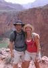
| partners | | Kyle and I decided on this as an easy overnight with the pups. I've always enjoyed this area, and this trip was no different.
I brought my bike and rode the 4.5 miles along FR300 to save us from having to do that less interesting section on foot. I was surprised how green and wet everything is, especially with the early fire restrictions this year. It really is early season up there, with many aspen not yet showing their leaves, and the maples just getting started.
Last time I did this section was in a freak April snow storm a couple of years ago, so it was neat to remember how things looked that day. Saturday was just borderline warm in the sun, but Sunday cooled off and was perfect, with cloud cover, breezy, and in the 60s.
I always forget about the numerous little draws to cross on the southern half of Houston Brothers, it's such a different hike from the northern half.
We stopped at Baker Butte on the way out. Shirley has been there for 18 years, and it's been at least 7 since I carried an antique sewing machine up into the tower for her, and she has since acquired a horse. The tower has been upgraded and now has new windows and doors and an outdoor walkway around it.
The views were nice, but a little bit hazy today. |
  |
Aspen Spring |
Quart per minute |
Quart per minute |
| | | Low flow, but nice clear, cold trickle. Great for filtering. |
|
Fred Haught Spring |
Quart per minute |
Quart per minute |
| | | Light flow and pools throughout the draw |
|
Houston Draw Head |
Quart per minute |
Quart per minute |
| | | Nice pool of water at the seep, trickling down into the draw. |
|
McFarland Spring |
Dripping |
Dripping |
| | | Very light flow at spring source, but plenty of water just downstream. Nice trickle flow and small pools. |
|
Pinchot Spring |
Gallon + per minute |
Gallon + per minute |
| | | Reliable and cold as always | | _____________________
| I'm not sure what my spirit animal is, but I'm confident it has rabies. |
| | |
|
|
|
 Route Editor


 the first of which driving to Strawberry, AZ, turned-out to be very stressful & risky for me.