username
X
password
register
for free!
help
ArticlesGuidesRoutes
 
Photosets
 
 Comments
triplogs   photosets   labels comments more
Miller Peak from Crest Trail - 27 members in 62 triplogs have rated this an average 4.1 ( 1 to 5 best )
1, 2, 3, 4  Next
62 triplogs
login for filter options
Mar 15 2025
avatar

 Routes 255
 Photos 8
 Triplogs 261

54 male
 Joined Feb 19 2015
 Phoenix
Miller Peak from Crest TrailTucson, AZ
Tucson, AZ
Hiking avatar Mar 15 2025
bjonsonTriplogs 261
Hiking10.53 Miles 2,976 AEG
Hiking10.53 Miles   4 Hrs   33 Mns   2.38 mph
2,976 ft AEG      8 Mns Break
 no routesno photosets
1st trip
Linked   none no linked trail guides
Partners none no partners
_____________________
 
Dec 28 2024
avatar

 Guides 187
 Routes 989
 Photos 12,068
 Triplogs 864

72 male
 Joined Jun 27 2015
 Tucson, Arizona
Miller Peak, AZ 
Miller Peak, AZ
 
Hiking avatar Dec 28 2024
markthurman53Triplogs 864
Hiking10.29 Miles 3,140 AEG
Hiking10.29 Miles   8 Hrs   3 Mns   1.46 mph
3,140 ft AEG   1 Hour   1 Min Break20 LBS Pack
 
1st trip
Linked   linked  
Partners partners
mamakatt22
After yesterdays hike in Scotia Canyon we drove around to Sierra Vista and stayed the night. We had plans of starting at Montezuma Pass and planned to hike to Bathtub Spring, trying to break up the AZT #1 into bite size pieces keeping our round trip distances to less than 14 miles. We got a late start (0900) so when we got to Miller Peak spur trail we had a choice, go up to the Peak (which I had never done) or continue on to Bathtub Spring. Ginny opted to go up to the peak which I was glad. It was getting late and Bathtub Spring was a bit out of our reach.

Great views from the peak in all directions. From the peak you are looking down on the Fort Huachuca dirigible. Good clear weather made visibility from the peak excellent. Temps in the mid 40's very little breeze made for perfect hiking weather. Took a lunch break at the summit and headed back.

I had hiked this trail before ( but not going to the peak) and remember the mines along the first portion of the hike, quite interesting. Most of them were sealed off with steel gates. On the way up I made a comment about very large boot prints, must be a very large person. A little while later we found one of the boots, it belonged to a mule or horse. Saw the droppings along the trail but never associated them with the prints. We did find another boot further on up the trail. Guess the mule is going without two of it's boots. Never heard of a mule wearing boots. Wonder if it had lipstick on too.

Once on the crest the sign for the Lutz Canyon Trail that comes up from Ash Creek was standing erect and the trail at least at the intersection was in good condition (I haven't been on that trail in at least 5 years). A little further along the Crest trail the sign for Bond Spring was on the ground, no sign just a post and the trail heading down the western slope was barely visible. The final ascent up to the pass where the junction of the Miller Peak Spur trail is steeper than I remember, lots of switchbacks as it climbs up and around large granite boulders. Interesting section of trail.

The only wildlife we saw not counting birds was an encounter with some deer. Didn't seem to alarmed by our presence. Only one other pair of hikers they were heading to Parker lake trailhead where we were yesterday and have a car waiting for them there. Dry along the whole trail.
_____________________
 
Dec 28 2024
avatar

 Routes 305
 Photos 39
 Triplogs 300

female
 Joined Feb 02 2020
 Shallowater,TX
Miller Peak, AZ 
Miller Peak, AZ
 
 Hiking avatar Dec 28 2024
mamakatt22Triplogs 300
 Hiking10.40 Miles 3,140 AEG
 Hiking10.40 Miles   8 Hrs      1.49 mph
3,140 ft AEG   1 Hour    Break12 LBS Pack
 no routesno photosets
1st trip
Linked   linked  
Partners partners
markthurman53
This was the second day of our hiking getaway. We stayed in Sierra Vista last night. This is a good workout and there are some old mines along the way. They are interesting and all were gated with big iron gates. Probably a good idea to keep out those of us who are curious about what is in that tunnel. We occasionally saw some discarded blankets, clothing, sleeping bags as illegals also must use this route. The trail is well maintained but rocky so you can't gawk at the scenery unless you stop. Otherwise it's steep and a tumble would not be fun. We kept seeing a kind of wide footprint that was odd. Then we came across a discarded horse shoe. It was made of either rubber or plastic and had a strap with velcro to keep it on. And also some horse poop but we never saw horses. We later found another shoe similar to the first one. Definitely not something we have come across before on any hikes. When we got back to the trailhead Mark reported it to the Border Patrol agent. The scenery is amazing! Mountain ranges everywhere you look. The border wall is also evident but unfinished as yet. There are plenty of birds around. The main ones I can identify are Mexican Jays. The smaller birds are fast and shy so hard to get a good look. We saw two deer does and actually got a short video. One of them was curious enough to stop and stare at us. Very pretty and looked healthy. Miller Peak was cool! We were up above the dirigible. Got some nice pictures. There were some ladybugs on the peak. It was a great place for our break. On the way back down we spooked some quail and that gave me a good heart rate increase. All in all I enjoyed this hike very much.
  3 archives
Oct 13 2023
avatar

 Routes 30
 Photos 893
 Triplogs 28

male
 Joined Oct 14 2021
 Tucson, AZ
Miller Peak from Crest TrailTucson, AZ
Tucson, AZ
Hiking avatar Oct 13 2023
BubbaJuiceTriplogs 28
Hiking10.35 Miles 3,204 AEG
Hiking10.35 Miles   5 Hrs   22 Mns   2.12 mph
3,204 ft AEG      29 Mns Break7 LBS Pack
 
1st trip
Linked   none no linked trail guides
Partners none no partners
Wanted fall colors and something new without driving too far. The views of the peak and adjacent Carr Peak were spectacular from Sierra Vista, with lots of red, orange, and yellow. Today was a wonderful day in terms of weather, partly cloudy and a good temperature. Were the only ones at the starting parking lot. There is water at the visitors center for the monument. I brought 3 liters of water for the hike itself, more for the drive. The bathroom at the pass was phenomenal, toilet paper, no smell, likely freshly emptied. The trail is nice, some cool adits were along this part of the trail. The views from the wilderness boundary were spectacular. The peak was still a while away although that was okay. Up to this part, we had already gained a majority of the elevation pretty quickly so it was nice to get it out of the way.

The rest of the hike is awesome because there are taller (and thus shadier and even more pretty!) most of the way up to the peak. However this portion of the hike lacked a lot of views of the peak and not a lot of fall colors. Along here, I saw a solar panel sticking up from out of the trees. It was a trail cam mounted on a tree at approx. 31.38369, -110.29599. There was a camp spot here. I wouldn't recommend camping at this spot. The junction with the trail to the spring has a post that had a sign but the sign is now gone. Once the trail starts switch-backing, the rocks and pines were like the rocks by the top of Mount Lemmon with cliffs and pines. Along this section there were also many lizards (likely Sceloporis jarrovii AKA Yarrow's spiny lizard). Some had more blue than others, some of the blue being navy and others being a more aqua color.

At the junction for the peak, there were some very nice views of Carr Peak and some of the grassland and aspens that Miller Peak does not offer. A lot of this part of the trail had vegetation bleeding over onto the trail, a common theme throughout this hike. I would recommend pants if the weather allows it. Had lunch at the top. There were a few ladybugs in some of the scrub. The views were awesome, it's hard to beat the tallest peak in a range with no visual obstructions from vegetation. There was this one tree that I wanted to know the species of. It is some sort of scrub pine/juniper/something similar. I couldn't find it online after a bit of search. Didn't think to get a closer photo. Going down was way easier and faster. Since it was shadier in the afternoon, it made some of the slopes look even better.

After the hike, we went to the visitor's center just before closing (at 4:00) and were able to see some javelina appear just for us at the watering hole and wash our hands. I guess there was a cave in the monument that looks cool but I didn't know it was there. We got McDonald's soft serve afterwards.
 Flora
 Flora [ checklist ]
[ checklist ]  Mexican Silene
 Named place
 Named place [ checklist ]
[ checklist ]  Montezuma Pass  Mount Wrightson
foliage observationfoliage observationfoliage observationfoliage observationfoliage observation
Autumn Foliage Observation Moderate
The oaks on south slope of Miller Peak are beautifully red and orange. Lots of oak along the trail that is yellow. Currently yellow aspens appear around summit spur trail.
wildflower observationwildflower observationwildflower observationwildflower observationwildflower observation
Wildflowers Observation Moderate
Some yellows, whites, orange-red, and purples. Not lush wildflowers however!
_____________________
Check out my benchmarks website :D : https://bubbajuice.github.io/benchmarks WIP!
 
Aug 19 2023
avatar

 Guides 110
 Routes 2,246
 Photos 8,982
 Triplogs 2,600

45 female
 Joined Dec 24 2007
 Ahwatukee, AZ
Miller Peak from Crest TrailTucson, AZ
Tucson, AZ
Hiking avatar Aug 19 2023
LindaAnnTriplogs 2,600
Hiking10.00 Miles 3,035 AEG
Hiking10.00 Miles   5 Hrs   44 Mns   2.05 mph
3,035 ft AEG      51 Mns Break
 
1st trip
Linked   linked  
Partners partners
RedChrisB
Route Scout Route Recorded  on Route Scout | Pop | Map | Popup | MapDEX
Got started from Montezuma Pass around 0730 and headed north on the Crest Trail. The trail was damp from rain either yesterday or overnight, but not muddy. Cool, cloudy, and occasionally breezy. Nice views in all directions, and fun to see all the mines.

Some deadfall just south of the junction with Lutz Canyon Trail, but there’s already a detour developing just above the trail. The trail is in mostly decent shape, with minimal vegetation encroaching. The Miller Peak Trail is a little more overgrown, but not too bad.

Cool and breezy at the summit, where we took a lunch break before retracing our steps back down. Saw two other hikers as we were leaving the summit, but that was it for the day. Nice hike and good workout.
wildflower observationwildflower observationwildflower observationwildflower observationwildflower observation
Wildflowers Observation Light
_____________________
Stop crying and just go do the hike.
 
May 06 2023
avatar

 Guides 59
 Routes 1,100
 Photos 1,191
 Triplogs 1,290

male
 Joined Jan 01 2023
 Arizona
Huachuca Mountains - AZT #1Tucson, AZ
Tucson, AZ
Hiking avatar May 06 2023
pseudalpineTriplogs 1,290
Hiking22.17 Miles 5,117 AEG
Hiking22.17 Miles   13 Hrs   25 Mns   1.94 mph
5,117 ft AEG   1 Hour   58 Mns Break
 
1st trip
Route Scout Route Recorded  on Route Scout | Pop | Map | Popup | MapDEX
Tough hike that deserved a double-barreled summit. :)
 Meteorology
 Meteorology [ checklist ]
[ checklist ]  Moon
  7 archives
Apr 29 2023
avatar

 Guides 1
 Routes 168
 Photos 384
 Triplogs 161

32 male
 Joined Aug 13 2017
 Tempe
Miller Peak from Crest TrailTucson, AZ
Tucson, AZ
Hiking avatar Apr 29 2023
clayncallawayTriplogs 161
Hiking10.65 Miles 3,189 AEG
Hiking10.65 Miles   5 Hrs      2.38 mph
3,189 ft AEG      31 Mns Break
 
1st trip
Linked   none no linked trail guides
Partners none no partners
First trip out of town in quite some time. Miller has been on the list for quite some time. Actually drove in from the west instead of coming in through Sierra Vista. The dirt/gravel road was in good shape. About 14 miles or so of that.

The trail for this is in great shape and the way it was built gradually takes you up and up and up. The first two miles puts you on top of a ridge and makes up the first 1k feet of gain. That two mile stretch is punctuated with caves that have been barred off and unfortunately a bit of trash. Not terrible but more than you would expect to see say in the Superstitions. It was interesting to be at that elevation and not see any trees for quite some time. There are spots with trees but they are few and far between.

The visibility wasn't fantastic on the peak, but it was still nice. The rest of the Huachuca range to your north, and Mexico to the south. The don wall is visible if you squint.

We ended up turning around on the descent in order to boost the elevation gain a bit.

I would like to come back to this range and start from the north, maybe pick up Carr and a few other points. Solid day out on the mountains.
_____________________
 
May 01 2022
avatar

 Guides 99
 Routes 1,484
 Photos 16,072
 Triplogs 1,374

male
 Joined Jan 07 2017
 Fountain Hills,
Montezuma - Miller - Border, AZ 
Montezuma - Miller - Border, AZ
 
Hiking avatar May 01 2022
DixieFlyerTriplogs 1,374
Hiking14.38 Miles 3,988 AEG
Hiking14.38 Miles   7 Hrs   7 Mns   2.46 mph
3,988 ft AEG   1 Hour   16 Mns Break
 
1st trip
Route Scout Route Recorded  on Route Scout | Pop | Map | Popup | MapDEX
I had hiked up to Miller Peak a couple of times previously, but both times I came in from the north via Miller Canyon. I also wanted to check out the southern terminus of the AZT, so decided to do this hike by starting at Montezuma Pass.

My original plan was to hike down to the border, then hike to Miller Peak, and then come back to Montezuma Pass. However, the temperatures were a bit warmer than I would have preferred, so I decided to hike to Miller Peak first in order to get most of the elevation gain done early in the morning. Of course, that meant that we'd finish the hike by going uphill for the last 2 miles, but I figured that was the lesser of 2 evils.

The Crest Trail from Montezuma Pass to Miller Peak had some obvious recent trail maintenance, which helped make for an enjoyable hike on this stretch. It was a bit breezy at the summit, but it wasn't too bad. It was a hazy days, so views weren't as nice as I have seen them before.

Once back at Montezuma Pass, we took a snack break, and then headed south to the border. The border wall was interesting, and we hung out there for a bit before heading back to the TH.

This was an enjoyable hike -- views were great along the way and the trails were in really good condition.
 Culture
 Culture [ checklist ]
[ checklist ]  Mine Shaft
_____________________
Civilization is a nice place to visit but I wouldn't want to live there
  1 archive
Mar 19 2022
avatar

 Guides 34
 Routes 138
 Photos 931
 Triplogs 111

68 male
 Joined Dec 26 2018
 Phoenix, AZ
Huachuca Mountains - AZT #1Tucson, AZ
Tucson, AZ
Backpack avatar Mar 19 2022
GrangerGuyTriplogs 111
Backpack24.40 Miles 4,301 AEG
Backpack24.40 Miles1 Day   6 Hrs   3 Mns   
4,301 ft AEG22 LBS Pack
 
1st trip
Partners none no partners
On the weekend of March 19-20, I hiked Passage 1 of the AZT, from Montezuma Pass south to the border, then north to Parker Canyon Lake. My lovely wife and her friend dropped me off at the pass, and they were still there when I returned a couple of hours later. They had walked up Coronado peak, and when they got back, the parking lot was closed off to clear a space for a helicopter to land as part of a rescue operation.

I continued on north, climbing to the summit of Miller Peak, and then hiking on just a little beyond Bathtub Spring to camp just before dark. I camped in the lee of the ridge, but the wind was really noisy, and coupled with the high elevation, I did not sleep well.

Sunday morning, I got up at dawn and discovered how difficult it is to light an alcohol stove at 38 degrees. Got it going, got my breakfast, and continued on to the lake.

Overall, the trail is in great shape. Just a few trees down in Sunnyside Canyon and just above. Access to both trailheads is easy by car. There were some tiny snow patches in the shady north facing slopes near Miller Peak, but nothing even remotely difficult. There might be a little more now. The weather came in just as I got to Parker Canyon Lake, and left at least a dusting of snow at higher elevations.

Compared to all the Sonoran desert I have been haunting lately, this area was a pleasure to visit. Lots of oaks, Douglas Fir, Ponderosa Pine, and Junipers made for a nice forest at the higher elevation. On the other hand, going uphill above 7000’ is always a challenge for this old guy.

We did pretty well hitting our rendezvous time at the marina. I was 10 minutes early and my wife was 25 minutes early.
 Culture
 Culture [ checklist ]
[ checklist ]  HAZ - Selfie
 Named place
 Named place [ checklist ]
[ checklist ]  Miller Peak
wildflower observationwildflower observationwildflower observationwildflower observationwildflower observation
Wildflowers Observation Isolated
 
Mar 19 2022
avatar

 Guides 1
 Routes 1
 Triplogs 24

45 male
 Joined Feb 27 2012
 Cochise County
Miller Canyon Trail #106Tucson, AZ
Tucson, AZ
Hiking avatar Mar 19 2022
AndrewAZTriplogs 24
Hiking11.83 Miles 4,630 AEG
Hiking11.83 Miles   6 Hrs      1.97 mph
4,630 ft AEG
 no routesno photosets
My first time going up Miller Canyon trail. Quite the steep one. The gentle gain on the Crest Trail was a relief in comparison. Sunny and warm, but still a decent amount of ice/mud in the Crest Trail in places (which I'm sure was doubled by the storm a few days later).

I met a trio of women who were hiking the AZT (or at least a big chunk). One went up Miller Peak while the other two kept going. I know some people hike that way, but I've always found it odd to separate by big distances during the day. And the two who didn't head up to the peak missed out.
_____________________
 
Nov 06 2021
avatar

 Guides 73
 Routes 176
 Photos 10,174
 Triplogs 2,324

46 male
 Joined Sep 08 2006
 
Miller Peak from Crest TrailTucson, AZ
Tucson, AZ
Hiking avatar Nov 06 2021
JimTriplogs 2,324
Hiking9.60 Miles 2,956 AEG
Hiking9.60 Miles   5 Hrs      2.09 mph
2,956 ft AEG      25 Mns Break10 LBS Pack
 no routes
1st trip
Linked   linked  
Partners none no partners
I came back down to the Huachucas to get some apples at the Miller Canyon Orchard at Betty's Guest Ranch. Unlike the Angle Orchard who seemed to have a great season, they had poor rainfall this year so this was my first time back since I picked apricots in June. Also, they have a bear problem. Probably related to the reduced rainfall. Either way, I was able to get about 13 pounds of Winesap, Albemarle Pippin, and a 3rd variety. I forgot the name.

Coming in, just before the switchback climb to the pass the Border Patrol had about a dozen illegals tied up on the road waiting for their transport to processing. They came over a pretty steep ridge to get there and it seemed like an odd spot. Either way, I guess they head up some of these canyons northward.

I wanted to hike something different, so I opted for Miller from the Crest Trail. I wasn't really a big fan of Miller Canyon, either. The south end of the Crest Trail is not a summer hike, that is for sure. Even now it was warm, but nice in the shade or higher up. I was glad I skipped this in June. This hike dose have some pretty expansive views especially to the east when descending, which was nice.

There has been recent trail work cutting trail and chopping the shrubs back. This first half of the hike is nice. It is getting thick beyond, so maybe they'll return to continue chopping the shrubs back?

Things are brown and dry again. The Huachucas are rather shrubby and brushy, and Miller feels almost the same as Wrightson. You just have a longer drive unless you live in Sierra Vista. More cliffs here, however.
_____________________
🍭
 
Oct 28 2021
avatar

 Guides 1
 Routes 1
 Triplogs 24

45 male
 Joined Feb 27 2012
 Cochise County
Crest Trail #103Tucson, AZ
Tucson, AZ
Hiking avatar Oct 28 2021
AndrewAZTriplogs 24
Hiking16.65 Miles 5,640 AEG
Hiking16.65 Miles   8 Hrs   2 Mns   2.07 mph
5,640 ft AEG
 no routesno photosets
1st trip
Starting at Montezuma Pass TH, going along the Crest Trail to Miller Peak, then along the Crest again to Carr Peak, and then all the way back to Montezuma Pass.

My first hike as a resident of the county. At the first overlook (not even .5 mi from the TH), a startled coati bolted through the tall grass into the nearby rocks. An auspicious start to living/hiking here.

Didn't see anyone else until I was on Miller Peak--two guys were on the far end of the southwest ridge that stretches away from the peak. Looked like hunters doing spotting prep work.

I hadn't been along the Crest from Miller to Bathtub Spring since I did the AZT a decade ago. Absolutely wonderful. The pine forests on the top of the sky islands really are God's country.

While I enjoy the "more open + tall grass + occasional pines" scenery that dominates after Bathtub Spring, it makes for much hotter hiking. The climb to Carr Peak was toasty.

On the way out, as I descended from the big juniper that's 2 miles from the TH, I kept hearing voices, so I assumed I would catch some hikers in front of me. I never caught them, but I kept hearing them. When I started looking hard, I realized there were 4 people doing a bushwhack straight down from the big juniper (where the Crest trail curves to the west of the canyon). They were maybe .5 mile down, and had quite a way to go through steep, rough country to reach the road at the bottom of the canyon. I hope they made it.
_____________________
 
Jan 02 2021
avatar

 Routes 7
 Photos 1,242
 Triplogs 61

57 female
 Joined Nov 21 2015
 Phoenix
Miller Peak from Crest TrailTucson, AZ
Tucson, AZ
Hiking avatar Jan 02 2021
PicklesTriplogs 61
Hiking10.37 Miles 3,066 AEG
Hiking10.37 Miles   5 Hrs   11 Mns   2.30 mph
3,066 ft AEG      40 Mns Break
 
1st trip
Linked   none no linked trail guides
Partners partners
te_wa
Route Scout Route Recorded  on Route Scout | Pop | Map | Popup | MapDEX
Mike and I got a late start but still managed to get this hike done while hanging out in Bisbee. Wonderful views and the trail is in great condition and effortless to follow. Certainly a good amount of gain and so many "drop-offy" areas to pay attention to. Mike is in recovery mode from a freak bike crash the day while we were biking in Rincon Valley before that left him impaled on a barrel cactus and pinned in an ocitillo but you would not have known by watching him climb this mountain! The needles in his leg will eventually pop out! Great hike but freezing at the top! Glad we did it!
 Culture
 Culture [ checklist ]
[ checklist ]  Throwing a Wendy
_____________________
 
Oct 28 2019
avatar

 Guides 13
 Routes 38
 Photos 1,651
 Triplogs 577

60 male
 Joined Nov 15 2005
 Jackson, CA
Huachuca Mountains - AZT #1Tucson, AZ
Tucson, AZ
Hiking avatar Oct 28 2019
toddakTriplogs 577
Hiking21.00 Miles 5,000 AEG
Hiking21.00 Miles   9 Hrs   30 Mns   2.21 mph
5,000 ft AEG
 no routes
1st trip
Day 3 of 3 and the AZT is in the books! SOBO up the monster climb in gorgeous Scotia and Sunnyside Canyons and along the crest, then my gracious wife / shuttle driver met me at Montezuma Pass and we did the final leg down to the border together.

All told I spent about 50 days hiking the AZT, mostly since 2017 when I started getting increasingly focused (obsessed?) with completing the whole thing. Mostly I did long day hikes, with 2 day/1 night backpacks for Passages 16/17, 18/19 and 35/36. Section hiking had the advantage of mixing up the hiking direction as well as the seasons. I was able to loop hike or bike shuttle about half the passages, car shuttle for the rest.

It's hard to describe the appeal of the AZT. No doubt there are long stretches that will never be featured in Arizona Highways, but every passage held beauty, interest, diversity and great appreciation for the vision and effort that went into building it. Definitely a case of the whole being much greater than just the sum of it's parts. AmaZingTrail.

water 1 out of 5water less than maxwater less than maxwater less than max Bathtub (Tub) Spring Dripping Dripping
full and clear
_____________________
 
Mar 16 2019
avatar

 Routes 137
 Photos 1
 Triplogs 105

44 female
 Joined Oct 21 2016
 Tempe, AZ
Miller Peak from Crest TrailTucson, AZ
Tucson, AZ
Hiking avatar Mar 16 2019
MAPTriplogs 105
Hiking14.86 Miles 3,076 AEG
Hiking14.86 Miles1 Day         
3,076 ft AEG
 
no photosets
1st trip
Linked   none no linked trail guides
Partners none no partners
Miller Peak was part of our AZT Passage 1 hike and my triplog is the Miller Peak portion copied from my Passage 1 triplog.

March 16, 2019: Left Bisbee around 6:30 am and drove to Montezuma Pass Overlook. Started hike at about 7:30 am with wild whipping winds & very cold temps (temp was around 38-40 deg but wind chill made it much colder). Luckily the wind died down quickly as we headed North and up the mountain. Pretty steady incline immediately and for the next few miles until Miller Peak TH intersection. Took a few short breaks and one probably 15 min break just before the snow got serious on the trail. Snow started about 0.3 mile before Miller TH. Was icy & slick in some places, easy in others. We made the extra 0.5 mile hike up to Miller Peak & it was so worth it! Incredible views above the clouds. We met a couple guys day-hiking to Miller and a group of maybe 6 people through hiking the AZT.
_____________________
 
Nov 04 2018
avatar

 Guides 12
 Routes 192
 Photos 863
 Triplogs 356

42 male
 Joined Nov 30 2015
 Phoenix, AZ
Huachuca Mountains - AZT #1Tucson, AZ
Tucson, AZ
Run/Jog avatar Nov 04 2018
ShatteredArmTriplogs 356
Run/Jog23.77 Miles 4,816 AEG
Run/Jog23.77 Miles   7 Hrs   18 Mns   3.31 mph
4,816 ft AEG      7 Mns Break
 
1st trip
Another one from the "retro" category... I'm a little undecided about how far back I want to log these adventures, but I do kind of want to make sure I document my quest to run the AZT. My trip down to the Huachucas didn't start with this goal in mind. I really just wanted to get down there and explore the area, maybe hit Miller Peak, Ramsey Canyon, whatever seemed worthwhile, but didn't have any intel on the area. A friend in Tucson made a suggestion, why not just do the first segment of the AZT?

Since he was willing to join, and help shuttle, I went with his idea.

From Coronado National Monument, we ran down to the border (the nice thing about the out-and-back nature of this section is we didn't have to carry water because we would be back at the car in a few miles). I had always wanted to see the border monument. I knew about the...openness...of the border here. Stepping through the wire fence to cross back and forth from Mexico is a lot more fun than it should be. Before anybody complains about the lack of border security here, the ranger we were talking to on the way back assured us that nobody crosses here due to the fact that there is surveillance everywhere.

Back at the vehicle, we picked up our packs, started heading up the long, gradual climb into the high country. The views from the ridge are amazing.

Of course we did the little quarter-mile-or-so spur to the windy Miller Peak summit. Enjoyed an even more spectacular view, had a snack, and continued on. The next several miles were just up and down, crossing over the crest a couple of times.

The beginning of the descent down into Sunnyside Canyon was very welcome, and really a lot of fun. It's quite a nice little canyon (unfortunately the trail doesn't go through the old Sunnyside townsite, which I didn't learn existed until later - it has a fascinating history).

Not gonna lie, the last 4-5 miles into Parker Canyon Lake never seemed to end, but overall, it was a really good time, and it wasn't until after I was done that I decided I would try to run all the AZT Passages.
_____________________
 
Jul 14 2018
avatar

 Guides 27
 Routes 669
 Photos 12,096
 Triplogs 856

56 male
 Joined Jul 05 2006
 Mesa, AZ
Miller Peak from Crest TrailTucson, AZ
Tucson, AZ
Hiking avatar Jul 14 2018
DarthStillerTriplogs 856
Hiking9.70 Miles 3,088 AEG
Hiking9.70 Miles   5 Hrs   15 Mns   1.85 mph
3,088 ft AEG
 
1st trip
Partners none no partners
After running from an early afternoon storm the day before, I was hoping an earlier start on the trails today would help me avoid the rains. No such luck. On the drive to the Montezuma trailhead, the sky was full of low hanging clouds. Once I was at the trailhead, many little cells of rain were visible throughout the desert. This made me kind of nervous, but I figured as long as I didn't hear thunder, I was good.

This actually turned out very well. The clouds rolled in as I ascended, and in some spots were pretty dark and threatening looking. But the only time I heard any thunder was on my way back down, and it was pretty timid, and only a couple times.

The rain started to hit just before I reached the Miller Peak Trail, and remained pretty steady until I was about 1.5 miles from the trailhead. I dont think the temperature ever got over 70 during the entire hike. It was actually kind of chilly at times with the rain and wind. I think because of the cold, that helped with the lack of thunder and lightning.

I made it to the peak in 3 hours flat, which surprised me. The trail has a few steep sections, but mainly an even grade, and not too many loose rocks or big steps. The higher elevation didn't affect me as much as I thought it would. I think the hike the day before reaching 6800' and the adrenaline of wanting to avoid lightning helped me in that regard. Although, just about at 9000' the trail does get steep, and for a minute that did hit me. But I was still able to keep a steady pace, if a bit slower.

When I arrived at the peak, I was expecting it to be a false summit. I wasn't really sure if I was there, and with the visibility being zero, that also made it hard to tell. I was just surprised I was there so quickly (by my standards).

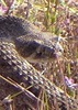
The rain picked up on the way down, and eventually I put on my rain jacket, more for some warmth as the wind picked up. My camera lens got smudged from the rain and there was no drying it, so after the peak, not many pictures. Not that much was visible anyway.

Obviously had the trail to myself the entire time. Finished just before noon, ate lunch again at the Montezuma Trailhead, then headed back to the hotel for some rest and a hot shower.
 Meteorology
 Meteorology [ checklist ]
[ checklist ]  Crepuscular rays
_____________________
 
May 27 2018
avatar

 Routes 596
 Photos 9,604
 Triplogs 2,400

58 male
 Joined Jan 30 2011
 Chandler, AZ
Carr Miller Pat Scott Peak Loop, AZ 
Carr Miller Pat Scott Peak Loop, AZ
 
Hiking avatar May 27 2018
JuanJaimeiiiTriplogs 2,400
Hiking18.57 Miles 5,460 AEG
Hiking18.57 Miles   7 Hrs   27 Mns   2.53 mph
5,460 ft AEG      6 Mns Break
 
This one was the good Doctors idea. I took off on Saturday and drove down through Nogalas, then ate dinner in Cananea and then up to Sierra Vista. Nick met me that morning at the hotel and we car pooled together up to the Old Sawmill Trailhead. We pretty much had perfect weather all day and this is always a great place to hike. First up was Carr Peak, then over to Miller and from there we headed over to Pat Scott. Nick said there was some controversy as to which peak was the true Pat Scott so we hit them both. As it would turn out there was a
"Sky Island Summit Challenge" there yesterday. Looks like we missed the crowds and had our own Summit Challenge. The hike down Pat Scott Canyon is always great and today was no exception.

Huge thanks to Nick for calling this one out. Was a great day to be in the Huachucas! :y:
 Flora
 Flora [ checklist ]
[ checklist ]  Yellow Columbine
wildflower observationwildflower observationwildflower observationwildflower observationwildflower observation
Wildflowers Observation Light

water 1 out of 5water 2 out of 5water less than maxwater less than max Bathtub (Tub) Spring Quart per minute Quart per minute

dry Comfort Spring Dry Dry

water 1 out of 5water 2 out of 5water less than maxwater less than max Old Sawmill Spring Quart per minute Quart per minute

water 1 out of 5water 2 out of 5water less than maxwater less than max Pat Scott Canyon Light flow Light flow
_____________________
 
May 27 2018
avatar

 Guides 93
 Routes 397
 Photos 4,984
 Triplogs 4,124

49 male
 Joined Jun 20 2003
 Tucson, AZ
Carr Miller Pat Scott Peak Loop, AZ 
Carr Miller Pat Scott Peak Loop, AZ
 
Hiking avatar May 27 2018
fricknaleyTriplogs 4,124
Hiking18.57 Miles 5,460 AEG
Hiking18.57 Miles   7 Hrs   27 Mns   2.53 mph
5,460 ft AEG      6 Mns Break10 LBS Pack
 no routes
1st trip
the huachucas have been calling my name and i wanted to get down there before any potential forest closures. i figured there was a good chance of luring the Good Count Tacula down south too!

picture perfect day in every way. we banged out a big high country ramble. the carr/miller combo is always amongst my favorite sky island experiences. we solved the pat scott peak issue by just doing them both :lol: . the trip down pat scott canyon was an unexpected wonderland of shade, big trees and even some water and flowers.

perfect day up there. thanks for coming down JJ :y:
wildflower observationwildflower observationwildflower observationwildflower observationwildflower observation
Wildflowers Observation Light
_____________________
hi
  1 archive
May 26 2018
avatar

 Guides 99
 Routes 1,484
 Photos 16,072
 Triplogs 1,374

male
 Joined Jan 07 2017
 Fountain Hills,
Sky Islands Summit Challenge, AZ 
Sky Islands Summit Challenge, AZ
 
Hiking avatar May 26 2018
DixieFlyerTriplogs 1,374
Hiking19.60 Miles 5,800 AEG
Hiking19.60 Miles   9 Hrs   23 Mns   2.50 mph
5,800 ft AEG   1 Hour   33 Mns Break
 
no photosets
1st trip
This was a hiking event organized by the City of Sierra Vista. Participants in this event had 3 options: hike to Carr Peak only; hike to Miller Peak and Carr Peak; or hike to Pat Scott Peak, Carr Peak, and Miller Peak. Miller Peak(9,466'), Carr Peak(9,220'), and Pat Scott Peak(8,700') are the 1st, 2nd, and 4th highest peaks, respectively, in the Huachuca Mountains. I naturally opted to hike to all 3 peaks.

This was a neat event, and at 19.6 miles and an AEG of 5,800', the hike was a buttkicker, at least for me. The hike started at the Ramsey Canyon Conservancy; went up the Hamburg Trail; then to the Pat Scott Canyon Trail; then off-trail to the summit of Pat Scott Peak; then on the Crest Trail to the Carr Peak trail to the Carr Peak spur trail which went to the summit of Carr Peak; then back to the Crest Trail to Bathtub Spring, and the route continued on the Crest Trail to the Miller Peak spur trail which went to the summit of Miller Peak; then back to Bathtub Spring, from which we went down the Miller Canyon Trail to the Miller Canyon TH, which completed the hike.

There were nice 360 degree views from the top of each of the 3 peaks.
_____________________
Civilization is a nice place to visit but I wouldn't want to live there
  1 archive
average hiking speed 2.14 mph
1, 2, 3, 4  Next

WARNING! Hiking and outdoor related sports can be dangerous. Be responsible and prepare for the trip. Study the area you are entering and plan accordingly. Dress for the current and unexpected weather changes. Take plenty of water. Never go alone. Make an itinerary with your plan(s), route(s), destination(s) and expected return time. Give your itinerary to trusted family and/or friends.

helpcommentissue

end of page marker