| | -
-
-
-
-
-
| 1 label |  |
|
2 |
-
-
-
-
-
-
-
-
|
| | |
|
| Hiking | 7.40 Miles |
1,216 AEG |
| | Hiking | 7.40 Miles | 5 Hrs 9 Mns | | 1.83 mph |
| 1,216 ft AEG | 1 Hour 6 Mns Break | | | |
|
|
| |
| Linked |
|
none
[ show ]
| no linked trail guides |
| Partners |
|
none
[ show ]
| no partners | | These mornings that start out cool and fresh just beg to be hiked, so I drove out Peralta Road to the Trailhead and headed out on the Dutchman Trail. I was hoping that I would get to the trailhead before the sun rose but even at 6:00am I was a bit late. As I was ascending the Dutchman Trail, I paused to looked back just in time to see the sun light up the Dacite Cliffs above the Don's Camp, and I could hear the distant howl of a lone Coyote as it welcomed the new day.
I crossed the ridge and headed down into Barkley Basin as the sun gradually rose above Coffee Flat Mountain and the desert slowly came to life again. My destination this day was the rock formation just past Miners Needle known as Castle Rock (sometimes called Cathedral Rock) and do a little "off trail" hiking in the area. Along the way, I was passed by a trail-running gal who was new to the area and was just doing a five mile out-and-back, hope she made it cause she wasn't carrying much water and I didn't see her at the Coffee Flat Trail cutoff.
There are no trails leading up to Castle Rock so I left Coffee Flat Trail and began busting brush up the steep, rock strewn slopes until I got to the main body of rocks and Hoodoos. I found a narrow canyon leading up a steep, slickrock approach into the bowels of the Castle. If this rock formation is called the "Castle" then this must be the "Staircase". This approach is dangerous steep with lots of loose rock peeling off the host walls, Saguaro, Ocotillo and Palo Verde growing in the middle and only a few hand or footholds. Slowly and cautiously I followed the Staircase up, finally reaching a saddle with a near vertical drop on the other side.... a virtual "Dead End". The trip back down, was even more treacherous since I didn't want to play "bear hug" with that Saguaro.
I was glad and relieved to finally make it back down to some footing that was more navigable and any questions I once had concerning the Castle Rock formation had been satisfactorily answered. No, I don't intend to return to Castle Rock, it's an interesting and photogenic piece of pre-historic volcanic reminant and should be viewed from from a safe distance. The morning was quickly warming up and, by the time I got back to the trailhead, I was glad that I had gotten an early start, but now I'm going home to take a rest, put some dressing on my cuts and have a cold refreshing brew.
. |
|
Wildflowers Observation Light
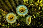
Not many wildflowers growing now, but the Saguaro more than make up for it. |
|
| _____________________
| On every trip into the Superstitions, I find another Gold Mine. Today the mine was filled with Memories. I can not wait for the next trip. |
| | |
|
|
|
|
|
| |
