username
X
password
register
for free!
help
ArticlesGuidesRoutes
 
Photosets
 
 Comments
triplogs   photosets   labels comments more
Reavis Ranch via 109 North - 75 members in 208 triplogs have rated this an average 3.9 ( 1 to 5 best )
1, 2, 3, 4, 5 ... 11  Next
208 triplogs
login for filter options
May 24 2025
avatar

 Routes 39
 Photos 64
 Triplogs 42

58 male
 Joined Mar 29 2015
 Chandler, AZ
Reavis Falls trail hike, AZ 
Reavis Falls trail hike, AZ
 
Hiking avatar May 24 2025
AndrewrdcTriplogs 42
Hiking8.16 Miles 1,503 AEG
Hiking8.16 Miles   3 Hrs   31 Mns   2.62 mph
1,503 ft AEG      24 Mns Break
 
no photosets
1st trip
Partners none no partners
Route Scout Route Recorded  on Route Scout | Pop | Map | Popup | MapDEX
Now that Apache Trail is finally reopened, have been anxious to investigate the Reavis falls trail in anticipation of a future backpacking trip all the way to the falls. The drive itself to the trailhead is half the fun… I wouldn’t say you need a lifted 4x4 to make the journey but I wouldn’t do this in a regular car. I did opt to put my jeep in 4wd for the drive up Reavis trailhead rd (212) to be safe.

This is a nice trail, well marked though seemingly lightly traveled. At a little passed the three mile mark, you will see a cairn indicating the turn of a the left for the Reavis falls trail. I took this up to the saddle for an amazing view and found a nice spot for a water and snack break. This is the point where you would have to commit to heading down into the basin… not part of my plan for the day so this became my turnaround point.

Great day out and a fun adventure. Definitely be very prepared as you are not likely to see very many other people out here (I did not see a single other soul) and best to come with friends!

Enjoy!

A
_____________________
 
Mar 29 2025
avatar

 Guides 94
 Routes 840
 Photos 22,055
 Triplogs 1,993

52 male
 Joined Sep 18 2002
 Tempe, AZ
Reavis Ranch via 109 NorthGlobe, AZ
Globe, AZ
Backpack avatar Mar 29 2025
chumleyTriplogs 1,993
Backpack28.79 Miles 4,457 AEG
Backpack28.79 Miles2 Days         
4,457 ft AEG
 no routes
Partners partners
patrickakabird
Apparently it had been over 12 years since I hiked to the ranch from the north :o The views over the first 4 miles are really quite spectacular, though largely the same over the entire stretch. And while it's definitely worth doing, I certainly refreshed my memory of why all my subsequent trips were from the south. Nonetheless, it was nice to set foot on this stretch of trail once again.

Only 2 cars in the lot to start. A couple on the exit warned of us a rabid fox that had been aggressive with some others at the ranch. Neither we, nor anybody else we chatted with had seen it. Hopefully it has since expired.

Fire damage was mostly as expected. It's been long enough that there's a good amount of scrubby growth, but no signs of anything new in a pine family. After a devastatingly dry winter, a few inches of rain has fallen in the past few weeks and sparked just a slight tinge of green across the otherwise barren hillsides.

The ranch wasn't busy, but there were five groups camped over the length of the valley, and we saw half a dozen others hiking by on the trail over the course of the weekend. I was set on an afternoon hike up to Mound Mountain, a summit of which I had not previously been. I did not expect Ryan or Patrick to join me, but Ryan's fomo prevented the better decision and he got to add an unplanned 8 miles and 2kft to his day :)

Fireline is a bit of a mess especially east of Whiskey Spring where post-fire flood erosion has really impacted the drainage that the trail follows. Circlestone is circlestone — simultaneously impressive and odd. I was under the impression that the previous manzanita hell route to Mound had been cleared by the Woodbury Fire almost 6 years ago. That is not the case. There's a way through though and it leads to a nice grove of unburned ponderosa on the west slopes. Near the top of the peak there's some thick growth of scrub oak interspersed with locust and other desert crap. Blood was shed.

The Mound summit was unexpectedly great. It's an absolute different planet from Circlestone. We had been fighting the forecasted 30mph winds all day and while they could be tolerated, the subsequent dust in the air definitely impacted the visibility today. And it was still fantastic. I'm very happy to have made the effort to do this one. We enjoyed a summit beverage and headed back down to camp ahead of sunset, thankful to find that Patrick had started the fire already.

The forecast called for a low of 48, and knowing that the Reavis valley is a cold sink I was expecting maybe mid 30s. It stayed warm until after 9 when the wind finally died down. By morning it was 28. :sweat: It's not too often that the forecast is off by 20 degrees. Powers Garden is another spot with similar conditions!

After a lazy morning, the hike out was uneventful. We stopped by in search of Owen's spring, but found absolutely nothing. 109 North seems to climb for 7 miles regardless of which direction you are going and yesterday's Mound Mtn add-on was taking a slight toll early on the exit. As the sun warmed we were happy to have another day of strong, cool wind, though once again, it kicked up a lot of dust and obscured views.

The Sunday drive on the 88 was fine until Tortilla Flat at which point it turned into exactly what we figured it would. It was my first time on FCH since they cleared the rockfall and repaired the erosion. At least the initial rush that happened after it opened has seemed to wane.

It was nice to get out and spend a night in the wilderness. :y:
 Culture
 Culture [ checklist ]
[ checklist ]  Benchmark  Ghost?
wildflower observationwildflower observationwildflower observationwildflower observationwildflower observation
Wildflowers Observation Isolated
Three. So approximately 1 flower per 10 miles hiked.

dry Owen's Spring Dry Dry
Not even the slightest sign of moistitude or dampiditity.

water 1 out of 5water 2 out of 5water less than maxwater less than max Reavis Creek at Fireline #118 Light flow Light flow

water 1 out of 5water 2 out of 5water less than maxwater less than max Reavis Creek at Gap Trail #117 Light flow Light flow
_____________________
I'm not sure what my spirit animal is, but I'm confident it has rabies.
 
Feb 22 2025
avatar

 Routes 31
 Photos 4,724
 Triplogs 187

50 male
 Joined Mar 14 2016
 Gold Canyon, AZ
Reavis Frog Tanks Loop, AZ 
Reavis Frog Tanks Loop, AZ
 
Hiking avatar Feb 22 2025
00blackoutTriplogs 187
Hiking21.32 Miles 3,867 AEG
Hiking21.32 Miles   11 Hrs   40 Mns   1.83 mph
3,867 ft AEG
 no routes
1st trip
Partners partners
adilling
ScottHika
wally
I put together a loop to complete the last section of trail that I needed to do to complete every official trail in the Superstition Wilderness and Wally, Scott, and Andy were happy to go through the torture with me. :lol: We arrived at Rogers Trough a little before 7 when I realized I had forgotten my shoes at home. ](*,) Knowing that it was a 90-minute drive back to my house, I thought the day was over before it started. Andy had a pair of Hoka sandals that were two sizes too small but I tried them on anyway. They were extremely tight but I decided to give them a shot and we headed off.

Reavis Ranch Trail
The section to Reavis is in great shape as expected since it is part of the AZT. The climb to Reavis Saddle did not feel too bad, however, once I got to the saddle my feet were cramping pretty badly from how small the sandals were, and truly thought about turning back at this point. Scott had an idea of 'fixing' them by cutting some of the side straps which seemed to work because as we stopped at the ranch for lunch, they were pretty sore but the cramping had subsided. Came across two backpackers at the mother tree heading back to RT and a huge group camping at the ranch. The section past Reavis Gap was a bit brushy but nothing horrible.

Frog Tanks
The upper section was the piece I needed to finish. The trail to Plow Saddle Spring was faint at times but a couple of carins and a set of new footprints kept us on track. We stopped at Plow Saddle Spring box where Wally and I filtered some water from the wash area as there was water in the spring box but it had a film on top and we didn't want to take the time to clean it up. The hike down to Paradise Canyon was long and it started getting hot. Just past the stone corral the catclaw started getting thick and just before Cimeron Spring it was a blood bath. The climb up to the ridge bypass was hot and full of Prickly Pear that I seemed to hit every single one of them. We made it down from the bypass into the cover of Rogers Canyon and took a break in the shade. From here it's a route-finding experience as the trail is there in some parts, however, overgrown, and walking through the creek from time to time was much easier. We finally made it to Angel Basin where we rehydrated and had a snack.

Rogers Canyon
Great trail nearly the entire way as it moves from the east and west benches. The climb out to RT dragged as we were all pretty tired, but not having the sun up made a huge difference. Grab my headlamp for the last half mile or so where Wally and Scott had been waiting for a few with Andy getting back shortly after.

Long day as you definitely needed your big boy pants (or shorts) for this loop. With completing the upper section of Frog Tanks, I have completed every official trail in the Supes, something I have been working towards for the past 7 years. My feet completely hate me and probably will for awhile. Thanks to Andy, Scott and the Supes encyclopedia Wally for joining me.

water 1 out of 5water 2 out of 5water 3 out of 5water 4 out of 5 Plow Saddle Springs Gallon + per minute Gallon + per minute
Spring Box and wash area have nice water.

water 1 out of 5water 2 out of 5water 3 out of 5water 4 out of 5 Reavis Creek at Fireline #118 Heavy flow Heavy flow
_____________________
Hiking is just walking where it’s okay to pee. :y:
  2 archives
Feb 22 2025
avatar

 Routes 93
 Photos 7,758
 Triplogs 1,691

64 male
 Joined Mar 11 2003
 AZ
Reavis Frog Tanks Loop, AZ 
Reavis Frog Tanks Loop, AZ
 
Hiking avatar Feb 22 2025
wallyfrackTriplogs 1,691
Hiking21.32 Miles 3,867 AEG
Hiking21.32 Miles   11 Hrs   40 Mns   1.83 mph
3,867 ft AEG
 no routes
1st trip
Partners partners
00blackout
adilling
ScottHika
wally
After a healthy Supes loop last week, why not go for another. Jason needed to hike what's left of the Frog Tanks trail so Scott, Andy and I agreed to join him. The weather had warmed up 9 degrees from the prior week so we knew midday would be a little toasty.

We debated on which way to hike but ended up going counterclockwise attacking the climb up to Reavis Saddle before the sunshine hit. The stroll into Reavis Ranch was nice and we took a break while the 20+ campers milling around in the pasture below. So far so good.

The hike from Reavis Ranch to Frog Tanks started to warm up but not too bad. We decided to filter some extra water at Plow Saddle Spring. The other side canyon had clean water flowing down so I initially went up there. Although full of water, the spring box had leaves blocking it leaving a nasty film on top. We filtered from a nicer pool above. In hindsight the water in the other canyon would probably have been better.

The hike down Frog Tanks in full sun was warm but we were going downhill so we made the best of it. The lower part of Frog tanks before Fish Creek/Rogers Canyon was nasty. You could find sections of trail but lots of catclaw, overgrowth and several down trees to make it an obstacle course.

Once we entered Roger Canyon the sunshine was blocked. It was much cooler and the water consumption returned to normal. The trail is hit or miss and staying in the creek was often the better option though we did hit many trail sections on the way to Angel Basin.

The trail back from Angel Basin has some catclaw in the lower half mile but after that it's easy to follow and is well used. The temperature kept slowly dropping and we slowed our pace from being worn down but the cool temps saved the day. We could have stopped at nectar spring to filter more water before the final mile out but made due.

It was good hiking with Jason, Scott and Andy again. Maybe next time we can hike something fun. :lol:
_____________________
  1 archive
Mar 12 2024
avatar

 Guides 44
 Routes 162
 Photos 24,766
 Triplogs 2,411

75 male
 Joined May 04 2004
 Mesa, AZ
Reavis Ranch via 109 NorthGlobe, AZ
Globe, AZ
Hiking avatar Mar 12 2024
CannondaleKidTriplogs 2,411
Hiking8.25 Miles 1,288 AEG
Hiking8.25 Miles   3 Hrs   38 Mns   2.44 mph
1,288 ft AEG      15 Mns Break15 LBS Pack
 no routes
1st trip
Linked   none no linked trail guides
Partners partners
trixiec
Tracey has been wanting to finish off her last unfinished bit of AZT #19 for quite some time now just happened to be the time.
Her plan was to hike from the Reavis North TH on Reavis Trail #109 to Pine Creek, camping overnight near Walnut Spring and exiting at the Two Bar Trailhead.
For my end of the deal, I would drive her to the TH, do an out-and-back hike while she continues on, then drive around to the Two Bar trailhead where I would car camp overnight. For the second day I planned on hiking out on AZT #19, up to the summit of Pinyon Mountain (which I had last summited in September of 2014), drop back down to AZT #19, and continue on until meeting up with Tracey before returning to the Two Bar TH.

The FIRST part of Day One went according to plan:
* Drive up AZ #87, AZ #188 to Roosevelt, AZ #88 down to FR #212 and finally up to Reavis trailhead:
Although AZ #88 is still unpaved, due to the ongoing pre-paving road-work it practically as smooth as a paved highway all the way to the FR #212 turn-off. (We had to wait at one spot for 12 minutes while workers unloaded a cement truck manually with shovels!) And FR #212 was no different, making it practical for even a low-clearance car to drive to the trailhead.
Video of the drive to Reavis North TH on FR #212 from AZ #88

* Hike out-and-back on Reavis Ranch Trail #109:
This was the easy part. Weather was perfect, a sunny day in the upper 50's to start. I hiked out 4+ miles with Tracey, stopped for a quick lunch and soloed back to the trailhead.

* Drive FR #212 down to AZ #88, AZ #88 up to Roosevelt:
Being later in the day the return trip on AZ #88 was a bit more dangerous due to significantly more traffic of all kinds. More cement trucks, plus graders and scrapers using both sides of the road, but the worst was the civilian traffic, a number of which were from out-of-state and seemingly freaking out by the single-lane parts (none of which sported guardrails) as they were completely on my side of the road coming around blind corners.

* Drive on AZ #188 to FR #83, following it all the way up to the Two bar Trailhead:
Although I had driven all the way to the Two Bar TH in 2014, I didn't remember it at all so it must have been an easy drive... but then again, I drove a well-modified Cherokee back then.
Anyway, MOST of the drive with the TRD Off-Road 4Runner was simply being careful to avoid sharp rocks and a few eroded spots, but the last mile I would only average 3 mph due to layers of uneven loose rock... driving in 4-Low, center and rear lockers engaged with Crawl Control enabled it just took time... and adrenaline, as up to that point I had never engaged all the electronic aids so all the noises it made engaging and disengaging individual wheel braking were a bit disconcerting. But no worries, other than picking up the 4Runner's first AZ pinstripes. A fine baptism it was!

So far Day One was going according to plan... but the day isn't over yet:
Although the drive after my out-and-back hike seemed to have taken an excessive amount of time, it was just after 2 pm when I reached the Two Bar TH.
So now what will I do to eat up the rest of the day?
I had a book to read on my tablet but I was reserving that for once it got dark.

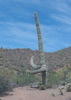
Ok, so Pinyon Mountain is right there in front of me, and rather than wait until morning for my up-and-over-and-back onto AZT #19, vividly remembering the rough next bit of the AZT #19 from our failed back-pack attempt in 2014, I figured I'd leave that all for tomorrow and just knock out Pinyon... after all, it's just a quick up-and-down, maybe a mile-and-a-half round-trip? Let's git-er-done!
(But not so fast... that will be in the Pinyon Mountain triplog)
_____________________
CannondaleKid
  2 archives
Mar 12 2024
avatar

 Routes 1
 Photos 264
 Triplogs 22

69 female
 Joined Jun 12 2010
 mesa,az
Reavis Ranch via 109 NorthGlobe, AZ
Globe, AZ
Backpack avatar Mar 12 2024
trixiecTriplogs 22
Backpack9.30 Miles 2,824 AEG
Backpack9.30 Miles   5 Hrs      1.86 mph
2,824 ft AEG17 LBS Pack
 no routes
1st trip
Linked   linked  
Partners partners
CannondaleKid
It's that time of year again, dodging the rain and snow storms, trying to finish off a small section of AZT 19. Wanted to start at Reavis TH to get to the AZT as I hadn't been to the ranch on this trail in over 40 years. I was white knuckling it in the passenger seat along Apache Trail... mountain curves, no guardrails, and cement trucks, but with Mark as my driver, I knew we'd make it safely.

Hit the trail running at 8:45, Mark turned around about 4 miles into the trip, headed back to pursue other interests. I continued on to Plow Saddle, it was breezy and once off the saddle the wind died down. Took a lunch break just before hitting the Frog Tank intersection, then on to the intersection of the AZT.

I never ran into anyone else on the trail, saw only bear and cat scat and rusted tools left in a pile on the side of the trail. My plan was to camp at Pine Creek but I arrived there at 2:45 and couldn't imagine what I'd do til the sun went down so filtered 5 liters of water (plenty of water there right now) and headed out towards Walnut Spring. Thru hikers commenting on the AZT app mentioned "epic campsites/campground" there. A small trail headed up onto a hill, and yes they were epic sites. However, it didn't take me long to realize it was a hill-top ruins. About 8 rooms, pottery shards and a broken grinding stone. I found another area close by that was a good camp spot, set up camp, fired up my pocket rocket, had some mushroom risotto for dinner and crawled into my tent to settle in for the night.

As the sun set, the clouds cleared and stars appeared, the birds and owls were finally silent. I never heard a sound all night. Ahh...the world before we were in it.

To be continued...if not eaten by a mountain lion..
_____________________
 
Mar 09 2024
avatar

 Routes 31
 Photos 4,724
 Triplogs 187

50 male
 Joined Mar 14 2016
 Gold Canyon, AZ
Reavis Ranch via 109 NorthGlobe, AZ
Globe, AZ
Hiking avatar Mar 09 2024
00blackoutTriplogs 187
Hiking17.26 Miles 2,487 AEG
Hiking17.26 Miles   8 Hrs   14 Mns   2.10 mph
2,487 ft AEG
 no routes
Linked   none no linked trail guides
Partners none no partners
Wanted to try and knock off another section in the Superstitions that I had not done yet so got up early Saturday morning and drove the long route over to the Reavis TH. I've hiked up to the Plow Saddle junction previously, but my goal today was to get to the ranch. Light sprinkles at the TH and one van in the parking lot with a group of 10 backpacking as I started up the Reavis Ranch trail. The trail is good a majority of the way; it gets a little thin near Castle Dome as a good amount of rocks have fallen down from the top and has some washouts, but you never really lose it. Once I got near Castle Dome the wind really picked up and I was freezing cold as I was wearing shorts as always and did not count on the wind. Continued on past Castle Dome, over Windy Pass, past Plow Saddle and made it to the Reavis/Frog Tanks Trail Junction. As I stopped for a quick break there my calves started cramping pretty bad, so I made the decision to turn around at this point. Hydrated up and started the hike back out. Back at Plow Saddle I came across the 10 backpackers from Ohio who decided to just stop and rest right in the middle of the trail. ](*,) Calves were a little sore and still cramping a bit but overall an uneventfull hike back to the truck. Scared up a group of White tail deer just past Plow Saddle and saw no one else besides the backpackers, which is perfect. Just a little short of my goal of making it to the Ranch from the north, Perfect way to spend a Saturday.
 Meteorology
 Meteorology [ checklist ]
[ checklist ]  Double Rainbow
wildflower observationwildflower observationwildflower observationwildflower observationwildflower observation
Wildflowers Observation Light
_____________________
Hiking is just walking where it’s okay to pee. :y:
 
Dec 02 2023
avatar

 Guides 59
 Routes 1,100
 Photos 1,191
 Triplogs 1,290

male
 Joined Jan 01 2023
 Arizona
Reavis Falls HikeGlobe, AZ
Globe, AZ
Hiking avatar Dec 02 2023
pseudalpineTriplogs 1,290
Hiking20.75 Miles 4,341 AEG
Hiking20.75 Miles   10 Hrs   10 Mns   2.24 mph
4,341 ft AEG      55 Mns Break
 
1st trip
Route Scout Route Recorded  on Route Scout | Pop | Map | Popup | MapDEX
Including the adorable Lime Mountain. :) I wasn't sure, but it was a relief that Reavis Canyon went without a rope and only a few minor bypass climbs (but I'm a climber, not a canyoneerer, major difference). Super bushwackiness in a few sections and the Green Room at ~8.62 miles in was awesome! Diverse slot and way better than Rough and Trap Canyons. Thickets of berry bushes nearing the ranch. I'd bet the bears like those in the summer. Hauled out some trash from the northern ranch camp. Less hikers than hunters with two that had each bagged a deer. Type II fun.
foliage observationfoliage observationfoliage observationfoliage observationfoliage observation
Autumn Foliage Observation Moderate

water 1 out of 5water 2 out of 5water 3 out of 5water less than max Reavis Creek Medium flow Medium flow

water 1 out of 5water 2 out of 5water less than maxwater less than max Reavis Falls Light flow Light flow
  13 archives
Nov 24 2023
avatar

 Routes 386
 Photos 49
 Triplogs 792

43 female
 Joined Jun 23 2015
 Phoenix, AZ
Reavis Ranch via 109 NorthGlobe, AZ
Globe, AZ
Hiking avatar Nov 24 2023
emilystardustTriplogs 792
Hiking19.74 Miles 2,647 AEG
Hiking19.74 Miles   8 Hrs   33 Mns   2.46 mph
2,647 ft AEG      31 Mns Break
 
no photosets
1st trip
Linked   linked  
Partners none no partners
Route Scout Route Recorded  on Route Scout | Pop | Map | Popup | MapDEX
Quick Reavis backpack from the north, which I haven’t done before. Nearly perfect weather, so many apples still and a light creek flow.
_____________________
  1 archive
Mar 11 2023
avatar

 Routes 93
 Photos 7,758
 Triplogs 1,691

64 male
 Joined Mar 11 2003
 AZ
Reavis Ranch via 109 NorthGlobe, AZ
Globe, AZ
Hiking avatar Mar 11 2023
wallyfrackTriplogs 1,691
Hiking13.50 Miles 2,301 AEG
Hiking13.50 Miles   4 Hrs   40 Mns   2.89 mph
2,301 ft AEG
 no routes
Linked   none no linked trail guides
Partners none no partners
I had a cold, so I had to skip the Stiller & Diller hike last week. There was still some remaining congestion this weekend but nothing a good hike wouldn't clear up. Not feeling energetic, I got a later start just after 9:00am. The road up from the dam is getting some work. Lots of equipment along the way but no workers on Saturday. The trailhead only had a few cars but there was family camped and cooking breakfast at the trailhead. They later packed up and hiked in. I saw two gals just beyond the falls who missed the turn and were hiking back but pretty much had the trail to myself on the way in. The wild flowers were scant on the trail but plentiful on the drive in. There was one tree across the trail which was passable. A few guys could probably roll in off the trail. The rocks that rolled off Castle Dome on to the trail weren't as bad I remembered. I saw a roadrunner and a rabbit but no snakes. There is an abandoned campsite between Windy Saddle & Plow Saddle. I picked up the sleeping bags to make sure there wasn't a body. It looks to be a few years old. The hike ended at Plow Saddle. Apparently not fully recovered from the cold, it was time to turn back to avoid running out of steam. I saw 12 backpackers hiking in on my way out. Party at Reavis Ranch I guess. The clouds and the breeze keep the temp down an I drank just under 2 quarts on the trail. SR 88 was a little busy on the drive out. I think my next venture in will be from the Reavis Gap trail.
_____________________
  4 archives
Nov 11 2022
avatar

 Routes 31
 Photos 4,724
 Triplogs 187

50 male
 Joined Mar 14 2016
 Gold Canyon, AZ
Reavis Ranch via 109 NorthGlobe, AZ
Globe, AZ
Hiking avatar Nov 11 2022
00blackoutTriplogs 187
Hiking15.00 Miles 2,088 AEG
Hiking15.00 Miles
2,088 ft AEG   7 Hrs   6 Mns Break
 no routes
Linked   none no linked trail guides
Partners none no partners
Got home from Vegas Thursday night and after being in that 'small' city for a few days, I needed a nature break. I've been wanting to build up my endurance to do a longer hike and yesterday gave me the chance to do that. Headed out to the newly vehicle accessible Reavis TH and started up the Reavis Ranch Trail. This trail starting from the north end heads up and up and up, it felt like the uphill portion would never end. Once I got up to 4,000 foot elevation the grass came on in full force. As I got to the base of Castle Dome the wind really picked up and the trail became extremely rocky from the rocks falling off the side of the mountain. The trail was a little hit or miss here but I never really lost it. Made it up to the top of the ridge and down into Windy Pass which is a grass land and down over to the Plow Saddle Junction. At the junction I came across a group of 4 guys who hiked down to Reavis Falls and were setting up camp. Took a quick break and talked with them for a few and headed back to my rig for the uneventful hike back.I hadn't done a 15 miler in awhile and it felt good to stretch my legs for a longer one, although my feet did not agree with me. :lol: Temps were in the 50's all day, although a bit windy on top it was a perfect day to hike in the Superstitions.

Side Note: 88 is now open to the IV Ranch and apparently the ranch owner is not a fan of people driving it in front of his ranch, ask me how I know. lol
foliage observationfoliage observationfoliage observationfoliage observationfoliage observation
Autumn Foliage Observation Isolated
wildflower observationwildflower observationwildflower observationwildflower observationwildflower observation
Wildflowers Observation Isolated

water 1 out of 5water 2 out of 5water less than maxwater less than max Plow Saddle Springs Quart per minute Quart per minute
_____________________
Hiking is just walking where it’s okay to pee. :y:
  2 archives
Feb 21 2021
avatar

 Guides 38
 Routes 182
 Photos 1,602
 Triplogs 232

40 male
 Joined Dec 09 2014
 Gilbert, AZ
Reavis - Frog Tanks - Rogers Loop, AZ 
Reavis - Frog Tanks - Rogers Loop, AZ
 
Hiking avatar Feb 21 2021
jacobemerickTriplogs 232
Hiking33.93 Miles 5,540 AEG
Hiking33.93 Miles   14 Hrs   8 Mns   2.70 mph
5,540 ft AEG   1 Hour   34 Mns Break
 
1st trip
Route Scout Route Recorded  on Route Scout | Pop | Map | Popup | MapDEX
Drove through 2 open gates along AZ-88 (from the Roosevelt side) until I bumped into the block at Apache Lake. There is a small open gate on it, far too narrow for a vehicle, with a sign allowing hiking/biking/horse/atv traffic. Looks fairly permanent.

After parking at the Apache Lake Vista around 5am, swung into the first wash past the blocked AZ-88 and followed Joes (or Wallys?) route cross country. I left the wash too early and was forced to a nearby ridge, which was no fun to navigate in the dark. Took around 40m and definitely warmed me up in the chill morning air. I think I'd rather start earlier and stick to the road on the way up if I do another pre-dawn hike out here. Trailhead was missing the register and a few signs :cry:

Reavis Ranch #109
Fantastic trail to walk in the dark. Some washouts along the way, all easy to hop over. The day gradually waking up over the hills was heckin' beautiful. Castle Dome ridge section had some more serious washouts and overgrowth, nothing a little TLC can't fix. Fire damage got real near Windy Saddle.

Plow Saddle #287
Lack of signed junction and cairns, coupled with fire-damaged tread, made this tough to find, but once it drops off the saddle it is very easy to follow. More fire damage, a few deadfall to work around, and the loosey steepness was annoying. It was sad to see the scorched cottonwoods in that drainage, not sure if any survived.

Frog Tanks #112
Started with a lot of catclaw, which is more bearable past the 4937' ridge. That drop into Fish Creek is just dreamy, huge views. Explored a little by the stone corral before attempting to continue on the trail, which was super tough. Lots of fire damage, lots of catclaw. After fifteen minutes of cursing, bleeding, and crying, I dropped into the creek and stuck to boulder-hopping, which, combined with the trickling water, was incredibly enjoyable. Slow going, but enjoyable. A mile in and the green canopy came back to the canyon and I was in heaven.

Rogers Canyon #110
Looked a bit for the trail and then just kept in the creek. I was initially disappointed by the lack of trickling water, though the huge boulders and surrounding geology made up for the (mostly) dry creekbed. Started to feel a little toasty by the time I reached Angel Basin, and even though I got to meet @Andrewrdc (hi!) I didn't linger long at the ruins, more interested in powering through than looking at rocks on rocks. Trail was super easy to follow upstream of the ruins, passed three groups on the way in. Fire damage showed up again for the last mile.

Reavis Ranch #109
This trail again, this time from end-to-end. Paused for a quick break and then powered up that darn climb, passing another three or four groups on their way out. Was sad to see how scorched the saddle got. Trees began to come back about a mile in, and from then on the damage was sporadic in the valley and mostly visible on the nearby hillsides. Trail was in great shape until AZT branches off (no surprise), then there were a few minor obstacles on the way back to Plow Saddle. Sun set about 20m before I hit trailhead.

Decided to stick to the wash on the way down, which was hard for five minutes and then a simple cruise. Outside of the peeps on Rogers and a few along Reavis (between the grave and valley) there was no other hikers out there. A long, quiet, and fantastic day.
 Culture
 Culture [ checklist ]
[ checklist ]  HAZ PicMimic

water 1 out of 5water 2 out of 5water less than maxwater less than max Paradise Canyon Light flow Light flow
Steady and dependable flow along the length of Frog Tanks Trail.

water 1 out of 5water less than maxwater less than maxwater less than max Plow Saddle Springs Dripping Dripping
Drainage was dripping, several deep pools to pull from.

water 1 out of 5water 2 out of 5water less than maxwater less than max Reavis Creek at Fireline #118 Light flow Light flow
Steady, happy little flow.

water 1 out of 5water 2 out of 5water less than maxwater less than max Reavis Saddle Spring Quart per minute Quart per minute
Steady flow from spring all along the length of trail.

water 1 out of 5water less than maxwater less than maxwater less than max Rogers Canyon Pools to trickle Pools to trickle
Dry at mouth. Some pools / trickles along the length.

water 1 out of 5water 2 out of 5water less than maxwater less than max Rough Canyon Light flow Light flow
Steady flow coming out of the mouth.
_____________________
 
Nov 24 2019
avatar

 Photos 9
 Triplogs 7

30 male
 Joined May 09 2018
 Phoenix, Arizona
Reavis Ranch via 109 NorthGlobe, AZ
Globe, AZ
Hiking avatar Nov 24 2019
lhalloranTriplogs 7
Hiking
Hiking
 no routesno photosets
1st trip
Linked   none no linked trail guides
Partners none no partners
88 is closed at Tortilla flat. Been closed since 9/30. No indication of when it will become open again.

Google Maps won't tell you this, don't make the same mistake I did!
 
Sep 07 2019
avatar

 Routes 93
 Photos 7,758
 Triplogs 1,691

64 male
 Joined Mar 11 2003
 AZ
Reavis Ranch via 109 NorthGlobe, AZ
Globe, AZ
Hiking avatar Sep 07 2019
wallyfrackTriplogs 1,691
Hiking20.70 Miles 3,417 AEG
Hiking20.70 Miles   7 Hrs   54 Mns   2.62 mph
3,417 ft AEG
 no routes
Linked   none no linked trail guides
Partners none no partners
Yes, I had to. I was cautiously optimistic but it's bad. There are a few spots that help you remember what was it was but it won't be back for a long time. Some small areas were missed but others completely gone. I was the only hiker out but there were a few on horseback. I started at 5:30 am and the temperature was nice. Just hiking the trail you can see how the conditions will change during when it gets a good rain. The first few miles will wash out in spots, the section before and after the falls trail will be muddy and the trail below Castle Dome will fill up with rocks coming down the now barren slope. Reavis Ranch itself is good but the surrounding hills are bare so it's not the same. I took the time to visit many of the ruin sites along the way and found 3 more now that the hills are bare. The camping spot near Plow Saddle Spring is bad. Plow Saddle Spring on the other hand was flowing. I saw 4 deer in that area some there is some life. To my surprise the clouds stay with me all day and there was a light rain for much of my hike out. There was no rain in the forecast so it may have been tears from the thundergods. This is just the first many planned hikes.

water 1 out of 5water 2 out of 5water less than maxwater less than max Plow Saddle Springs Quart per minute Quart per minute
The spring was full and flowing out. There was water pooling below the spring.
_____________________
 
May 27 2019
avatar

 Guides 33
 Routes 286
 Photos 445
 Triplogs 251

35 male
 Joined Oct 23 2017
 Tempe
Reavis Ranch via 109 NorthGlobe, AZ
Globe, AZ
Backpack avatar May 27 2019
KingLeonidasTriplogs 251
Backpack10.20 Miles 821 AEG
Backpack10.20 Miles   4 Hrs   8 Mns   2.58 mph
821 ft AEG30 LBS Pack
 
no photosets
Linked   none no linked trail guides
Partners none no partners
Route Scout Route Recorded  on Route Scout | Pop | Map | Popup | MapDEX
This was day 3 of a three day expedition to Circlestone Ruins in the Superstitions Wilderness.

Our group was a party of four; my wife and I and another couple. We planned to hike Reavis Ranch North and camp at Reavis Creek at the end of the first day. The second day we would day hike to Circlestone Ruins and return to our camp at Reavis Creek. The third day we would hike back out via Reavis Ranch North.

Our hike out was somewhat easier than the hike in. Two days on the trail had everyone acclimated to the exercise and we had consumed the majority of our provisions and fuel so our packs were lighter.

We saw a few people while breaking camp and hiking out. It seems that there is a loop hike in the area that is popular with backpackers. Most of them made their approach from Rogers Canyon or Reavis Ranch South. We might have to try that at some point in the future if we can scrounge up enough 4x4 vehicles for the whole party.

We made it back to the trailhead without difficulty and headed back to Phoenix for a celebratory dinner

A link to the hike video with maps can be found here:
[ youtube video ]
wildflower observationwildflower observationwildflower observationwildflower observationwildflower observation
Wildflowers Observation Substantial
Every variety of cactus was is full bloom, there were also some thistles and other plants in flower
_____________________
 
Nov 09 2018
avatar

 Routes 11
 Photos 2,313
 Triplogs 222

59 male
 Joined Oct 17 2010
 GILBERT
Reavis Frog Tanks Rogers Canyon Loop, AZ 
Reavis Frog Tanks Rogers Canyon Loop, AZ
 
Backpack avatar Nov 09 2018
ALMALTriplogs 222
Backpack31.80 Miles 4,940 AEG
Backpack31.80 Miles3 Days         
4,940 ft AEG
 no routes
1st trip
Started Friday morning with a full parking lot, 3 big trucks with trailers taking up most of the spaces. Followed Mr. Squishy route. Smooth sailing to Plow Saddle, only some sketchy water in the troughs. Continued on to Fish creek and a nice campsite. Saw a fox before dark, not aggressive, just nosy. Threw a couple of rocks and it thought I was throwing food I think. Quiet and not too cold night. Saturday headed down to Angel Basin and then up past the ruins and on to Reavis. Landed at the ranch by 2pm, camped at same spot as 3 weeks ago. Not too crowded, picked a few apples, one landed square on my forehead looking up, got a little bruise. Stood still for a couple of minutes and listened to apples falling at the rate of 2-4 per minute nearby. Got cold after dark. Left early and back to the lot by noon.
Nice loop! Water in Fish creek and throughout Rogers as well.
 Culture
 Culture [ checklist ]
[ checklist ]  Campsite
_____________________
You aren't late if you don't show up!
  1 archive
Nov 04 2018
avatar

 Routes 25
 Triplogs 5

38 female
 Joined Apr 09 2017
 mesa, az
Reavis Ranch via 109 NorthGlobe, AZ
Globe, AZ
Hiking avatar Nov 04 2018
kelofthewildTriplogs 5
Hiking11.27 Miles 1,988 AEG
Hiking11.27 Miles   25 Hrs   7 Mns   2.07 mph
1,988 ft AEG   19 Hrs   41 Mns Break
 no routesno photosets
Linked   none no linked trail guides
Partners none no partners
_____________________
 
Nov 04 2018
avatar

 Routes 25
 Triplogs 5

38 female
 Joined Apr 09 2017
 mesa, az
Reavis Ranch via 109 NorthGlobe, AZ
Globe, AZ
Hiking avatar Nov 04 2018
kelofthewildTriplogs 5
Hiking10.16 Miles 781 AEG
Hiking10.16 Miles   4 Hrs   3 Mns   2.65 mph
781 ft AEG      13 Mns Break
 no routesno photosets
Linked   none no linked trail guides
Partners none no partners
_____________________
 
Nov 03 2018
avatar

 Guides 264
 Routes 2,797
 Photos 14,494
 Triplogs 5,894

55 male
 Joined Nov 20 1996
 
Reavis Gap, Fireline & Campaign Creek LoopGlobe, AZ
Globe, AZ
Hiking avatar Nov 03 2018
joebartelsTriplogs 5,894
Hiking17.33 Miles 3,646 AEG
Hiking17.33 Miles   9 Hrs   19 Mns   2.07 mph
3,646 ft AEG      56 Mns Break14 LBS Pack
 
Campaign Trail #256
Springs area just past the school is a muddy tiptoe. Otherwise excellent condition compared to yesteryear. You might miss a creek crossing but nothing of concern. Very few catclaw nags.

Fireline Trail #118
Memory had this trail in better condition. Campaign to top is mild overgrown. Circlestone turnoff to Reavis Creek is fab save the one standard rutted hill. We passed a group of 3, 1 guy then a group of 7ish. All inquired about circlestone.

Reavis Ranch Trail #109
Been a while since I've passed through when it's a popular destination. Perhaps 25-60+. 5 weeks after my bumper crop report there are still enough apples in the trees for a small army. Plenty easily accessible too. Low hanging, shake a branch, limbs that have busted from weight pressure... you name it. Tasty treats galore, come get 'em!

Reavis Gap Trail #117
A little naggy catclaw, nothing bad. Per usual, steep grades east of the saddle.

FR449A
As good of condition as ever. What happened to the large stretches of deep sand?
High clearance + AWD / 4WD or a driver with a clue still required for the steep climb out.

Synopsis
Loved it! Hope to return and experience Autumn Fest at Reavis forever!
foliage observationfoliage observationfoliage observationfoliage observationfoliage observation
Autumn Foliage Observation Light
Sycamores thru Campaign are moderate. Majority of the balance is light. First I recall the Pear Trees in foliage.
wildflower observationwildflower observationwildflower observationwildflower observationwildflower observation
Wildflowers Observation Moderate
The big fields of daisies are off season. 5-8 miles was constant small yellows. Gooding's Verbena dabbled several areas. 2 isolated sprigs of Indian Paintbrush.

water 1 out of 5water less than maxwater less than maxwater less than max Pine Creek at Reavis Gap #117 Pools to trickle Pools to trickle
water report recorded in the field on our app Route Scout

water 1 out of 5water 2 out of 5water less than maxwater less than max Reavis Creek at Fireline #118 Light flow Light flow
light clear flow, easy to cross

water 1 out of 5water less than maxwater less than maxwater less than max Reavis Creek at Gap Trail #117 Pools to trickle Pools to trickle
spotty pools, no flow
_____________________
- joe
 
Oct 20 2018
avatar

 Routes 11
 Photos 2,313
 Triplogs 222

59 male
 Joined Oct 17 2010
 GILBERT
Reavis Ranch via 109 NorthGlobe, AZ
Globe, AZ
Backpack avatar Oct 20 2018
ALMALTriplogs 222
Backpack18.60 Miles 2,824 AEG
Backpack18.60 Miles
2,824 ft AEG
 no routes
1st trip
Linked   none no linked trail guides
Partners none no partners
This one has been on my radar for a long time. If there were trout here, it wouldn’t have taken me so long.
Nice place for sure. Apples + Water = Lots of people. Seemed like a packed house Saturday night. Someone saw a bear. Deer everywhere. It rained right before I packed up Sunday morning. The green apples are super good!

water 1 out of 5water 2 out of 5water less than maxwater less than max Reavis Creek at Fireline #118 Light flow Light flow
_____________________
You aren't late if you don't show up!
 
average hiking speed 2.33 mph
1, 2, 3, 4, 5 ... 11  Next

WARNING! Hiking and outdoor related sports can be dangerous. Be responsible and prepare for the trip. Study the area you are entering and plan accordingly. Dress for the current and unexpected weather changes. Take plenty of water. Never go alone. Make an itinerary with your plan(s), route(s), destination(s) and expected return time. Give your itinerary to trusted family and/or friends.

helpcommentissue

end of page marker