|
| | | |
| |
|
| Backpack | 18.00 Miles |
2,300 AEG |
| | Backpack | 18.00 Miles | 2 Days | | |
| 2,300 ft AEG | | | | |
|
|
| |
| Linked |
|
none
[ show ]
| no linked trail guides |
| Partners |
|
none
[ show ]
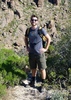
| no partners | | Car camped at Barfoot Park on night 1. Beautiful dispersed campsite next to a meadow, totally empty on a Saturday night in early October.
Lazy start Sunday morning after sleeping in and taking our time packing up, didn't get going until almost noon. Parked at the trailhead just outside the entrance gate to Rustler Park, currently it is $8 to park at the trailhead, but I displayed my Coronado National Forest recreation pass which covers the parking fee.
Hiked 42D to Long Park since it's shorter and more shaded than the first stretch of the Crest Trail. Encountered some "hunters" near Long Park shooting across East Turkey Creek Canyon toward the opposite ridge, which would be the wilderness boundary. We stopped and watched them for a minute, concerned and slightly perplexed that they would be shooting across a very large canyon. Guy claimed they spotted a deer on the opposite ridge, about 800 yards away  I don't hunt so I am not familiar with hunting best practices, although I do fully support responsible hunting for anyone who eats meat. That said, 800 yards seems a bit wild, and if they are lucky enough to hit at that distance I imagine a kill shot would be unlikely, and more likely that they would disable the animal and then probably never find it if they actually attempted to retrieve it. I don't hunt so I am not familiar with hunting best practices, although I do fully support responsible hunting for anyone who eats meat. That said, 800 yards seems a bit wild, and if they are lucky enough to hit at that distance I imagine a kill shot would be unlikely, and more likely that they would disable the animal and then probably never find it if they actually attempted to retrieve it.
Crest Trail was in good shape the entire way, as expected. Wear pants if you have sensitive skin, as the vegetation can get scratchy and slightly overgrown, but nothing that clings to you like locust or catclaw. Tons of aspen along the trail framing wonderful views to the west. Climbing out of Cima Park there were some incredible scenes of late-summer wildflower blooms intermingling with autumn-hued aspens. I've never seen a juxtaposition like that before. Thank you, record-breaking monsoon.
That evening we set up camp at Anita park under a young aspen grove. From Anita Park it's a short hike with a couple hundred foot drop to Anita Spring where there was plenty of water. That evening hiked a bit of the Monte Vista Peak trail to get some nice views to the northwest over Chiricahua National Monument and Dos Cabezas.
The next morning we hiked Chiricahua Peak for sunrise. The views are mostly non-existent, but you might as well bag it while you're there. On the hike out we checked out Cima Springs, Booger Springs, and Bear Wallow Springs. All had plenty of water.
Cima Springs: Didn't realize there was a spring box at Cima Springs until reviewing past triplogs today, but we observed a nice trickle in the canyon near the FS cabin in Cima Canyon with small pools that one could easily grab water from. Sweeping with the filter bag for a Sawyer squeeze filter could be challenging. Camping near the cabin looks great, and the Greenhouse Trail from the crest to the cabin is beautiful and in great shape.
Booger Springs: The trail to Booger Springs is overgrown from Round Park, but easy to follow. There are 2 catchments about 20 feet from each other, both had water, the farther upstream catchment has a cement cover that is difficult to remove.
Bear Wallow Springs: Cement cover over catchment has handles, so much easier to move than Booger Springs. Plenty of water, gorgeous canyon around the springs.
Bear Wallow Trail and Centella Trail were the prettiest of the weekend. Bear Wallow Springs is very lush, as is the Centella Trail approaching Fly's Park. Didn't do the side trip to Centella Point this time, although we've done it before and it is probably my favorite spot in the Chiricahua Wilderness. We got rained on pretty hard while hiking Bear Wallow and Centella Trails. Unpleasant since I forgot my rain gear (although I had my pack's rain gear), but it did saturate the vegetation which certainly made things prettier.
Wonderful trip into one of my favorite areas of the state. With the endless trails and reliable water sources, Chiricahuas are kind of a hidden backpackers paradise. |
|
Autumn Foliage Observation Isolated
|
|
|
Wildflowers Observation Moderate
|
|
  |
Anita Spring |
Quart per minute |
Quart per minute |
| | | Plenty of clear water in the catchment. Slightly overflowing. |
|
Bear Wallow Spring |
Quart per minute |
Quart per minute |
| | | Plenty of water in catchment. Cement cover easy to remove with handles. Trickle in creekbed below catchment. |
|
Booger Spring |
Quart per minute |
Quart per minute |
| | | 2 cement catchments. About 6 inches of water in larger, uncovered catchment. Plenty of water in covered catchment, although cement cover could be very difficult to remove for some. |
|
Cima Spring |
Quart per minute |
Quart per minute |
| | | Did not check spring box near cabin, as I didn't realize there was one, and it's not immediately apparent while walking the area. But, the creekbed near the spring had a nice trickle with plenty of pools. If you use a Sawyer squeeze filter, bring something else to use to gather water, as sweeping the filter bag in these pools could be a challenge. | | _____________________
"Arizona is the land of contrast... You can go from Minnesota to California in a matter of minutes, then have Mexican food that night." -Jack Dykinga
http://www.joelhazelton.com |
| | |
|
|
|
 Route Editor


 . Cool. The summits were all nice but the better views were actually on the trails along the way. Linda had 4 peak options but I only had 3 in me. Still a nice outing and the conversation and banter were quite enjoyable!

 Thanks to Linda for planning and driving and Wally for getting up so early and joining us! Like HAZ , you two rock!!