|
| | | Kellner Telephone Loop, AZ | | | |
|
|
Kellner Telephone Loop, AZ
| | |
| |
|
| Hiking | 13.45 Miles |
3,457 AEG |
| | Hiking | 13.45 Miles | 5 Hrs 15 Mns | | 2.97 mph |
| 3,457 ft AEG | 43 Mns Break | | | |
|
|
| |
| Partners |
|
[ show ]
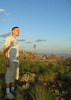
| partners | | Chums and I met at 6AM and were on the trail ~7:45AM, starting at the top of Kellner Canyon Trail from a parking spot along FR 651. We had good cloud cover to start, with 4+ miles of downhill on Kellner until we reached the intersection with Icehouse, the low point of the loop at ~5,200'. Just as we approached the intersection, the sun came out in time for the long climb up toward Pinal Peak, and the humidity made it a real sweat-fest.
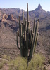
We took a break once we got back into better tree cover near the Icehouse/Telephone intersection, then continued up Telephone, which had some serious trail maintenance done last year and remains nicely cleared. The final approach up to Ferndell Spring was steeper than I remembered, but the pipe at the spring was flowingly nicely. From there, we took Ferndell Trail (also steeper than I remembered) up to the top and saw two deer just south of Pinal Peak as we headed over to Ladder Rock.
The clouds had returned, and with minimal wind, we took another break on top of the rock...very pleasant except for an extremely persistent bee that tormented me for several minutes. As dark clouds started to gather above us, we climbed down and headed north toward Signal Peak, with a quick stop at Pinal. We found one of the reference marks, but the benchmark must be missing or buried.
The forecast called for a 40% chance of rain, and it started to sprinkle on the way over to Signal, so Chumley pulled out the umbrella, but the sprinkles remained relatively light. We took Pipeline to avoid more road hiking, then made the final approach up to the peak and chatted with the guy stationed at the lookout tower. He let us borrow his picnic table for another short break as the rain started up again, but it let up almost immediately after we put on rain gear and had dry conditions and partly sunny skies the rest of the way.
To finish off the loop, we took a pleasant off-trail route that let us avoid the road and provided some nice views of the Superstitions and impressive thunderheads over the Sierra Anchas. The hiking gods rewarded Chumley for drawing up such a nice route with a Motorola walkie talkie/MP3 player we found on the way back...it looked like something out of the 80s but was only a few years old. We were done at 1PM and hadn't seen any other hikers/bikers all day.
Not much wildlife other than the deer, but it was a fun loop with good weather despite the sprinkles--the sun felt warm on some of the exposed uphill stretches, but the temperature never reached 80°, and it was nice to get out of Phoenix and hike somewhere that doesn't rhyme with Mouth Fountain for a change. |
  |
Dog House Spring |
Dripping |
Dripping |
| | | Spring box below the spring was full, but water was murky |
|
Ferndell Spring |
Quart per minute |
Quart per minute |
| |  Steady flow from the pipe Steady flow from the pipe | | | |
|
|
|
 Route Editor