| | -
| 1 label | 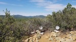 |
|
|
-
-
-
-
| |  |
|
4 |
-
|
| | |
|
| Hiking | 8.20 Miles |
2,072 AEG |
| | Hiking | 8.20 Miles | | | |
| 2,072 ft AEG | | 8 LBS Pack | | |
|
|
| |
| Partners |
|
none
[ show ]
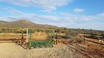
| no partners | | Gameplan today was to Bag and Tag and complete the holes for the official hike description for Bear Down Mountain (6962') which is the evil rival 1 mile south of Sun Devil Peak (6903'). "Bear Down" is SOUTH of Sun Devil, like Tucson is to Tempe. Its also higher in elevation. Left Walker about 5:40am and arrived at TH right around 6:35am. 57 degrees with a sweatshirt on when I left the lodge, warmed up to low 70's at the Prescott National Forests (PNF) latest and greatest "Newton Trailhead". The last time we were here, it had a pathetic 2 car parking area with a gate along the border of the National Forest. The PNF spared no expense on this TH. Seemed like an acre sized; fenced compound, smoothly graveled, with a very intricate bridge gate to for the Charcoal Gulch #9419 Trailhead. The only things they forgot for this TH was a crapper and a water fountain. I will lodge a formal complaint (sarcasm).
So 0.70 miles in, I was presented with a fork in the trail. I guess your supposed to stay RIGHT. I went left, took me down and up across Green Gulch and passed a coupled of killer camp spots complete with lots of shade with Alligator Juniper and fire rings and then a dead end. Time to go off trail. I kinda was running parallel with the actual trail and hitting some catclaw and decided enough was enough, broke NW and reconnected, onward and upward.
Charcoal Gulch reminded me a bit of Beamer Trail in the Grand Canyon, those pesky, in and out, up and down of the side drainages. Except in this case, it is all the base ridges that make up Sun Devil Peak. They were getting old fast. To pass the time on my route, as usual, was providing trail maintenance, kicking/moving rocks boulders and trimming overgrown branches.
I told my 4-legged hike partner when we launched it might be a good idea to pre-hydrate and even poured him a big bowl of ice cold water in has favorite big blue bowl. He would not have anything to do with that and was more focused on clearing out any wildlife within a 1/4 mile of the TH. Ohh well.
Once we hit the Charcoal Gulch, we took a brief detour to hunt and find the Charcoal Spring. Found the waypointed spot of the spring and the blue circle as noted on the USGS Topographic map and came up with scratch. Water report was a big fat zero. With not a cloud in the sky and no wind, hike partner was a little parched, so we found some shade in the Charcoal Gulch and I give him a 1/2 quart to quench his thirst. He has 1.5 quarts left. Once we got on #9419 again, he took off and was gone for about a mile. He caught up to me, panting and frothing at the mouth. Gave him the balance of his first quart.
At 4.07 miles into our expedition, I followed the trail which was banking NE. In looking at my surroundings figured this was not right at all. Looked down at Route Scout and sure as pumpkin confirmed had to turn back. At 4.5 miles my hike partner parked it in some shade and was done, gave him another 1/2 quart. At this point I figured we were not going to summit Bear Down. We made it to the junction of Salida Gulch Trail #93 where their is a pet cemetery (or memorial) of 3 dogs. Hiding is a patch of shade Tyson gave me the "come on man" look so we shut it down and started back. No clouds. No wind. Although shady and beneath trees all the way to Charcoal Gulch, I knew once we hit the lower base ridges of Sun Devil it was going to suck, and it did. Thankfully I pre-hydrated and kept giving Tyson 1/2 quart here and there until we ran out, about 0.7 miles before TH.
Bear Down Mountain 1 Medal/Tyson 0 |
| _____________________
"Before there was a trail..... there was no trail" |
| | |
|
|
|
|
|
| |
 Route Editor


