| | -
| 1 label |  |
|
|
-
| |  |
|
3 |
-
-
-
| |  |
|
1 |
-
-
| |  |
|
3 |
-
| 1 label | 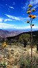 |
|
|
-
-
| 1 label | 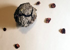 |
|
3 |
-
| 1 label | 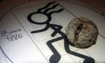 |
|
|
|
| | |
|
| Hiking | 16.17 Miles |
4,348 AEG |
| | Hiking | 16.17 Miles | 7 Hrs 50 Mns | | 2.35 mph |
| 4,348 ft AEG | 57 Mns Break | | | |
|
|
| |
| Partners |
|
[ show ]
| partners | | July isn't prime. Storms everywhere else added appeal... clouds!
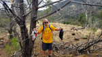
Tradition requires a car guess competition for this trailhead. Typically I lose. Today my guess of 2 beat the counter "less than". 6 cars @ the TH seemed crazy for July. 1 mtn biker tackled two laps. The balance was small groups of 1-2 runners descending. Muy gusto amigos!
Schweddy ascent. Reasonable with clouds. Light breezes were few and far between.
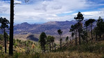
Took a nice easy off trail jaunt to the east heading up where Bruce explored solo years ago. Views over Pumpkin Center and Tonto Basin made me realize the population down there is more than I assumed.
Sun busted out just as we arrived at the peak, luckily not a minute sooner. Circled the facilities and headed down. Overall more enjoyable than anticipated. Realized a favorite of mine, Arizona Cypress, is represented well on this hike! |
|
Wildflowers Observation Isolated
tiny to microscopic |
|
| _____________________
| | |
|
|
|
|
|
| |
 Route Editor


