username
X
password
register
for free!
help
ArticlesGuidesRoutes
 
Photosets
 
 Comments
triplogs   photosets   labels comments more
Herb Martyr Trail #247 - 7 members in 15 triplogs have rated this an average 4.1 ( 1 to 5 best )
15 triplogs
login for filter options
Sep 27 2024
avatar

 Guides 1
 Routes 262
 Photos 864
 Triplogs 266

51 male
 Joined Mar 24 2021
 Tucson, AZ
Snowshed & Greenhouse LoopTucson, AZ
Tucson, AZ
Backpack avatar Sep 27 2024
JackluminousTriplogs 266
Backpack16.70 Miles 4,508 AEG
Backpack16.70 Miles1 Day   2 Hrs   50 Mns   
4,508 ft AEG22 LBS Pack
 
1st trip
I had the opportunity to get away for an overnight, and I've been wanting to try the east side of the Chiricahuas for a long time. The stars aligned and off I went!

I had planned on being at the trailhead by 10 on Friday, but things didn't work out and I got out of town late. For some reason I didn't want to drive to Herb Martyr campground with a battery that was mostly dead (as in, slightly alive). So I stopped to get a new one on the way out of town.

I started hiking from Herb Martyr just before noon. My goal was to reach Aspen Saddle to camp, which is about the halfway point on the Snowshed/Greenhouse loop.

Herb Martyr Trail
This trail was in pretty good shape. The weekend I went was a major heatwave with the valleys reaching 105; it was probably in the low 80s when I started hiking. The middle section of Herb Martyr follows an exposed ridge and man was it toasty. I hiked like a lizard, zipping between shady spots. The latter half of the trail was a super steep climb, but it was treed and therefore more tolerable. It got a little overgrown close to the junction with Snowshed, and erosion has definitely been taking its toll on tread quality up there.

Snowshed Trail
At the trail junction with Snowshed, the sign for Herb Martyr was missing. Well, pieces of it were here and there, but nothing legible. The Snowshed sign, however, was in perfect condition.

Snowshed was in fabulous condition from the junction with Herb Martyr until after just after Pine Park. This amounted to about 1/8 mile of piney greatness. The remainder of the trail to the Crest alternated between exposed scree and a bushwhack through overgrown shrubbery of various persuasions, and not all friendly. Between loose rocks and dense overgrowth the trail was a little treacherous in places. Nonetheless the trail was followable, until the approach to Snowshed Saddle where it pretty much disappeared. Pink flagging tape at the saddle was helpful.

Snowshed needs love, a lot of love. But it's worthy, with pretty incredible views along its length that just get better as you go.

I definitely underestimated how the heat and the challenging trail would slow me down. I didn't make it to the Crest and Juniper Spring until about 6pm, which was sunset. I didn't have time to collect water, hike the 3/4 mile or so to Aspen Saddle, and pitch a tent before dark. I was also pretty tired, and Juniper Saddle was gorgeous. So I collected water at the spring and hiked to a flat spot on the ridge below, carpeted with wildflowers and featuring a stunning view of Rucker Canyon.

While setting up camp I realized that I thought I had packed my tent, poles, and ground sheet, but instead had packed my rain fly, poles, and ground sheet. No tent. Whoops. So I had to cowboy camp on a perfectly temperate, cloudless, moonless night staring at a blanket of stars. I regretted packing the poles and rain fly more than I regretted forgetting the tent!

I woke very well rested to a stunning panorama of Rucker Canyon, totally stoked that I didn't make it to Aspen Saddle.

Juniper Spring
See my water report.

Crest 270C
At first the trail was very, very faint but followable. It was almost gone south of Eagle Spring. Between Eagle Spring and Aspen saddle it was still faint but followable. From Aspen to Junction it was easy to follow but overgrown, with about four downed trees across it.

This stretch of the Crest is probably my favorite because of the views into Rucker Canyon. I look forward to the time when it gets the restoration work it deserves.

Eagle Spring
See my water report.

Crest 270A
It was a freakin’ superhighway! Lots of recent tread work really shines and even the overgrown parts are easy.

The area from Junction Saddle to Cima Park had burned really badly so it was basically a steeply sloped meadow of wildflowers and tree skeletons, some of them rather spooky. I've always thought of this stretch as the Halloween Trail.

Just south of Cima Park is a stand of aspens, which were turning at the time I passed through. It was really pretty.

Anita Park
The spur trail had a shiny new sign! The trail to Anita Park was overgrown but followable without trouble. I just went to check out Anita Park, which was tall grass and standing dead trees. I sat down on a log in the midst of an aspen stand, ate a snack, and cleared the stickers and seeds out of my shoes. This was a process I repeated many times on this trip.

I decided not to bother hunting for Anita Spring since there was so much overgrowth everywhere. Mental note: when hiking the Chiricahuas in late summer, wear gaiters and bring a machete.

Greenhouse Trail
I stopped at the cabin for lunch and to take advantage of the outhouse. The outhouse was being converted into an unsanctioned rodent hotel; there was a broom inside which I used for demolition purposes.

Greenhouse was in great shape in the forested section till you get to the creek, then things get dicey. Through the creek the trail was hard to follow at times, with lots of overgrowth and obstacles around creek crossings. Lots of water to collect though! And fall colors to enjoy!

Conditions improved as the trail left the creek only in the "easy to follow" department, but not in the "wildly overgrown" one. The tread was loose rock in the burn scars. Some of the overgrowth was pretty gnarly. It was consistently overgrown all the way to the road, but down in Greenhouse Canyon it was mostly grass. There was some deadfall, but only one large tree down near Greenhouse creek gave any trouble.

Winn Falls was not flowing much, it was more Winn Trickle. The views were pretty great nonetheless.

The last 1.5 was a road walk. At least it wasn’t overgrown.

This was what I would call a "real" Chiricahua experience. Neither Snowshed nor Greenhouse trails had seen much or any maintenance in recent years, and both have been pretty majorly affected by fire. I expected this to be a tough hike. While the hike was pretty challenging it was definitely worth doing. I hope these trails get some attention, as they are great trails to access the Crest from the Portal side.
foliage observationfoliage observationfoliage observationfoliage observationfoliage observation
Autumn Foliage Observation Light
The aspens are starting to turn. There are some nice splashes of red and yellow throughout the area, but especially on the Crest near Cima Saddle and along the creek in Cima Canyon. Fairly sporadic along Snowshed trail as well.
wildflower observationwildflower observationwildflower observationwildflower observationwildflower observation
Wildflowers Observation Moderate
Yard-high daisies everywhere, even down the middle of most of the trails! Bring a machete.

water 1 out of 5water less than maxwater less than maxwater less than max Eagle Spring Dripping Dripping
Nice sign but trail down to it is faint and hard to discern if you don’t know where to go. Just hike down the slippery rocks toward the pine tree off to the right (facing the sign) and down the hill a bit. The spring is northwest of the tree.

Overflow is full but slimy with algae. Cover for the spring box is about 1/3 buried with rock and gravel. The spring is useable if you don’t mind clearing out slimy gook.

water 1 out of 5water less than maxwater less than maxwater less than max Juniper Spring Dripping Dripping
Overflow trough and tank not useful. A concrete dam is holding water a bit uphill. Water is seeping out around it, making the ground a little muddy. Water in reservoir is shallow but still deep enough to submerge a small water bottle. Filters great if you're careful to keep the cruddies out; useable spring.

water 1 out of 5water less than maxwater less than maxwater less than max Winn Falls Pools to trickle Pools to trickle
Even if the flow is great, how this is a water source is beyond me. It is impossible to get to from the trail. Jetpack? There was a trickle of water dribbling down the cliff, so I'm not sure you could really call it a waterfall at this time.
 
May 28 2023
avatar

 Guides 94
 Routes 840
 Photos 22,055
 Triplogs 1,993

52 male
 Joined Sep 18 2002
 Tempe, AZ
Basin Trail #600Tucson, AZ
Tucson, AZ
Hiking avatar May 28 2023
chumleyTriplogs 1,993
Hiking3.93 Miles 444 AEG
Hiking3.93 Miles   1 Hour   44 Mns   2.27 mph
444 ft AEG
 no routes
1st trip
Partners partners
BiFrost
John9L
slowandsteady
After spotting a family of elegant trogons fluttering in the trees while randomly sitting at camp we decided to peel off a couple miles before dinner. This seemed like an easy option and it wasn't far from where the pretty birds were showing off their colors.

Ash Spring is an old 2 track that climbs gently from the Herb Martyr campground up to Ash Spring, which was a surprisingly nice water source here. Of course, it's so close to the perennial Cave Creek that it's really just a redundant water source.

Basin 600 led us through a sea of ferns and some unexpectedly fantastic views of Helen Keller's Yosemite of Arizona. A short connector along Herb Martyr brought us across the creek and up to Snowshed 246.

This ended up being disappointing as we were planning on a couple miles of creekside walking, but this route stays high, far out of sight and earshot of the creek below. We did make a quick detour over to the majestic HM Falls where a family of locals was swimming.

Back to camp for dinner over the fire and planning for tomorrow's hike.
_____________________
I'm not sure what my spirit animal is, but I'm confident it has rabies.
 
May 28 2023
avatar

 Guides 4
 Routes 491
 Photos 10,890
 Triplogs 1,257

55 male
 Joined Nov 20 2012
 Phoenix, AZ
Basin Trail #600Tucson, AZ
Tucson, AZ
Hiking avatar May 28 2023
BiFrostTriplogs 1,257
Hiking3.93 Miles 444 AEG
Hiking3.93 Miles   1 Hour   44 Mns   2.27 mph
444 ft AEG
 no routes
1st trip
Partners partners
chumley
John9L
slowandsteady
Quick hike before sunset and nice extra miles after doing South Fork Cave Creek earlier. Pretty easy loop from Herb Martyr Campground with some nice ferns and forest along the way. Checked out Ash Spring which had some decent water before continuing on the loop.

On the last two miles we crossed Cave Creek which had good water. However, we thought the trail would follow the creek only to find out that it stayed on a bench well above so we didn't get our creek side hike. Still a good hike before dinner.
_____________________
  1 archive
Sep 02 2022
avatar

 Photos 115
 Triplogs 31

male
 Joined Sep 15 2020
 Phoenix, AZ
Greenhouse Trail #248Tucson, AZ
Tucson, AZ
Hiking avatar Sep 02 2022
xsproutxTriplogs 31
Hiking14.00 Miles 4,790 AEG
Hiking14.00 Miles
4,790 ft AEG15 LBS Pack
 no routes
1st trip
Day 1 - Climbs, thorns, snakes, bears, oh my

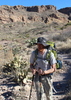
My first day actually started on Mt Lemmon, about 5 miles away from the Marshall Gulch trailhead. I woke up early, hiked out, and made the drive over to the Chiricahuas. As I turned on to Noland Road from the interstate and approached the Chiricahuas, I knew that this was going to be a special place. It was a beautiful day and the road was in great condition. As I got close to Portal, Cave Creek crosses the road and was flowing nicely which gave me comfort that the various creeks would be running. My original plan was to start at Herb Martyr Campground and hike up Greenhouse Road to Greenhouse Trail and, ultimately, end the night at the cabin near Cima Park. I had gotten a later start than anticipated, though, so wanted to see if I could drive up Greenhouse Road a bit to knock off a mile or more and at least 500 feet of the elevation gain on the first day, as it was a big climb. For the most part, Greenhouse Rd is in good condition and could be made by any SUV. It's tight in some sections and there's a chance you might get some pin stripes, but it's in good condition until about a mile in. I also saw a small bear in one of the clearings, but he didn't try to get in my way. Smart bear. At that point, the road crosses Greenhouse Creek and it gets a bit bouldery. I didn't have much an issue with my lifted outback but I did have to reposition some rocks in a couple of spots and had some tire spinning. Fearing it would get worse, when I saw an area that looked ok to park for a few days right at the creek crossing, I figured that was good enough and I'd start the hike from there. Turns out the rest of the road after crossing the creek to the actual TH is like the first part and just fine for any SUV probably, so the only part of that road I would say really needs clearance or AWD/4WD is that section that is about 1000 feet long.

It was about a half mile to the trailhead and while it was just a half mile of forest road, it was interesting: two groups of deer spotted, old bear scat mixed with still steaming bear scat, one snake (signs of what's to come). Once to the actual trail, I could see that this was going to be an interesting climb. As I started what would ultimately be 2700 feet of gain, I could sort of kind of see the trail but I mostly saw vegetation. It was thick, but mostly soft grass so not the worst thing in the world. Then I saw another rattler. Well, to be fair, I never actually saw this one, I could just hear it right off trail. After backing off and giving it a few minutes to see if it would move... it didn't. So, I climbed up the hill to the right a bit in waist high grass hoping I wouldn't find a friend of his and let him have the trail. As I made it to the wilderness boundary and the approximate 15 million switchbacks, the vegetation only got thicker and there was little sign of trail in most spots. If anyone wants to frame me for murder, I left about 5 gallons of blood there so I'm sure you can figure out something. I would not recommend this trail in shorts and this is coming from a guy who only hikes in shorts, overgrown trails and all: this felt like nearly an off trail excursion in a lot of areas.

Eventually, I made it to the Winn Falls viewpoint which was flowing quite nicely and I could hear loudly even from that distance. Loud enough that I almost stepped on yet another black rattlesnake because I couldn't hear it's rattle. Noped out of there real quick and got back on "trail", anxious to get the last bit of climbing out of the way. Eventually the trail meets up with Cima creek and what bit of trail you have disappears almost entirely to brush and deadfall. This next mile to the cabin took almost an hour as I figured out the best path but was an enjoyable hour if nothing else. Cima Creek was flowing beautifully and there are tons of little slick rock waterfalls and fun little chutes that it flows through to keep things interesting. I made it to the cabin around 7:30 or so, set up my tent, and started a small fire to relax by for a little bit before bed. The forest service has carved a couple of big logs as benches which left a ton of good firewood making it easy on me.


Day 2 - Fog, snakes, snakes, snakes, aspens

I woke up early to the pitter patter of rain and looked outside to see the entire area covered in fog and some fierce winds. What I thought was rain was actually moisture collecting on the trees above me and then being blown off by the wind. This made for some great horror movie vibes but did get me thinking about my plan a bit. Originally, I had planned on hiking north on the crest trail this day and making a 10 mile loop, ending back in the same spot or maybe another mile or two south. After checking the weather report again, it looked like things were only going to get worse in this area that day and night so I made the decision to hike on down Snowshed to drop some elevation and just play it by ear. I made this decision in the great forest service outhouse by the cabin. Truly fantastic.
The first few miles were brutal with the wind whipping the trees into my face but also beautiful. I dipped down to Anita spring real quick to check it out and then I climbed up Chiricahua peak to be met with... well, nothing. I couldn't see anything more than a few feet in front of me due to the fog. Don't worry though, because there was another black rattlesnake in the trail. Joy. This one gave me fair warning, though, which was nice of him. The wind and fog continued until hitting Aspen saddle where the trail starts to turn East. Of note, there is some good camping at Aspen Saddle that is tucked away in the trees; I took a break behind the treeline to get out of the wind and they did a great job of blocking it. I went south on crest to check out eagle and juniper springs and right at the trail split, it seemed like a light switch was thrown and the fog dissipated and the wind died down to a much more manageable level. The views from here to Herb Martyr are just absolutely insane and I found myself stopping often to take pictures/record/stare. Eagle spring is somewhat sketchy to get to; it seems there's been a lot of erosion and it's a fairly steep path with lots of small rocks. I scooted it on my butt. Juniper was a lot easier to get to and it just off the trail. There are three catchments, all have seen better days, but all had water of one variety of algae or another. I refilled here and while it still had a slight brown color to it, it tasted fine.
Guess what else I saw here? I guess black snakes gotta drink, too, because it was just handing out on the rock where a seep is coming through. We were pretty far from each other, though. I asked how it's family was, it didn't answer which I thought was rude, but whatever.
The next few miles are more just descending, beautiful views, and stopping when you hear a rattlesnake next to you to see where it is and realizing it's 6 inches from your foot on the side of this mountain making you an olympic track star. Sounds monotonous, but this one wasn't black like the rest, so it added a little spice.
Eventually I made it to Herb Martyr trail which was a nice change of pace. Well, the pace was still DOWN but now we're in green trees instead of rocky mountainsides. I was able to move much faster on this section and was making the plan to just pick a spot at the campground potentially for the night. I knew when I was getting close: the scent of hot dogs and burgers could be smelled from a mile out. I eventually made it there around 6. I found a spot right outside of the campground by the creek that had obviously been used for tents before and just pitched mine, which became more interesting than it should have. Halfway through, I feel someone smacking my back. I turned around ready for anything to see... a 12 year old boy. Who was immediately mortified and let out a small, "I thought you were my dad", before running away. No, small child, I don't believe I am. That was the first person i saw since setting out the day before, though. Then I checked out the vault toilet in the campground. Review: 5 star. Think they had cleaned it for labor day as it was spotless, the toilet paper was fresh, and it smelled like lysol.

Day 3: Just a quick 1.5 mile hike out along forest road. Nothing special but still a pleasant area. Found a family car camping right near mine which surprised me but it's a beautiful spot, so I get it. Drove out to the National Monument for some more hiking.

Final Thoughts: This is an absolutely beautiful, phenomenal, amazing, and remote area. It's also extremely rugged, tough, and affected by fire. These factors result in a trail that at times is trying to throw you off the mountain due to erosion and, other times, trying to separate your legs from your body with the vegetation. I also saw more wildlife in this one trip than I have seen on many trips combined including two bears, a scorpion, snake after snake after snake, a couple coatis, 6+ herds of deer, and all sorts of birds I haven't seen before. I would recommend the area and these specific trails to anyone wearing pants in decent physical condition and I will be going back soon.
 Named place
 Named place [ checklist ]
[ checklist ]  Winn Falls
wildflower observationwildflower observationwildflower observationwildflower observationwildflower observation
Wildflowers Observation Light
 
Jun 28 2021
avatar

 Guides 187
 Routes 989
 Photos 12,068
 Triplogs 864

72 male
 Joined Jun 27 2015
 Tucson, Arizona
Snowshed Herb Martyr Loop, AZ 
Snowshed Herb Martyr Loop, AZ
 
Hiking avatar Jun 28 2021
markthurman53Triplogs 864
Hiking11.07 Miles 2,691 AEG
Hiking11.07 Miles   7 Hrs   17 Mns   2.03 mph
2,691 ft AEG   1 Hour   50 Mns Break
 
1st trip
Partners none no partners
On day 2 of my hiking trip to the Chiricahua Mountains I Hiked the Snowshed Trail and Herb Martyr Trail returning via the Snowshed Basin Trail. This was an 11.1 mile hike with 2700 feet of accumulated elevation gain. Wasn't sure if I was up to this hike today with being worn out from yesterday and having to do damage control on both of my heals. Once I got started I was determined to finish up this loop hike.

The lower part of the Snowshed trail up to Cypress Saddle was steep and require a lot of standing breaks to to allow my legs a rest. Good views all along this trail down lower Cave Creek and Silver peak, Mount Sceloporus and Cathedral Rock. The trail is in good condition and easy to follow but I could see that at times the grass and brush could obscure the trail. Once past Cypress Saddle the trail follows along the north side of the ridge and appears to level off a bit and the walking easier. Fossil Saddle is 5 miles in and at 5.2 the Junction with the Herb Martyr Trail and Pine Park. This intersection is signed. I took a half hour break here. While resting here a very low flying jet screamed by and buzzed Chiricahua Peak. The forest is so quiet and then all of a sudden a defining roar of a jet that that took maybe 3 second to disappear over the mountain. then after the echo's died away the forest was back to quiet like nothing happened. That must be a kick in the pants doing that. I would of liked to video it but it was so fast it was over before I could even think about getting my camera. I wanted to contact the pilot and tell him I wanted a do over. Probably wouldn't do it anyway because I'm sure it was a marginally legal stunt. Reminded me of when I was in my early 20s along with a friend of mine, we were dangling our feet off the east cliff of Mount Whitney when two F4 Phantoms flew just hundreds of feet over the top of the peek with AB burning. Me and my friends both looked at each other and at the same time just said a very slow "WOW" (we were doing some of mother natures stuff). Before we could finish the elongated wow those jets flew over Owens Valley, past Inyo Mountains and were heading down Panament Valley. Very impressive. Well enough of memory lane.

The hike down the Herb Martyr trail was beautiful, The pillowy clouds with the shadows cast across the landscape made for some pretty scenery. The Trail is in excellent condition and appears to get a lot more use than the lower Snowshed Trail. Actually if I was going to go up to the crest via the Snowshed Trail I would use the Herb Martyr instead of the lower Snowshed Trail. There are some nice views of the upper Cave Creek Canyon along this trail.

The temperatures were in the mid 70's for most of the trail but at the high elevation the sun was intense (never seemed to be behind one of the many clouds in the sky). On the Snowshed Basin trail for the last 2 miles the temps were in the mid 80's with a high humidity. I was glad to get back to the jeep where I had some salty pretzel sticks and a root beer. I almost gave up on this hike as I was heading up the lower Snowshed Trail, I'm glad I stuck it out.
_____________________
 
Jun 26 2021
avatar

 Routes 137
 Photos 1
 Triplogs 105

44 female
 Joined Oct 21 2016
 Tempe, AZ
Snowshed Trail #246Tucson, AZ
Tucson, AZ
Hiking avatar Jun 26 2021
MAPTriplogs 105
Hiking12.90 Miles 3,923 AEG
Hiking12.90 Miles   8 Hrs   14 Mns   1.72 mph
3,923 ft AEG      45 Mns Break
 
no photosets
1st trip
Linked   linked  
Partners none no partners
Stayed at Sunny Flat Campground Friday night. Great little campground with all the views! Started hiking around 5 am Saturday morning on the Herb Martyr Trail #247. It felt a little chilly for us Phoenix folx but we warmed up with our first few steps. Herb Martyr is up up up up up with a few short breaks of level ground. The trail is in fantastic condition and is a beautiful foresty trail with dirt and pine needles. Little to no tripping hazards allow you to actually look up and enjoy the surroundings.

We intersected with Snowshed Trail #246 around 3 miles. Snowshed continues the climb up a little more gradually. The views along this entire stretch are incredible. Snowshed Trail is also in great shape. There are a few eroded areas where footing requires you to pay attention but nothing major. Deer Spring is visibly dripping across the trail but not dripping enough to access with a container or to drink. We didn't scramble up to see if there is anything holding the spring water but there was a lot of green visible along the upper slope.

We reached the saddle and started up a visible peak trail marked with cairns. The trail disappears quickly and we hopped up the rock-covered sections to make our way up. There are sporadic cairns along the rock areas. Even with no trail, it is not a difficult peak hike. The new growth are mostly Aspens and are easy to move through. The peak has incredible views on the far east side. There was a nice breeze & temps felt good at the peak around 9:30 am.

We headed down & immediately felt an increase in temperature just at the saddle. Going down was fast but definitely had the eastern morning sun on us the whole hike. We reached the intersection of Snowshed/Herb Martyr trails & took a break. I checked my thermometer there & it said 85 deg. That point is around 2,000' from the trailhead and the trailhead temp was 93 deg when we got back to the car so that checked out. The hike down Herb Martyr was easy and we got some more shade from the trees. A couple nice pools of water in the creek to splash water on our faces was appreciated toward the end of the hike.

This hike was absolutely gorgeous, straightforward easy trails, and good elevation gain to make you work for it. We had large brimmed sun hats on, sun protective clothing, saltstick tabs, and I brought almost 4L of water for myself. We felt good at the end...definitely hot but not delirious hot. I wouldn't recommend this hike in the summer without extra preparation though. There is no protection from the southern sun unless it's a cloudy day and we didn't see another person the whole hike. Also, surprisingly not a lot of wildlife either aside from birds. That was a huge difference from the South Fork of Cave Creek just below that was teeming with wildlife!

water 1 out of 5water less than maxwater less than maxwater less than max Deer Spring Dripping Dripping
_____________________
 
Jun 02 2021
avatar

 Routes 154
 Photos 1,505
 Triplogs 266

31 male
 Joined Jun 02 2019
 Phoenix, AZ
Snowshed - Paint Rock Loop, AZ 
Snowshed - Paint Rock Loop, AZ
 
Hiking avatar Jun 02 2021
LJWTriplogs 266
Hiking20.77 Miles 5,317 AEG
Hiking20.77 Miles   7 Hrs   9 Mns   3.12 mph
5,317 ft AEG      30 Mns Break
 
1st trip
Route Scout Route Recorded  on Route Scout | Pop | Map | Popup | MapDEX
A friend and I needed to get away. Hadn't made a trip down to the Chiricahuas this spring yet, so off we went. Wanted to repeat a loop from last year from Turkey Creek, but with lightning in the forecast around 11am, and since I've never been East of the Crest, we drove down through Portal with dive-bombing birds and neurotic jackrabbits flashing through the high beams trying to make sunrise. Figured this loop would be shorter, but I'm not sure it was. My friend lounged around Herb Martyr CG where she enjoyed the sights, sounds, and smells of the wilderness while I disappeared for 7 hours and offered my body to it as a sacrifice. Went clockwise.

Herb Martyr Trail in superb shape. Sunrise views of Sanders Peak that nearly dropped me dead. A mile from the top took a break to catch my breath and heard footsteps out in the brush north of the trail. Bid hello from below, half dozen more slow steps and silence. Kept going, and didn't see anything. Trail climbs into a patch of old growth conifers near the jct and Pine Park. Really pretty area, and the last trees until Snowshed Peak.

Snowshed trail to saddle and up. Went straight up and bumped into a decent trail that climbs the ridge. Followed it most of the way down. It's often overgrown or covered over with deadfall, but it beats wading through the aspen. Summit views okay, but the forest of fir and pine on the summit/ridge is worth the diversion. Back to snowshed and took that around Aspen Peak. My favorite views in the range are probably looking across Rucker Canyon to Paint Rock, Raspberry Peak, and Monte Vista. Long time to admire from the Snowshed/Crest jct to Chiricahua Saddle. Trails in good condition to that point, although the end of Snowshed near Crest is soon to disappear in the ferns.

Short out and back under stormy clouds up Paint Rock. Probably my favorite summit in the range I've been on and the worst place to be with a chance of lightning. Fun climb up to the summit, but the views were a little hazy. Back to Chiricahua Saddle with a short break under the trees. Brilliant forest around Chiricahua peak. In the burn areas where the fir and pines are gone aspens are growing in. Decent trade off. Around the peak with huge views north toward Graham, Dos Cabezas, etc.

Got to Cima Park and headed down Greenhouse. Wanted to be there before 11, got there at 10:30. 10:50 heard the first thunder and was happy to be off the crest of the mountains. Greenhouse was my favorite new trail of the day, old growth forest and big views toward Silver Peak and Portal lower down. Wound back around with Basin Trail. Good road walk between the trails. Basin had unexpectedly good views. Cut down to the TH with Ash Spring Trail through some of the tallest junipers and sycamores I've ever seen. Didn't see anyone on the hike, 60s just about the whole time.
wildflower observationwildflower observationwildflower observationwildflower observationwildflower observation
Wildflowers Observation Light
  4 archives
May 22 2021
avatar

 Photos 392
 Triplogs 25

38 male
 Joined Apr 01 2018
 Phoenix, AZ
Herb Martyr Trail #247Tucson, AZ
Tucson, AZ
Backpack avatar May 22 2021
bretinthewildTriplogs 25
Backpack17.00 Miles 4,756 AEG
Backpack17.00 Miles4 Days         
4,756 ft AEG
 no routes
1st trip
First exploration of the Chiricahua Wilderness! A fun adventure with my brother, whom I'd not seen in more than a year. Hopefully this log will be helpful for anyone seeking to plan a backpack into this area. There doesn't seem to be too many HAZ logs for these parts.

Here's a breakdown of our trip:
Day 1: Car camp at Herb Martyr Campground
Day 2: Hike up Herb Martyr Trail, dry camp at Pine Park (near Snowshed Trail junction)
Day 3: Camp at Anita Park
Day 4: Camp at Cima Cabin
Day 5 Hike out on Greenhouse Trail

Day 1
We drove from Phoenix to Portal on a Saturday afternoon. We car camped at Herb Martyr Campground. It was about half full (ie 2 other groups). There are some nice open walk-in sites, bear-proof trash cans and a toilet, just no running water.

Day 2
We started our hike from the campground parking lot on the Herb Martyr Trail (which is marked "Basin Trail 247" at the TH). The hike takes you up into the mountain at a steady pace. Our goal was to dry camp at Pine Park, just 3 miles, but 2200 feet in elevation gain. We each carried 6L of water and it took us 2.5 hours. Set up camp and enjoyed time soaking in the views and the sunset.

Day 3
We continued on Snowshed Trail on our way to the Crest Trail. This section of the wilderness was badly burned in the Horseshoe II fire in 2011. It is very exposed, hot and dry, but being between 8000-9000ft elevation the breeze kept us cool enough. We planned to fill up water at Deer Creek, which seemed to be running slowly, but I misread the map and thought it wasn't the right spot so we kept going. Skipping the spring would haunt us a bit later as we started running low on water after last night's dry camp.

At the trail junction on Snowshed Saddle, we attempted to find Aspen Trail #246A to take us around Aspen Peak on the northeast side, but we couldn't find the trail amongst all the young aspen trees. Rather than go all the way around to the southwest side, we opted just to go off-trail straight up and over Aspen Peak and down to Aspen Saddle.

From Aspen Saddle we ran down to Headquarters Spring, which I had read on a local blog was fairly reliable. But alas, the spring was bone dry. Rather than trying our luck at Ojo Agua Fria (an extra mile round trip), we opted to go over to Anita Park and see if we could find water at Anita Spring. As luck would have it, there was a perfectly nice cool pool of water waiting for us at Anita Spring. Thrilling.

We opted to camp at Anita Park that night, next to a nice young grove of Aspen Trees that gave us protection from the wind, which eventually died down. The camp spot was also pretty safe as far as any potential treefall from the many dead ponderosas in the area. Total for the day ~6 miles (Pine Park to Anita Park w/ spring hunting).

Day 4
Leaving Anita Park we took the Crest up to Cima Park. There are some incredible views on this section of trail. At Cima Park we took the Greenhouse Trail down, attempting to find Cima Spring and a potential place to camp on our last night. Where Cima Spring is marked on the map, there was a spring box but it was dry. We continued on maybe just 0.5 mile further and came to a couple idyllic forest service cabins with an amazing camping area, fire ring, clean pit toilet and spring box full of water. It was set in an unburned section of pine forest, which is fairly rare in this area. What a find! We camped here, of course. We also enjoyed a nice day hike up to Round Park for lunch.

Day 5
We finished off the Greenhouse Trail and a bit of primitive road hiking to finish the loop to the car at Herb Martyr. Greenhouse Trail is only about 4 miles but it drops about 3000 feet. There is a neat viewpoint of Winn Falls, which were dry this time of year (late May) but I'm told are often icy and running in early spring.

Overall, this is a really cool place, as long as you are OK with hiking up steep mountains, scrounging for springs at times (as we do in AZ) and walking through some pretty heavily fire damaged areas. We experienced tremendous solitude -- after leaving the campground on Sunday we didn't see another soul until returning to the car on Wednesday. That was pretty special.
 Culture
 Culture [ checklist ]
[ checklist ]  Campsite
 Named place
 Named place [ checklist ]
[ checklist ]  Anita Spring  Cima Spring  Winn Falls

water 1 out of 5water 2 out of 5water less than maxwater less than max Anita Spring Quart per minute Quart per minute
Nice clean pool in the side of the hill. Was refilling itself slowly.

water 1 out of 5water 2 out of 5water less than maxwater less than max Cima Spring Quart per minute Quart per minute
Full spring box, located just below Cima Cabin. Has a lid on it, need to lift it up. See photos in triplog.

water 1 out of 5water less than maxwater less than maxwater less than max Deer Spring Dripping Dripping
Dripping from the side of the hill

dry Headquarters Spring - Chiricahua Dry Dry
Just a dry tub. Very disappointing.

dry Winn Falls Dry Dry
Not running at all
  2 archives
Nov 28 2020
avatar

 Guides 12
 Routes 192
 Photos 863
 Triplogs 356

42 male
 Joined Nov 30 2015
 Phoenix, AZ
Snowshed & Greenhouse LoopTucson, AZ
Tucson, AZ
Run/Jog avatar Nov 28 2020
ShatteredArmTriplogs 356
Run/Jog17.60 Miles 4,674 AEG
Run/Jog17.60 Miles   5 Hrs   49 Mns   3.03 mph
4,674 ft AEG
 
no photosets
1st trip
Plan was to loop Snowshed and Greenhouse. Got started a little bit late, so brought lights just in case. Herb Martyr Trail was steep but pretty. Snowshed was not as steep, but rougher. Loved both; beautiful terrain up there.

We decided to do the out and back to Snowshed Peak. The first half is easy, then it gets overgrown. Looks like they've done some work on the first half.

Headed towards Chiricauhua via an alleged trail north of Aspen Peak, which my map shows but clearly does not exist in any meaningful form. Would have been easier just to go up and over.

Chiricauhua Peak was comparatively easy. I had been up from Rustler Park a few years ago, so nothing new.

Greenhouse Trail was cold. Creek was mostly frozen, as was Winn Falls.

Made it back to the car just as the sun was starting to set.
_____________________
  2 archives
Nov 12 2020
avatar

 Photos 117
 Triplogs 23

48 male
 Joined Apr 25 2017
 Phoenix, AZ
Crest Trail #270 - Barfoot Park Rd to Jct SdlTucson, AZ
Tucson, AZ
Backpack avatar Nov 12 2020
desertadaptedTriplogs 23
Backpack36.00 Miles 9,700 AEG
Backpack36.00 Miles3 Days         
9,700 ft AEG
 no routes
1st trip
Given how far the Chiricahuas are from the Valley, I've only had a chance to visit once before, on a brief backpacking trip with my family. My plan was a bit diffuse initially, but I ended up deciding to use the Crest to backstop two loops, one east, one west: Herb Martyr and Mormon/Saulsbury. Given the colder temps we've been having (finally), I decided to camp low to stay warm.

Day 1. Started at Bootlegger Park. Started immediately on the Crest Trail, which has had some work done on it over the last couple years. Several years back it had been washed out in portions. It's now solid, and no overgrown. I was struck at how slow that area has been to come back from fire. I took a hike over Flys Peak, which does not improve on the crest itself in terms of views. Anita Spring is full. Unsure of what kind of water I'd be seeing at Herb Martyr, I overfilled. I'm the poster child for the backpacker who has incredibly expensive lightweight gear and screws it all up with overly conservative water carries. So it goes. After Anita Spring I continued on the crest to Snowshed Trail. Snowshed is thin, angled and exposed. There's very little post-fire growth in this area, leading to notable erosion. Pine Park is lovely, however, and the Herb Martyr Trail was perfect in all respects. After crossing Cave Creek (flowing nicely), I continued around on FR713 to head towards Greenhouse Trail. I found a nice campsite. Hadn't seen a soul all day (even at the Herb Martyr Campground).

Day 2. The hike up Greenhouse was steep. Winn Falls is flowing slightly. Cima Creek was flowing and I was able to refill my still-ample water supply. I encountered my first (and only) backpacker heading down from Chiricahua Saddle to Mormon Ridge. Route finding was generally fine on Mormon Ridge but I did manage to briefly get off trail towards the beginning, and was glad for GPS. I'll note that Mormon Creek had a ton of deadfall at the start, so I opted for Mormon Ridge instead. There was ample water in Turkey Creek where the Ridge Trail connects to the road. I curved around and headed a bit up Saulsbury, but was gassed from the morning's climb.

Day 3. Saulsbury up to Saulsbury Saddle is relatively well-maintained and easy to follow. The stretch from the Saddle back to the Crest Trail has need seen attention for a while. I frequently had to course-correct with GPS, and push through overgrowth, deadfall, and brambly evil. It's also steep, though that might have been my legs giving out. Once back on the Crest I had a quick walk over to Flys Park and took that road back to Rustler Park. Given how much I struggled up the second segment of Saulsbury, I was ready for some easy hiking.

I'm truly bummed that it's such a drive to get to the Chiricahuas. Living in the Valley, it's tough to commit. I look forward to getting back there in another couple years. I'd like to start out of Rucker on the south side to do some more exploring.
 Named place
 Named place [ checklist ]
[ checklist ]  Anita Spring

water 1 out of 5water 2 out of 5water less than maxwater less than max Anita Spring Quart per minute Quart per minute
Tank is full and clear.

water 1 out of 5water less than maxwater less than maxwater less than max Deer Spring Dripping Dripping
Spring was dripping across the trail. Did not go up to spring - a bit sketchy post-burn.
_____________________
  2 archives
Sep 17 2020
avatar

 Guides 187
 Routes 989
 Photos 12,068
 Triplogs 864

72 male
 Joined Jun 27 2015
 Tucson, Arizona
Snowshed Basin TrailTucson, AZ
Tucson, AZ
Hiking avatar Sep 17 2020
markthurman53Triplogs 864
Hiking7.62 Miles 989 AEG
Hiking7.62 Miles   3 Hrs   10 Mns   2.41 mph
989 ft AEG15 LBS Pack
 
1st trip
Partners none no partners
Since it was a bit warm (Or I'm turning into a whimp), Rather than tackle the Snowshed Greenhouse Canyon Loop I decided to save that for a cooler day and instead did the lower Snowshed Trail, Snowshed Basin Trail and the lower part of the Herb Martyr Trail. I started at the Snowshed Basin connector Trail along FR42A .3 miles to the junction with the Snowshed Basin Trail and headed east toward the Snowshed Trail #246. I could not find the trailhead for the Snowshed trail along FR42 so I continued on the Snowshed trail down to its start point on FR 42. Now I know where it's at. I returned the way I came to the junction with the connector trail and continued west on the Snowshed Basin trail to the Herb Martyr Trail #247. I spent a little time at the Herb Martyr Junction trying to figure out how todays trail connects to yesterdays trail. On the return trip I stopped off at John Hands Falls which is about 100 yards off trail. This falls like the Herb Martyr Falls were once dams along Cave Creek but have since filled with gravel. The flow in Cave creek was slow especially for monsoon season (the one that bypassed us this year).

This is a fairly level trail with minor ups and downs. The majority of the AEG on this hike was along the lower section of the Snowshed Trail #246. I did see a King snake along the trail. It was a small one and I thought it might be a coral snake and since I can't remember how the rhyme goes I left it alone. When I got home I determined by the color bands that it was a a friend of Jack. Once again lots of friendly deer, it's like being in a national park. From the trailhead along FR 42A to the Herb Martyr trail is a nice walk and a good way to spend a couple of hours. Finished this hike around noon and time to head back to Tucson.
 Fauna
 Fauna [ checklist ]
[ checklist ]  Kingsnake

water 1 out of 5water 2 out of 5water less than maxwater less than max Cave Creek Canyon Light flow Light flow
Light flow in some areas
_____________________
 
Oct 08 2008
avatar

 Guides 2
 Routes 1
 Photos 44
 Triplogs 24

81 male
 Joined Mar 26 2004
 Houston, TX
Snowshed & Greenhouse LoopTucson, AZ
Tucson, AZ
Hiking avatar Oct 08 2008
sumnergeoTriplogs 24
Hiking15.00 Miles 4,300 AEG
Hiking15.00 Miles2 Days         
4,300 ft AEG
 no routesno photosets
Partners none no partners
Trip Report: Snowshed Trail (#246), October 8-9, 2008

Trail Head, Herb Martyr lower parking lot, 31.87255, 109.23475, 5832 feet

Basin to Snowshed to Crest Trail, ~7 miles, 3500 feet in elevation

Steve Tolzman, his dog Igor and I left the trailhead at 2:00 pm on Wednesday with plans to backpack to Pine Park (3 miles from TH and at 8000 ft) and make a dry camp. The hike up Basin Trail (#247) to Snowshed Trail was uneventful although we did move several small trees off the trail and pruned back and cut branches from the crown of an oak tree that completely blocked the trail. Once we finished our work we were able to worm our way through without having to go off trail or shed our packs. We reached Pine Park around 4:30 on a calm and pleasant warm afternoon. Too bad there's no water otherwise this might qualify as the best camping spot in the Chiricahuas.

On Thursday, we left our camping gear and headed up Snowshed Trail toward Deer Springs. This is about 2.7 miles with a climb from 8000 to 9200 feet. The first 1 ½ miles are easy although there are some steep pitches in the first ½ mile from Pine Park. This trail was cleared and worked in the Fall of 2005 so there are a couple of trees down but the trail is in good shape and easy to follow. A fire in June 2008 caused some downslope erosion over the last portion of good trail. Once across a gully, the trace of the trail from 1 ½ to 2 ½ miles from Pine Park is marked with stones on logs and flagging but still requires a high degree of alertness to keep on-trail. From 2 ½ miles from Pine Park or 3/8 of a mile below Deer Spring the trail was cleared in June 2008.

It took us 1 ½ hours to negotiate the 1 mile of bad trail. After filling our water bottles at Deer Spring and admiring the aspen colors on the facing slopes, we returned to Pine Park in about 2 hours and then back to the Herb Martyr trailhead.

The associated GPS track is for the bad stretch of trail above Pine Park and below Deer Spring.

Here is the track for the one mile of uncleared trail:
N31.83416 W109.26707 8920 ft
N31.83440 W109.26619 8920 ft
N31.83421 W109.26613 8899 ft
N31.83481 W109.26524 8858 ft
N31.83505 W109.26408 8816 ft
N31.83537 W109.26320 8783 ft
N31.83648 W109.26337 8754 ft
N31.83717 W109.26269 8738 ft
N31.83800 W109.26179 8697 ft
N31.83789 W109.26081 8653 ft
N31.83774 W109.25984 8620 ft
N31.83777 W109.25963 8592 ft
N31.83874 W109.25913 8551 ft
N31.83961 W109.25851 8533 ft
N31.83980 W109.25752 8505 ft
N31.83978 W109.25743 8485 ft
N31.83978 W109.25743 8496 ft
N31.83989 W109.25644 8496 ft
N31.84050 W109.25668 8477 ft
N31.84105 W109.25749 8470 ft
N31.84174 W109.25813 8492 ft
N31.84271 W109.25780 8489 ft
N31.84271 W109.25780 8472 ft
foliage observationfoliage observationfoliage observationfoliage observationfoliage observation
Autumn Foliage Observation Moderate

water 1 out of 5water 2 out of 5water less than maxwater less than max Deer Spring Quart per minute Quart per minute
spring box and tank filled to overflowing
_____________________
it's the only earth we have
  8 archives
Apr 05 2008
avatar

 Guides 2
 Routes 1
 Photos 44
 Triplogs 24

81 male
 Joined Mar 26 2004
 Houston, TX
Basin Trail #600Tucson, AZ
Tucson, AZ
Hiking avatar Apr 05 2008
sumnergeoTriplogs 24
Hiking3.00 Miles 500 AEG
Hiking3.00 Miles   5 Hrs      0.60 mph
500 ft AEG
 no routes
1st trip
Partners none no partners
Trail Head, FR 42, 31.89947, 109.23878, 6263 feet

This is oak, pinyon, juniper, and yucca country. A friend from Portal and I started early on another perfect early Spring day to enjoy the view and do some trail work on the Basin Trail (#600). We spent half a day brushing, improving the tread and clearing a couple of large trees from the trail. The creek coming down from Centella Point (North Fork of Cave Creek?) was running well but no problem to cross. The ceanothus was in early bloom otherwise not too many flowers. Since the trail runs along the west side of the Cave Creek Basin there are perfect views of Silver Peak, Portal Peak, Sulphur Peak, Snowshed Ridge and Snowshed Peak. Footing treacherous through shaley areas - good fosssils in the limestones; limestone, sandstone and shale of the Bisbee Formation. The Greenhouse Trail Creek was also running but the drainage coming from Welch Seep was dry.

It's about three miles to the jeep trail (FR713) that runs from FR 42A to the Greenhouse (#248) trail head, so our out and back took the morning. With the work we did on the Herb Martyr and Ash Spring Trails (#247 and 247A) earlier in the week, the combined trails from FR 42 to Snowshed Ridge (about 8 miles) are now clear of downed timber.
wildflower observationwildflower observationwildflower observationwildflower observationwildflower observation
Wildflowers Observation Isolated
_____________________
it's the only earth we have
 
Apr 05 2008
avatar

 Guides 2
 Routes 1
 Photos 44
 Triplogs 24

81 male
 Joined Mar 26 2004
 Houston, TX
Ash Spring Trail #247ATucson, AZ
Tucson, AZ
Hiking avatar Apr 05 2008
sumnergeoTriplogs 24
Hiking2.00 Miles 400 AEG
Hiking2.00 Miles   1 Hour      2.00 mph
400 ft AEG
 no routesno photosets
1st trip
Partners none no partners
triplog: Ash Spring Trail (#247A), April 5 2008

Trail Head, Herb Martyr lower parking lot, 31.87255, 109.23475, 5832 feet

I started this 2-mile loop late in the day after working on and walking the Basin Trail. It was another perfect day and the slanting light made it all the better. I walked it in the reverse direction, first to FR713 to the trail intersection; the trail contours south to the spring and old homestead (check out the old apple tree - still has a few flowers). This first half is all in live oaks and pinyons with some junipers, yucca and a few century plants. Past the spring, the trail enters the valley with Cima Creek. Just past the gate near the spring, keep an eye out for the best pine drops I've seen in the Chiricahuas. This is also birding country.

Back to the parking lot in less than an hour, with after cutting out a good-sized silver leaf oak near the junction with the Herb Martyr Trail (#247).
_____________________
it's the only earth we have
 
Apr 03 2008
avatar

 Guides 2
 Routes 1
 Photos 44
 Triplogs 24

81 male
 Joined Mar 26 2004
 Houston, TX
Herb Martyr Trail #247Tucson, AZ
Tucson, AZ
Hiking avatar Apr 03 2008
sumnergeoTriplogs 24
Hiking5.00 Miles 1,700 AEG
Hiking5.00 Miles   6 Hrs      0.83 mph
1,700 ft AEG
 no routesno photosets
1st trip
Linked   linked  
Partners none no partners
Trail Head, Herb Martyr lower parking lot, 31.87255, 109.23475, 5832 feet

Ray Brooks and I left the trail head at 6 am with the intention of clearing the Basin Trail (#247) from Herb Martyr to the junction with the Snowshed Trail (#246). Weather was perfect: clear, sunny and cool. Both Cima and Cave Creek were running well but we had no problem crossing them. We carried loppers, a 21-inch pruning saw and a D-handled bucking saw to clear the anticipated six or so large logs (Douglas Fir and Ponderosa Pine) that I had noted were on the trail in 2007. It turns out that several more large trees had fallen in the interim plus an even larger number of 4 -- 6 inch silver leaf oaks from the 1994 Rattlesnake fire. So we walked, moved off the smaller stuff and cut out the bigger stuff as we worked our way up the trail toward Snowshed Ridge.

We got to about 7500 ft, about 2 ½ miles from the trail head and 0.2 miles from the Snowshed Trail by mid afternoon. We cut out the last large blowdown and decided that we had done enough for one day.

One unusual sight was an F-15 that flew down canyon below us at around 2:30 in the afternoon. It brought back memories of sonic booms that were once routine in the Chiricahuas several decades ago; something that is likely a no-no these days.

Camped at Herb Martyr campground and hiked the remaining trails in the Cave Creek Basin: Ash Fork and Basin. Dark skies and lots of stars.
_____________________
it's the only earth we have
 
average hiking speed 1.77 mph

WARNING! Hiking and outdoor related sports can be dangerous. Be responsible and prepare for the trip. Study the area you are entering and plan accordingly. Dress for the current and unexpected weather changes. Take plenty of water. Never go alone. Make an itinerary with your plan(s), route(s), destination(s) and expected return time. Give your itinerary to trusted family and/or friends.

helpcommentissue

end of page marker