|
| | | |
| |
|
| Backpack | 35.34 Miles |
7,340 AEG |
| | Backpack | 35.34 Miles | 4 Days | | |
| 7,340 ft AEG | | | | |
|
|
| |
| Partners |
|
none
[ show ]
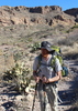
| no partners | | The planned route was an attempt to follow @Lizard's original Club Cabin description with two key differences: I wanted to reverse it and use Sandy Saddle to go up (instead of Half Moon / Rock Creek). However, things didn't go well and I ended up bailing on the last leg.
Barnhardt #43
First time heading up this trail in daylight. Starting to get a bit overgrown in sections, all friendly green stuff that never hurt nobody. Bumped into a yuge group (12+) from Prescott Comm. who were doing a 3-week trip from here to Fossil Creek. These would be the last people I'd see in... a long time.
Sandy Saddle #231
Good grief. Even getting to Castersen Seep involved trekking-poles-above-head wading through the manzanita. There are sections of defined tread and clear track, they are just few and far between. Castersen was okay, few tanks w/ skunky water. Had a hard time tracking trail over to the next wash, and that last climb doesn't believe in switchbacks. Made it to the saddle proper with the sunset, a solid hour behind schedule. This would make a decent camp, plus there were tanks few hundred yards to the west for water. Unsure of how dependable they are.
Anyways, didn't even try to look for tread coming down the west side, just dropped in the drainage and followed it down. The wash was easy enough to navigate in the twilight / moonlight and I made it to Divide Trail, then Horse Camp Seep, without needing headlamp. Rehydrated and snoozing in hammock by ten.
Mazatzal Divide #23
As usual, big views. Was cool to look down from the ridge above the Park and try to track where Willow Spring plays on 6351'. Trail is in great shape. Thought about pushing on to Pete's Pond to camel up and didn't - stupid mistake.
Willow Spring #223
Heh. That first mile is turrible. Deadfall wasn't really a problem, more the manzanita and loose rocks underfoot. Found no cairn or tread along the way. Got a gnarly bloody nose here too thanks to a face-whacking branch, took way too long to stem the flow. Things got better on the ridge, with old tread and game trails providing an easier way forward through the shorter brush. Views across Maverick Basin were ridiculously awesome, too.
The dance along the side of 6351' was annoying, with the trail fading in and out of existence and too few cairns to connect the dots, and a pretty steep hillside to work along. Short section of good trail on the drop until it faded out again and I ended up taking a rocky drainage down to wash below. At this point I was starting to run low on water and decided to stick to the sandy wash in hopes of finding water (and maybe to avoid the manzanita/deadfall mix that waited on the southern bank). Found a decent tank (though I suspect it was only there from last night's rain) and filtered up, spooked an elk while packing up, and then hacked my way back up to trail.
Things gradually got easier along the ridge and, by the time I bumped into the Midnight Mesa Junction, the trail was straightforward to pick out. Dancing along the side of Midnight Mesa was downright fun, and the rest of the hike to Mountain Spring was enjoyable as well. Reached the spring with two hours of daylight for camp chores and treated myself to some homemade thai curry mix and a quick trough-side rinse-off.
Aside from the second night: at about ten at night that elk showed up for a drink. Darn thing was less than ten feet away before I realized he wasn't another tiny nocturnal rodent. Seeing a giant rack upside down, looking down on you as you cowboy-camp, is a hell of a way to wake up. Spooked him off and then fell back asleep to his annoyed bugles. Elk sound silly when they're angry.
Deadman #25
Getting to the junction is easy to follow, and there is a good path w/ cairns that lead down to Horse Creek. And then it disappears. Tried going up and down the banks a few time to find where it climbs and eventually just hacked up the hill. It's frustrating, because there are two old barbed fences to cross, and one would think that there'd be a gate or cairn or something to mark where you're supposed to pass through them - nothing. Got to practice my Zeta-Jones skills squeezing underneath the wires, at least. Tread shows up at the next drainage crossing and is easy to follow for the next mile, then gets faint on the long drop to Deadman Creek.
Deadman Creek seems to be dependable here, with lots of friendly trees and some reeds growing around the trickling waters. Trail was hard to track on the other side - I crossed, got to the corral, and then followed the fence east, and then lost it. Think I should have gone further east. Anyways, hacked my own way up some turrible brush and then picked a route up the hill. Found a few cairns but the tread wasn't trackable for too long. Felt like it took forever to climb up to the saddle. Once I reached the top, feeling a bit light-headed from the growing heat, I was immediately stung several times by a wasp. Made it down to the junction w/ Davenport Trail before the reaction started getting serious.
This is when things get a bit blurry. I reached out to wife (@klemerick) via inReach and let her know what had happened. I decided to head up to Club Cabin and rest for a while, took every ounce of energy to make it up that hillside - something was definitely off, either from heat or sting or both. Once I got there I remember wandering around, uncertain of what to do next, taking almost an hour before realizing that I should be drinking water given the 100+ temps. @klemerick was in constant contact and she decided that I needed to get out of there the fastest way possible, down Davenport, and that she and @reynchr would help me out along the way. Spent the rest of the day futzing around the cabin, not doing much of anything, mostly trying to get a grip on things. It was terrifying.
Davenport #89
Woke up the next morning feeling slightly better, still off. Those little climbs, especially near Rock Spring, kept knocking the wind out of me. At least the path was easy to track after the last few days - think I only lost it twice, and was able to quickly backtrack and get back on it. Don't know how I had such a hard time following it last year lol. Made it about halfway down that last mesa, outside the wilderness boundary, when a USFS truck showed up to give me a ride the rest of the way.
My rescuers, @klemerick and @reynchr, had spent the night at Sears Trailhead and left a water cache for me there while they went back and tried to find a way to get their vehicle across the Verde. By sheer luck they bumped into a ranger at the camp and explained the situation. He had access to the dam gates and drove over to save me the last four miles of hiking, which was definitely appreciated. Made it out of there in relatively good shape, though I was still shaky and weird from the day before. I have no idea how I would have gotten out of there without their help, though - trying to cross back over to Barnhardt would have been far outside my capabilities in my shape. Am very grateful for them.
Mazatzal Miles: 164.6/275 (60%) |
  |
Castersen Seep |
Dripping |
Dripping |
| | | Well, the seep proper was dry, but there were tanks downstream that held water. | | _____________________
| | |
|
|
|
 Route Editor


 We went upstream to Horse Camp Seep, playing in the other 6 waterfalls along the way. Then we headed back.