|
| | | |
| |
|
| Hiking | 7.60 Miles |
1,400 AEG |
| | Hiking | 7.60 Miles | | | |
| 1,400 ft AEG | | | | |
|
|
| |
| Linked |
|
none
[ show ]
| no linked trail guides |
| Partners |
|
none
[ show ]
| no partners | | This is a little tardy and I apologize, but I thought I should post it anyway since there has been no trip report on this hike since last summer when the trail and trailhead were still closed in the aftermath of the Sunflower fire of 2012.
Two friends, one of whom I had not hiked with since the '70s, wanted to give their legs some exercise. I suggested this trip, as defined by GPSJoe (another of his many contributions to this site and the hiking community, bless his soul). They thought it sounded great and set it up. I had done this hike back in 2010 and enjoyed it very much. Then I remembered that the Sunflower fire in 2012 had burned over this area, and wondered if a trip now would be that enjoyable. I checked the trip reports and found that none had been filed since last summer (2013) and it said that the Mormon Grove trailhead, the starting point, was still closed. What to do? We decided to see if it was open, and if it wasn't to go to plan B which meant another destination.
We were pleasantly surprised to find the trailhead and trail OPEN! So we decided to go with plan A, and to check on how the area was recovering. The old corral at the trail head is essentially gone, as are the signs at the intersection of the trail in with the AZ Trail.
But we were also pleasantly surprised to find that the fire was spotty, hitting some areas and not others (not uncommon in wildfires). The trees were burned badly in the fire areas and will never come back - but the undergrowth is bouncing back in surprisingly fine fashion (in our opinion).
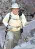
I left my camera in the car, but BobF, one of my hiking partners, took lots of photographs which he kindly allowed me to post on this site. You can see for yourself, how the area looks, thanks to Bob.
One problem that remains is that trail erosion has resulted from rains since the fire (also, not uncommon after wild fires). In places, the trail is in poor shape, but passable.
Two other surprising things resulted from this trek:
First, the mercury processing plant and most of its artifacts have been removed from the site. This includes the rock crushing equipment, the buildings, the old truck, and the mercury condenser. Still left are the concrete pads and the steel ball mill. I suspect the ball mill is packed with re-hardened rock dust and weighs way too much to attempt to remove. I don't know when and how this removal happened. The roads in and out don't look like there has been big equipment brought in, so it remains a mystery to me. Maybe someone on this site knows the answer to this mystery. Helicopter?
The second thing is that in another act of forgetfulness, I left my hiking pole at one of the mining audits up canyon from the processing site (this is not at all surprising to my wife). I didn't realize that I didn't have it until several miles away on our trip back to the trailhead. I wasn't going to extend the trip by 4 miles just to get it.
But, to turn this lemon into lemonade, SuzanneT and I decided to hike into the site on the following Tuesday, our regular hiking day, to attempt to find my pole. But we decided to go in another way. We chose to use FR 25A, so we parked at about the intersection of FR25 & 25A and treked in from there. I'm glad that I didn't drive this road, since there are several areas that involve rock crawling, which my Xterror is not equipped to do. But it is an interesting hike (and a shorter route in) along Sycamore Creek, which was flowing. There were lots of fall-painted Sycamore trees along the creek bed.
Suffice it to say, that I did find the hiking pole on this trip, giving cause for celebration - mission accomplished. Thanks for listening. |
| _____________________
| To plunder, to slaughter, to steal, these things they misname empire; and where they make a wilderness, they call it peace. -- Publius Cornelius Tacitus (56 AD – 117 AD) |
| | |
|
|
|
 Route Editor


 Saddle Mtn Trail -