username
X
password
register
for free!
help
ArticlesGuidesRoutes
 
Photosets
 
 Comments
triplogs   photosets   labels comments more
Dripping Springs from Woodbury - 16 members in 32 triplogs have rated this an average 3.3 ( 1 to 5 best )
1, 2  Next
32 triplogs
login for filter options
Dec 06 2023
avatar

 Guides 59
 Routes 1,100
 Photos 1,191
 Triplogs 1,290

male
 Joined Jan 01 2023
 Arizona
Fraser - Randolph LoopGlobe, AZ
Globe, AZ
Hiking avatar Dec 06 2023
pseudalpineTriplogs 1,290
Hiking9.94 Miles 1,103 AEG
Hiking9.94 Miles   3 Hrs   36 Mns   2.88 mph
1,103 ft AEG      9 Mns Break
 
1st trip
Route Scout Route Recorded  on Route Scout | Pop | Map | Popup | MapDEX
Meh, an easy and mediocre loop considering the crappy approach drive with all the geriatric snowbird side by siders. Completed in reverse (CCW), descending the uninspiring Randolph Canyon first. Cow feces everywhere, loaded up with dry burdocks, mostly pre-burnt with overgrown, unnecessarily cairned side passages. Every hike can't be great, but I guess no trail should go unhiked. : wink : Dese was with me, so it was an appropriate pick for today, but both of us couldn't wait until this loop ended!
 Fauna
 Fauna [ checklist ]
[ checklist ]  Dog  Rooster
 Named place
 Named place [ checklist ]
[ checklist ]  J F Ranch

water 1 out of 5water less than maxwater less than maxwater less than max Dripping Spring Dripping Dripping

dry Fraser Canyon Dry Dry

dry Randolph Spring Dry Dry
Just pools.

water 1 out of 5water less than maxwater less than maxwater less than max Red Tanks Canyon Pools to trickle Pools to trickle

dry Whetrock Canyon Dry Dry
  3 archives
Jan 08 2022
avatar

 Guides 12
 Routes 192
 Photos 863
 Triplogs 356

42 male
 Joined Nov 30 2015
 Phoenix, AZ
Fraser - Randolph LoopGlobe, AZ
Globe, AZ
Hiking avatar Jan 08 2022
ShatteredArmTriplogs 356
Hiking9.30 Miles 1,100 AEG
Hiking9.30 Miles   4 Hrs   20 Mns   2.66 mph
1,100 ft AEG      50 Mns Break
 no routesno photosets
1st trip
Been meaning to check this out for awhile. The road has gotten quite a bit worse in the past year, but a Subaru Crosstrek can still make it. Barely. Dropped down to Woodbury Trail, which is almost nonexistent at this point. Noticeably more so than a year ago.

Poked around the JF ranch for a little bit. Didn't know there is a fully intact house there. After this point, we decided to disregard the trail altogether since it was covered in catclaw and the creek is nice and clear.

Got down to the confluence in a couple hours and poked around a bit in the Dripping Springs area. Some nice cottonwood trees here; nice spot. Good flow in the creek.

Randolph Canyon was great along Red Tanks trail (which we also ignored in favor of staying in the creek). Upstream from where the trail departs was pretty uninteresting; the canyon is just entirely filled with sand at this point.

Fun adventure overall, and I like seeing all the creeks flowing in the Superstitions. Kinda regret not having seen those canyons before they were filled with sand, though.

water 1 out of 5water 2 out of 5water 3 out of 5water less than max Fraser Canyon Medium flow Medium flow
Good flow up to Whetstone Canyon, intermittent flow from there up past Fraser ranch.

water 1 out of 5water 2 out of 5water 3 out of 5water 4 out of 5 Musk Hog Canyon Heavy flow Heavy flow
Accounted for most of Fraser's flow.

water 1 out of 5water 2 out of 5water 3 out of 5water less than max Randolph Spring Gallon per minute Gallon per minute
Creek was flowing, hard to tell what's actually coming from the spring.

water 1 out of 5water 2 out of 5water 3 out of 5water less than max Red Tanks Canyon Medium flow Medium flow
Good flow, probably equaled the flow from Randolph.

water 1 out of 5water 2 out of 5water 3 out of 5water less than max Whetrock Canyon Medium flow Medium flow
_____________________
  7 archives
Dec 03 2021
avatar

 Routes 31
 Photos 4,724
 Triplogs 187

50 male
 Joined Mar 14 2016
 Gold Canyon, AZ
Dripping Springs from WoodburyGlobe, AZ
Globe, AZ
Hiking avatar Dec 03 2021
00blackoutTriplogs 187
Hiking8.60 Miles 1,012 AEG
Hiking8.60 Miles   4 Hrs   45 Mns   1.81 mph
1,012 ft AEG
 no routes
1st trip
Linked   none no linked trail guides
Partners none no partners
Took a day off from adulting yesterday and headed up 172 to the Woodbury TH. Climbed over the gate and made my way down to Coffee Flat. Like a lot of trails in the Superstitions nowadays it's easier to stay in the creek bed as it avoids the bush whack and the catclaw (took one across the face that left a nice mark). No water in the creek until I got near Musk Hog Canyon where there was a light flow with a couple of pools (some not so good) I'm assuming from Musk Hog Spring but not positive. At Musk Hog the creek turned more riparian with a good amount of the Cottonwoods and Superstition savannah grass. Made it to the Fraser/Randolph confluence, checked out Dripping Spring and relaxed for a bit. The confluence is one of my favorite areas in the western half of the wilderness but it definitely has lost some of it's luster. It's clear the area had a major flood this summer that covered most of the beautiful purple/pink sandstone with dirt and sand. Relaxed there for a good 30 minutes and made my way back. I had forgotten how pooey the hike back up the road after the ranch is, made the hike more meh. There were 3 other trucks at the TH but I saw no one else the entire time other then a couple doe near the confluence. RS still giving me some issues where I have to restart it but it was only a few times yesterday compared to previous times.
 Named place
 Named place [ checklist ]
[ checklist ]  Dripping Spring  J F Ranch
foliage observationfoliage observationfoliage observationfoliage observationfoliage observation
Autumn Foliage Observation Light

water 1 out of 5water less than maxwater less than maxwater less than max Dripping Spring Dripping Dripping

water 1 out of 5water less than maxwater less than maxwater less than max Fraser Canyon Pools to trickle Pools to trickle

water 1 out of 5water less than maxwater less than maxwater less than max Musk Hog Canyon Pools to trickle Pools to trickle
_____________________
Hiking is just walking where it’s okay to pee. :y:
  1 archive
Dec 30 2020
avatar

 Routes 175
 Photos 2,335
 Triplogs 191

44 female
 Joined Jan 21 2019
 Pine, AZ
Bushwhackers Paradise - Supes loop, AZ 
Bushwhackers Paradise - Supes loop, AZ
 
Hiking avatar Dec 30 2020
jillyonanadventureTriplogs 191
Hiking11.68 Miles 1,195 AEG
Hiking11.68 Miles   6 Hrs   42 Mns   1.99 mph
1,195 ft AEG      49 Mns Break
1st trip
Partners none no partners
A nice long loop in the Supes exploring a couple of new {to me} areas, along with some others I’d seen before. Things started off very chilly and windy in the morning, but within an hour or so, layers were coming off. We had a nice trail on the way in, although the Cockscombs were full on Ralphie's Red Ryder to the dogs. :( Be prepared with scissors if bringing dogs (especially any longer haired dogs) into this area. Arriving at Red Tanks was my favorite part of the hike, as that canyon is just so stunningly beautiful. That wasn’t part of our official route, but we did venture down a bit & see some pools of water. Dripping springs looked completely different than the last time I had visited as it was pretty much completely dry. The fall colors were still gorgeous in this area though! We took a snack/drink break here before heading back to the second portion of our loop. I’m not sure if this was just completely destroyed by the fire/draught, but this section was just miles of complete bushwhacking - so much catclaw, foxtails and super easy to lose any type of “trail/path.” We finally got through this section and had a steady climb up to get back to the trailhead. We were all pretty tired by that point and very excited to see the vehicles! During the hike, we only saw one couple at dripping springs (man was carrying a machete!), but on the way out we were pretty shocked by how crowded it was on the Woodbury road, especially towards the beginning. Tons of ATV’s, people shooting, what looked like big set ups for large parties, etc. Despite the bushwhacking and chilly temps, the company was excellent and it was overall an enjoyable day and great escape from all the stress of life. Note: do yourself a favor and wear hiking pants; leggings were a very unwise choice. :sweat:

water 1 out of 5water less than maxwater less than maxwater less than max Red Tanks Canyon Pools to trickle Pools to trickle
water report recorded in the field on our app Route Scout
_____________________
Restless between adventures...
 
May 17 2019
avatar

 Guides 117
 Routes 338
 Photos 11,399
 Triplogs 894

63 male
 Joined Dec 20 2010
 Sunnyslope, PHX
Fraser - Randolph LoopGlobe, AZ
Globe, AZ
Hiking avatar May 17 2019
kingsnakeTriplogs 894
Hiking11.45 Miles 1,265 AEG
Hiking11.45 Miles   6 Hrs   6 Mns   1.88 mph
1,265 ft AEG
 no routes
1st trip
Since temps were expected to be very comfortable last Friday, I decided to stay in the Valley. (More or less.)

The furthest I had ever been up rocky, bumpy, FR 172 was Pam's New Year climb up Roblas Butte back in 2016: [ photoset ]

I took my time driving up FR 172, enjoying the views, and taking care in what to me were trickier sections. The last thing I wanted was a flat, or to puncture the oil pan, as FR 172 has no cell reception at all. It took me 1h 15m. I started hiking at 8:30 a.m.

The turn off for Coffee Flat Trail #108, down Fraser Canyon, is just before Woodbury Well, and is marked by a cairn. But first I explored the well. It has a windmill, but it no longer operates the pump, which is now solar-powered. At the base of the windmill was an elevated rubber pipe end, which was giving a steady flow of clear water. Two adjacent large plastic tanks sound like they were both full. (I knocked.) A spring box was dry, but a cattle tank was close to full. There were a number of well-licked salt blocks laying about. 🐄

Coffee Flat Trail #108 would have been a great hike had it not been for the INSANE amount of foxtail on it, particularly below JF Ranch. I'm not joking when I say sometimes the trail disappeared in the foxtail. I suppose I should have followed recommendations and hiked the canyon bottom, but I wanted to lay down an accurate track. 🙄

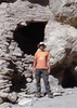
Fraser Canyon gets pretty tight for the next two miles, past Whetrock Canyon and Musk Hog Canyon, to Dripping Spring. There’s a decent amount of shade, and lots saguaro on the canyon slopes. Near Whetstone Spring, I found an mine adit that went in less than 50 ft.

I took a break at Dripping Spring, contemplating my foxtail riddled shoes & socks. I decided it would take too long to de-foxtail them, and that the existing infestation might somewhat innoculate me against further foxtails I might accumulate in Randolph Canyon. 🤔

After my break, I started up Red Tanks Trail #107, which passed by some pools and pretty purple boulders & slick rock. Along the way, I encountered a gila monster — the first one I’ve seen in the wild since I hiked from the Bronco Trailhead to Cave Creek in 2016.

After a ½ mile, Red Tanks Trail #107 heads north while Randolph Canyon continues northeast. I thought at first I might have found a use trail, but it quickly disappeared. I really did not want to fight catclaw for four miles, so I stuck to the rocky canyon bottom. That got old quick.

Though Randolph Canyon only climbs 500 ft. in the 3.5 miles to JF Trail #106, it felt like I was climbing stairs the whole way. My leg muscles got so tired, I briefly considered turning back, and even had non-sensical thoughts like “drop pack” and “cross country would be easier”. Both would have been bad news. I had to gut it out.

A few minutes before I reached Randolph Spring, I came within 5 ft. of a wetern diamondback sunning itself on a pink boulder. Naturally, I jumped back, but he never did rattle me, or even coil. 😅

Despite mostly staying in the rocky bottom of Randolph Canyon, I still accumulated scads more foxtail, as I occasionally had to work my way around an obstacle, trying to keep my stabby feet dry. (I eventually gave up staying dry.)

Two and a ½ miles up Randolph Canyon, I was dead tired. Naturally, that is when I encountered a 2-3 ft. high fence, across the wash. I’ve seen read that there is a gate in the brush on the side of the wash. Not knowing it at the time, I wondered how I could lift my weary legs over the fence, as there was no room to low crawl it. Even if there was, I did not have the energy to get back to my feet. After contemplating my options for a few minutes, I settled for stepping on the fence, depressing it enough that I was (barely) able to lift my other leg over it.

Finally, after nearly seven hours, I came to JF Trail #106. Though there is a cairn, the trail is faint. If you miss it, and really enjoy rock hopping, JF Trail #106 crosses Randolph Canyon a second time, in another half mile. I opted to climb the 150 ft. out of the canyon, stopping several times along the way for 10 seconds here and 15 seconds there. I was spent. 🚑

About halfway between the Woodbury Well and the trailhead, I got rattled by a second western diamondback*, on the left side of the jeep trail. Surprised, I did the hokey pokey back step. After gathering my senses, I walked around him.
* I almost ran over two more western diamondbacks on my drive back down FR 172! 🐍
I returned to the Woodbury Trailhead at 4:10 p.m., after nearly eight hours of hiking. (I might have taken even more time, if I was not concerned about getting back to pavement before dark.) Cold beer never tasted so good!

In summary, I liked Fraser Canyon, but downgraded it a star due to all the foxtail. Randolph Canyon blew chunks.

Drive to Woodbury TH: https://vimeo.com/490162864
Hike Video: https://vimeo.com/490169304
wildflower observationwildflower observationwildflower observationwildflower observationwildflower observation
Wildflowers Observation Light
Desert Marigold, Ocotillo, Cholla, Flat Top Buckwheat, Desert Lavender, Sacred Datura, Prickly Pear Cactus, New Mexico Thistle, Saguaro, Salt Cedar and -- of course -- Brittlebush.

dry Fraser Canyon Dry Dry
Some water here & there, but not comparable to Randolph Canyon.

water 1 out of 5water 2 out of 5water less than maxwater less than max Randolph Spring Quart per minute Quart per minute
Pools, and flow from trickle to audible pour, both above & below Randolph Spring. Some of the pools decent size. Some with algae, some crystal clear.
_____________________
http://prestonm.com : Everyone's enjoyment of the outdoors is different and should be equally honored.
  1 archive
Mar 16 2019
avatar

 Guides 6
 Routes 183
 Photos 5,612
 Triplogs 1,647

male
 Joined Mar 12 2004
 Scottsdale, AZ
Fraser - Randolph LoopGlobe, AZ
Globe, AZ
Hiking avatar Mar 16 2019
John9LTriplogs 1,647
Hiking10.00 Miles 1,245 AEG
Hiking10.00 Miles
1,245 ft AEG
 no routesno photosets
Met up with Kyle for a nice hike in the Supes. We made the drive to the Woodbury TH and headed in. We opted for a CCW loop starting with Randolph Canyon. There was a quite a bit of water after a couple of winter storms a few weeks prior. We tried keeping our feet dry but it was more of a hassle so we jumped on in. Most of the water was ankle deep with a few knee deep pools. We took a break by the spring with the concrete dam and continued until we reached the Red Tanks Trail. This was the highlight of the hike. We opted to follow the creek down as we headed south and all the water made for a memorable hike. There were several small waterfalls and we really enjoyed this section. We took a break by Dripping Springs and then headed back on the Coffee Flat Trail.

Along this section we had an interesting encounter with a fox. It appeared on the trail and was trotting right towards us. We thought it would flee as soon as it saw us but it kept approaching. I tossed a couple of rocks in its direction but it kept coming at us. Kyle then threw a rock near it and the fox got the hint and ran off into the brush about 12 feet off trail. We didn’t linger as we headed up the trail and got out of there. It was a very weird and unusual encounter. I’m not saying the fox was rabid but something wasn’t right. The rest of the hike was uneventful. We would see the one and only person along the hike near the Woodbury TH. It was an older guy who was doing a multiday backpacking trip. We got back to the jeep soon after and headed back to Phoenix.
_____________________
 
Feb 16 2019
avatar

 Guides 1
 Routes 2
 Photos 472
 Triplogs 38

female
 Joined Apr 27 2015
 cave creek, az
Dripping Springs from WoodburyGlobe, AZ
Globe, AZ
Hiking avatar Feb 16 2019
thirstylizardTriplogs 38
Hiking9.52 Miles 1,363 AEG
Hiking9.52 Miles   4 Hrs   58 Mns   1.92 mph
1,363 ft AEG
 no routes
1st trip
Linked   none no linked trail guides
Partners none no partners
This was another fine hike we got ourselves into...

We decided to take the JF / Woodbury route to Coffee Flat Trail instead of 172B road from the trailhead. A nice choice but we distracted ourselves too long and missed our turn and so we did a “Heidi” bushwhack across to get where we needed to be. I am not sure “Heidi” bushwhack is an actual hiking term, but I use it to describe something that involves almost no obstruction in getting across the land in between oneself and one’s target location. Cattle grazing has probably helped make the hillside less cumbersome to cross and no doubt added to the distribution of wildflowers.

Back on track, we made it to the ranch and headed out on the Coffee Flat Trail. Water running the entire way but not to a negotiation issue level. The views were nothing less than “Wow!” and while we didn’t see wildlife, plenty of varied track was left in the mud along our route.

Toward the intersection with Red Tank Trail, evidence of fall beauty could be found under foot, making this a possible return trip in a different season. Lovely water running all over the red rocks at the tanks. Due to the water level, we did a little bushwhack to Dripping Springs which was a full waterfall.

As we turned back, we ran into more hikers who told us they were going back via Randolph Canyon. That may have to be my variation for the next trip. We also saw some cowboys from South Dakota out for a ride.

The trip back was a bit faster paced but no less enjoyable. We hiked the road out and that was a bit of a cardio climb. That, along with the little gate climb over, provided a little bitty boot camp experience for the finish.

I am sure the basic and sad rule of HAZenomics applies to days like this... “If your boot is on one trail, it cannot be on another.” But if one must put a boot down somewhere, this is a very good “where” to be.
 Culture
 Culture [ checklist ]
[ checklist ]  HAZ Decal
 Named place
 Named place [ checklist ]
[ checklist ]  Dripping Spring  J F Ranch
_____________________
  2 archives
Jan 27 2019
avatar

 Guides 44
 Routes 162
 Photos 24,766
 Triplogs 2,411

75 male
 Joined May 04 2004
 Mesa, AZ
FR172B Dripping Springs Woodbury Loop, AZ 
FR172B Dripping Springs Woodbury Loop, AZ
 
Hiking avatar Jan 27 2019
CannondaleKidTriplogs 2,411
Hiking10.00 Miles 1,902 AEG
Hiking10.00 Miles   5 Hrs      2.07 mph
1,902 ft AEG      10 Mns Break20 LBS Pack
 no routesno photosets
1st trip
Partners partners
trixiec
The original plan was to climb Peak 3635 just off the Woodbury Trail then explore some mines in the other direction.
That plan only lasted 2 miles at the point we would need to leave the trail and begin the ascent. Neither one of us liked the look of any of the possible routes I had mapped out, at which point Tracey asked have we ever hiked to Dripping Springs from Woodbury. We had not, so we continued on to Dripping Springs, enjoying the quiet broken only by chirping of various birds.

We took a short break at the springs then headed back along the Coffee Flat and Woodbury Trails. Shortly before reaching the JF Trail intersection we encountered a spike buck white-tail(?) just staring at us. The left 'spike' was barely a half-inch long and the right maybe an inch. It kept an eye on us until we were out-of-sight.

Eventually we crossed the JF Trail and continued east to pay a visit to a few old mines. Since we had no planned on the out-and-back to Dripping Springs, by time we reached the first mine and found little of interest, we decided to skip the 1+ mile to the next one. Rather than returning on the Woodbury Trail to JF Trail and back to the TH, we climbed to the top of the ridge, scaled the fence then took a decidedly rough off-trail route back to the TH.

Good thing we started early as the vehicle traffic on FR 172 was already getting crazy, so we returned following the wash back to Hewitt road. By then the ATV traffic on Hewitt road was absolutely nuts, but I guess that's to be expected on a winter weekend.

So, between the 4x4/ATV traffic and the upcoming Renaissance Fair, we won't be going out this way except on weekdays.
_____________________
CannondaleKid
 
Jan 05 2019
avatar

 Guides 1
 Routes 447
 Photos 4,407
 Triplogs 938

68 male
 Joined Mar 09 2012
 Gilbert, AZ
Fraser - Randolph LoopGlobe, AZ
Globe, AZ
Hiking avatar Jan 05 2019
rayhustonTriplogs 938
Hiking10.28 Miles 1,305 AEG
Hiking10.28 Miles   4 Hrs   41 Mns   2.36 mph
1,305 ft AEG      20 Mns Break
 no routes
1st trip
Partners none no partners
I don't know which I enjoyed more, the drive to the trailhead or the hike itself. Both were certainly worthwhile.

Although I've been to Dripping Spring many times, this is the first time I've attempted it from the Woodbury TH. I was not disappointed. Interesting geology in the creek beds, opportunities to go exploring in the nearly hills that line the creeks and fabulous views. The best part of the hike is the area near Dripping Springs where the canyons come together. I love that area.

I saw two couples out hiking. I met the first not long after I started the hike. I met the other near JF Ranch as I was finishing the hike. I stopped and chatted with both. I finished the hike on the forest road just past JF Ranch. Nice, long uphill boost to finish the hike.

The skies were overcast for the most part with the sun peeking out as I returned along Fraser Canyon. Not much water in the creeks; a few pools here and there. The temps were perfect.

This was a very enjoyable hike.
 Named place
 Named place [ checklist ]
[ checklist ]  J F Ranch

water 1 out of 5water less than maxwater less than maxwater less than max Dripping Spring Dripping Dripping
Had lunch right next to it. I could hear it dripping,

dry Fraser Canyon Dry Dry

dry Randolph Spring Dry Dry

water 1 out of 5water less than maxwater less than maxwater less than max Red Tanks Canyon Pools to trickle Pools to trickle
Not much, but a few clear pools

_____________________
 
May 07 2018
avatar

 Guides 44
 Routes 162
 Photos 24,766
 Triplogs 2,411

75 male
 Joined May 04 2004
 Mesa, AZ
Peak 3856 - Iron Mountain Quad, AZ 
Peak 3856 - Iron Mountain Quad, AZ
 
Hiking avatar May 07 2018
CannondaleKidTriplogs 2,411
Hiking4.50 Miles 1,394 AEG
Hiking4.50 Miles   2 Hrs   57 Mns   1.53 mph
1,394 ft AEG15 LBS Pack
 no routes
1st trip
Partners none no partners
Planned to hit three peaks from the Woodbury TH but I forgot the CamelBak bladder in fridge so with it expected to hit 100+ I just bagged the closest peak instead.
_____________________
CannondaleKid
  1 archive
Mar 17 2018
avatar

 Guides 1
 Routes 148
 Photos 9,924
 Triplogs 3,652

63 male
 Joined Apr 02 2005
 Mesa, AZ
Coffee Flat Trail #108Phoenix, AZ
Phoenix, AZ
Hiking avatar Mar 17 2018
Tortoise_HikerTriplogs 3,652
Hiking8.90 Miles 1,253 AEG
Hiking8.90 Miles   4 Hrs   8 Mns   2.15 mph
1,253 ft AEG
 no routes
Partners partners
wallyfrack
I went checking out some stuff with Wally in the Supes. He is also helping me do some parts of trails I have not done yet. Today we did all the Woodbury and the part of Coffee Flat Trail I had not done. Coffee Flat write up only goes to Reeds or Dripping Springs, I believe. It really goes all the way to JF headquarters so we did the section from JF to Dripping Springs today. Dripping Springs is just a wet wall with no pools to filter. There was some nice little pools right across the way in the wash beside the intersection of Coffee Flat and Red Tanks trails. Looked clean enough to filter in my opinion. Coffee Flat trail went in and out of the wash from time to time. I thought it was a pretty good trail with some good scenery. Wally led me on a little exploring also :o :) . It went well and I stayed upright this time :D . Good weather, good company, good times! Thanks Wally, :yr:
_____________________
Tortoise Hiking. Stop and smell the Petrichor.
 
Feb 11 2017
avatar

 Routes 67
 Photos 2,708
 Triplogs 755

89 male
 Joined Mar 28 2008
 Phoenix, AZ
Fraser - Randolph LoopGlobe, AZ
Globe, AZ
Hiking avatar Feb 11 2017
Tough_BootsTriplogs 755
Hiking9.87 Miles 1,209 AEG
Hiking9.87 Miles
1,209 ft AEG
 no routesno photosets
1st trip
Partners partners
clairebear
John9L
juliachaos
This turned out to be a really nice day. I thought it was going to get toasty but the clouds stayed above us. The dogs were loving all the water. The water made this a great loop-- I don't think I would do this loop again without it. We did the loop counter-clockwise and had lunch at Dripping Springs where we saw the only other group all day. We short-cut it through the JF Ranch road on the return.
_____________________
 
Feb 11 2017
avatar

 Photos 188
 Triplogs 163

43 female
 Joined Oct 26 2011
 Tempe, AZ
Fraser - Randolph LoopGlobe, AZ
Globe, AZ
Hiking avatar Feb 11 2017
clairebearTriplogs 163
Hiking9.97 Miles 1,245 AEG
Hiking9.97 Miles   5 Hrs   2 Mns   2.22 mph
1,245 ft AEG      32 Mns Break
 no routesno photosets
1st trip
Partners partners
John9L
juliachaos
Tough_Boots
New trails to explore in the Superstitions ~. It was nice that Liz came out and joined us. From Woodbury TH we hiked a short distance and then turned into Randolph Canyon. We got a scare when Kiva flushed out a large javalina chasing it for a few minutes but she was fine and came back. After our lunch we turned into Fraser Canyon. Later on Kiva found some cows that she found very interesting. Then we exited the canyon and made our way up back passing the JF ranch along the way. Both canyons were interesting and different ~ it was nice to check out a new place. The canyons were also nicely empty with the exception of our group and I thought we would go the whole way without seeing another human until we passed a group near Randolph Spring where we paused for lunch.
_____________________
 
Feb 11 2017
avatar

 Guides 6
 Routes 183
 Photos 5,612
 Triplogs 1,647

male
 Joined Mar 12 2004
 Scottsdale, AZ
Fraser - Randolph LoopGlobe, AZ
Globe, AZ
Hiking avatar Feb 11 2017
John9LTriplogs 1,647
Hiking9.97 Miles 1,245 AEG
Hiking9.97 Miles   5 Hrs   2 Mns   2.22 mph
1,245 ft AEG      32 Mns Break
 no routesno photosets
Partners partners
clairebear
juliachaos
Tough_Boots
Headed out for a nice day in the Supes. Our group of four plus two dogs started hiking from the Woodbury TH around 10am and headed for Randolph Canyon. There was a nice flow of clear and cool water. From there we worked our way down canyon as we rock hopped and pushed through sporadic brush. It's easy going for the most part and very scenic. We took a short break by Randolph Spring and then took our lunch by Dripping Springs. We then started our return up Fraser Canyon. It's easy going again as there is less water and good trail for most part. We passed the JF Ranch and then followed the road back to our TH. We were done by mid afternoon. This was a really nice hike with a great group. We had perfect weather and it was great getting out. Thanks Kyle for driving.
_____________________
  1 archive
Mar 26 2016
avatar

 Routes 10
 Photos 121
 Triplogs 12

47 male
 Joined Mar 19 2012
 Phoenix, AZ
Dripping Springs from WoodburyGlobe, AZ
Globe, AZ
Hiking avatar Mar 26 2016
AsTheCrowFliesTriplogs 12
Hiking8.60 Miles 1,012 AEG
Hiking8.60 Miles   3 Hrs   45 Mns   2.46 mph
1,012 ft AEG      15 Mns Break6 LBS Pack
 
1st trip
Linked   none no linked trail guides
Partners none no partners
Woke up early this morning to scope for water at Dripping Springs before our 5 day backpacking trip in two weeks. I left the house about 4am and reached the Queen Valley turnoff about 5. When I finally got the Kia onto Hewitt Canyon I was surprised at how much worse the road was than the last time I was out here. Two years ago I drove a Corolla almost to Rogers TH before turning around. Definitely won't be doing that again!

I hit Woodbury about 6 and was on the trail shortly after. I had never done this route to Dripping Springs and was pretty surprised at how easy of a hike it was. Other than the steep climbs up the road at the beginning and end of course!

The trail started out easy to follow but shortly after the ranch house I lost it a few times and followed the creek bed. It didn't really matter though because either way it was pretty smooth sailing. It was a cool morning and I was pretty stunned by some of the views! Lots of cacti!

I ran into some water right around Musk Hog Canyon but I wouldn't have wanted to pump it because it wasn't flowing and had a nice scum on the surface. Fraser Canyon was much more promising as there were several large pools to filter and some areas were flowing lightly. I stopped for a break before turning around and had my breakfast near the Dripping Spring Beach (at least that's what I call it). Overall this looks like a good spot to work into a Superstitions loop in a few weeks. Always like to camp near water so I have more room for beer in my pack!

On my return trip I found a few sections of trail that I hadn't seen on my way in. The sun was finally coming over the mountains and that was when I realized I forgot my floppy hat... Bummer. I walked for about 15 minutes with my hand over my eyes before the sun was finally high enough to stop blinding me. Pretty sure that led to even more walking in the stream bed!

After I passed the ranch again I decided to take the road all of the way up to Woodbury rather than the trail. I thought better of that decision about halfway up as it seemed much steeper than the trail would have... Oh well, I guess it added a little variation to my trip!

I finally got to the car about 9:45 and headed back to civilization. Next week we are going to check out the Barnhardt Trail and see what the water situation is like there. Afterwards we have to decide where to go. After this morning, I really want to come back to the Superstitions!
wildflower observationwildflower observationwildflower observationwildflower observationwildflower observation
Wildflowers Observation Isolated

water 1 out of 5water 2 out of 5water less than maxwater less than max Fraser Canyon Light flow Light flow
Light flow and some deep pools near the sandy beach.
_____________________
  6 archives
Nov 05 2015
avatar

 Guides 16
 Routes 81
 Photos 1,269
 Triplogs 1,145

51 male
 Joined Apr 30 2008
 Tucson, AZ
trans-Supes (Miles to First Water), AZ 
trans-Supes (Miles to First Water), AZ
 
Hiking avatar Nov 05 2015
azdesertfatherTriplogs 1,145
Hiking37.30 Miles 6,300 AEG
Hiking37.30 Miles   16 Hrs   51 Mns   2.54 mph
6,300 ft AEG   2 Hrs   9 Mns Break
 no routesno photosets
1st trip
Originally planned to take a couple of days to do the Highline from end to end in Payson, but weather nixed that last minute as the first snow system of the year blew in 3-6". So, decided the day before to divert to the Supes and do a trans-Superstitions hike from east to west, and I decided on Miles as the start and First Water as the end.

There are lots of possibilities for something like this. Actually, if we had had a little bit more time, I would rather have taken a route that included Rogers Canyon Trail rather than the forest road between Rogers TH and Woodbury E TH, but we needed to shave off a few miles. Weather was nice for our trip, but we knew we only had a day and a half, as my friend Bill needed to get to another appointment, thus the cuts. My first time out on the trail with him, great company!

Spent the night at Miles Trailhead, just as the weather system was finishing up in the state. It actually still had more rain to get out of its system before daybreak, but we kept dry. Sure did make our start on day 1 a bit wet though, all the water on the grass and bushes had our pants, shoes and socks soaked through after we started out the next morning. Just before sunrise, checked out the property a little bit before starting on the trail. Was surprised to see a fairly new grave on the Miles property, dated 2014. Then stated down the West Pinto. At first the creek was dry, but once we passed Oak Flat the creek started building up a pretty nice flow. Past Oak Flat, there still was the sketchy trail for a few miles, requiring the GPS a few times. Saw a couple of whitetail deer on the trail, lots of bear scat (some fresh), punched through the catclaw and other bushes. We were able to make the high point of the trail, then descend to Rogers Spring, check it out and get to Rogers Trough TH by 11:30.

Bill and I coasted down the forest service road to Woodbury's eastern trailhead, seeing our only person for the day here...an ATV'er on the forest road. Once on Woodbury, much of it was intuitive, cross-country hiking, not any well-defined trail. I checked out the homestead again, whereby this time the bear scat of course was more like ... cow scat. Went around JF Ranch to hit the Coffee Flat Trail, which basically just follows Fraser Canyon's wash from the ranch to Dripping Spring and beyond before becoming an actual trail. Descended into Barkley Basin (love that view of all the saguaros in the basin!), then over to Miners Needle and the Dutchman Trail to get to Peralta. Bill had some foot trouble, all the water and wet feet on the trail led to some pretty nasty blisters that he ended up needing to have a doctor tend to (yikes!). Arriving at Peralta at 5:20, we decided to pause there for the afternoon, crashing nearby until sunup the next morning.

That next morning was a quick half-day, heading up Bluff Springs Trail from Peralta to the Terrapin, and then over Bull Pass Trail to the Dutchman Trail and out. On our second day, we didn't run into anyone until we were on the other side of Parker Pass, just a couple of miles from First Water TH. Did see another whitetail out there on day 2, though.

Trip took a bit longer than expected due to my friend's blisters, but not too bad at all. Had some nice breaks to sit down and admire the scenery, and give him a chance to go at his own pace and catch up to me. 10:45 day 1, 6:06 day 2.

water 1 out of 5water 2 out of 5water less than maxwater less than max Dripping Spring Quart per minute Quart per minute
pretty good water supply here today

water 1 out of 5water less than maxwater less than maxwater less than max Rogers Spring Dripping Dripping
slow trickle

water 1 out of 5water 2 out of 5water 3 out of 5water less than max West Fork Pinto Creek Medium flow Medium flow
pretty good, solid flow along the Pinto Trail, once west of Oak Flat
_____________________
"I went to the woods because I wished to live deliberately, to front only the essential facts of life, and see if I could not learn what it had to teach, and not, when I came to die, discover that I had not lived." — Henry David Thoreau
  2 archives
Jan 18 2015
avatar

 Guides 37
 Routes 556
 Photos 10,872
 Triplogs 1,052

43 male
 Joined Jan 21 2013
 AZ
Campaign TH to First Water TH, AZ 
Campaign TH to First Water TH, AZ
 
Backpack avatar Jan 18 2015
FOTGTriplogs 1,052
Backpack42.08 Miles 6,927 AEG
Backpack42.08 Miles2 Days         
6,927 ft AEG
 
1st trip
Due to coaching obligations, I was not able to maximize my MLK day weekend this year and had to settle for a Sunday to Monday over-night somewhere. I chose the Supes a place that I don't have a lot of
familiarity with ;

I chose your pretty standard Campaign TH to First Water TH over-nighter for the pups and myself. I was able to enlist the help of Chumley to set up my shuttle who surprisingly was very cool with the idea of waking up at 430 in the morning to drop me off at Campaign TH. I told Chumley that I thought I could make it across the supes in 32-34 miles, 35 tops. I think I may have missed a trail or two in my estimation :-k A very uncharacteristic mileage estimation by myself, very uncharacteristic, Kyle, and Chumley will attest to my usually very accurate trail estimation numbers.

Day One: 20.6 miles

Campaign Trail: Campaign Trail is always pleasant to me. I met a very large group of CCC employees out of Flag and they are in process of a multi day trail clearing project of Campaign Trail, might be a good time to hit trail, if you have never been.

Reavis Gap The trail is in great shape! Trail seems to be seeing some decent traffic this winter. Water everywhere, water on trail, water in secondary washes, water flowing at intersection with Pine Creek.

Reavis Ranch Trail (S): Ranch was dead, signs of over-night campers but everyone gone. Hike south was great, one of my favorite sections of trail in Supes. Water flowing nearly the entire way to saddle. I met a guy who said the reason he was hiking his dog out here was because of Blanco and Cup, I guess they have some fans, not to stroke their egos.

Roger's Canyon: Standard Roger's Canyon conditions, a little busy around the ruins. Water conditions very disappointing, the antithesis of the conditions I encountered earlier in day and far below other winters for comparison. However, on bright side Roger's Canyon Trail seemed to have been the recipient of some recent trail work and the climb to Tortilla Divide was pretty much brush free.

JF Ranch Trail: Camped near wilderness boundary at last available spot with water. Initially I planned to camp near this really pictureseque spot just before Dripping Springs, but I could tell Cup was beat. I figured I could make up those lost miles with an earlier start and I could also get Cup some extra rest for day two.

Day Two: 21.6 miles

Cup woke up relatively spry I packed up camp quickly devoured some oatmeal and coffee and hit the trail just before six.

Woodbury Head-lamped it not much to report.

Coffee Flats: I ran into two guys camping at Dripping Springs who immediately greeted Cup and Blanco by name, yup more fans :roll: Both guys were members on HAZ, but they said they don't really post much one username had a lot letters and numbers in it and I think the other one had a pirate it in it, I can't remember, but good guys, chatted for a minute and then continued mission. The cows have really done a number on this otherwise beautiful area.

Dutchman Trail I spent a lot of time on this trail on the second day and still can't think of anything nice to say, just a means to an end in the instance of this trip. Actually, did not mind the Dutchman, its just not my favorite trail in the Supes. Water conditions were great along trail, met some cool horsemen, a few hikers, and enjoyed the nice trail.

Bluff Springs Trail: short and sweet, lots of water took a dedicated break to filter and rest dogs.

Terrapin Trail: I did dread the Terrapin a little, because not the most ideal trail for making good time and it has seemed to drag on from past trips. However, it was a blur today, seems as quick as we started it we were finishing and getting back on the Dutchman again. Water levels good, but have seen better, but generally flowing up to divide on each side. Trail is over-grown in a few spots, and enough acacia to make you wish you wore pants, I know because I wore shorts.

Final Notes: An excellent way to see the Supes if you ask me, especially, if you are in a rush. It was very cool to go from the Pines to the desert to the riparian area of Fraser and essentially see all the Supes have to offer. I may have had a tremendous miscalculation in miles, however, I was correct in choosing the east to west direction of travel as my assumption that I would be losing more elevation then gaining. The profile really highlights the difference in elevations of the Eastern and Western Supes. I did choose the most dog friendly trails I could think of and Cup responded well. I was little worried about her the way she dragged herself into camp the first night, but she bounced back admirable and walked out right next to me at four o'clock on the dot today.
_____________________
  3 archives
Apr 27 2014
avatar

 Guides 48
 Routes 510
 Photos 9,555
 Triplogs 578

79 male
 Joined Dec 28 2006
 Scottsdale, AZ
Whetrock Canyon LoopGlobe, AZ
Globe, AZ
Hiking avatar Apr 27 2014
GrasshopperTriplogs 578
Hiking10.00 Miles 1,900 AEG
Hiking10.00 Miles   8 Hrs   20 Mns   1.71 mph
1,900 ft AEG   2 Hrs   30 Mns Break
 
Partners partners
FOTG
Oregon_Hiker
In December'07 while vehicle camping under Byous Butte for Christmas week with friends (re: my then typical holiday week at "Camp Grasshopper" [ photo ] ), one of our planned day hikes was to attempt the upper mining section down to Whetrock Canyon to visit the old wrecked "Modern Dairy- Globe,AZ" milk truck that I had only seen in 8) HAZ pictures- :next: [ photo ]

Here is a quote from my Dec 26th 2007 triplog:
"It was a beautiful blue sky day with no wind as we topped-out at the saddle. Heading down the backside of this saddle it was only about .125mls before this old, rocky mining road became completely washed-out and disappeared with bushwhacking required to reach the lower mine and our planned stopping point at that old Dairy Truck. Just too much of a hassle for us to enjoy continuing." :( In hindsight now 6+ years later, that rocky old, washed out, bushwhack mining road really did not disappear. What happened is that shortly after the 1st mine adit (see my posted GPS Route), the old road took a 90 degree turn to the right downhill, and I just missed it and continued straight "into a blood sucking jungle" ;) .

Honestly I never thought I would have the opportunity again to correctly hike this loop, but thanks to the invite from our HAZ- friendofThundergod(Lee), his long time Supes backpacking buddy-Jim, and Oregon Hiker(Larry) offering to drive us, I was off on another Whetrock Canyon adventure. This time a much more enjoyable visit and success! :thanx: [ photo ]

water 1 out of 5water less than maxwater less than maxwater less than max Dripping Spring Dripping Dripping
A "slow drip only" from wet rock/cliff wall and it would be difficult and time consuming to await a liter of water to filter or treat from this actual perennial spring source location. As of this date there was a number of water seeps and pooling within the slick rock intersection area of Dripping Spring (ie, at the intersection of Fraser Canyon and Randolph Canyon).

water 1 out of 5water less than maxwater less than maxwater less than max Whetrock Canyon Pools to trickle Pools to trickle
Some pool seeps in the middle and lower sections only. It should also be mentioned that it did rain some the day prior.
_____________________
(Outside.. "there is No Place Like It!!")
 
Jan 20 2013
avatar

 Routes 36
 Photos 2,658
 Triplogs 1,347

67 male
 Joined Jul 28 2004
 Scottsdale, AZ
Fraser - Randolph LoopGlobe, AZ
Globe, AZ
Hiking avatar Jan 20 2013
mazatzalTriplogs 1,347
Hiking9.30 Miles 1,175 AEG
Hiking9.30 Miles   5 Hrs   20 Mns   2.07 mph
1,175 ft AEG      50 Mns Break
 no routesno photosets
1st trip
Lots of boulder/rock hopping in Randolph with some nice slick rock areas too. The red tanks section and the area above Dripping Springs are very cool.
_____________________
  2 archives
Nov 17 2012
avatar

 Guides 44
 Routes 162
 Photos 24,766
 Triplogs 2,411

75 male
 Joined May 04 2004
 Mesa, AZ
Whetrock Canyon LoopGlobe, AZ
Globe, AZ
Hiking avatar Nov 17 2012
CannondaleKidTriplogs 2,411
Hiking7.20 Miles 1,522 AEG
Hiking7.20 Miles   4 Hrs   41 Mns   1.90 mph
1,522 ft AEG      54 Mns Break20 LBS Pack
 no routes
1st trip
Partners partners
trixiec
After the beating Tracey took on our White Canyon Promontory hike last week she wanted something a bit less challenging featuring an actual trail. Maybe a hike in the Supes but somewhere we hadn't hiked before. We'd never hiked west from Woodbury TH so figured that might be a good place to start. Then scanning the trails and GPS routes of the area the lines got a bit blurred and we settled for Whetrock Canyon loop... only a 6+ mile loop hike.

Now if she had read the description or any of the triplogs, I'm sure she would have put the kibosh on that real quick-like. But, she didn't, so who was I to say anything. [-(
But in truth, neither the drive up nor the hike were anything like what I read in the triplogs.

Even with the Cherokee being over a foot longer than a Wrangler and a 6" longer wheelbase, with a little extra care choosing the line we made it up FR1928 fine. Ok, so Tracey was ready to bail out a few times, but it really wasn't that bad... I didn't use either front or rear locker.
Note: The road is FR1928, not FR192B as designated in some triplogs.

As far as the trail conditions... yes there was plenty of thorny brush and cats-claw, but with no beaten path other than game trails it was just a matter of careful route selection to stay out of it. Neither of us got so much as a scratch from brush, and the only scrape Tracey got was from falling down when a rock turned over as she stepped on it.

The mine areas were interesting but we spent the most time taking photos at the remains of the old New Modern Dairy truck body hung up in the wash below the mines. With no frame who knows the how and why of it being there. From there we traversed across the slope for a while before dropping to canyon floor where we stayed for most of the hike while in Whetrock Canyon. The closer we got to Coffee Flat Trail, the more the terrain looked like White Canyon, Tracey's nemesis of last week. So once we turned onto the Coffee Flat Trail it was clear sailing for us. Most of the time when the trail left the wash we kept to the wash to avoid the somewhat overgrown thorny areas.

The road segment from JF Ranch to the gates above Woodbury TH went the smoothest of course, but it was just the beginning of our climb way back up to where we began. From the gates it was cross-country loosely following what may have been a road possibly 75 years ago crossing a fence line back and forth a number of times to avoid steep drops. So when we came over the last hill and saw the Cherokee below us, boy did that feel good.

And now the drive back down... a little more care was required on two deeply rutted turns than on the uphill but the only drama was how tight Tracey held onto the oh :pk: ! strap.

Overall though, it was a great hike and we took tons of photos. I cut it down to to the 50 I posted here on HAZ with the full set on my website as usual.
_____________________
CannondaleKid
 
average hiking speed 2.14 mph
1, 2  Next

WARNING! Hiking and outdoor related sports can be dangerous. Be responsible and prepare for the trip. Study the area you are entering and plan accordingly. Dress for the current and unexpected weather changes. Take plenty of water. Never go alone. Make an itinerary with your plan(s), route(s), destination(s) and expected return time. Give your itinerary to trusted family and/or friends.

helpcommentissue

end of page marker