|
| | | |
| |
|
| Hiking | 44.50 Miles |
11,000 AEG |
| | Hiking | 44.50 Miles | 49 Hrs 56 Mns | | 1.19 mph |
| 11,000 ft AEG | 12 Hrs 33 Mns Break | 45 LBS Pack | | |
|
|
| |
| Partners |
|
none
[ show ]
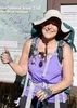
| no partners | | After previously backpacking every mile of trails/routes on the South Rim of the Grand Canyon, I decided it was time to complete Rim to Rim!  I got a permit for my last choice weekend, October 24-26, and backpacked across the North Kaibab/Bright Angel route. I got a permit for my last choice weekend, October 24-26, and backpacked across the North Kaibab/Bright Angel route.
Along for the trip were my parents, two siblings, and my brother's girlfriend (a total of six people). For some strange reason, NPS gave us a permit for 7 people, stating in an email that we had miscalculated the total fee for the permit, and they would be charging us for 7 people. Even after calling to make sure they knew we only had 6 people, they refused to update the permit or give a refund for the 7th person that didn't go along on the trip! Oh well...I guess it all worked out fine because we got to camp at the nice group sites. 
We found a friend on Facebook (lives in Page) who was willing to be our shuttle driver from South to North since the normal shuttles aren't running this year. After being dropped off, and after enjoying our sandwiches on the rim before the hike, we realized we forgot our pot and fuel at home!  Apparently, somewhere along the way, there was a miscommunication in who was taking what. Apparently, somewhere along the way, there was a miscommunication in who was taking what.  Sure enough, when we got home, there was our 4-liter pot and 16 oz. of fuel, sitting right next to the fish bowl! Sure enough, when we got home, there was our 4-liter pot and 16 oz. of fuel, sitting right next to the fish bowl! ](https://hikearizona.com/dex2/images/smilies/eusa_wall.gif "Brick wall") Well, after talking through the options, we decided that since we were on corridor trails, we would be able to find sufficient kind hikers from whom we could buy/bribe/borrow some fuel. A kind man on the rim overheard our plight and gave us his stainless steel doggy bowl to use as a makeshift pot. It only held 2.5 cups, but we were grateful nonetheless. To finish out this story, at Cottonwood campground, I finally found someone who had some extra fuel, so I borrowed their canister for our dinner (they refused to accept payment). Our breakfast was cold-soaked oatmeal, which rehydrated quite well overnight. On the trail the next day, we met some backpackers who were from Chicago and had some extra fuel. They couldn't take it with them on the plane anyway, so they were happy to give it to us. We're thankful for the kindness of our fellow backpackers and hope we have a chance to help someone out similarly some day. Well, after talking through the options, we decided that since we were on corridor trails, we would be able to find sufficient kind hikers from whom we could buy/bribe/borrow some fuel. A kind man on the rim overheard our plight and gave us his stainless steel doggy bowl to use as a makeshift pot. It only held 2.5 cups, but we were grateful nonetheless. To finish out this story, at Cottonwood campground, I finally found someone who had some extra fuel, so I borrowed their canister for our dinner (they refused to accept payment). Our breakfast was cold-soaked oatmeal, which rehydrated quite well overnight. On the trail the next day, we met some backpackers who were from Chicago and had some extra fuel. They couldn't take it with them on the plane anyway, so they were happy to give it to us. We're thankful for the kindness of our fellow backpackers and hope we have a chance to help someone out similarly some day. 
The North Kaibab trail itself is a very nice trail, quite smooth and gradual. The 5,000+ feet of descent really seems to go by quite quickly, and in no time, we were at Cottonwood campground! We enjoyed the amazing stargazing both in the evening, and early the next morning before the sun rose. In addition to identifying numerous stars and constellations, we also spotted Saturn and Jupiter. I tried my hand at some night sky photography, and was quite pleased with the results (I'm writing this at work while I wait for a test to run...will probably have a photoset uploaded sometime late this evening or tomorrow afternoon for you all to enjoy). The next day was a long day from Cottonwood to Indian Gardens, and especially being in a group of six, we move pretty slowly (due to the nature of group dynamics, not any particular person). We woke up at 4:45, and got out of shortly after first light. About half-way from Cottonwood to Phantom Ranch, we came across a group of 7 bighorn sheep drinking water from Bright Angel Creek. Apparently, they decided to move on, and we watched in amazement as they climbed over 200 ft high overhead on very steep (almost vertical) terrain. Within minutes, they had ascended easily 200 ft. but we continued watching for another half hour or so, as they were so interesting to watch. Eventually they got beyond the ridgeline and we couldn't see them any longer. It was definitely a once-in-a-lifetime experience!
We spent a bit of time at the beach along the Colorado River before climbing up the Bright Angel trail. The highlight there was watching 2 kayaks, 3 rafts, and a dory boat run the small rapids there (the dory looked like a replica of the Bass boat at Bass beach in the Western Grand Canyon).
That night, at Indian Gardens, the temperatures dropped substantially and the wind was very strong. Forecasts posted at Phantom Ranch indicated gusts around 25 mph, and I felt like at Indian Gardens, they were even stronger. We secured our tents with several guy lines to large rocks, and they did fine. The rangers also warned us of a potential 1/2 inch snow at Indian Gardens and up to 5 inches on the South Rim. Thankfully, the weathermen were wrong (  ), and we got no precipitation to speak of (maybe a grand total of 10 or 20 rain drops on the tent ). As usually happens when a cold front moves in, the next day was gorgeous, with blue sky and good visibility, albeit just a little cold. When we left camp, it was right around 40, and the temperature slowly dropped all day, until it was just below freezing for the last couple miles of hiking. Driving home through Flagstaff, the temps dropped as low as 24. ), and we got no precipitation to speak of (maybe a grand total of 10 or 20 rain drops on the tent ). As usually happens when a cold front moves in, the next day was gorgeous, with blue sky and good visibility, albeit just a little cold. When we left camp, it was right around 40, and the temperature slowly dropped all day, until it was just below freezing for the last couple miles of hiking. Driving home through Flagstaff, the temps dropped as low as 24.
Overall, this was a great trip. Everything worked out OK, even though we forgot our pot and fuel (we still had the stove and utensils, so it could have been much worse!). The North Kaibab trail in particular was extremely busy. Just to give you an idea, we talked to a ranger at Indian Gardens who said that the Grand Canyon's previous record for rim-to-rim day-hikers was 1200 in one day. She said they exceeded 2000 rim-to-rim day-hikers on October 24th this year. It felt like someone was going past about every minute in one direction or the other. It was crazy! I now remember why I've done so much wilderness hiking in the Grand Canyon in the past...the crowds simply aren't there. I'm thinking back to when we did South Bass to Boucher, and saw only 1 person in 7 days (except for a few people on the top of the Hermit trail going out). Or the Royal Arch Route where we saw no one for 6 days. I've done Rim to Rim now, just to say that I've done it, but I can assure you my next Rim to Rim will be something like Nankoweep to Tanner or North Bass to South Bass. That'll be far more enjoyable. |
|
Autumn Foliage Observation Light
Some aspen, cottonwood, and oak (though most aspen were past their peak). |
|
  |
Ribbon Falls |
Light flow |
Light flow |
| | | Just about the same flow as March 2018 when I saw it last. |
|
Roaring Springs |
Gallon + per minute |
Gallon + per minute |
| | | Heavy flow over the falls from Roaring Springs | | | |
|
|
|
 Route Editor


 It was maybe in the upper 40's at the top of the south rim, and in the low 90's down below. So to beat the heat we headed to the cantina to nurse a lemon-aide for a few hours and stay cool. Oh, and a word of warning about those squirrels in the campground - I had my pack sitting on the bench right next me while I took out my food bag, and a squirrel managed to get into my hip pouch and steal my snack (macadamia nuts and dried cranberries!) and my salt tabs (but they left those laying on the ground) in a matter of seconds. And I later found a hole in my camelback near the top (thankfully) and some bite marks on the compactor bag it was in. Lesson learned.