|
| | | |
| |
|
| Hiking | 6.65 Miles |
2,513 AEG |
| | Hiking | 6.65 Miles | 6 Hrs 5 Mns | | 1.70 mph |
| 2,513 ft AEG | 2 Hrs 10 Mns Break | | | |
|
|
| |
| Partners |
|
none
[ show ]
| no partners | | we arrived about 5 pm on july 2, and found only two of the campsites taken where we like to camp, and our favorite spot was available, so we jumped on it. i didn't know whether i wanted to rest on the 3rd and hike on the 4th or the other way around. there was a chance that the weatherman randy was going to join for saturday, so i went ahead and procrastinated, which is a normal state for me. the evening of the 3rd saw the biggest gain in campers, and most decided to leave before the planned socially distant fireworks in sierra vista. i had some hearty oatmeal to start, and then i was on my way. so far away from the yelling kids, the unz unz, and the vehicle noise.
some people like to hike for fitness, and that's not me. some people like to hike for the camaraderie. also... not me. i want to get as far away from it all as possible, and that's when you'll find me smiling from ear to ear on the trail.
i started on the sawmill springs trail, which tries to kill me every time i hike up or down that damn thing, and after i got on the carr peak trail, i saw that someone had numbered the switchbacks in paint (vandals). i had noticed this the last time i hiked it, so this time i figured i'd go ahead an take a picture to document the destruction. i was also wondering how many switchbacks before i couldn't hear the screaming children, the vehicles struggling up the hill, or the unz unz of the vehicle's "music." the answer, for those of you wondering, is just two to not hear the children, and eight to not hear any signs of vehicles. and here i was debating whether or not to go all the way... i heard fellow hikers at switchback 9, and even with my slow hiking, it took another switchback to not hear those voices.
i didn't have very good cell service at the campsite, so i was planning on calling my mom when i got to the top for her birthday. i opened a celebratory beer and had a good conversation with my mom until it started raining. i cut the call short, downed the rest of my beer, and before i knew it, the rain had turned to hail. it wasn't too far along the trail, when the thunder and lightning started too. i'm glad i made it off the unprotected peak and down the trail a bit before that. the hike down was pleasant, with the softer dirt under my feet. the rocks were still unforgiving though. a few more breaks communicating with folks because i had cell service, and i eventually made it back to camp. it had rained there, too, and it continued to sprinkle on and off for a couple of hours.
i had great plans to watch the sierra vista fireworks from the picnic bench on top of the hill, but the view wasn't great, and it was too far away to see much of anything.
we packed up camp the next morning and had breakfast burritos in sierra vista before making our way back to the sweltering heat if the valley. the weekends always end too soon. |
|
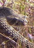
Wildflowers Observation Isolated
|
|
| _____________________
| There are just two switchbacks left. And another half-mile to the destination... |
| | |
|
|
|
 Route Editor