|
| | | |
| |
|
| Hiking | 18.60 Miles |
2,824 AEG |
| | Hiking | 18.60 Miles | 3 Days | | |
| 2,824 ft AEG | | | | |
|
|
| |
| Linked |
|
none
[ show ]
| no linked trail guides |
| Partners |
|
none
[ show ]
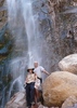
| no partners | | We headed into Reavis Ranch this weekend to launch a hike up to Circlestone. WOW! Reavis was cold!! We got to the trailhead at 7 PM with a couple of cars there. Strapped on the headlights and headed out. Saw a fire further up on the trail, thought someone had a campfire going. We got there and the fire was out, it used to be a century plant that was right in the trail. Someone had just set the thing on fire and left. It was still burning hot coals. We put it out the best we could and moved on. Very spooky, could see headlights further up the trail. Got to bottom of the pass where the fence goes across the trail and another fire. They had put parts of a century plant at the bottom of the fence post and lit the entire post on fire! Again, put it out the best we could and moved on. I could see a headlight only about a 1/4 mile ahead. We came through the pass and looked down, nothing. Didn't see anything the rest of the night, probably better that way. So it was a spooky hike in. I go hiking to get AWAY from Jackholes!
As for the cold, we rounded the last bend down into the valley and the temps seemed to drop 20 degrees in about 100 feet. We were in pants and a shirt up to then, but we scrambled for beanies, gloves, and down jackets for the last 10 minutes. We hit the North camp and had to build a fire to get our hands working again. Don't have a thermometer so can't give the exact temp, but there was frost on the ground when we got there at about 11:30PM. For reference I was sleeping in long underwear,2 shirts, fleece pants, down jacket, beanie, and gloves inside my 30 degree bag(MonteBelle) - got zero sleep. Wife was same in a Western Mountaineering 30 deg, buddy was in my BA 20 deg/0 deg bag pad combo with less layers - no sleep. We had foam pads on top of air mattresses. I'm not sure if it was much under 30 deg, water on the ground froze, hanging water, not as much. I'm thinking it must have something to do with the humid air cause it cut to the bone.
We checked out Circlestone the next day, very cool. Then packed up our stuff and hiked back to the plow saddle trail to camp for the night. Cold, but still warmer. Still a fun weekend. |
| _____________________
| | |
|
|
|
 Route Editor