|
| | | |
| |
|
| Hiking | 6.29 Miles |
2,157 AEG |
| | Hiking | 6.29 Miles | 5 Hrs 30 Mns | | 1.14 mph |
| 2,157 ft AEG | | | | |
|
|
| |
| Linked |
|
none
[ show ]
| no linked trail guides |
| Partners |
|
none
[ show ]
| no partners | | With the cooler temperature in the 60s, I figured it was a great day to hike in the lower desert. I've been in this area several times, but this would be my first time to South Butte. I don't think many people do this summit or even hike around this area, which mostly attracts off-road enthusiasts.
I drove east along the Florence-Kelvin Highway and then made a left on Cochran Rd. I parked near a windmill off the side of Cochran Rd. at a big parking area (33.07402, -111.16136). Other than a few places with deep sand (which wasn't enough for me to have to use 4WD), Cochran Rd. was a breeze to drive on. It had shockingly minimal traffic as well - I only passed by one oncoming group of OHVs on the way in, and nobody on the way out. There were a lot of campers parked along Cochran Rd. though.
For the first mile of the hike, I followed along a dirt road that was quite sandy in places. The rest of the hike was all off-trail except for one-tenth of a mile along Donnelly Wash. As I headed toward Donnelly Wash, I veered off my planned route by going up to a small peak and nearby rock shelter just to see if there were any signs of the ancients. I found none, but later I did notice a handful of rock walls on top of South Butte.
Several ATVers drove along Donnelly Wash throughout the day, but none were around when I walked in it. From that wash, I used the HAZ official route to the summit of South Butte. The butte looked intimidating from the wash with its steep, vertical walls and cliffs encircling a large portion of the perimeter. But following the official route, I never feared for my safety while climbing up. I did use my hands a few times on some short, sloping rock walls here & there. Went through a neat, long, narrow crack along the way. Route finding wasn't easy due to not having any visibility above the many rock formations, and I was constantly consulting my GPS to make sure I was on the route.
When reaching the top of the butte, there is still about a half mile remaining to get to the benchmark on the other end. There are lots of rocks (and today a lot of deep, grassy vegetation). When I stepped up on a large boulder that was among a pile of boulders, I spooked something underneath the pile. It sounded a bit large, and I could hear it moving and making progress along its escape route. I stood there watching and waiting. After a few seconds and about seven feet away, a turkey vulture came out. It looked at me and then quickly took flight. A couple seconds later, a second one came out. So cool - I wish I had my video going.
After the guilt of scaring the vultures, I headed over to the benchmark. It was easy to find, just a few steps away from a gigantic cairn. I assumed the register was inside the cairn, but several large wasps were claiming ownership of it and intimidating me, so I didn't poke around. After taking in the views, I walked over to the cliffed-out south edge. The vast spread of light brown and cream-colored bedrock down below looked amazing. I made a mental note of that area to put it on my to-do list 
I saw two coyotes crossing the Florence-Kelvin Highway while driving to the hike. Along Cochran Rd. I saw three ground squirrels, a regular squirrel, chipmunk, rabbit and lots of birds. When driving back, I was just about to sneeze when a deer ran across Florence-Kelvin Highway right in front of me. Thankfully there was no collision. My sneeze never happened but involuntarily turned into a brief, weird-sounding scream  |
|
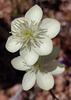
Wildflowers Observation Moderate
The two most popular flowers of the day were Owl Clover and Lupine. Also saw Brittlebush, Scorpion Weed, Desert Chicory, Fiddleneck, and many others. |
|
| _____________________
| | |
|
|
|
 Route Editor