| |
| Peak 3281 - Superstition Wilderness, AZ | | -
-
-
-
-
-
-
-
-
-
-
-
| |  |
|
3 |
-
-
-
|
| | Peak 3281 - Superstition Wilderness, AZ | | | |
|
|
Peak 3281 - Superstition Wilderness, AZ
| | |
|
| Hiking | 5.00 Miles |
1,243 AEG |
| | Hiking | 5.00 Miles | 4 Hrs 6 Mns | | 1.27 mph |
| 1,243 ft AEG | 10 Mns Break | 25 LBS Pack | | |
|
|
| |
| Linked |
|
none
[ show ]
| no linked trail guides |
| Partners |
|
none
[ show ]
| no partners | | Due to heavy overnight rain and the high humidity I wasn't sure I even wanted to hike today. So I dawdled, figuring I'd wait for the humidity to drop... but it didn't. Oh well, I'll quickly throw together reasonably short hike somewhere close.
Ha! "quickly throw something together" Yeah, right! :bdh:
And so the very much last-minute plan was to bag two peaks within a few miles of the First Water TH. Being just over a 5-mile loop should be easy enough, wouldn't you think? I wish...
:-({|=
It ended up 5 miles without coming close to peak #2. But wait, I'm getting ahead of myself.
Leaving First Water TH at exactly 11 am it was 81° and VERY humid so I began at a leisurely pace so as not to work up a sweat. Ha! Fat chance of that... by time I reached the Dutchman/Second Water intersection I was already sweating profusely. Well I'm here, so let's get on with it!
I followed the Dutchman Trail for 1.5 miles before turning south and following one of the now-dray tributaries to First Water Creek. After all the rain that practically washed the trail clean to the bare rock, I was quite surprised that even small puddles of water was a rare sight.
Following the dry creek-bed was an exercise in rock and boulder-hopping until I said enough! and began the cross-country trek to Peak 3281. As I confronted the actual terrain, the farther up I climbed the farther from the route I had mapped out on Route Manager. Sometimes it was 'easier' to climb over a ridge, other times following the contour was better. But eventually it was a matter of just climb!... through whatever bush/tree stood in the way and climb steep boulders, slick with wet moss.
And just when I thought I was right next to the summit, I consulted my GPS only to find I was still 440 feet away, across a field of somewhat flat boulders, many with 6-foot drops in between.
Dang! So now, what do I do? Drop down 100 feet to by-pass the boulder field or take on the hazard directly? I was so drenched in sweat by now, I did NOT want to drop down and lose that hard-fought 100 feet, so I took it on! It was a good thing I got past the hazard when I did as I was getting Gumby-legs from the fear of sliding off a boulder.

Once across the boulder field I finally could see the summit... a large outcrop sticking 30-40 feet straight up above me. And I thought there's no way I can climb that! and stopped to take stock of the situation.
](https://hikearizona.com/dex2/images/smilies/eusa_wall.gif "Brick wall")
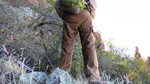
(See the photoset for self-portraits of me soaked in sweat...  it's now 97° and STILL humid) it's now 97° and STILL humid)
After a moment to take the photos I was about to find another way back down when I noticed a small gap that would bring to to the other side of the summit, and possibly a better route?
Yes! After bulling my way through the vegetation-clogged gap I broke through into sunlight, and upon turning around, there was THE way to the summit! (I knew there had to be because I knew two people had bagged it in February 2011) Again I had to climb through more brush (slightly thornier this time) but I reached the point of the highest boulder. I would drop back down 5 feet to the relative safety of half-way level ground to film the summit pan video.
By now all I could do is cast my eyes toward Peak 3399 and say, another time, my friend, another time. But at least I got a good view and now have a better-looking route to its summit. And I would find the eastern slope of Peak 3281 to be an infinitely better and safer route than my ascent from the other side. Ok, so I still had to go through some thick brush at times, but at least I was going down.
Feeling even hotter and sweatier, I checked my GPs for a reading from the Tempe sensor and was shocked to see only 74°! Then I realized I was so thoroughly drenched with sweat even my GPS case was dripping, so in the light breeze I was sure the evaporation was causing the false reading. When I finally made it back to the Jeep I took a number of readings with my temp gun and at 3 pm it was 98°.
(The metal pipe fencing around First Water TH was 108° in the shade behind my Jeep... conduction from where it was in the sun I suppose.)
For this hike I drank 16 oz before I left home, another 16 oz at the TH before the hike, on the hike I went through all 100 oz in my CamelBak plus another 16 oz bottle, another 32 oz on the drive back home for a total of 180 ounces. That means I drank over 11 pounds of water yet STILL lost 6 pounds on the hike... the reason I HATE humidity when it accompanies warm temps.
One video:
Peak 3281 Summit Panorama |
| _____________________
| | |
|
|
|
|
|
| |
 Route Editor


