username
X
password
register
for free!
help
ArticlesGuidesRoutes
 
Photosets
 
 Comments
triplogs   photosets   labels comments more
Woodbury Trail #114 - 13 members in 37 triplogs have rated this an average 2.5 ( 1 to 5 best )
1, 2  Next
37 triplogs
login for filter options
Apr 16 2023
avatar

 Guides 59
 Routes 1,100
 Photos 1,191
 Triplogs 1,290

male
 Joined Jan 01 2023
 Arizona
Rogers Canyon - JF Trail LoopGlobe, AZ
Globe, AZ
Hiking avatar Apr 16 2023
pseudalpineTriplogs 1,290
Hiking14.78 Miles 3,132 AEG
Hiking14.78 Miles   8 Hrs   49 Mns   2.40 mph
3,132 ft AEG   2 Hrs   39 Mns Break
 
1st trip
Route Scout Route Recorded  on Route Scout | Pop | Map | Popup | MapDEX
Extraordinarily beautiful presently. The Sycamore have broken bud and there are many different wildflowers.
  3 archives
Dec 14 2022
avatar

 Guides 187
 Routes 990
 Photos 12,079
 Triplogs 865

72 male
 Joined Jun 27 2015
 Tucson, Arizona
Coffee Flat Woodbury Trail, AZ 
Coffee Flat Woodbury Trail, AZ
 
Hiking avatar Dec 14 2022
markthurman53Triplogs 865
Hiking9.41 Miles 1,174 AEG
Hiking9.41 Miles   4 Hrs   45 Mns   2.26 mph
1,174 ft AEG      35 Mns Break
 
1st trip
Partners none no partners
On the second day I took the Hewitt Canyon road to an area of the Superstitions I had only been to once before when I was doing the Arizona Trail. There are a couple trails I have not been on before and one of them was the East end of the Coffee Flat and the west end of the Woodbury Trail. The Woodbury trail is pretty much nonexistent to the old JF Ranch headquarters marked occasionally by cairns and maintained by whatever animals may use it. With close observation and a little imagination I believe I followed along where the trail use to be. The old abandon JF Ranch headquarters are still there complete with what looked like a working windmill, it was spinning in the wind and that’s what they are supposed to do, Could use a little lubricant though. From the JF Ranch the trail was a bit easier to follow though most of the time it just stayed in the creek bed of Frazier Canyon. At 5 miles in I came to Randolph Canyon and my turn around point. I was at this point 4 years ago on another hike along the west end of the Coffee Flat Trail. My original plan was to return along Randolph Canyon but with it getting late in the day I opted to return the way I came. Frazier Creek and Randolph Creek had a light flow. The scenery on the hike and the drive in is high on the WOW factor meter and the drive out at sunset was pegging it.
 Culture
 Culture [ checklist ]
[ checklist ]  Windmill

water 1 out of 5water 2 out of 5water less than maxwater less than max Fraser Canyon Light flow Light flow

water 1 out of 5water 2 out of 5water less than maxwater less than max Randolph Canyon Light flow Light flow
_____________________
 
Aug 22 2022
avatar

 Guides 264
 Routes 2,797
 Photos 14,494
 Triplogs 5,894

55 male
 Joined Nov 20 1996
 
Fort Knox Circumference, AZ 
Fort Knox Circumference, AZ
 
Hiking avatar Aug 22 2022
joebartelsTriplogs 5,894
Hiking15.29 Miles 3,007 AEG
Hiking15.29 Miles   10 Hrs   21 Mns   1.76 mph
3,007 ft AEG   1 Hour   40 Mns Break
 
1st trip
Route Scout Route Recorded  on Route Scout | Pop | Map | Popup | MapDEX
Started from the Woodbury Trailhead for a change of perspective. The initial 110-ft hill isn't luring Reavis/Roger ruins destination hikers claiming they have an interest in the journey. If it wasn't for the JF/Woodbury sign you wouldn't know Woodbury existed.

Walking through the moisture-enriched morning grass had me thinking Gortex shoes might be preferred but I felt like I was going above and beyond wearing a long sleeve shirt coupled with pants for the hecklers. Grass is hiding the hint of rarely used trail. Sparse and avoidable catclaw on Woodbury heading east to 172A. Remarkable terrain but the drive negates this as a reasonable dayhike in itself. I passed some of the most sacred datura on earth according to the Wyatt Earp diaries.

Taking a final turn to Rogers, I noticed the elevation was 4,809 ft after a 1500-foot ascent. Due to relentless sweating, I was ready for a few gravity miles. It was a hallmark moment too with the cry of a Red-tailed Hawk soaring overhead.

Rogers Canyon Trail #110
The first ~mile of Rogers jungle is still impressive a week later. There were several light rainfalls in the past week but none of the creeks were flowing today. Pants and a long sleeve shirt really are nice for plowing through the vegetation. ...that may have been the breeze speaking, I hate pants.

Rogers from the Reavis junction to Angel Basin had a healthy scattering of sunflower stalks. I took a stab at the intervals of trail along the creek several times. For the majority, the trail has been abandoned. There are a couple of short segments but ya gotta work for 'em.

The Angel Basin vicinity was a mess of catclaw as expected. Just before reaching Angel Spring, I realized I was wasting energy on the wrong catclaw... lol.

Finding #110 propper for the first quarter-mile out of the basin was difficult to find even with GPS and key cairns. Two of the cairns were spot on but it seemed impossible to go 5-10 feet until thinking outside of the box. This was semi-expected because I recall having trouble here on a Tule to Peralta dayhike in 2010.

The eye-opener was only two semi-quick miles in the remaining six. We were hauling pumpkin in 2010 so I didn't get to absorb the area. At a crawl-pace, I found the distance views, and new to me geology to be worthy of more trips (with loppers).

JF Trail #106
Knee-high grass with lots of catclaw.

Warning
This loop in its current condition will be cursed by most.

Fauna
No snakes, thankfully. The largest group of swallowtail butterflies I've ever seen, scattered admirals and a couple checkered. One greater roadrunner and just one white-tailed deer. Scared up flocks of birds out of the grass in the morning stretch and the late afternoon. Some were quail, no clue about the majority.

FS172 to Woodbury Trailhead
From the 172A split is flat/quick after the initial creek crossing and rutted hill.

[ youtube video ]
 Culture
 Culture [ checklist ]
[ checklist ]  Windmill
wildflower observationwildflower observationwildflower observationwildflower observationwildflower observation
Wildflowers Observation Moderate
lots of sunflower stalks en route to Angel Basin, primrose, daisies, verbena

water 1 out of 5water less than maxwater less than maxwater less than max Roger's Creek Pools to trickle Pools to trickle
two tiny pools
_____________________
- joe
 
Jan 08 2022
avatar

 Guides 12
 Routes 192
 Photos 863
 Triplogs 356

42 male
 Joined Nov 30 2015
 Phoenix, AZ
Fraser - Randolph LoopGlobe, AZ
Globe, AZ
Hiking avatar Jan 08 2022
ShatteredArmTriplogs 356
Hiking9.30 Miles 1,100 AEG
Hiking9.30 Miles   4 Hrs   20 Mns   2.66 mph
1,100 ft AEG      50 Mns Break
 no routesno photosets
1st trip
Been meaning to check this out for awhile. The road has gotten quite a bit worse in the past year, but a Subaru Crosstrek can still make it. Barely. Dropped down to Woodbury Trail, which is almost nonexistent at this point. Noticeably more so than a year ago.

Poked around the JF ranch for a little bit. Didn't know there is a fully intact house there. After this point, we decided to disregard the trail altogether since it was covered in catclaw and the creek is nice and clear.

Got down to the confluence in a couple hours and poked around a bit in the Dripping Springs area. Some nice cottonwood trees here; nice spot. Good flow in the creek.

Randolph Canyon was great along Red Tanks trail (which we also ignored in favor of staying in the creek). Upstream from where the trail departs was pretty uninteresting; the canyon is just entirely filled with sand at this point.

Fun adventure overall, and I like seeing all the creeks flowing in the Superstitions. Kinda regret not having seen those canyons before they were filled with sand, though.

water 1 out of 5water 2 out of 5water 3 out of 5water less than max Fraser Canyon Medium flow Medium flow
Good flow up to Whetstone Canyon, intermittent flow from there up past Fraser ranch.

water 1 out of 5water 2 out of 5water 3 out of 5water 4 out of 5 Musk Hog Canyon Heavy flow Heavy flow
Accounted for most of Fraser's flow.

water 1 out of 5water 2 out of 5water 3 out of 5water less than max Randolph Spring Gallon per minute Gallon per minute
Creek was flowing, hard to tell what's actually coming from the spring.

water 1 out of 5water 2 out of 5water 3 out of 5water less than max Red Tanks Canyon Medium flow Medium flow
Good flow, probably equaled the flow from Randolph.

water 1 out of 5water 2 out of 5water 3 out of 5water less than max Whetrock Canyon Medium flow Medium flow
_____________________
  7 archives
Feb 04 2021
avatar

 Routes 154
 Photos 1,505
 Triplogs 266

31 male
 Joined Jun 02 2019
 Phoenix, AZ
La Barge Mountain Loop, AZ 
La Barge Mountain Loop, AZ
 
Hiking avatar Feb 04 2021
LJWTriplogs 266
Hiking25.64 Miles 4,989 AEG
Hiking25.64 Miles   9 Hrs   15 Mns   3.02 mph
4,989 ft AEG      45 Mns Break
 
1st trip
Route Scout Route Recorded  on Route Scout | Pop | Map | Popup | MapDEX
Another week in the Superstitions looping through unfamiliar ground. This time from Woodbury with La Barge Mountain the centerpiece of the route. Started a quarter after 8am and went counterclockwise.

JF trail up to Tortilla Pass. Trail's in great shape and doesn't pass through much burn until after Tortilla Pass. Broke away from the trail there and hiked up La Barge, which is almost completely burned, especially near the summit. Doesn't take much away from the views. It's a light bushwhack at worst but steep in places. Started later than expected, so headed down quickly. JF passed through the burn area and into the grassy fields toward Hoolie Bacon.

Hoolie Bacon up Tortilla Creek, which had a light flow of water. Over Horse ridge and caught the wind the whole way down into Horse Camp Basin. Passed the only person of the day around Trap Canyon. Probably my favorite new trail of the day.

Red Tanks south like last week to CFT/Fraser Canyon. Had trouble finding the trail and stuck to the creek bed. Nicest hiking surface I think I've ever been on for the bottom of a Creek. Lots of catclaw and other annoyances, especially before I gave up on the trail.

Fraser to Woodbury trail, which I was too tired to be worried about finding, so I spent some more time in Fraser than I wanted. Got back with a little under an hour before sunset.

water 1 out of 5water 2 out of 5water less than maxwater less than max Cedar Basin Canyon Light flow Light flow

dry Fraser Canyon Dry Dry

water 1 out of 5water less than maxwater less than maxwater less than max Red Tanks Canyon Pools to trickle Pools to trickle
  5 archives
Dec 20 2020
avatar

 Guides 12
 Routes 192
 Photos 863
 Triplogs 356

42 male
 Joined Nov 30 2015
 Phoenix, AZ
Rogers Canyon - JF Trail LoopGlobe, AZ
Globe, AZ
Run/Jog avatar Dec 20 2020
ShatteredArmTriplogs 356
Run/Jog14.73 Miles 2,953 AEG
Run/Jog14.73 Miles   4 Hrs   43 Mns   3.12 mph
2,953 ft AEG
 
no photosets
1st trip
Partners none no partners
Hadn't been to Woodbury TH before, so decided to check it out. I have also been curious about the condition of Rogers Canyon and Angel Basin since the fire; it was pretty torched at the Reavis junction.

Started with the road section in order to get it out of the way; outside of one giant flock of OHVs, the traffic wasn't bad.

As mentioned, the canyon is in bad shape at Reavis junction. Fortunately, within a mile or so, the condition improved greatly. In places you'd forget there was even a fire, if it weren't for the parts of the trail in the creek bed being wiped out.

Angel Basin wasn't in terrible shape, at least at the Frog Tanks junction. Just past the first side canyon heading west, it gets pretty badly torched again. Stopped by Angel Spring to check it out, no flow.

The first mile heading up out of Angel Basin has some pretty miserable catclaw, but once leaving the bottom of the canyon, it's not too bad. View from Tortilla Pass was nice, and the way down was not particularly smooth.

dry Angel Spring Dry Dry
There are a couple of pools, no flow. Could make do if in a pinch.

dry Roger's Creek Dry Dry
_____________________
 
Dec 19 2020
avatar

 Routes 93
 Photos 7,758
 Triplogs 1,691

64 male
 Joined Mar 11 2003
 AZ
Rogers Canyon - JF Trail LoopGlobe, AZ
Globe, AZ
Hiking avatar Dec 19 2020
wallyfrackTriplogs 1,691
Hiking14.48 Miles 3,159 AEG
Hiking14.48 Miles   8 Hrs   16 Mns   1.87 mph
3,159 ft AEG      32 Mns Break
 no routes
Partners partners
DarthStiller
I haven't been out to Angel Basin in a while so this loop was overdue. The hike up to Tortilla Pass seems to drag on but the temperature was nice. The JF trail was rocky but easy enough to follow. There was a short catclaw gauntlet nearing Angel Basin but that's normal for that area. Chris and I made up to the ruins and had not seen any hikers yet. After a break for lunch we continued up Rogers Canyon pointing out other ruin locations and the Ore Cart mine. We passed several hikers coming down the trail. There were not as many hikers out as I would expect on a Saturday. After making it to Rogers Trough trailhead we continued down Fr 172A to the Upper Woodbury trailhead. The road is rough in spots but I could drive it. :lol: The upper section of Woodbury trail is easy going and I think we made up some time in the last few miles.
 Named place
 Named place [ checklist ]
[ checklist ]  Randolph Canyon
_____________________
  4 archives
Dec 19 2020
avatar

 Guides 27
 Routes 670
 Photos 12,111
 Triplogs 857

56 male
 Joined Jul 05 2006
 Mesa, AZ
Rogers Canyon - JF Trail LoopGlobe, AZ
Globe, AZ
Hiking avatar Dec 19 2020
DarthStillerTriplogs 857
Hiking14.48 Miles 3,159 AEG
Hiking14.48 Miles   8 Hrs   22 Mns   1.85 mph
3,159 ft AEG      32 Mns Break
 
1st trip
Partners none no partners
I first hiked this back in 2004, today it seemed alot longer than I remembered. Wally and I started at Woodbury and hiked clockwise. JF isn't too bad, but maybe that was because we'd started with that. It was pretty rocky, which always slows me down. All the fire damage from 2 summers ago is very faint.

We got to the ruins in just under 4 hours. The leaves in the stream bed below pile up in their own kind of pools, making for mild hazards as you step in them. We climbed up to the ruins, but for the last bit of the ascent I decided against going further. The exposure had me uncomfortable especially with my backpack shifting around. I've been in the twice before, that's enough. Below we found some sherds and other possible tools. The one sherd had some color on it.

After lunch we'd headed up Rogers Canyon. Wally pointed out the upper ruins and some others that he's found over the years. Nice to make note of that if I ever decide to go searching. Today I was content with the power of my zoom lens for some good pics.

It was a bit of a slog on the way up to Rogers Trough, then still a slog down the road over to Woodbury. I still can't decide if it's me getting older or it's been so long that I don't remember how difficult it was 16 years ago. Probably a bit of both. Nice to be out in the Supes again and hike with someone.
 Named place
 Named place [ checklist ]
[ checklist ]  Angel Basin
_____________________
 
Jan 18 2020
avatar

 Guides 1
 Routes 1
 Triplogs 24

45 male
 Joined Feb 27 2012
 Cochise County
JF Trail #106Phoenix, AZ
Phoenix, AZ
Hiking avatar Jan 18 2020
AndrewAZTriplogs 24
Hiking23.71 Miles 5,075 AEG
Hiking23.71 Miles   11 Hrs   5 Mns   2.14 mph
5,075 ft AEG
 no routesno photosets
1st trip
From Woodbury TH: JF over Tortilla Saddle to Hoolie Bacon to Red Tanks to Coffee Flat to Woodbury.
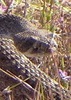
This one was a real :pk: kicker. I left my place before 5am, left US 60 around 6am, drove FR 172 in the dark, and started hiking at 7am. After Tortilla Saddle, I saw a buck and doe along JF, but that was it for wildlife. I had lunch at the saddle on Hoolie Bacon at 12:30.

While hunting for trail along a burned/eroded part of Hoolie, I was down in a wash and found a stainless steel canteen. Cap was still on tight and it was about 3/4 full of water (I'd guess it's a quart-sized bottle). The little chain holding the cap on was rusted, but otherwise it was in decent shape. I dumped it and hiked it out. I wonder how long it had been out there.

My hopes were getting high that I was finally going to do it: over 20 miles on established trails in the Superstitions without seeing anyone (without hiking in July or something dangerous like that). My hopes were dashed along Red Tanks when I finally met a pair of hikers. Only people I saw all day.

I was tempted to go up Randolph Canyon instead of using Coffee Flat trail, but there was enough water coming out of Randolph that it seemed like it could be tricky to stay dry. Plus, I hoped Coffee had better trail. I was wrong on that part. If there was ever good trail along that stretch of Coffee, it's gone now (aside from one portion that goes up high along the canyon wall, I assume to avoid a pouroff). The easiest thing was to walk in the wash, which had enough firm sand to make for pleasant walking on my very tired feet. With all the greenery and the trickle of water down the center, it was a nice "I can hardly believe this is Arizona" walk.

I was running low on fun around mile 18. I was out of fun by mile 20-21. The last two miles were more of a forced march than I would've liked.

I had to hustle along Red Tanks and Coffee Flat when I realized how much daylight I had left. I made the final climb along Woodbury as the sun was setting behind me (that final climb can kiss my :pk:). I got back to my truck with just enough light to change my shoes and drink the last of my water. It turned out to be even less fun to drive out on FR 172 in the dark than it was to drive in.

Lots of water flowing in most of the major washes. Not much along the higher parts of JF or Hoolie Bacon, but water almost everywhere else. Probably the most along Red Tanks, and definitely the most once it combined with the flow out of Randolph.

This was my first time on JF and the final stretch of Coffee Flat. I've now done every major trail on the western side of the Superstitions on my Green Trails map except the 1.6-mile stretch from Tortilla Pass to Angel Basin. However, I'm still missing some of the less-used (unofficial?) trails like Randolph Canyon, the Cedar Basin alternate to Hoolie Bacon, and West Boulder Canyon.

Comments on the specific trails:

JF: alternating areas of burnt and unburnt. Some stretches of vague and indistinct trail due to too few feet stomping the grass down. A little brushy in places, but nothing too bad. In spots where it did burn, it didn't seem to affect the trail too much.

Hoolie Bacon: the climb over the saddle is still steep and hot. Lots of burn damage (and subsequent flood damage). No underbrush among the dead manzanita groves, so parts of the trail are hard to follow--where once there was a clear path through underbrush, now everything looks open and vaguely trail-like. More than a few places I was thankful for cairns.

Red Tanks: Even more burn/flood damage than Hoolie. If it weren't for cairns, parts of this would be incredibly difficult to follow. Much of this reminded me of the burned-out areas along the AZT in the Mazatzals. The creek appears to have had torrential floods in the last mile or so approaching Coffee Flat trail. I don't recall it being that deep or wide the last time I walked it. I'd say this was the most damaged of all the trails I walked.

Coffee Flat: as mentioned above, there's really not much of a trail for most of this. It's just walking in the wash.
_____________________
  1 archive
Jan 11 2020
avatar

 Routes 93
 Photos 7,758
 Triplogs 1,691

64 male
 Joined Mar 11 2003
 AZ
Fraser - Randolph LoopGlobe, AZ
Globe, AZ
Hiking avatar Jan 11 2020
wallyfrackTriplogs 1,691
Hiking10.40 Miles 1,215 AEG
Hiking10.40 Miles   5 Hrs   54 Mns   1.76 mph
1,215 ft AEG
 no routes
Partners partners
DarthStiller
A loop in the Supes. The drive in on FR 172 was a little rough but passable with high clearance. The creek crossings are washed out so you need to slow down to get through. The trails are in decent shape and the burn while present didn't change the overall look of the terrain by much. Randolph Canyon was flowing but you could get by if you watched out for soft spots in the sediment. Chris noticed a mine/cave up in the cliff and then about a quarter mile later we saw another one. We stopped but the Red Tanks Coffee Flat junction for a break. I was cold in the shade and the sun felt good once we were moving again. Fraser Canyon was flowing as well and the trail has some fallen trees in a few spots. All in all a good hike on a good day.
_____________________
  1 archive
Jan 11 2020
avatar

 Guides 27
 Routes 670
 Photos 12,111
 Triplogs 857

56 male
 Joined Jul 05 2006
 Mesa, AZ
Fraser - Randolph LoopGlobe, AZ
Globe, AZ
Hiking avatar Jan 11 2020
DarthStillerTriplogs 857
Hiking10.40 Miles 1,215 AEG
Hiking10.40 Miles   5 Hrs   54 Mns   1.90 mph
1,215 ft AEG      26 Mns Break
 
1st trip
Partners partners
wallyfrack
I had never hiked Randolph Canyon, and the last time I hiked the Coffee Flat and Woodbury Trails in Fraser Canyon, it was nearly 17 years ago. With the limited trailhead access the further east you go in the Supes, this seemed like a good hike. I wasn't sure of the road condition or the trail conditions, so I asked Wally if he was interested and/or knew if it was doable hike. The tires on my vehicle are in need of a change soon, so I also asked Wally to drive for this one.

We did the loop counter clockwise, getting the off trail part done first, and also doing that section downhill. this turned out to be a good choice. Randolph Canyon had water running in it the entire way. It was actually very easy to hike, but I would imagine that hiking it uphill would be a bit harder. Silt filled in a lot of the rocks, making the hiking probably easier than normal. some sections were soupy and would result in some very soft footing. the trick seemed to be to stay towards the center of the stream, since that was where the most solid silt was. the water was still pretty shallow for the most part, and the deeper section were always narrow enough to step over.

the fire really didn't seem to harm this area very badly. Even the most cooked spots didn't look really all that different from the rest of the surrounding desert. There really weren't too many dead saguaros, except for some pockets here and there.

We stopped for lunch at the junction of the Red Tanks and Coffee Flat Trails. It was there that we saw the first other hikers all morning, after 3.5 hours. As I sat down for lunch, the one hiker was walking up to us and said, "Hey, you're Wally, right?" Not surprising.

the hike uphill along the Coffee Flat and Woodbury Trails was very rocky, as expected. There were a few flat sections here and there. The offtrail section of the hike was probably easier to hike than the trail section. At the ranch Wally pointed out where he and Denny has seen scores of pottery sherds on a previous hike. it was interesting to check that out and not see any sign of nearby ruins.

The biggest climb was along the Woodbury Trail back up to the Woodbury TH. Finished in just under 6 hours. Nice to have another hike back in the heart of the Supes, haven't been there in a while.
 Named place
 Named place [ checklist ]
[ checklist ]  J F Ranch
 Meteorology
 Meteorology [ checklist ]
[ checklist ]  Moon
_____________________
  1 archive
Nov 15 2019
avatar

 Guides 177
 Routes 249
 Photos 10,213
 Triplogs 2,215

74 male
 Joined Feb 12 2002
 Gold Canyon, AZ
Woodbury Trail #114Globe, AZ
Globe, AZ
Hiking avatar Nov 15 2019
AZLOT69Triplogs 2,215
Hiking2.05 Miles 857 AEG
Hiking2.05 Miles
857 ft AEG
 no routesno photosets
1st trip
Linked   none no linked trail guides
Partners none no partners
Nice day, checking out fire damage. Surprisingly lots of vegetation growing, recovering.
_____________________
It's best for a man to remain silent and be thought a fool, than to open his mouth and remove all doubt.
--Mark Twain
 
Sep 28 2019
avatar

 Routes 93
 Photos 7,758
 Triplogs 1,691

64 male
 Joined Mar 11 2003
 AZ
Woodbury Trail #114Globe, AZ
Globe, AZ
Hiking avatar Sep 28 2019
wallyfrackTriplogs 1,691
Hiking14.90 Miles 3,666 AEG
Hiking14.90 Miles   7 Hrs   35 Mns   1.96 mph
3,666 ft AEG
 no routes
Linked   linked  
Partners none no partners
Since the burn started near the junction of FR172 & FR172A I wanted to go out there and see what it looked like. First off FR172 & FR172A are in really good shape. The rains were not as heavy over there. Even the low spot crossing Queen Creek is leveled. I decided on parking at the Woodbury Trailhead and hiking up to Rogers Ridge. I wanted to hike the ridge before but the choked vegetation was not alluring. The ridge is an easy go now but you will pick up lots of soot along the way. I went up to Peak 5106 to look for the bench mark one more time but no luck. Hiking along the Ridge is a good way to take in the views. Mostly brush and grass were burned in this area so the recovery should be much better. I looked for the "lost Dutchman Mine" from Jack San Felice's Book but upon further evidence I was at another prospect above the site. The view of Weavers Needle from the prospect is close to the drawing that's made it rounds. Eventually I made my way toward Rogers Canyon. The Rogers Spring area did not burn and I saw a whitetail doe there. The wash above Rogers Spring was cleared out so I took that heading back for a while. Took a detour to look for the Lobb Mine which wasn't much of anything and found a dead deer while making my way down to Rogers Canyon. Rogers Canyon trail is okay but there is a lot of sediment around the creek crossings which is expected. I saw one hiker near Rogers Trough trailhead and passed no cars or OHVs on FR172 in or out. Apparently people are staying away from this area but the roads are good and the trails not too bad. Still optimistic...
 Culture
 Culture [ checklist ]
[ checklist ]  Old Rusty Stuff
_____________________
  5 archives
Jan 27 2019
avatar

 Guides 44
 Routes 162
 Photos 24,766
 Triplogs 2,411

75 male
 Joined May 04 2004
 Mesa, AZ
FR172B Dripping Springs Woodbury Loop, AZ 
FR172B Dripping Springs Woodbury Loop, AZ
 
Hiking avatar Jan 27 2019
CannondaleKidTriplogs 2,411
Hiking10.00 Miles 1,902 AEG
Hiking10.00 Miles   5 Hrs      2.07 mph
1,902 ft AEG      10 Mns Break20 LBS Pack
 no routesno photosets
1st trip
Partners partners
trixiec
The original plan was to climb Peak 3635 just off the Woodbury Trail then explore some mines in the other direction.
That plan only lasted 2 miles at the point we would need to leave the trail and begin the ascent. Neither one of us liked the look of any of the possible routes I had mapped out, at which point Tracey asked have we ever hiked to Dripping Springs from Woodbury. We had not, so we continued on to Dripping Springs, enjoying the quiet broken only by chirping of various birds.

We took a short break at the springs then headed back along the Coffee Flat and Woodbury Trails. Shortly before reaching the JF Trail intersection we encountered a spike buck white-tail(?) just staring at us. The left 'spike' was barely a half-inch long and the right maybe an inch. It kept an eye on us until we were out-of-sight.

Eventually we crossed the JF Trail and continued east to pay a visit to a few old mines. Since we had no planned on the out-and-back to Dripping Springs, by time we reached the first mine and found little of interest, we decided to skip the 1+ mile to the next one. Rather than returning on the Woodbury Trail to JF Trail and back to the TH, we climbed to the top of the ridge, scaled the fence then took a decidedly rough off-trail route back to the TH.

Good thing we started early as the vehicle traffic on FR 172 was already getting crazy, so we returned following the wash back to Hewitt road. By then the ATV traffic on Hewitt road was absolutely nuts, but I guess that's to be expected on a winter weekend.

So, between the 4x4/ATV traffic and the upcoming Renaissance Fair, we won't be going out this way except on weekdays.
_____________________
CannondaleKid
 
Jan 20 2019
avatar

 Routes 27
 Photos 279
 Triplogs 56

39 male
 Joined Aug 06 2009
 Phoenix, AZ
Rogers Canyon - JF Trail LoopGlobe, AZ
Globe, AZ
Backpack avatar Jan 20 2019
nathanbriskTriplogs 56
Backpack14.68 Miles 2,905 AEG
Backpack14.68 Miles   7 Hrs   20 Mns   2.24 mph
2,905 ft AEG
 
Route Scout Route Recorded  on Route Scout | Pop | Map | Popup | MapDEX
Drove in to the Woodbury trailhead because I don't trust my AWD Saturn Vue to get to Rogers Trough trailhead.

We did this loop in reverse--starting from the Woodbury trailhead and taking the loop to the west.

Emma, Bruce the pooch and I got started on the trail at about 8am. It's the first time I haven't lost the trail immediately from the Woodbury Trail/JF Trail junction . . . some kind soul erected a few cairns, so we were good to go. Pruned thorny branches as I went . . . actually broke my pruners! Hiking up to Tortilla pass was challenging per usual. Weather was perfect. Clear, treatable pools were encountered on the JF Trail south of Rogers Canyon Trail junction. HIking down into the canyon, the brush was extremely overgrown. Unfortunately, by this time I had already broken the pruners . . .

I'm pretty stoked! I've been to this area several times, but logistics never worked out to see the ruins. Got to see them this time! Awesome :)

The creek beside Angel Basin was half-full and flowing. This particular evening happened to include a complete lunar eclipse as well. That was a treat.

It's a fun section of slight bouldering going NE on Rogers Canyon Trail past the cliff dwellings. Once we rolled in to Rogers Trough Trailhead, we needed to hike the road for about 2 miles to join the Woodbury Trail to the JF Trail and back to the Woodbury Trailhead.


 Named place
 Named place [ checklist ]
[ checklist ]  Angel Basin
_____________________
  3 archives
Mar 17 2018
avatar

 Guides 1
 Routes 148
 Photos 9,925
 Triplogs 3,654

63 male
 Joined Apr 02 2005
 Mesa, AZ
Coffee Flat Trail #108Phoenix, AZ
Phoenix, AZ
Hiking avatar Mar 17 2018
Tortoise_HikerTriplogs 3,654
Hiking8.90 Miles 1,253 AEG
Hiking8.90 Miles   4 Hrs   8 Mns   2.15 mph
1,253 ft AEG
 no routes
Partners partners
wallyfrack
I went checking out some stuff with Wally in the Supes. He is also helping me do some parts of trails I have not done yet. Today we did all the Woodbury and the part of Coffee Flat Trail I had not done. Coffee Flat write up only goes to Reeds or Dripping Springs, I believe. It really goes all the way to JF headquarters so we did the section from JF to Dripping Springs today. Dripping Springs is just a wet wall with no pools to filter. There was some nice little pools right across the way in the wash beside the intersection of Coffee Flat and Red Tanks trails. Looked clean enough to filter in my opinion. Coffee Flat trail went in and out of the wash from time to time. I thought it was a pretty good trail with some good scenery. Wally led me on a little exploring also :o :) . It went well and I stayed upright this time :D . Good weather, good company, good times! Thanks Wally, :yr:
_____________________
Tortoise Hiking. Stop and smell the Petrichor.
 
Mar 03 2018
avatar

 Routes 93
 Photos 7,758
 Triplogs 1,691

64 male
 Joined Mar 11 2003
 AZ
Woodbury Trail #114Globe, AZ
Globe, AZ
Hiking avatar Mar 03 2018
wallyfrackTriplogs 1,691
Hiking12.44 Miles 2,435 AEG
Hiking12.44 Miles   5 Hrs   47 Mns   2.15 mph
2,435 ft AEG
 no routes
Linked   none no linked trail guides
Partners none no partners
This was a trip down Woodbury trail to check out some caves on Coffee Flat Mountain. Both the Woodbury trail and The Coffee Flat trail are in good condition. I approached the cliffs from Red Tanks trail which was steep but not too choked. The route ended up high above a side canyon and skirted over to the caves. There was sign of old prospector trash but nothing else. I decided to exit on the Coffee Flat side and hit the high saddle. That was a mistake as it dropped off on the west side. After scrambling down to the lower break in the ridge I was able to get down. I didn't see another person on the trail all day.
_____________________
  1 archive
Feb 09 2018
avatar

 Guides 7
 Routes 187
 Photos 2,318
 Triplogs 909

74 male
 Joined Dec 10 2016
 Gold Canyon
Woodbury Trail #114Globe, AZ
Globe, AZ
Hiking avatar Feb 09 2018
DaytripperTriplogs 909
Hiking7.10 Miles 1,263 AEG
Hiking7.10 Miles   3 Hrs   10 Mns   2.75 mph
1,263 ft AEG      35 Mns Break20 LBS Pack
 no routesno photosets
1st trip
Linked   linked  
Partners none no partners
Parked at the Woodbury trail head to meander around. Hiked up to the gate on 172B and proceeded down the road to the JF Ranch. Large corral empty but small corral next to barn with 2 occupants. Was not bold enough to walk up to or into the barn. Windmill was functioning, nice stone and mortar water troughs not in use but large aluminum tub filled. Proceeded on coffee flat trail to check out this portion of Fraser canyon, per Garmin I was 2.1 miles from dripping springs,since I had been there 2 days before I did an about face . Proceeded a short distance back up 172B to the signed junction for Woodbury trail. Continued on this steadily climbing until dropping down to the junction with JF trail, another water filled aluminum tub for the cattle who trotted off, I wish someone else had been there so I could shout “stampede”. I continued mostly upward,about another 500 feet elevation gain to the end. There at the junction with 172A there was a large group camp set up though the tents were down and weighted with rocks.It was quite breezy at times,the temperature was 74 about 1430 at the trailhead,was 68 at the start and was 83 in Florence Junction on returning there. Woodbury trail is not too difficult to follow and is free of vegetation as it seems to be along an old road route. Decided to just walk 172A and 172 back to the trailhead just to make that portion a loop, not too bad a walk,dodged a couple of ATV’s .I drove a 2 wheel drive truck to the trailhead taking about an hour from the turn onto 172, road condition is good,may want to reassess if we get heavy rains.
_____________________
Navy31 Army13
 
Feb 25 2017
avatar

 Guides 264
 Routes 2,797
 Photos 14,494
 Triplogs 5,894

55 male
 Joined Nov 20 1996
 
Woodbury Coffee and Red Bacon with JF, AZ 
Woodbury Coffee and Red Bacon with JF, AZ
 
Hiking avatar Feb 25 2017
joebartelsTriplogs 5,894
Hiking24.14 Miles 5,147 AEG
Hiking24.14 Miles   11 Hrs   50 Mns   2.28 mph
5,147 ft AEG   1 Hour   14 Mns Break14 LBS Pack
 
1st trip
Most high clearance 2wd vehicles should be able to make the drive. Several water crossings. The only likely issue is for those timid with a gas pedal crossing Queen Creek.

Woodbury Trail #114
Hiked this to scratch if off a list.

Coffee Flat Trail #108
The cow patties get your attention when it's dry. It's a slice of heaven when the creeks are flowing. Really nice saguaros either way.

Red Tanks #107
Five years after our first hike on the eastern side we returned. It didn't ring a bell. A little rough. This trail has four distinct personalities: La Barge Creek, Upper La Barge Box, North of Red Tanks Divide, Red Tanks Canyon. I like 'em all. It's not a trail for flip flops and shorts, come prepared.

Hoolie Bacon # 111
The best part of this trail is Bacon in the name. Horse Ridge saddle is a fine lunch stop with great 360 views. 4143 is better, please keep that a secret.

JF Trail #106
I've jigsawed this in the past, mainly Tule to Peralta. I do not care for either end. The 2.3 mile middle segment from 4597 to Tortilla Pass is worthy. It has a Reavis spirit of intrigue that I find relaxes the mind.

Synopsis
Bruce suggested JefF out-n-back. Meh... do I know you? He came back with this loop and it was game on! We had perfect temps with all the creeks in taper down flow. I didn't blink at 22+ miles. Boy howdy, 12 hours sucker punched my body.
Hurts so good, great hike!

carried 3.5 quarts, consumed 2.5
 Culture
 Culture [ checklist ]
[ checklist ]  Horseshoe  Mascot
wildflower observationwildflower observationwildflower observationwildflower observationwildflower observation
Wildflowers Observation Isolated
a few sprigs of paintbrush was the main attraction, several dozen Dichelostemma capitatum scattered throughout our loop, two poppies... yeah not much

lots of wiry lotus, which is like getting excited over dollar store cookies
_____________________
- joe
 
Feb 25 2017
avatar

 Guides 41
 Routes 1,626
 Photos 14,983
 Triplogs 2,762

69 male
 Joined Jan 20 2009
 Far NE Phoenix,
Woodbury Coffee and Red Bacon with JF, AZ 
Woodbury Coffee and Red Bacon with JF, AZ
 
Hiking avatar Feb 25 2017
The_EagleTriplogs 2,762
Hiking24.29 Miles 5,200 AEG
Hiking24.29 Miles   11 Hrs   50 Mns   2.29 mph
5,200 ft AEG   1 Hour   14 Mns Break14 LBS Pack
 
1st trip
The drive in on 172/172A was uneventful. Queen Creek had a decent flow, but nothing a vehicle that would be driving these roads couldn't handle. Close to our TH, we saw a large Ford Transit panel van coming down 172A.

Woodbury Trail #114
There was one truck at the TH when we got there.
This trail down to the Woodbury TH appears to be and old road.
Probably a one and done

Coffee Flat Trail #108
This eastern stretch of the Coffee Flat Trail to Red Tanks was new for me. It was an easy stroll through Fraser Canyon. Very pleasant with the green and water everywhere. This would make a nice loop with other canyons in the area.

Red Tanks #107
I'd done this section before but did not remember much of it. It's quite scenic with the views of the surrounding areas and all the flowing water.

Hoolie Bacon # 111
Hoolie Bacon for me, is just a way to get to other places in the Supes. We had lunch at Horse Saddle and it did have some great views. The only hikers we saw all day, were at this saddle. One dayhiker, one backpacker and us just happened to all meet at the same time there. The hike down from Horse Saddle to the North is steep, rough and loose. Once down in the lower sections the trail is much nicer. You easily cross the flowing Tortilla Creek numerous times.

JF Trail #106
The northwestern portions of this trail is just OK. There are BIG views of the surrounding areas that help a bunch.
The trail finally starts to get interesting in the mid section around unnamed Peak 4597. [ photo ] . It seemed to take forever to get to Tortilla Pass. Dropping down JF from Tortilla Pass, there is also some steep, loose washed out areas. Towards the bottom we hit sunset and donned our headlamps.

The 1.2 mile 500'+ climb out on Woodbury to the truck, could not end quick enough.
It was a full day in the Supes.
You couldn't ask for better hiking weather.

With this this loop I'm getting closer to hitting all the trails in the Supes (37 of 39 done).
I Just have the 2 shortest left, with just 1.1 Total miles to go!
 Named place
 Named place [ checklist ]
[ checklist ]  Horse Camp Spring  Tortilla Creek
wildflower observationwildflower observationwildflower observationwildflower observationwildflower observation
Wildflowers Observation Isolated

water 1 out of 5water 2 out of 5water 3 out of 5water less than max Fraser Canyon Medium flow Medium flow
flow all the way up to JF HQ

water 1 out of 5water 2 out of 5water less than maxwater less than max Horse Camp Spring Quart per minute Quart per minute
Spring Box has not held water in quite some time. Plenty of water in the spring area

water 1 out of 5water 2 out of 5water less than maxwater less than max Musk Hog Canyon Light flow Light flow
Flow

water 1 out of 5water 2 out of 5water less than maxwater less than max Night Hawk Spring Quart per minute Quart per minute
Hard to tell what was from Tortilla Creek and what was from the Spring

water 1 out of 5water 2 out of 5water 3 out of 5water less than max Red Tanks Canyon Medium flow Medium flow
Plenty of clear cool water

water 1 out of 5water 2 out of 5water 3 out of 5water less than max Whetrock Canyon Medium flow Medium flow
flowing

water 1 out of 5water 2 out of 5water less than maxwater less than max Whetstone Spring Quart per minute Quart per minute
Did not examine the spring, but plenty of flow in the area
_____________________
There is a very fine line between "hobby" and "mental illness."
Dave Barry 🦅
 
average hiking speed 2.15 mph
1, 2  Next

WARNING! Hiking and outdoor related sports can be dangerous. Be responsible and prepare for the trip. Study the area you are entering and plan accordingly. Dress for the current and unexpected weather changes. Take plenty of water. Never go alone. Make an itinerary with your plan(s), route(s), destination(s) and expected return time. Give your itinerary to trusted family and/or friends.

helpcommentissue

end of page marker