|
| | | |
| |
|
| Hiking | 7.60 Miles |
2,060 AEG |
| | Hiking | 7.60 Miles | 6 Hrs 47 Mns | | 1.87 mph |
| 2,060 ft AEG | 2 Hrs 43 Mns Break | 15 LBS Pack | | |
|
|
| |
| Partners |
|
none
[ show ]
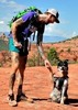
| no partners | | On 10/28/2021, I took a day hike to Munds Mountain Wilderness. It was a gorgeous fall day, with lots of reds and yellows of the maples and oaks. I’m sure Oak Creek Canyon (which this looks down on) is overrun with people looking at the “fall colors”, but up here, there is no one!
I took the Schnebly Trail #158 from Schnebly Hill Road to the cloverleaf interchange with Hot Loop Trail #94, Jack’s Canyon Trail #55, and Munds Mtn Trail #77. I then continued the climb up to the summit of Munds, and a ways past along the ridge, before returning much the same way.
The route from Phoenix to the trailhead is about as straightforward as it gets: I-17 north to Schnebly Hill Road, then west about 7 miles to the trailhead. EXCEPT, the last two miles to the trailhead are definitely high clearance 4WD. I was comfortable in my Trail Rated Cherokee, but I don’t think my wife’s Crosstrek is up to it. There is a road crew grading the road from top to bottom, though, and maybe someday it will be better. I had to dodge a fast moving dump truck a couple times on the way out, and I waved to the road grader driver at 2 miles from the trailhead. There is good parking at the trailhead on the opposite side of the road from the Schnebly Trail.
Trail #158 is an old road bed, but it has almost completely returned to single track for much of it’s length. The views from it down to Sedona and up Oak Creek Canyon as far as Humphrey’s Peak are spectacular. You can get your fill of red rock scenery, from a distance, and the trail passes through some very peaceful little forests of red and yellow maples and oaks.
Partway up, the two-track resumes and continues up over the hill, while the trail veers off right, back in and out of more forest and great views.
At a saddle, the trail first intersects the Hot Loop trail which stays on the mesa, and then the Jacks Canyon Trail and Munds Mtn Trail. The wilderness boundary is here.
The Munds Mountain trail ascends the hill aggressively, and it does require some attention to stay on the path and also not to slip. This climb is not for the faint hearted. After a few switchbacks, though, the trail tops out on a ridge and follows it up to the broad summit of Munds. The views from the summit proper are not good. Too many trees, and the summit is more of a mesa.
I found a summit register at the X that marks the summit on the old USGS map. The register is a glass jar with a metal lid, which required some persuasion to open. I wrapped the lid with my ACE bandage to get leverage and wore my cut-resistant gloves, in case I broke the jar. I lubricated the threads when I reassembled it, and put the whole thing in a zip-loc, so maybe the next time it will be easier.
After the summit, I continued on Trail 77 a ways, until I found a sunny rock with good views to stop and eat my sandwich, before working my way back. From here, you can see all the way to Jerome and Cottonwood. Trail 77 continues with more views as far as you wish, but eventually just ends.
The switchbacks back down Munds are easier to spot from above, but it is still slow going, to keep from slipping on loose rock.
Once leaving the wilderness, I stopped at several Geocaches on the hilltop. Also, I took a sample of the muddy water from Committee Tank. I have been thinking lately about how to efficiently use muddy water from those tanks and I wanted a sample to take home to experiment on.
Schnebly Hill Road is popular for the Jeep Tours from Sedona, as I could see from above, but on this journey I saw no one until I was back on the good part of the road, headed toward I-17. That makes it an almost perfect trip. |
|
Autumn Foliage Observation Substantial
Lots of oaks and maples. |
|
| | |
|
|
|
 Route Editor