|
| | | |
| |
|
| Hiking | 9.42 Miles |
655 AEG |
| | Hiking | 9.42 Miles | 3 Hrs 37 Mns | | 3.06 mph |
| 655 ft AEG | 32 Mns Break | | | |
|
|
| |
| Partners |
|
[ show ]
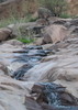
| partners | | After the brief climb up to Wolverton Mountain Trail #9415, Paul & headed down Aspen Creek Trail #48. Good choice: We were immediately greeted by a large quantity and variety of flowers, a trend which would continue throughout the day. The species were mixed up with each other all along the Prescott Circle Trail: columbine, lupine, globemallow, Arizona thistle and many more. I’d guess at least 20 species, some too small for my cruddy pocket camera to photograph, even in macro mode. 
Unfortunately, while crouching down to take my very first flower photograph, I ripped the crotch of my frequently patched hiking pants. This lead to much merriment on Paul’s part, cracking jokes as the hours wore on and the rip grew larger. It got so big — nearly down to my knee — that every time we encountered other people, I turned away as if photographing whatever flower happened to be near. It’s a good thing I was not going commando. 
When we arrived back at the Aspen Creek trailhead, my wife was gone, so I texted her to please go to Walmart and get me some shorts, any shorts, so that when Paul & I finished the hike I would have something to wear which would not earn me a record as a sex criminal. 
I continued hiking with the enhanced ventilation.
Luckily, we only saw two other hikers. Not so luckily, we were passed by at 30-40 mountain bikers. We saw a few every 10-15 minutes, including one MTB club ride of at least 20. 
I’m not sure about the other Prescott Circle Trail segments, but the one between Copper Basin Rd. and Thumb Butte Rd. is optimized for mountain bikes, with plenty of switchbacks, gentle grade, and few obstacles. A hiker, or experienced biker, will cruise right over the ‘rocky’ PCT sections.
It was mostly sunny along the Prescott Circle Trail, but dark clouds were moving over the city itself.
Halfway up Potts Creek Trail #327, we got misdirected onto FR 51 for a half mile. My bad. I blame the distraction in my pants.
Circle Connection Trail #322 is short, maybe ¾s of a mile, but it has been slightly rerouted for trail reclamation. You can’t get lost. Unless you are me.
By the time Paul & I got to Garden Grove Trail #392, it was raining over Prescott. We didn’t even get drizzle, but thunder caused by rather close lightning strikes twice made me jump. 
Once we reached Thumb Butte Rd. we turned east along what I believe is an unnumbered trail that parallels the south side of the road. A ⅓ of a mile before the Thumb Butte Recreation Area, there is an old stone well. There is a spring next to it, but the well itself is now dry and full of dirt.
I made it most of the way across the campground without anyone noticing the gaping hole in the front of my pants. Unfortunately, there was a forest crew enjoying a break right next to where my wife was waiting for Paul & I. The shorts she bought were a bit small, but like I told her, by that point I would have worn a dress. 
Postscript: Today marked my 144th hike of 2018, breaking a personal best I set just last year. 
Hike Video: https://vimeo.com/497252515 |
|
Wildflowers Observation Moderate
Beautiful flowers scattered all along the trail. Check out the photoset for a small sample. Do yourself a favor and do this hike *now*, before the flowers go away! |
|
| _____________________
| http://prestonm.com : Everyone's enjoyment of the outdoors is different and should be equally honored. |
| | |
|
|
|
 Route Editor


 . All and All a great day on the trail. I did have a sore knee and foot but that's on me