username
X
password
register
for free!
help
ArticlesGuidesRoutes
 
Photosets
 
 Comments
triplogs   photosets   labels comments more
Rogers Canyon - JF Trail Loop - 14 members in 40 triplogs have rated this an average 3.9 ( 1 to 5 best )
1, 2  Next
40 triplogs
login for filter options
Apr 19 2025
avatar

 Guides 2
 Routes 207
 Photos 93
 Triplogs 204

male
 Joined Aug 08 2020
 Phx az
Rogers Canyon - JF Trail LoopGlobe, AZ
Globe, AZ
Hiking avatar Apr 19 2025
ScaredyCatTriplogs 204
Hiking14.83 Miles 3,408 AEG
Hiking14.83 Miles   8 Hrs   53 Mns   1.91 mph
3,408 ft AEG   1 Hour   7 Mns Break
 no routesno photosets
1st trip
Partners none no partners
So a friend recommended this route from an inferior trails page. Turns out it's the same as this loop+forming a bit of a stick by starting from Woodbury Trailhead. HC vehicle obviously needed but not 4X4.

This is an area and trails none of us had been to previously. Was excited to do some exploring. Did not disappoint. Will return to this area next season for sure! Hiking road section is steep and fatiguing.

Lots of this outing is fairly chill. We eventually found the ruins. Apparently they used to be more dramatic till some careless buffoon caused major damage. Furthermore, I ended up needing a double wrapped bag to collect all the discarded beer cans & bottles. Pack it in, pack it out people!

After the ruins, the trail got a bit tougher before mellowing out again. Then climbed to the final HP. Chilled there some before the steep, rocky descent with catclaw to the sides of you. Damaged my weak ankle slightly through there. Final climb back to TH was wearing a couple of us down.
 
Apr 16 2023
avatar

 Guides 59
 Routes 1,100
 Photos 1,191
 Triplogs 1,290

male
 Joined Jan 01 2023
 Arizona
Rogers Canyon - JF Trail LoopGlobe, AZ
Globe, AZ
Hiking avatar Apr 16 2023
pseudalpineTriplogs 1,290
Hiking14.78 Miles 3,132 AEG
Hiking14.78 Miles   8 Hrs   49 Mns   2.40 mph
3,132 ft AEG   2 Hrs   39 Mns Break
 
1st trip
Route Scout Route Recorded  on Route Scout | Pop | Map | Popup | MapDEX
Extraordinarily beautiful presently. The Sycamore have broken bud and there are many different wildflowers.
  3 archives
Aug 22 2022
avatar

 Guides 264
 Routes 2,797
 Photos 14,494
 Triplogs 5,894

55 male
 Joined Nov 20 1996
 
Fort Knox Circumference, AZ 
Fort Knox Circumference, AZ
 
Hiking avatar Aug 22 2022
joebartelsTriplogs 5,894
Hiking15.29 Miles 3,007 AEG
Hiking15.29 Miles   10 Hrs   21 Mns   1.76 mph
3,007 ft AEG   1 Hour   40 Mns Break
 
1st trip
Route Scout Route Recorded  on Route Scout | Pop | Map | Popup | MapDEX
Started from the Woodbury Trailhead for a change of perspective. The initial 110-ft hill isn't luring Reavis/Roger ruins destination hikers claiming they have an interest in the journey. If it wasn't for the JF/Woodbury sign you wouldn't know Woodbury existed.

Walking through the moisture-enriched morning grass had me thinking Gortex shoes might be preferred but I felt like I was going above and beyond wearing a long sleeve shirt coupled with pants for the hecklers. Grass is hiding the hint of rarely used trail. Sparse and avoidable catclaw on Woodbury heading east to 172A. Remarkable terrain but the drive negates this as a reasonable dayhike in itself. I passed some of the most sacred datura on earth according to the Wyatt Earp diaries.

Taking a final turn to Rogers, I noticed the elevation was 4,809 ft after a 1500-foot ascent. Due to relentless sweating, I was ready for a few gravity miles. It was a hallmark moment too with the cry of a Red-tailed Hawk soaring overhead.

Rogers Canyon Trail #110
The first ~mile of Rogers jungle is still impressive a week later. There were several light rainfalls in the past week but none of the creeks were flowing today. Pants and a long sleeve shirt really are nice for plowing through the vegetation. ...that may have been the breeze speaking, I hate pants.

Rogers from the Reavis junction to Angel Basin had a healthy scattering of sunflower stalks. I took a stab at the intervals of trail along the creek several times. For the majority, the trail has been abandoned. There are a couple of short segments but ya gotta work for 'em.

The Angel Basin vicinity was a mess of catclaw as expected. Just before reaching Angel Spring, I realized I was wasting energy on the wrong catclaw... lol.

Finding #110 propper for the first quarter-mile out of the basin was difficult to find even with GPS and key cairns. Two of the cairns were spot on but it seemed impossible to go 5-10 feet until thinking outside of the box. This was semi-expected because I recall having trouble here on a Tule to Peralta dayhike in 2010.

The eye-opener was only two semi-quick miles in the remaining six. We were hauling pumpkin in 2010 so I didn't get to absorb the area. At a crawl-pace, I found the distance views, and new to me geology to be worthy of more trips (with loppers).

JF Trail #106
Knee-high grass with lots of catclaw.

Warning
This loop in its current condition will be cursed by most.

Fauna
No snakes, thankfully. The largest group of swallowtail butterflies I've ever seen, scattered admirals and a couple checkered. One greater roadrunner and just one white-tailed deer. Scared up flocks of birds out of the grass in the morning stretch and the late afternoon. Some were quail, no clue about the majority.

FS172 to Woodbury Trailhead
From the 172A split is flat/quick after the initial creek crossing and rutted hill.

[ youtube video ]
 Culture
 Culture [ checklist ]
[ checklist ]  Windmill
wildflower observationwildflower observationwildflower observationwildflower observationwildflower observation
Wildflowers Observation Moderate
lots of sunflower stalks en route to Angel Basin, primrose, daisies, verbena

water 1 out of 5water less than maxwater less than maxwater less than max Roger's Creek Pools to trickle Pools to trickle
two tiny pools
_____________________
- joe
 
Dec 20 2020
avatar

 Guides 12
 Routes 192
 Photos 863
 Triplogs 356

42 male
 Joined Nov 30 2015
 Phoenix, AZ
Rogers Canyon - JF Trail LoopGlobe, AZ
Globe, AZ
Run/Jog avatar Dec 20 2020
ShatteredArmTriplogs 356
Run/Jog14.73 Miles 2,953 AEG
Run/Jog14.73 Miles   4 Hrs   43 Mns   3.12 mph
2,953 ft AEG
 
no photosets
1st trip
Partners none no partners
Hadn't been to Woodbury TH before, so decided to check it out. I have also been curious about the condition of Rogers Canyon and Angel Basin since the fire; it was pretty torched at the Reavis junction.

Started with the road section in order to get it out of the way; outside of one giant flock of OHVs, the traffic wasn't bad.

As mentioned, the canyon is in bad shape at Reavis junction. Fortunately, within a mile or so, the condition improved greatly. In places you'd forget there was even a fire, if it weren't for the parts of the trail in the creek bed being wiped out.

Angel Basin wasn't in terrible shape, at least at the Frog Tanks junction. Just past the first side canyon heading west, it gets pretty badly torched again. Stopped by Angel Spring to check it out, no flow.

The first mile heading up out of Angel Basin has some pretty miserable catclaw, but once leaving the bottom of the canyon, it's not too bad. View from Tortilla Pass was nice, and the way down was not particularly smooth.

dry Angel Spring Dry Dry
There are a couple of pools, no flow. Could make do if in a pinch.

dry Roger's Creek Dry Dry
_____________________
 
Dec 19 2020
avatar

 Routes 93
 Photos 7,758
 Triplogs 1,691

64 male
 Joined Mar 11 2003
 AZ
Rogers Canyon - JF Trail LoopGlobe, AZ
Globe, AZ
Hiking avatar Dec 19 2020
wallyfrackTriplogs 1,691
Hiking14.48 Miles 3,159 AEG
Hiking14.48 Miles   8 Hrs   16 Mns   1.87 mph
3,159 ft AEG      32 Mns Break
 no routes
Partners partners
DarthStiller
I haven't been out to Angel Basin in a while so this loop was overdue. The hike up to Tortilla Pass seems to drag on but the temperature was nice. The JF trail was rocky but easy enough to follow. There was a short catclaw gauntlet nearing Angel Basin but that's normal for that area. Chris and I made up to the ruins and had not seen any hikers yet. After a break for lunch we continued up Rogers Canyon pointing out other ruin locations and the Ore Cart mine. We passed several hikers coming down the trail. There were not as many hikers out as I would expect on a Saturday. After making it to Rogers Trough trailhead we continued down Fr 172A to the Upper Woodbury trailhead. The road is rough in spots but I could drive it. :lol: The upper section of Woodbury trail is easy going and I think we made up some time in the last few miles.
 Named place
 Named place [ checklist ]
[ checklist ]  Randolph Canyon
_____________________
  4 archives
Dec 19 2020
avatar

 Guides 27
 Routes 669
 Photos 12,096
 Triplogs 856

56 male
 Joined Jul 05 2006
 Mesa, AZ
Rogers Canyon - JF Trail LoopGlobe, AZ
Globe, AZ
Hiking avatar Dec 19 2020
DarthStillerTriplogs 856
Hiking14.48 Miles 3,159 AEG
Hiking14.48 Miles   8 Hrs   22 Mns   1.85 mph
3,159 ft AEG      32 Mns Break
 
1st trip
Partners none no partners
I first hiked this back in 2004, today it seemed alot longer than I remembered. Wally and I started at Woodbury and hiked clockwise. JF isn't too bad, but maybe that was because we'd started with that. It was pretty rocky, which always slows me down. All the fire damage from 2 summers ago is very faint.

We got to the ruins in just under 4 hours. The leaves in the stream bed below pile up in their own kind of pools, making for mild hazards as you step in them. We climbed up to the ruins, but for the last bit of the ascent I decided against going further. The exposure had me uncomfortable especially with my backpack shifting around. I've been in the twice before, that's enough. Below we found some sherds and other possible tools. The one sherd had some color on it.

After lunch we'd headed up Rogers Canyon. Wally pointed out the upper ruins and some others that he's found over the years. Nice to make note of that if I ever decide to go searching. Today I was content with the power of my zoom lens for some good pics.

It was a bit of a slog on the way up to Rogers Trough, then still a slog down the road over to Woodbury. I still can't decide if it's me getting older or it's been so long that I don't remember how difficult it was 16 years ago. Probably a bit of both. Nice to be out in the Supes again and hike with someone.
 Named place
 Named place [ checklist ]
[ checklist ]  Angel Basin
_____________________
 
Jan 12 2020
avatar

 Guides 1
 Routes 15
 Photos 520
 Triplogs 38

46 male
 Joined Oct 01 2005
 Queen Creek, AZ
Rogers Canyon - JF Trail LoopGlobe, AZ
Globe, AZ
Hiking avatar Jan 12 2020
adv_trevTriplogs 38
Hiking13.05 Miles 3,023 AEG
Hiking13.05 Miles   5 Hrs   19 Mns   2.62 mph
3,023 ft AEG      20 Mns Break15 LBS Pack
 no routes
1st trip
Linked   none no linked trail guides
Partners none no partners
Can I started off by going counter-clockwise from Woodbury. I think it was a good way to go, minus climbing up Rogers canyon. I think that would have been easier going downhill. There is plenty of water where everywhere. I got the Angels basin, I thought I missed the ruins. I started climbing up and out Rogers canyon and there they were. I would say they are hard to miss. I ran into a rather large mountain lion track oh, but I wasn't worried. There was a lot of burn sign turn that recent fire, but I think it's coming back pretty quick. I just wish that it burned up more of that damn catclaw

water 1 out of 5water 2 out of 5water 3 out of 5water less than max Red Wood Spring Gallon per minute Gallon per minute

water 1 out of 5water 2 out of 5water less than maxwater less than max Roger's Creek Light flow Light flow

water 1 out of 5water 2 out of 5water 3 out of 5water less than max Rogers Canyon Spring Gallon per minute Gallon per minute

water 1 out of 5water 2 out of 5water 3 out of 5water less than max Rogers Spring Gallon per minute Gallon per minute
_____________________
 
Jan 20 2019
avatar

 Routes 27
 Photos 279
 Triplogs 56

39 male
 Joined Aug 06 2009
 Phoenix, AZ
Rogers Canyon - JF Trail LoopGlobe, AZ
Globe, AZ
Hiking avatar Jan 20 2019
nathanbriskTriplogs 56
Hiking1.22 Miles 399 AEG
Hiking1.22 Miles      45 Mns   1.88 mph
399 ft AEG      6 Mns Break
 
Linked   none no linked trail guides
Partners partners
Elavelle
Route Scout Route Recorded  on Route Scout | Pop | Map | Popup | MapDEX
Hiked into the crag. There is a separate photo album for this side hike from Angel Basin. Got a nice view of Angel Basin from above.
 Named place
 Named place [ checklist ]
[ checklist ]  Angel Basin
_____________________
  3 archives
Jan 20 2019
avatar

 Routes 27
 Photos 279
 Triplogs 56

39 male
 Joined Aug 06 2009
 Phoenix, AZ
Rogers Canyon - JF Trail LoopGlobe, AZ
Globe, AZ
Backpack avatar Jan 20 2019
nathanbriskTriplogs 56
Backpack14.68 Miles 2,905 AEG
Backpack14.68 Miles   7 Hrs   20 Mns   2.24 mph
2,905 ft AEG
 
Route Scout Route Recorded  on Route Scout | Pop | Map | Popup | MapDEX
Drove in to the Woodbury trailhead because I don't trust my AWD Saturn Vue to get to Rogers Trough trailhead.

We did this loop in reverse--starting from the Woodbury trailhead and taking the loop to the west.

Emma, Bruce the pooch and I got started on the trail at about 8am. It's the first time I haven't lost the trail immediately from the Woodbury Trail/JF Trail junction . . . some kind soul erected a few cairns, so we were good to go. Pruned thorny branches as I went . . . actually broke my pruners! Hiking up to Tortilla pass was challenging per usual. Weather was perfect. Clear, treatable pools were encountered on the JF Trail south of Rogers Canyon Trail junction. HIking down into the canyon, the brush was extremely overgrown. Unfortunately, by this time I had already broken the pruners . . .

I'm pretty stoked! I've been to this area several times, but logistics never worked out to see the ruins. Got to see them this time! Awesome :)

The creek beside Angel Basin was half-full and flowing. This particular evening happened to include a complete lunar eclipse as well. That was a treat.

It's a fun section of slight bouldering going NE on Rogers Canyon Trail past the cliff dwellings. Once we rolled in to Rogers Trough Trailhead, we needed to hike the road for about 2 miles to join the Woodbury Trail to the JF Trail and back to the Woodbury Trailhead.


 Named place
 Named place [ checklist ]
[ checklist ]  Angel Basin
_____________________
  3 archives
Mar 26 2016
avatar

 Photos 83
 Triplogs 3

41 male
 Joined Feb 14 2014
 Mesa AZ
Rogers Canyon - JF Trail LoopGlobe, AZ
Globe, AZ
Hiking avatar Mar 26 2016
legshurtbackhurtsTriplogs 3
Hiking13.05 Miles 2,700 AEG
Hiking13.05 Miles
2,700 ft AEG
 no routes
1st trip
Linked   none no linked trail guides
Partners none no partners
Man I’ve been bad about posting triplogs. But I’m trying to do better because I love the hell out of everyone else’s triplogs. Plus: triplogs are incredibly useful.

This was our sixth backpack of the semester (we’re teachers) (Lower La Barge Box, La Barge Spring, Upper La Barge/Red Tanks Loop, Horse Camp Seep, Aravaipa, and now this). Happy to give anyone info on those places, but you guys know all about those places. All great.

First time to Woodbury Trailhead. Road’s fairly gnarled-up. We just got a Subaru, and were totally fine in that. Before the Subaru we were driving a Mustang, and I wouldn’t have gone to the Woodbury Trailhead in the Mustang. Anyway. Hit the trail. Cruised up JF (hot, no water, surprisingly tiring/long, nice views, happy to be out there). Made it to Tortilla Pass. Had celebratory clementine oranges (side note: people are tossing mad orange peels in the Rogers Canyon area – this was not us – not fans of the tossed orange peels). Made our way down to Angel Basin. Little bit of flow in the creek at Angel Basin. Plus it is very green there now. Also: most of the trees have just grown new leaves, so they’re all pretty as hell. We stayed at one of the creekside campsite between the ruins and Angel Basin. Great spot. Nice flow in the creek right there. Heard what we thought were goats/sheep braying (?) nearby. Went to look for them. They heard us coming. Stopped braying.

Spent the afternoon/evening up at the ruins. We’d been here once before but were in a hurry, and totally missed the upstairs room. The upstairs is incredible. My wife and I spent a couple hours at the ruins. Warm evening, cool breeze. Found some pottery sherds. Cruised down. Went to Angel Basin for the sunset.

Well: you can’t beat Rogers Canyon. Oh also: there are a million butterflies right now of all different colors. We noted at the campsite that at any moment there was at least one butterfly present. Slept like a champ. Gurgling brook was audible from the tent. Some screeching birdies but that was part of the fun. Morning campfire. Said our goodbyes to the space.

Good lord Rogers Canyon between Rogers Trough trailhead and the ruins is incredible! Shade/water/views pretty much the entire way. Nice breeze. High canyon walls with alcoves/caves to gawk at. Butterflies. Made it to the trailhead. Road-walked to where 172A hits the Woodbury trail. Honestly the road to Rogers Trough is not even that bad – the worst part is before the Woodbury turnoff (in my opinion).

Made it back to Woodbury. Saw a rattlesnake on the drive out.

Watching the trees in Rogers Canyon from the vantage of the ruins was the most peaceful thing ever. I know many of you have had the same experience. Happy to share that with you all.
_____________________
 
Nov 20 2015
avatar

 Triplogs 1

48 male
 Joined Oct 25 2015
 Queen Creek
Rogers Canyon - JF Trail LoopGlobe, AZ
Globe, AZ
Backpack avatar Nov 20 2015
bmwbj2Triplogs 1
Backpack13.05 Miles 2,700 AEG
Backpack13.05 Miles
2,700 ft AEG20 LBS Pack
 no routesno photosets
1st trip
Linked   none no linked trail guides
Partners none no partners
Hiked with my sons. Caleb=11 and Braden=8. My son Braden's first backpacking trip. Overnighter. Didn't realize the road up Hewitt Canyon was so rough. Took longer than expected. Didn't start hiking until 4:30. Got dark soon, but enjoyed the night hike up and over Tortilla Pass. Boys did great. The last mile down from Tortilla Pass to Angel Basin is pretty overgrown. Fighting catclaw. Didn't get into camp until 9:00 PM. Lots of water in Angel Basin, nice flow in the creek bottom. Very windy in Angel Basin. Boys slept in the tent, I cowboy camped. Not as cold as I had anticipated it to be. Quite pleasant actually. Next morning was absolutely beautiful when the sun hit the cliffs surrounding the basin. Explored the cave dwellings for awhile. The boys were fascinated by them. Couldn't believe they were 700 years old. The hike up Roger's Canyon was phenomenal. Great hiking weather, not too hot, not too cold, gradual incline, beautiful fall colors. We didn't see anybody the whole trip until the last 2 miles up Rogers, then we ran into lots of people coming down. Once at Roger's Trough we hiked back down the road to Woodbury. What a view! You can see forever up there! Boys worn out by the time we got down. Last mile was tough on Braden and I wondered if I had pushed him 1 mile too far. But when we got home he said he wanted a new backpack, better shoes and a new headlamp for Christmas. Success!!!
foliage observationfoliage observationfoliage observationfoliage observationfoliage observation
Autumn Foliage Observation Extreme
Yellow, Orange, Brown. Stunning Colors in Roger's Canyon.

water 1 out of 5water 2 out of 5water 3 out of 5water 4 out of 5 Angel Spring Gallon + per minute Gallon + per minute
Lots of flowing water in Angel Basin.

water 1 out of 5water 2 out of 5water 3 out of 5water less than max Roger's Creek Medium flow Medium flow
Plenty of water all the way up Roger's Canyon. Pools and medium flow areas. Some places dry, but lots of water along the way.
_____________________
 
Feb 08 2015
avatar

 Routes 93
 Photos 7,758
 Triplogs 1,691

64 male
 Joined Mar 11 2003
 AZ
Rogers Canyon - JF Trail LoopGlobe, AZ
Globe, AZ
Hiking avatar Feb 08 2015
wallyfrackTriplogs 1,691
Hiking13.57 Miles 2,907 AEG
Hiking13.57 Miles   5 Hrs   40 Mns   2.39 mph
2,907 ft AEG
 no routes
Linked   linked  
Partners none no partners
I took a ride in to Woodbury TH to hike the loop through Rogers Canyon. I saw another alcove high up (in a photo)and wanted to get a closer look. The plan was to hike in and out but that changed into a loop option. The trails were in good shape but the alcove looked empty. I stopped by an old mine on the way out. Nice day for a hike.
 Culture
 Culture [ checklist ]
[ checklist ]  Mine Shaft
_____________________
  5 archives
Dec 25 2013
avatar

 Guides 37
 Routes 556
 Photos 10,872
 Triplogs 1,052

43 male
 Joined Jan 21 2013
 AZ
Central Supes Loop, AZ 
Central Supes Loop, AZ
 
Backpack avatar Dec 25 2013
FOTGTriplogs 1,052
Backpack54.60 Miles
Backpack54.60 Miles5 Days         
 
Just a five day 55 mile jaunt through the middle of the Superstition Wilderness. I met Wally with a friend on Christmas day at Roger's Trough, 7:30. Wally showed me a few sets of lesser traveled cliff-dwellings in area and we both finally located the trough at Angel Basin, which for all the time we had spent out there neither of us had been until that day. Towards the end of the day I had one of my nicest finds in Supes, a very nice set of cliff-dwellings. Christmas turned out to be a day of great finds, and a little over 13 miles of exploring. Despite hurricane force winds we hung around the fire, chatted and ate food for the rest of the night. Wally left in the morning and Lucy, myself and the dogs started the annoying climb to Tortilla Divide and the JF Ranch Trail.

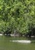
Day two consisted of Roger's Canyon to JF Ranch Trail, to Coffee Flats Trail, to Reed's Water where we camped. I did do some additional exploring on day two. I cam across another cliff-dwelling, in the past this would have been the find of the year for me, however, after what we came across the day before, it was more reserved, but still appreciated. I spend so much time in the more remote areas, I had forgotten about places like Reed's Water. We got water from the well, had a nice dinner and enjoyed a very nice camp site in a picturesque area. However, the windmill can get quite noisy and startle you at time when it creaks and starts.

Day three was our short day and recovery day, we met my good friend Jim around the Charlebois area and went to one of our favorite spots. The dogs rested we rested and ate some food while considering our options for returning to Roger's Trough.

Day four consisted of the Dutchman to Red Tanks, Red Tanks to Hoolie Bacon, and then the JF Ranch Trail to Clover Spring for camp. On Hoolie Bacon I saw two hikers with llamas the was different. Saw some day hikers when we got closer to the intersection with JF Trail, other than that Hoolie Bacon was well..Hoolie Bacon. JF trail was in typical form as well, century plants across the trail, and prickly pear and agave winning the battle for trail supremacy. The above couple with the fact that we seemed to have been climbing all day on day four, first the Upper La Barge Box and then the climb from Horse Camp Basin to Horse Ridge and right back up the JF..sigh..I banked a lot on my one memory of JF from a year ago and thought we would have a place to camp, water and maybe some wood near Clover Spring. The gamble worked, as camping options along the JF Trail are very limited.

Day five we hiked to Tortilla Divide, the last stretch to the divide is becoming quite the little bushwhack in spots as you make your climb from JF Trail. We then took JF Ranch Trail to the Woodbury Ranch site, and instead of making our way to established TH, I took care of my last 1.2 miles left of marked Supes trails and hiked the portion that ends at FR 172. From there the hike was kind of hard at times, the wind was blowing really hard and I now had dogs on lead, plus the fatigue of having already hiked in from Clover Spring and now we were climbing up to Roger's Trough, but we made it and were in car heading down FR 172 by 12:30.

My AEG is all jacked up, but final miles for trip were 54.6. This "trek" was particularly unique because of the sharp contrasts in the environments we hiked through, from the often snow covered area around Iron Mountain, to the riparian, and jungle like areas along Coffee Flats in Randolph Canyon, then the low desert areas, back to the canopy areas along La Barge then back up to the wind-swept ridge-lines of JF Ranch Trail, finishing up at the sparsely vegetated Woodbury Ranch area. One night I was putting on lotion so my neck would not peal from a little sun burn and the next morning the dog's water was frozen.
_____________________
  2 archives
Nov 30 2013
avatar

 Photos 101
 Triplogs 16

59 male
 Joined Feb 23 2008
 gold canyon
Rogers Canyon - JF Trail LoopGlobe, AZ
Globe, AZ
Backpack avatar Nov 30 2013
AlexTriplogs 16
Backpack14.40 Miles 3,068 AEG
Backpack14.40 Miles2 Days         
3,068 ft AEG
 no routes
1st trip
Linked   none no linked trail guides
Partners none no partners
My good friend Trent, who just got of the Army after five years, wanted to go on a backpacking trip, so I took him to see the ruins in Rogers Canyon that never disappoint.
We started from the Woodbury Trailhead and headed up the JF Trail, the weather could not have been any nicer. After a quick lunch at the junction of the JF Trail and Rogers Canyon trail we headed on down to Angle Basin, very over grown with catclaw, :x very bloody.
Plenty of water in Angle Basin from the heavy rains last weekend and only one other camper, so we set up camp and started searching for fire wood, more catclaw but hardly any wood to be found. Got a little chile at night, about 38 degrees. It was good to get caught up with him around the fire.
The next morning we headed over to the ruins for about 1/2 hour, They did not disappoint.
We continued up Rogers Canyon to Rogers Trough Tailhead and down 172a to the crosscut to Woodbury. A very sceenic loop, a great trip to take a good friend on who has been gone a while.
_____________________
 
Oct 20 2013
avatar

 Routes 5
 Photos 58
 Triplogs 46

49 male
 Joined Apr 18 2002
 Phoenix, AZ
Rogers Canyon - JF Trail LoopGlobe, AZ
Globe, AZ
Hiking avatar Oct 20 2013
rehlersTriplogs 46
Hiking13.05 Miles 2,700 AEG
Hiking13.05 Miles
2,700 ft AEG
 
no photosets
Linked   none no linked trail guides
Partners none no partners
Did this trail CW from Woodbury Trailhead

Trail Conditions
JF - pretty good. Not too hard to follow and mostly clear
Roger's Canyon - Always a beast after you climb down to the canyon below and before you get to angel basin. Not bad to follow, but lots of brush to push through. The rest was in good shape
Reavis - good
Road - good :)
Woodbury Trail (114) - Kind of faint in parts, but it used to be a road so not too hard to keep on target.
_____________________
 
Mar 12 2011
avatar

 Triplogs 3

39 male
 Joined Mar 13 2011
 Scottsdale, AZ
Rogers Canyon - JF Trail LoopGlobe, AZ
Globe, AZ
Hiking avatar Mar 12 2011
acw1986Triplogs 3
Hiking9.90 Miles 1,705 AEG
Hiking9.90 Miles   4 Hrs   20 Mns   2.28 mph
1,705 ft AEG
 no routesno photosets
1st trip
Linked   none no linked trail guides
Partners none no partners
_____________________
 
Jan 14 2011
avatar

 Routes 3
 Photos 4
 Triplogs 22

46 female
 Joined Jan 27 2008
 Phoenix, AZ
Rogers Canyon - JF Trail LoopGlobe, AZ
Globe, AZ
Backpack avatar Jan 14 2011
kateTriplogs 22
Backpack16.39 Miles 2,850 AEG
Backpack16.39 Miles3 Days   8 Hrs   26 Mns   
2,850 ft AEG
 no routesno photosets
1st trip
Linked   none no linked trail guides
Partners none no partners
Woodbury TH -> JF Trail -> Tortilla Pass-> Rogers Canyon->Angels Basin->Reavis Ranch Trail --> Roger Trough Trailhead --> FS172A --> Woodbury Trail -->Woodbury TH

We got a late start Friday from the Woodbury TH so when we arrived at Tortilla Pass at sundown we decided to camp at the established site there at the trail junction. While our site happened to be in a wind tunnel and our tent almost blew away with us inside it, we were glad we had called it a day there after hiking the stretch of Rogers Canyon Trail to Angels Basin the next day and finding just how overgrown it was. It would have been quite difficult to navigate in the dark.

Saturday we went downhill to Angels Basin and by the time we got to the bottom we looked like we'd been in a street fight with a gang of feral cats. Luckily the boy scouts began showing up before we had begun to make camp at Angels Basin and they let us know there would be 22 of them. We apprecieated the warning so we hiked about 1.7 miles beyond Angels Basin and the cliff dwellings and found a fantastic site on the opposite side of the creek from the trail.

The ground was soft dirt, there were plenty of trees for shade and pack hanging, the creek was flowing and there was an existing fire ring and rock furniture. And it wasn't right on top of the trail like the other sites we saw. After seeing the rest of the camp sites, I'm convinced we had the best one on that loop. We relaxed, had a few camp cocktails and made a delicious trail dinner before sun-down.

Sunday morning we made our way up Rogers Canyon and Reavis Ranch Trail to the Rogers Trough trailhead. This portion of the trail appeared to be much more traveled. While we didn't pass too many people, it was easy to follow and only a few patches of overgrowth. Compared to the western side of Rogers Canyon Trail it was heaven. There was water most of the way up the canyon but not so much that you couldn't rockhop the crossings.

Once we made it to Rogers Trough Trailhead we hiked down FS172A to the Woodbury Trail. While it was pretty steep and a road rather than trail, the views made up for it. Crossing over on the Woodbury Trail took us back to the windmill and then back down JF Trail to the Woodbury Trailhead.

All in all a great hike, but will definitely be wearing some very tough long sleeves and pants if going down Rogers Canyon on the West side again.
_____________________
 
Mar 20 2010
avatar

 Guides 44
 Routes 162
 Photos 24,766
 Triplogs 2,411

75 male
 Joined May 04 2004
 Mesa, AZ
Rogers Canyon - JF Trail LoopGlobe, AZ
Globe, AZ
Hiking avatar Mar 20 2010
CannondaleKidTriplogs 2,411
Hiking17.50 Miles 3,546 AEG
Hiking17.50 Miles   8 Hrs   6 Mns   2.16 mph
3,546 ft AEG
 no routes
1st trip
Partners partners
trixiec
It didn't look very easy on paper so we prepared for a long day with plenty of elevation gain. But planning and doing can turn out to be two altogether different. Even though hiking much of it from Roger's Trough TH back to Woodbury were on the relative easy terrain of the road, it felt like more of an epic trek than a day hike. Still, all the effort was well worth the end results. I managed to take so many photos I had to group them into two sections as listed below. Having taken over 200 pictures, if a picture is worth a thousand words, then I guess I saved myself from writing 200,000 words to describe the hike. I hope you enjoy the photos!

Photos from Woodbury Trail Head to Frog Tanks Trail are here:
http://www.changephoenix.com/10/2010-03-20JF-Roger'sCanyon1.html

Photos from there past the Salado Indian ruins to Roger's Trough TH are here:
http://www.changephoenix.com/10/2010-03-20JF-Roger'sCanyon2.html
_____________________
CannondaleKid
 
Nov 21 2009
avatar

 Guides 16
 Routes 81
 Photos 1,269
 Triplogs 1,144

51 male
 Joined Apr 30 2008
 Tucson, AZ
Rogers Canyon - JF Trail LoopGlobe, AZ
Globe, AZ
Hiking avatar Nov 21 2009
azdesertfatherTriplogs 1,144
Hiking16.00 Miles 2,200 AEG
Hiking16.00 Miles   7 Hrs   10 Mns   2.23 mph
2,200 ft AEG
 no routes
1st trip
Linked   linked  
Partners partners
Tortoise_Hiker
wallyfrack
Couldn't say it any better than Tortoise Hiker did...

Wally said he wanted to hike Rogers Canyon,cache some water,hike to Reavis Grave and check out the ruins. Dave suggested we make it a loop. So we did all of the above. My first time on this trail and I enjoyed it. Some nice views.We made good time time to the Grave then headed down to the ruins. We saw a dead fawn carcas on trail. A lttle before the ruins we got to see a bunch of coatimundi.My first time seeing them.Very cool! The ruins were cool too! After the ruins we cached the water. From there we all got are cutters out for the next couple of miles through the catclaw.Didn't see a drop of water until the windmill but did shed a few drops of blood here and there.We came across a hiker from Houston,Texas by the JF Trail intersection. He had been out there camping a couple days.He said he was retired and comes out here in Nov. to enjoy the Supes.We headed back Woodbury then started the climb back up to Rogers Trailhead. That was the hardest spot although the catclaw section hurt a little. Great hike and workout. When we got back Dave had to go but Wally was buying dinner so I couldn't say no. :D Thanks Wally for driving and dinner, and to both of you for going! :)


Only thing he left out was the snake that shot across the trail while I was leading a downhill haul. It was so close that its tail was right against the toe of my boot! :o And it was so fast that I never even got a chance to see its head. It was about 3/4" in diameter, probably about 2 feet long.
 Fauna
 Fauna [ checklist ]
[ checklist ]  Coatimundi
_____________________
"I went to the woods because I wished to live deliberately, to front only the essential facts of life, and see if I could not learn what it had to teach, and not, when I came to die, discover that I had not lived." — Henry David Thoreau
 
Nov 21 2009
avatar

 Guides 1
 Routes 148
 Photos 9,924
 Triplogs 3,652

63 male
 Joined Apr 02 2005
 Mesa, AZ
Rogers Canyon - JF Trail LoopGlobe, AZ
Globe, AZ
Hiking avatar Nov 21 2009
Tortoise_HikerTriplogs 3,652
Hiking16.00 Miles 2,900 AEG
Hiking16.00 Miles   7 Hrs   7 Mns   2.25 mph
2,900 ft AEG
 no routes
1st trip
Partners partners
azdesertfather
wallyfrack
Wally said he wanted to hike Rogers Canyon,cache some water,hike to Reavis Grave and check out the ruins. Dave suggested we make it a loop. So we did all of the above. My first time on this trail and I enjoyed it. Some nice views.We made good time time to the Grave then headed down to the ruins. We saw a dead fawn carcas on trail. A lttle before the ruins we got to see a bunch of coatimundi.My first time seeing them.Very cool! The ruins were cool too! After the ruins we cached the water. From there we all got are cutters out for the next couple of miles through the catclaw.Didn't see a drop of water until the windmill but did shed a few drops of blood here and there.We came across a hiker from Houston,Texas by the JF Trail intersection. He had been out there camping a couple days.He said he was retired and comes out here in Nov. to enjoy the Supes.We headed back Woodbury then started the climb back up to Rogers Trailhead. That was the hardest spot although the catclaw section hurt a little. Great hike and workout. When we got back Dave had to go but Wally was buying dinner so I couldn't say no. :D Thanks Wally for driving and dinner, and to both of you for going! :)
 Fauna
 Fauna [ checklist ]
[ checklist ]  Coatimundi
_____________________
Tortoise Hiking. Stop and smell the Petrichor.
 
average hiking speed 2.14 mph
1, 2  Next

WARNING! Hiking and outdoor related sports can be dangerous. Be responsible and prepare for the trip. Study the area you are entering and plan accordingly. Dress for the current and unexpected weather changes. Take plenty of water. Never go alone. Make an itinerary with your plan(s), route(s), destination(s) and expected return time. Give your itinerary to trusted family and/or friends.

helpcommentissue

end of page marker