username
X
password
register
for free!
help
ArticlesGuidesRoutes
 
Photosets
 
 Comments
triplogs   photosets   labels comments more
Meridian Mystery Trail - 3 members in 21 triplogs have rated this an average 2.7 ( 1 to 5 best )
1, 2  Next
21 triplogs
login for filter options
Jan 31 2025
avatar

 Routes 93
 Photos 7,758
 Triplogs 1,691

64 male
 Joined Mar 11 2003
 AZ
Willow Springs Canyon UpperPhoenix, AZ
Phoenix, AZ
Hiking avatar Jan 31 2025
wallyfrackTriplogs 1,691
Hiking14.00 Miles 1,440 AEG
Hiking14.00 Miles   6 Hrs   14 Mns   2.25 mph
1,440 ft AEG
 no routes
1st trip
Denny and I had talked about a shuttle hike in the Goldfields from the Willow Spring trailhead to the Meridian trailhead years ago. I thought we could break it up into two or three hikes but Denny went all in like he was holding a pair of aces. I had a route with an option to hike over a ridge but the passes were about a mile farther north because of a second ridge we'd need to hike around so we opted for the southern route which was all on trail. We connection parts of 11 trails in 14 miles to make the trek. Part of the trails were roads and part were washes and sometimes the track we had used a wash but a trail was there. In the Goldfields most of the trails are not marked and some are marked occasionally so a having a track is very helpful. The weather cooperated and Denny keep going so we finished the entire route (included an extra mile looking for a pass) in good time. There is some interesting geology in the Goldfields so I guess they're okay. Thanks for the hike Denny.
_____________________
  1 archive
Jan 31 2025
avatar

 Guides 1
 Routes 148
 Photos 9,924
 Triplogs 3,652

63 male
 Joined Apr 02 2005
 Mesa, AZ
Willow Springs Canyon UpperPhoenix, AZ
Phoenix, AZ
Hiking avatar Jan 31 2025
Tortoise_HikerTriplogs 3,652
Hiking14.00 Miles 1,440 AEG
Hiking14.00 Miles   6 Hrs   14 Mns   2.25 mph
1,440 ft AEG
 no routes
1st trip
Wally and I dropped a car off at Meridian trail head and drove over to Willow to start our hike. Wally was nice enough to draw us up a route and some options. Hit the trail about 7:30. 1 shirt and shorts would have been good but I wore pants for some exploring. 🥴 Lots of cool rock formations and stuff to see. Only saw a hand full of people all day!
Weather and route were great and most trails were in good shape. Thanks for making it go so smoothly Wally. Like HAZ, you rock!!
_____________________
Tortoise Hiking. Stop and smell the Petrichor.
 
Sep 13 2024
avatar

 Routes 93
 Photos 7,758
 Triplogs 1,691

64 male
 Joined Mar 11 2003
 AZ
Meridian Mystery TrailPhoenix, AZ
Phoenix, AZ
Hiking avatar Sep 13 2024
wallyfrackTriplogs 1,691
Hiking5.20 Miles 18 AEG
Hiking5.20 Miles   1 Hour   45 Mns   2.97 mph
18 ft AEG
 no routes
Linked   none no linked trail guides
Partners none no partners
Set out to view the burn. The flames on the Superstition Ridgeline were visible in the dark but not big. I didn't see much smoke once the sun came up but could smell it a few miles in. Not much fauna out, only a hawk and some rabbits. The mornings seem a little cooler.
_____________________
  1 archive
Aug 18 2024
avatar

 Routes 93
 Photos 7,758
 Triplogs 1,691

64 male
 Joined Mar 11 2003
 AZ
Meridian Mystery TrailPhoenix, AZ
Phoenix, AZ
Hiking avatar Aug 18 2024
wallyfrackTriplogs 1,691
Hiking5.00 Miles 616 AEG
Hiking5.00 Miles   1 Hour   40 Mns   3.00 mph
616 ft AEG
 no routes
Linked   none no linked trail guides
Partners none no partners
The plan was to leave early but I heard the thunder and delayed a few hours. The rain had stopped and no lightning was seen so I sped off to the Meridian trailhead. There were several cars in the lot so the plan changed to hike east and avoid the herd. I only saw one other hiker and got to see a desert tortoise. The temps were good with nice cloud cover but the humidity :sweat: was high. Great morning for a hike.
 Fauna
 Fauna [ checklist ]
[ checklist ]  Desert Tortoise
_____________________
  1 archive
May 12 2024
avatar

 Guides 27
 Routes 669
 Photos 12,096
 Triplogs 856

56 male
 Joined Jul 05 2006
 Mesa, AZ
Peak 3004 Loop - Goldfield MtnsPhoenix, AZ
Phoenix, AZ
Hiking avatar May 12 2024
DarthStillerTriplogs 856
Hiking7.73 Miles 1,572 AEG
Hiking7.73 Miles   3 Hrs   52 Mns   2.00 mph
1,572 ft AEG
 
Linked   linked  
Partners partners
adilling
mt98dew
Brian left his phone in my car after the Wrightson hike. Wally found it when we stopped for cheaper gas on I-10 on the way back. Brian got back to me right away once I PMed him and once I had texted Andy for where to hike on Sunday we had a meetup set up.

I like to always try to hike something new everytime, but since I hike so much now, I've given up and accepted repeat hikes to places close to home. this hike is becoming a recent favorite for the closeness, and quickness with some decent AEG to make it a decent workout.

Brian left us in the dust at the halfway point, and Andy and I slinked back to the starting point. from there we headed east on the Meridian Trail and turned back in time for me to stop and get Radmila floweers for Mother's Day on the way home. Nice to get out and hike before the weather gets too hot.
_____________________
 
May 12 2024
avatar

 Guides 2
 Routes 267
 Photos 9,816
 Triplogs 402

62 male
 Joined Dec 02 2014
 Mesa, AZ
Peak 3004 Loop - Goldfield Mtns, AZ 
Peak 3004 Loop - Goldfield Mtns, AZ
 
Hiking avatar May 12 2024
adillingTriplogs 402
Hiking7.64 Miles 1,419 AEG
Hiking7.64 Miles   3 Hrs   51 Mns   2.06 mph
1,419 ft AEG      8 Mns Break
 
1st trip
Partners partners
DarthStiller
mt98dew
Route Scout Route Recorded  on Route Scout | Pop | Map | Popup | MapDEX
I wasn't sure where I would end up hiking this weekend, but Chris invited me to hit this cool little loop. This his "recovery" hike after hitting Mt Wrightson near Tucson the day before.

I have done this loop a few times, but it's been many years since I have been on this one all the way around.

We met up at 630am and started off in counter-clockwise fashion. Chris was there early as was Brian. I have never hiked with him before. Nice to meet you Brian!

I was a slow-poke going up and a semi slow-poke hiking down from the saddle. Brian had to jet as it's Mother's Day and hiking all day is not a good idea when Mom's need attention. He left us in the dust, but we did see him going down the Pass Mountain Trail as we started down the 2nd saddle.

Chris wanted to add some more miles, so we hiked down the Meridian Mystery Trail for a little while and then turned around.

A few critters, but no snakes :( . There was a little horned toad missing his tail at the Pass Mtn Saddle, lots of doves, a few quail, bunnies and ground squirrels, and the ever present lizards darting up and down and across the trail. Most of the blooms that were so beautiful just a few weeks ago have been roasted. But, I saw quite a few saguaro blooms and even a few barrel cacti blooms too.

A nice 7.5 mile loop with a little elevation gain. The trail on the loop was in good shape. Much better than I remembered for sure. The weather was starting to get a little toasty at the end, but it was very nice starting off. In a month, I would gladly take a day like today.

Thanks for the invite Chris, and it's alway awesome meeting up the HAZers on the trail. Let's hike again soon, Brian.
_____________________
"Jobs fill your pockets, adventures fill your soul."

instagram: @andydilling
 
Feb 10 2024
avatar

 Guides 2
 Routes 207
 Photos 93
 Triplogs 204

male
 Joined Aug 08 2020
 Phx az
Bulldog Saddle TrailPhoenix, AZ
Phoenix, AZ
Hiking avatar Feb 10 2024
ScaredyCatTriplogs 204
Hiking9.14 Miles 1,607 AEG
Hiking9.14 Miles   4 Hrs   38 Mns   2.56 mph
1,607 ft AEG   1 Hour   4 Mns Break
 
no photosets
1st trip
Linked   linked  
Partners none no partners
Route Scout Route Recorded  on Route Scout | Pop | Map | Popup | MapDEX
10 am Meetup was chilly standing outside waiting for the no shows. Rained all the way there but stopped just before arriving. Didn't start again till just after finishing. 😃

Group kept a strong pace on the early uphill section. Loop was only 5 miles so added 2 mile trail each way. This jct does now have signage. Thatconfirmed this is in the Sups and not the goldfields.

Be aware there is confusing signage further in that denotes the lower trail to be 303. However, this is wrong. There is what appears to be the end of the trail further down. Some apps reflect this. HAZ shows it continuing so we were able to spot the reduced trail that continues onward. Toward the actual end are a couple more jcts that don't show on any maps I have.
 
Dec 17 2023
avatar

 Guides 27
 Routes 669
 Photos 12,096
 Triplogs 856

56 male
 Joined Jul 05 2006
 Mesa, AZ
Meridian Mystery TrailPhoenix, AZ
Phoenix, AZ
Hiking avatar Dec 17 2023
DarthStillerTriplogs 856
Hiking9.70 Miles 993 AEG
Hiking9.70 Miles   4 Hrs   25 Mns   2.20 mph
993 ft AEG
 
Sunday morning hike just to get some miles in instead of my usual morning jog. Started from the Meridian/Bulldog Pass TH just before dawn and didn't need a headlamp. Headed east on Meridian Mystery until the sun hit the horizon and then turned around and headed into Usery Park and did a loop and then back to the car. New numbered trail markers are at the Meridian Mystery and other trails outside of Usery. Also 2 new interpretive signs showcasing the geology of the area. Saw one hiker outside of Usery, and a few more inside. Surprisingly not many bikers. Overall traffic was rather low, which is surprising considering how nice the weather was.
_____________________
 
Sep 01 2023
avatar

 Routes 93
 Photos 7,758
 Triplogs 1,691

64 male
 Joined Mar 11 2003
 AZ
Meridian Mystery TrailPhoenix, AZ
Phoenix, AZ
Hiking avatar Sep 01 2023
wallyfrackTriplogs 1,691
Hiking5.80 Miles 703 AEG
Hiking5.80 Miles   2 Hrs   1 Min   2.88 mph
703 ft AEG
 no routes
Linked   none no linked trail guides
Partners none no partners
I decided to explore this trail in the afternoon cloud cover. It's part of the Sonoran Desert Trail System.
Pretty sure this is trail 304 and it led to an intersection with trail 303. A nice day out. I saw a turtle and 4 small mule deer.
_____________________
  1 archive
Mar 26 2022
avatar

 Guides 25
 Routes 376
 Photos 5,897
 Triplogs 346

40 male
 Joined Mar 01 2018
 Chandler, AZ
Ironwood Ridgeline and Four Goldfield Peaks, AZ 
Ironwood Ridgeline and Four Goldfield Peaks, AZ
 
Hiking avatar Mar 26 2022
John10sTriplogs 346
Hiking6.20 Miles 1,825 AEG
Hiking6.20 Miles   5 Hrs   59 Mns   1.41 mph
1,825 ft AEG   1 Hour   36 Mns Break
1st trip
I hadn't hiked in this part of the Goldfields in a few years, and I was looking for something relatively short today because my friend had to be home by mid-afternoon, and the Ironwood Ridgeline looked like a good option to see some new peaks. The Medicine Wheel parking lot was mostly full when we arrived just after sunrise, though some of the cars looked like they were from locals camped out/sleeping in their cars, which I've also noticed at other Goldfield trailheads...

We took a quick right on Meridian Mystery Trail and saw two deer along that stretch before we started following the social trail up to the ridgeline. It was a comfortable morning, and we shed the extra layers early before we started the ascent, which was marked with the traditional, unnecessary Goldfield white spray paint arrows and dots. We took the easy detour over to the first peak, 3108, and had a nice view of the series of peaks along the ridgeline.

"Temptation Peak" (the southern of the two Peak 3195s) looked like quite a scramble from a distance but was pretty straightforward once we got there. There was a summit register on top with a couple of familiar HAZ names and a total of eight previous sign-ins this year, the most recent of which was yesterday. We scrambled down off the east side of the peak and continued toward Peak 3125, picking up a faint trail that led over toward the left side of the summit, where we scrambled up a chute to the top and got a better look at Hippy Hill (Peak 3163) and the northern Peak 3195.

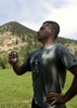
Hippy Hill was a little more challenging than the three previous peaks but was a fun one. We stayed to the east and scrambled up that side...ishamod found a more efficient route than the chute full of spider webs and cacti that I originally started up before following his lead :). We took a break on top and noticed two other hikers back on Peak 3125, the only two people we saw on the ridgeline today.

[ youtube video ]

We scrambled down a steep section on the northeast side of the peak, but there was a lot of solid rock, then headed over to 3195. Having read about the conditions of that climb, we didn't plan to go up there but wanted a closer look. The only realistic spot to climb up that we saw was a lower spot with a chute of yellow rock, which was every bit as crumbly as advertised...the first foothold that ishamod tested at the base of the chute immediately broke off, confirming we weren't going to try going up.

We circled around to the north side of 3195 and explored two fairly large caves, then bushwhacked to the southwest to get back on the Ironwood Ridgeline route. We saw a small arch along the way and followed the trail down to Bulldog Saddle. I'd hoped to get up to Peak 3004 as well, but ishamod was short on time today, so we just circled back to the trailhead from there.

Today was one of the hottest days of the year but was still comfortable, especially with a little cloud cover, but it was a reminder that summer is coming soon, and it's good to get some of these lower-elevation hikes in before the extreme heat kicks in. Today's was a short but fun one with a lot of off-trail scrambling. I hadn't hiked with ishamod in more than three months, so it was great to see him again and catch up and explore some new peaks in the Goldfields.
 Fauna
 Fauna [ checklist ]
[ checklist ]  Mule Deer
 Geology
 Geology [ checklist ]
[ checklist ]  Natural Arch
 Meteorology
 Meteorology [ checklist ]
[ checklist ]  Sun Dog
  1 archive
Feb 12 2022
avatar

 Guides 187
 Routes 989
 Photos 12,068
 Triplogs 864

72 male
 Joined Jun 27 2015
 Tucson, Arizona
Meridian Trail, AZ 
Meridian Trail, AZ
 
Hiking avatar Feb 12 2022
markthurman53Triplogs 864
Hiking5.92 Miles 984 AEG
Hiking5.92 Miles   3 Hrs   38 Mns   2.21 mph
984 ft AEG      57 Mns Break
 
1st trip
Linked   linked  
Partners none no partners
Second hike on day two was from the Meridian Trail Head heading east on the Meridian Trail. I would hike to a point 3 miles east to Idaho Road and return the way I came. Continuing east on this trail will take you to Bulldog Canyon Trail Head, a trail I was on a few years ago. The whole length of this trail is in good condition with some trail work just done on the far east end. This was also kind of an uneventful trail but the heat (80 degrees) and the rough terrain around the middle section of the trail made it a bit more challenging. The views weren’t that spectacular unless you consider looking over housing developments to the south good. There were some great views of the Superstitions to the southeast. There were also some interesting rock formations along the trail that kept you a bit entertained. This is a connector trail that leads from the Goldfields and the Usery Mountains and not one you would take for its scenery. I just took it because I hadn’t been on it before. There is a trail that connect to this trail from Ironwood road. I headed back to my dive and pizza for dinner.
_____________________
 
Dec 12 2021
avatar

 Guides 27
 Routes 669
 Photos 12,096
 Triplogs 856

56 male
 Joined Jul 05 2006
 Mesa, AZ
Meridian Mystery TrailPhoenix, AZ
Phoenix, AZ
Hiking avatar Dec 12 2021
DarthStillerTriplogs 856
Hiking5.68 Miles 973 AEG
Hiking5.68 Miles   2 Hrs   44 Mns   2.17 mph
973 ft AEG      7 Mns Break
 
Linked   none no linked trail guides
Partners none no partners
No Steeler game this Sunday, so it was time for another family hike. They've been gettign tired of the hikes with the big climbs, so I decided to take them on the Meridian Mystery Trail, which only has a couple short climbs. We started from the Meridian Trailhead and headed east on the trail. At the split we took the upper trail, then when we got back down at the bottom of the loop, we headed east more until we got just short of the saddle and then headed back, taking the lower trail. Saw a few other hikers and bikers, not too busy. Weather was cool and breezy until the last half hour, but still never really warm. Very nice morning doing a quick hike getting in some family time. Hit lunch afterwards and headed home.
_____________________
 
Dec 10 2021
avatar

 Guides 7
 Routes 187
 Photos 2,318
 Triplogs 909

74 male
 Joined Dec 10 2016
 Gold Canyon
Meridian Mystery TrailPhoenix, AZ
Phoenix, AZ
Hiking avatar Dec 10 2021
DaytripperTriplogs 909
Hiking6.21 Miles 850 AEG
Hiking6.21 Miles   2 Hrs   49 Mns   2.33 mph
850 ft AEG      9 Mns Break
 
no photosets
1st trip
Linked   linked  
Partners none no partners
Route Scout Route Recorded  on Route Scout | Pop | Map | Popup | MapDEX
Nice fresh air and leftover cloudiness after last nights rain were calling for a hike. Decided to walk over toward Wolverine Pass from Meridian TH. . After passing Ironwood needed to pay attention to stay on the faint trail. Made to the highpoint above Idaho and decided to turn around there. Nice views but the Superstitions remained clouded over. Only saw a couple of other hikers on this refreshing outing.
_____________________
Navy31 Army13
 
Sep 25 2021
avatar

 Guides 27
 Routes 669
 Photos 12,096
 Triplogs 856

56 male
 Joined Jul 05 2006
 Mesa, AZ
Meridian Mystery TrailPhoenix, AZ
Phoenix, AZ
Hiking avatar Sep 25 2021
DarthStillerTriplogs 856
Hiking8.07 Miles 1,231 AEG
Hiking8.07 Miles   4 Hrs   1 Min   2.01 mph
1,231 ft AEG
 
Linked   linked  
Partners none no partners
Picked the Goldfields again because it's close to home and I had various chores to get done. Started at the Bulldog Canyon area and headed west on the Wolverine Pass Trail. I missed the trail along the road, but then I found trail number 303 and took that, which then junctions with Wolverine Pass. Headed further east and went out about 2 miles on the Meridian Mystery Trail and came back, then finished a loop of Deer Tanks and FR10 back to the parking area. Slower going since the trails here are rockier than the park trails I've got a little too used to, so I only got 8 miles in. Cloudy and drizzly at the start with threatening looking clouds to the east, then sunny by the end. Saw 2 trail runners, 2 hikers, and some 4 wheelers and dirt bikers on the roads. Temps are much more comfortable, and no humidity that soaks you after a half hour.
_____________________
 
Feb 07 2021
avatar

 Guides 99
 Routes 1,484
 Photos 16,072
 Triplogs 1,374

male
 Joined Jan 07 2017
 Fountain Hills,
Four Goldfield Peaks, AZ 
Four Goldfield Peaks, AZ
 
Hiking avatar Feb 07 2021
DixieFlyerTriplogs 1,374
Hiking7.80 Miles 2,240 AEG
Hiking7.80 Miles
2,240 ft AEG
 
1st trip
It had been almost 2 years since I had been on the Ironwood Ridgeline, so I decided that Super Bowl Sunday morning would be a good time to go once again.

Starting from the Meridian TH, we went a short distance on the Bulldog Saddle Trail, and then went east on the Meridian Mystery Trail. After going a ways we went on what is now a decent social trail up to a saddle below the Ironwood Ridgeline. For whatever reason there were a few painted arrows on the social trail, providing a reminder of how close to Phoenix we were.

Once on the ridgeline, we went to the summits of Peak 3108, Temptation Peak, and Peak 3125. Peak 3108 is an easy walkup, but there was a bit of climbing on the other 2 peaks. We descended Peak 3125 to the north and then climbed up to Peak 3163, which is a fun climb.

Then we went off-trail to the west side of Peak 3125, and followed a social trail down to Bulldog Saddle. Instead of going directly back to the TH, we followed the Peak 3004 Loop to the north of Peak 3004 and then up to Pass Mountain Saddle. From there we went back to the TH.

We didn't see anyone on the hike until we got down to Bulldog Saddle. From Pass Mountain Saddle back to the TH we encountered a number of people, which is to be expected on a weekend. A couple of them had boom boxes, but at least there were no painted arrows.
 Culture
 Culture [ checklist ]
[ checklist ]  Risky
_____________________
Civilization is a nice place to visit but I wouldn't want to live there
 
Jan 08 2021
avatar

 Guides 1
 Routes 5
 Photos 656
 Triplogs 512

47 male
 Joined Jul 20 2007
 Gilbert, AZ
Meridian Mystery TrailPhoenix, AZ
Phoenix, AZ
Hiking avatar Jan 08 2021
jtaylorTriplogs 512
Hiking4.00 Miles 590 AEG
Hiking4.00 Miles
590 ft AEG
 no routesno photosets
1st trip
Linked   none no linked trail guides
Partners none no partners
Later start to my 2021 hiking year. This was a somewhat spontaneous later afternoon hike. Deterred by crowds, I saw someone coming off what I later learned was the Meridian Mystery Trail and decided to roll with it instead of the Peak 3004 loop. A little weird being in people's backyards the whole way, but nice to mix it up and great golden hour views of the Supes.
_____________________
“...wilderness is not a luxury but a necessity of the human spirit, and as vital to our lives as water and good bread.”
-Edward Abbey, Desert Solitaire
 
Dec 05 2020
avatar

 Guides 27
 Routes 669
 Photos 12,096
 Triplogs 856

56 male
 Joined Jul 05 2006
 Mesa, AZ
Meridian Mystery TrailPhoenix, AZ
Phoenix, AZ
Hiking avatar Dec 05 2020
DarthStillerTriplogs 856
Hiking7.50 Miles 1,304 AEG
Hiking7.50 Miles   3 Hrs   59 Mns   1.89 mph
1,304 ft AEG      1 Min Break
 
Linked   linked  
Partners none no partners
I didn't feel like driving far for a hike, but I still wanted to find some trails that I still haven't done. I decided to check this area out and I'm glad I did. Looked like two options to hike the Deer Tanks and Wolverine Pass Trails from the same trailhead. and Deer Tanks looked like it wasn't too far from the Meridian Mystery Trail, which I had done some of back in April 2019 and noticed some trails that looked like they headed towards this trailhead.

I started on Deer Tanks just as sunrise. It was a bit chilly, but I was glad to feel that after a pretty brutal summer. Once it Deer Tanks north to follow the wash towards Bulldog Canyon, I saw a spur for a trail that headed east. I could already see the trail head up the hill to a pass. I took that and continued east bound. I passed the end of where the official Meridian Mystery Trail track is but didn't see a trail there. I did see a junction just north of that, though. I continued to head east until I connected with the Meridian Mystery Trail, then headed back to the Deer Tanks Trail, hitting another section of the unmarked trail south of Meridian Mystery.

Once I got back to Deer Tanks, I followed that to the north, eventually descending into the slot canyon, then getting out. I stopped just short of the Bulldog Canyon Road, not realizing it because I hadn't paid attention. After that I headed back to the trailhead and called it a day. Got less miles than usual in due to a later start with the late sunrise, and hiking a little slower than usual. Felt like a more laid back hike, discovering new trails that I didn't know were there.

Saw 3 other hikers on the trails with me. At the trailhead I saw someone briefly up on the rocks, looked like they were climbing. Temp was still in the 60s when I finished.
_____________________
 
May 27 2019
avatar

 Guides 99
 Routes 1,484
 Photos 16,072
 Triplogs 1,374

male
 Joined Jan 07 2017
 Fountain Hills,
Goldfield's Mystery Tour, AZ 
Goldfield's Mystery Tour, AZ
 
Hiking avatar May 27 2019
DixieFlyerTriplogs 1,374
Hiking11.10 Miles 2,817 AEG
Hiking11.10 Miles
2,817 ft AEG
 
1st trip
Let's see: It's late May(on Memorial Day no less) and the high temperature is in the mid-70's; so what else would I do but go hiking in the Goldfields!

I had been wanting to go out to the Meridian Trailhead and post a couple of guides on this site for the Meridian Mystery Trail and the Bulldog Saddle Trail, and today was the perfect day for it.

I recorded 2 separate tracks on my GPS:
1) I went on the Meridian Mystery Trail from where it branches off from the Bulldog Saddle Trail until it peters out a couple of miles later. This trail is well-groomed and easy to follow for almost 2 miles. Then the trail gets more faint and difficult to follow until it essentially ends. Once the trail essentially ended, I continued east on a very easy bushwhack up to a ridge that was probably not much more than 0.25 miles from the Idaho Pass Trail. I then turned around and went back the way that I came. Along the way, I noticed a cave off to the north, so naturally I had to climb up to the cave. It turned out not to be much of a cave -- it went back maybe 10-12 feet -- and some moron had taken some blue spray paint and tainted the cave with graffiti. I doubt if I will make the trip to the cave again. I have used the Meridian Mystery Trail a few times as part of the Peak 3108 Loop Hike, but this was the first time that I have been to the end of the trail. I made my way back to the trailhead. My GPS recorded 5.1 miles with an AEG of 1,026' on this portion of the hike.
2) I did the Peak 3004 Loop Hike, but added sidetrips to Peak 3125 and Hill 2290. I had been up to Peak 3125 from Bulldog Saddle a couple of times, but route finding was easier this time -- someone has made an easy to follow use trail almost all the way to the top. This was the first time that I had been to Hill 2290. The views on Hill 2290 were much nicer than I expected, given its modest elevation and the fact that it is in a valley. There were nice 360 degree views -- particularly Bulldog Ridge, Dome Mountain, Panorama Peak, and Lone Mountain to the NW. While atop Hill 2290 I saw 6-7 javelinas in the valley down below. My GPS recorded 6.0 miles and an AEG of 1,791' on this portion of the hike.

To get the mileage and elevation gain for the hike I just added the 2 segments together.

It was a great day to be out in the beautiful and underrated Goldfields!
_____________________
Civilization is a nice place to visit but I wouldn't want to live there
 
Apr 12 2019
avatar

 Guides 99
 Routes 1,484
 Photos 16,072
 Triplogs 1,374

male
 Joined Jan 07 2017
 Fountain Hills,
Peak 3108 Ridgeline Plus, AZ 
Peak 3108 Ridgeline Plus, AZ
 
Hiking avatar Apr 12 2019
DixieFlyerTriplogs 1,374
Hiking8.20 Miles 2,555 AEG
Hiking8.20 Miles   8 Hrs      2.03 mph
2,555 ft AEG   3 Hrs   58 Mns Break
 
1st trip
This was a fun hike in the underrated Goldfield Mountains that started and ended at the Meridian TH, at the north end of Meridian Road in Mesa/Apache Junction.

The hike consisted of 3 parts: The Peak 3108 Ridgeline; the South Bulldog Ridgeline; and the Peak 3004 Ridgeline. Most of the hike was totally off-trail and it included a bit of bushwhacking.

From the TH, I went north a short distance on the Bulldog Saddle Trail; but instead of going to Bulldog Saddle, I took a right and went east for almost 1.5 miles on the unsigned Meridian Mystery Trail. Then I went off-trail on a well-cairned use trail, heading north up toward the Peak 3108 Ridgeline. I made my way to a saddle on the Ridgeline, and then went NW along the top of the ridgeline. I enjoy hiking on this ridgeline -- the views are super, and are much better than the views on the Pass Mountain Ridgeline imho. I made to the summit of Peak 3108, and then went up to Temptation Peak (3,195'). It was an easy ascent on the south side of Temptation Peak, but the northside had some verticality to it so I descended on the east side and looped around to the north side, and then made my way up to Peak 3125 (fwiw, T. Tenny refers to this peak as Peak 3113). To get up Peak 3125 I did a little class 3 climbing up a chute, but it wasn't a bad climb.

After enjoying the views atop Peak 3125, I dropped down to the north and went to Peak 3163, aka Hippy Hill, on South Bulldog Ridge. My intention was to climb up the 3 peaks on the Ridge: Peak 3163, North Peak 3195 ( [ Peak 3195 Goldfield Mountains ] ), and Peak 3075.

Peak 3163 looked a bit daunting, but once there it was a short, easy class 3 climb to the top. I had set my hiking poles down before climbing up, so I had to descend the same way that I went up; otherwise I would have descended to the north going toward Peak 3195. After circling the east side of Hippy Hill, I made my way over to Peak 3195. There was only one obvious way to climb up Peak 3195, but I was out there by myself and the first part of the climb was a tad sketchy. Thus, with discretion being the better part of valor, I decided to wimp out and come back another day to climb up to Peak 3195. I wasn't too worried about the climb up, but I didn't really want to have to deal with finding footholds on the descent when I was there by myself.

I started to go over to Peak 3075, but time was getting away from me, so I decided to make my way over to the Peak 3004 Ridgeline and hike up to Peak 3004. This is the ridgeline that runs between Bulldog Saddle and Pass Mountain Saddle. From the base of Peak 3195, I could see a fairly easy route up to Peak 3004, so I did an off-trail bushwhack through a couple of canyons and made my way to the trail that loops around Peak 3004, and then did the off-trail climb up to Peak 3004. This was not a difficult way to get up there, although there was a bit of class 3 climbing near the summit. On the descent, I headed west over to Pass Mountain Saddle. There was a bit more up-and-down getting to Pass Mountain Saddle than I had envisioned; in retrospect, it would have been easier to go back the way that I came and go to Bulldog Saddle.

From the Pass Mountain saddle I just took that Pass Mountain Loop Trail back to the trailhead.

This was another great day of hiking in the Goldfield's. I will come back out another day and hopefully do the other 2 ascents on South Bulldog Ridge.
wildflower observationwildflower observationwildflower observationwildflower observationwildflower observation
Wildflowers Observation Substantial
There were quite a few flowers blooming, including: brittlebush, creosote bush, fairy duster, ocotillo, hedgehog cactus, buckhorn cholla, globemallow, and lupine
_____________________
Civilization is a nice place to visit but I wouldn't want to live there
  1 archive
Dec 11 2018
avatar

 Routes 268
 Photos 2,969
 Triplogs 541

66 male
 Joined Aug 16 2009
 Mesa,AZ
Ironwood Explore, AZ 
Ironwood Explore, AZ
 
Hiking avatar Dec 11 2018
hikerdwTriplogs 541
Hiking4.82 Miles 796 AEG
Hiking4.82 Miles   2 Hrs   22 Mns   2.28 mph
796 ft AEG      15 Mns Break
 
1st trip
Linked   linked  
Partners none no partners
Limited on time so thought I would check out a new, close to me, area. Saw a coyote that saw me first. More trails than I expected, with some flags present maybe indicating there might be more.
_____________________
Expect to self rescue
  1 archive
average hiking speed 2.26 mph
1, 2  Next

WARNING! Hiking and outdoor related sports can be dangerous. Be responsible and prepare for the trip. Study the area you are entering and plan accordingly. Dress for the current and unexpected weather changes. Take plenty of water. Never go alone. Make an itinerary with your plan(s), route(s), destination(s) and expected return time. Give your itinerary to trusted family and/or friends.

helpcommentissue

end of page marker