|
| | | Carr Miller Hamburg Loop, AZ | | | |
|
|
Carr Miller Hamburg Loop, AZ
| | |
| |
|
| Hiking | 14.00 Miles |
4,000 AEG |
| | Hiking | 14.00 Miles | 7 Hrs 40 Mns | | 2.10 mph |
| 4,000 ft AEG | 1 Hour Break | 13 LBS Pack | | |
|
|
| |
| Partners |
|
[ show ]
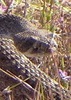
| partners | | Linda and I got started a little before 08:00 to wonderful temps and a stout breeze. Though pretty mellow, the climb begins immediately all the way to Carr. By the time we arrived at the spur to Carr peak, we had absorbed enough solar radiation to have broken a bit of a sweat, and were now rounding the corner into the shade and a stiff wind. Though it was a short go, it was pretty biting, then as we topped out the atmosphere turned absolutely perfect, sunny, calm & cool. We didn't stay long as we had a long way to go and I was already lagging, so we headed over to the Crest to make our way to Miller. I really loved this section; great views, largely shaded, protected from the wind, level-ish. Soon enough, we were on the ascent again, and not long before reaching Miiler, I was already running on fumes. It was at this point that I secretly tethered myself to Linda's pack and just let her tow me along. Every now and again I would carry my own weight so as to not raise too much suspicion. At the peak we encountered 3 humans just sitting there. Strangely, they didn't seem at all afraid of us, so we just calmly bypassed, being careful not to startle them as they continued their foraging.
After a break at the peak, it was time to get rolling. The trip so far had be rather rough on me, as I was not feeling too wonderful, so I was really looking forward to the downhill side. The trip back took us down the Hamburg Trail into Wisconsin Canyon, which has got to be in the top 3 most beautiful canyons in SoAZ. It's a massive, steep, dense, green ecosystem that will drop your jaw. Pretty soon we were on the Comfort Spring Trail, the final stretch. I had long since run out of gas and Linda was simply dragging my lifeless body behind her up the final incline, yet unaware of the tether between us. Once back to the TH, I kissed the level ground as Linda and I said our goodbyes.
Another beautiful day above the 7,000 ft mark, over incredible trails, in excellent weather and in the finest of company.
Thanks Linda for makeing the long trip. |
| _____________________
| | |
|
|
|
 Route Editor