username
X
password
register
for free!
help
ArticlesGuidesRoutes
 
Photosets
 
 Comments
triplogs   photosets   labels comments more
Goldwater Loop Trail - 12 members in 33 triplogs have rated this an average 3.3 ( 1 to 5 best )
1, 2  Next
33 triplogs
login for filter options
Aug 02 2025
avatar

 Guides 1
 Routes 209
 Photos 1,231
 Triplogs 196

male
 Joined Mar 14 2015
 Phoenix, AZ
Goldwater Lakes Trail #396Prescott, AZ
Prescott, AZ
Hiking avatar Aug 02 2025
astrobrewerTriplogs 196
Hiking8.04 Miles 1,273 AEG
Hiking8.04 Miles   2 Hrs   48 Mns   2.91 mph
1,273 ft AEG      2 Mns Break
 
1st trip
Linked   linked  
Partners none no partners
Route Scout Route Recorded  on Route Scout | Pop | Map | Popup | MapDEX
Was in Prescott anyway, so decided to find a new trail. Forecast was for 90+ temperatures in Prescott, so I didn't want anything too strenuous. Decided to try the Goldwater Lakes Trail #396. I parked right next to the trailhead. But I saw lots of cars in a lot just below where I parked and figured that must be the right place. Wrong. Luckily Route Scout knew where the trail was and after my initial bad start I saw the right trail and got going. There was an ominous waring sign about this being a multi-use trail and basically hikers can get injured by fast moving mountain bikers. Turned out not to be that bad. Maybe the heat kept most bikers away. For the most part I hardly saw anyone on the trail.

The trail is a nice dirt single track that winds through the forest. One mile in the trail reaches a ridge with nice view of Granite Mountain where there is a memorial to the Granite Mountain Hotshots. Continuing on the tall pine trees provided nice shade and there was a breeze that kept it very comfortable. Looking through the trees I caught a glimpse of the Lower Goldwater Lake. Soon after that there was a spur trail heading steeply down toward the water. It was very peaceful and serene at the waters edge. I could see a small group of people fishing across the lake, but otherwise it was deserted. Initially I was thinking of heading back up to trail #396, but the lake was so pretty and I decided to follow the trail that runs along the shoreline. That trail went around Lower Goldwater Lake and then up to Upper Goldwater Lake.

Upper Goldwater Lake had lots of people on kayaks and paddleboards. On the other side of the lake from where I was it looked like there was a place to rent kayaks. I followed the shoreline of the Upper lake until I reached a trail that headed back toward #396. It was a little confusing as there were lots of trails. I thought #396 would be obvious, but ended up crossing it and going past. Route Scout saved me again and soon I was heading back to the start as I intended. It took longer than I expected to get back to the point where I had initially left the main trail. I guess I didn't realize how far along the lake shores I had hiked.

I enjoyed this trail a lot. It was easy to walk on. Mostly just hard dirt. Not rocky. Not too steep. Lots of pretty forest to walk through. Perfect short hike if you don't have all day.
 Flora
 Flora [ checklist ]
[ checklist ]  Common Cattail

water 1 out of 5water 2 out of 5water 3 out of 5water 4 out of 5 Lower Goldwater Lake 76-100% full 76-100% full

water 1 out of 5water 2 out of 5water 3 out of 5water 4 out of 5 Upper Goldwater Lake 76-100% full 76-100% full
_____________________
 
May 26 2025
avatar

 Routes 386
 Photos 49
 Triplogs 792

43 female
 Joined Jun 23 2015
 Phoenix, AZ
Goldwater Loop TrailPrescott, AZ
Prescott, AZ
Hiking avatar May 26 2025
emilystardustTriplogs 792
Hiking6.68 Miles 798 AEG
Hiking6.68 Miles   2 Hrs   24 Mns   2.82 mph
798 ft AEG      2 Mns Break
 
no photosets
1st trip
Linked   none no linked trail guides
Partners none no partners
Route Scout Route Recorded  on Route Scout | Pop | Map | Popup | MapDEX
_____________________
 
Jun 03 2024
avatar

 Routes 85
 Photos 3,718
 Triplogs 486

female
 Joined Oct 15 2002
 Rimrock, Arizona
Goldwater Loop TrailPrescott, AZ
Prescott, AZ
Hiking avatar Jun 03 2024
cactuscatTriplogs 486
Hiking3.27 Miles 292 AEG
Hiking3.27 Miles   2 Hrs   21 Mns   1.72 mph
292 ft AEG      27 Mns Break
 
1st trip
Linked   none no linked trail guides
Partners none no partners
Route Scout Route Recorded  on Route Scout | Pop | Map | Popup | MapDEX
It was my last free day before starting work, and I needed to go to Prescott anyhow - so I decided to visit another lake ... or two, actually.
I thought I had done this hike many years previously, but it wasn't what I remembered, so maybe not.
Other than the main picnic/boat launch area, it was very quiet - especially the lower lake. Encountered a handful of other hikers and dog walkers, and a pair of equestrians near the lower lake.
Temperatures were pleasant, scenery was nice and birding was pretty good.
Definitely a good choice to get out for a couple hours.
_____________________
 
Apr 20 2024
avatar

 Guides 7
 Routes 72
 Photos 14,456
 Triplogs 627

62 female
 Joined Aug 19 2011
 Scottsdale, AZ
Goldwater Loop TrailPrescott, AZ
Prescott, AZ
Hiking avatar Apr 20 2024
outdoor_loverTriplogs 627
Hiking2.80 Miles 458 AEG
Hiking2.80 Miles
458 ft AEG
 
Linked   none no linked trail guides
Partners none no partners
After Kayaking Watson Lake, I headed here. It was a Saturday and it was crowded, but I wanted to hike the trail.

Just a little history. When I last hiked the trail around Upper Goldwater Lake, it was years ago. As I hiked around the other side of the lake, the trail had ended, just before the dam. But since I was as stubborn then as I am now, I kept going and slipped and slid my way down the other side of the dam. I crossed to the north side and followed a faint trail on the north side of Lower Goldwater Lake until it ended at the lower dam. I thought about trying to get all the way around, but the other side looked steep with no trail. So I turned around. There was not a soul in sight on Lower Goldwater Lake that day.

And well, hello, have times changed. New maps on the trail and now, they have continued the Banning Creek Trail, which was the original trail, and made a giant loop around BOTH lakes. Much to Joe's chagrin, they have abandoned the Banning Creek Trail name and it is now the Goldwater Loop Trail. Brand new signs and maps abound. And apparently they have now "opened" Lower Goldwater Lake. In addition to the new trail on that side, there is a road, a day use area and restrooms! If you want quiet, go now, before the general public hears the news. There was like, 5 cars in the whole lot. :D The dam separates quiet from mayhem on a Saturday afternoon.

It was a sweet hike, with sweet bird finds and even a few really sweet photos. Good to be out and about and on the trail again. A Saturday well spent. Can't wait for May and a long road trip to finish dusting off the cobwebs.
wildflower observationwildflower observationwildflower observationwildflower observationwildflower observation
Wildflowers Observation Isolated
Just a few brave souls trying to attract butterflies.

water 1 out of 5water 2 out of 5water 3 out of 5water 4 out of 5 Lower Goldwater Lake 76-100% full 76-100% full

water 1 out of 5water 2 out of 5water 3 out of 5water 4 out of 5 Upper Goldwater Lake 76-100% full 76-100% full
_____________________
Life is not a journey to the grave with the intention of arriving safely in a pretty & well preserved body, but rather to skid in broadside, totally worn out & proclaiming, "Wow What a Ride!"
 
Sep 30 2023
avatar

 Guides 12
 Routes 192
 Photos 863
 Triplogs 356

42 male
 Joined Nov 30 2015
 Phoenix, AZ
Saddles 50, AZ 
Saddles 50, AZ
 
Run/Jog avatar Sep 30 2023
ShatteredArmTriplogs 356
Run/Jog48.00 Miles 6,644 AEG
Run/Jog48.00 Miles   14 Hrs   24 Mns   3.50 mph
6,644 ft AEG      42 Mns Break
 no routesno photosets
1st trip
Was signed up for the 100. But due to an injury that prevented me from doing much on Labor Day weekend, I figured I'm probably in no condition to attempt that, so the primary goal was 50.

Started out early in Downtown Prescott, and basically followed 89 2.5 miles to the trail. Pleasant temps in the morning, nothing remarkable as I made my way up to Groom Creek trail 10 miles in. By then it was light out, and it was nice and cool for the climb up Spruce and down Smith Ravine.

On Homestead, it started warming up, and I realized I had basically no energy. I'll chalk that up to a quick turnaround from flying back across the country on Thursday evening... Didn't want to be struggling just 20 miles in, but you can't have it all. At least the breeze tempered the sun a little.

Ranch trail was where the misery really started. I expected the climb, having been on that trail a couple times, but I absolutely hated Badger Mountain Trail. Long, windy, exposed, with the type of switchbacks that were probably designed to ensure mountain bikers don't have to put in any effort at all. 11 miles to do what's probably a 3-4 mile drive... Hopefully I never have to see Badger Mountain Trail ever again.

Things improved a little on Sundog Trail, which I actually liked better than BM. Then Peavine, which is just...flat. By the time I got to the dells, it was 5pm, and I figured the sun would be down before I got to 50. The north side of Watson Lake was actually a lot of fun, and I liked trying to move through there as fast as possible. Probably the only part of the day that was legitimately enjoyable.

One of my friends was waiting for me at the Watson Boat Ramp with a beer, which was a nice surprise.

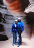
By the time I got to Willow, it was getting dark, and I had to use a light most of the way through there. There were also thunderstorms moving in, which was fun (they didn't get to Willow, but I heard it got a little crazy closer to Granite Mountain). I really don't recommend going through the dells in the dark, it definitely upped the difficulty a level or two.

After that section, I decided to make it official and not go for what would've probably been a last place finish. I'm starting to come around to one of my friends' views that 50 miles is a superior distance to 100.
_____________________
 
Oct 08 2021
avatar

 Guides 13
 Routes 38
 Photos 1,651
 Triplogs 577

60 male
 Joined Nov 15 2005
 Jackson, CA
Seven Mile Gulch Trail #9854Prescott, AZ
Prescott, AZ
Hiking avatar Oct 08 2021
toddakTriplogs 577
Hiking23.00 Miles 3,500 AEG
Hiking23.00 Miles   9 Hrs      2.56 mph
3,500 ft AEG
 no routesno photosets
1st trip
Yet another @The_Eagle / @joebartels quality mashup route they did a couple weeks ago, linking primo singletracks with tolerable two-tracks.
_____________________
 
Sep 25 2021
avatar

 Guides 264
 Routes 2,797
 Photos 14,494
 Triplogs 5,894

55 male
 Joined Nov 20 1996
 
Prescott Lakes Tour, AZ 
Prescott Lakes Tour, AZ
 
Hiking avatar Sep 25 2021
joebartelsTriplogs 5,894
Hiking24.15 Miles 3,564 AEG
Hiking24.15 Miles   9 Hrs   33 Mns   2.74 mph
3,564 ft AEG      45 Mns Break
 
Route Scout Route Recorded  on Route Scout | Pop | Map | Popup | MapDEX
Seven Mile Gulch Trail #9854
Starting temps put the last 6 months to shame. About 3 minutes up we passed new signage for Hoot Owl #745. Minutes later, babbling up a storm we missed a turn. Bruce wanted to check it out and who am I to argue when he wants to add mileage to the 21.4-mile plan. 1.4 miles later we were sensibly back to the missed turn. We've hiked a variation of this loop several times. Albeit humid we both agreed it was nice not to be baking for once. Crane flies swarmed us for the ascent. Per usual, the dizzy drunken flies just bump without harm.

Ranch Trail #62
2.25-mi up #9854 we turned onto #62 for its upper 4-mile stretch. Lots of tall pines in the first 2-miles heading west. This wraps around the northern end of the Bradshaw range with views over Prescott and ends dropping down to the Watershed TH along the Senator Highway.

Goldwater Lakes Trail #396
After crossing the Hwy it was 1.25 miles down to the lake. You can reach the lake 0.3 miles quicker but we opted for a shorter return after following the southern shore Banning Creek Trail. With summer out of the books and overcast, it wasn't very busy. Looks like they've been busy adding benches galore.

Watershed Trail #299
Back up to the Watershed TH, we took #299 up to the ridge in search of a lunch spot. Nearly a month ago, Bruce clued me in on the Klymit V-Seat inflatable seat cushion deal. They are super butt comfy! A storm drifted in, so we ate quickly and boogied onward. We got lucky, the storm didn't linger.

Spruce Mountain Road
This bridges the loop through an occupied belt of cabins with no trespassing signage galore and a few lonely fenced-in dogs seeking attention/blood. The Midnight Mine ore cart is the anticipated highlight.

Smith Ravine Trail #297
The death star busted through like a champ on our descent. We enjoyed a break that lasted longer than lunch heading down. Naturally, Bruce one-upped me with a larger seat cushion. An inflatable recliner by Christmas wouldn't surprise me.

Homestead Trail #305
This parallels Walker Rd to Lynx Lake. We shared the trail with a chic out walking her dogs.

Lynx Recreation Trail #311 - Lake Loop
Many HAZr's would probably avoid this, but I'm a big fan of this trail. It's always busy. Like the other little Prescott lakes, it's almost always a family atmosphere. With 24-mi within reach, Bruce found a way to make it happen.

Synopsis
When Bruce first put this loop out years ago I cringed my nose. It's turned into one of my favorites. Well over a third, possibly half is through or along tall pines. The icing on the cake today was my first 24 miler since @LindaAnn & @Tortoise_Hiker's 30-miler on Baldy! 5k / 24mi used to be my acceptance to worthy... lol
foliage observationfoliage observationfoliage observationfoliage observationfoliage observation
Autumn Foliage Observation Isolated
hints, yeah baby!
wildflower observationwildflower observationwildflower observationwildflower observationwildflower observation
Wildflowers Observation Light
nothing to write home about but a large enough stretch of insignificant yellows to not be forgotten
_____________________
- joe
 
Sep 25 2021
avatar

 Guides 41
 Routes 1,626
 Photos 14,983
 Triplogs 2,760

69 male
 Joined Jan 20 2009
 Far NE Phoenix,
Prescott Lakes Loop, AZ 
Prescott Lakes Loop, AZ
 
Hiking avatar Sep 25 2021
The_EagleTriplogs 2,760
Hiking25.24 Miles 3,475 AEG
Hiking25.24 Miles   9 Hrs   35 Mns   2.85 mph
3,475 ft AEG      43 Mns Break14 LBS Pack
 
Route Scout Route Recorded  on Route Scout | Pop | Map | Popup | MapDEX
We've done variations of this loop multiple times and it'll be done again.

Seven Mile Gulch Trail is my least favorite. When it's warm or sunny, it's a sweat feast. On this day it was in the 50's and cloudy, but still sweaty. We took a wrong turn and thought it might work out until we decided to back track. This is a multi-use trail that we've never seen anyone on.

Ranch Trail is a jem. Pleasant grades, good views and smooth trails. You will almost always run into hikers or MTB'rs.

We expected to see people on the Goldwater Lakes Trail. Families enjoying the day, hikers, bikers and kayakers. The sprinkles stared for the day.

Watershed Trail is another multi-use trail. We saw noone on the entire length of this trail. The upper east TH has been rerouted since last year. We had a quick 11 minute lunch in high winds, rain and what felt like 45 degree temps, each huddled under our umbrellas. We had to get moving to get some warmth back.

We took our road walk up Spruch Mountain Rd to get on the Smith Ravine Trail. This is another favorite. Tall pines, shade and nice trail tread. The sun finally made an appearance so we finished our lunch break here.

Homestead Trail is a pleasant gentle roller coaster making your way over to Lynx Lake.

The expected dog walkers were abundant on the Lxnx Recreation Trail. Good views of the now calm lake.

We hit part of the Salida Gulch Long Loop and the Highlands Trail to finish things off. Other than the lunchtime squall, perfect weather.

No @Hansenaz was spotted in the Lynx Lake/Creek area
 Named place
 Named place [ checklist ]
[ checklist ]  Lynx Lake
wildflower observationwildflower observationwildflower observationwildflower observationwildflower observation
Wildflowers Observation Moderate

water 1 out of 5water less than maxwater less than maxwater less than max Deer Lick Spring Dripping Dripping
water report recorded in the field on our app Route Scout

water 1 out of 5water 2 out of 5water 3 out of 5water 4 out of 5 Lynx Lake 76-100% full 76-100% full

dry Sevenmile Tank Dry Dry
water report recorded in the field on our app Route Scout

water 1 out of 5water 2 out of 5water 3 out of 5water 4 out of 5 Upper Goldwater Lake 76-100% full 76-100% full
_____________________
There is a very fine line between "hobby" and "mental illness."
Dave Barry 🦅
 
Apr 04 2021
avatar

 Routes 69
 Photos 3,135
 Triplogs 1,853

72 male
 Joined Jul 24 2009
 Mesa, AZ
Goldwater Loop TrailPrescott, AZ
Prescott, AZ
Hiking avatar Apr 04 2021
trailzrusTriplogs 1,853
Hiking0.75 Miles 60 AEG
Hiking0.75 Miles
60 ft AEG
 no routesno photosets
1st trip
Linked   none no linked trail guides
Partners none no partners
_____________________
 
Mar 09 2021
avatar

 Routes 174
 Photos 471
 Triplogs 184

51 male
 Joined Mar 16 2019
 Phoenix
Goldwater Lakes Trail #396Prescott, AZ
Prescott, AZ
Hiking avatar Mar 09 2021
AugustWestTriplogs 184
Hiking7.52 Miles 1,194 AEG
Hiking7.52 Miles   2 Hrs   16 Mns   3.37 mph
1,194 ft AEG      2 Mns Break
 
1st trip
Route Scout Route Recorded  on Route Scout | Pop | Map | Popup | MapDEX
I am up in Prescott for the week and the White Spar TH is the closest to where I am staying. Door to door was 8 minutes even with Prescott's traffic. The trailhead is right inside the boundary of the Prescott NF and seemingly at the edge of the suburbs.

This trail network reminds me of Hawes with trees. Nothing is too steep, but everything rolls up and down which I found enjoyable.

I started out on Schoolhouse and then #81 which are gated FS roads. They are nice, but the real single track starts on Goldwater Lake Trail.

Prescott NF does an exceptional job of forest management for the sustainability and recreational enjoyment of the public. I noted not too long ago on the Groom Creek Loop that the gathered forest understory and selective thinning gives the forest a chance in the case of a fire. Previously, I would argue for the 'wilderness' to be left alone, but I have come around to the fact that if we want any standing trees in Arizona our forests managers should take a more proactive stance towards managing for the sake of recreation. This trail system is just another example of the Prescott NF giving the forest the best chance possible.

There aren't great views except for that of Upper Goldwater Lake which includes, benches, tables, a playground and other developed areas. Nonetheless, the majority of the paths were extremely peaceful and gave the impression of being a lot further from town than what these trails actually are.

I saw 5 hikers and 4 mountain bikers. The temps were in the 50's, but sunny with perfectly clear skies except for the end of the day. The parking lot was half full both upon departure and return to my truck.
_____________________
Wildflower seed in the sand and wind
May the four winds blow you home again
 
Sep 20 2020
avatar

 Routes 8
 Photos 2,243
 Triplogs 204

38 male
 Joined Mar 07 2009
 Colorado Springs
Goldwater Lake Loop, AZ 
Goldwater Lake Loop, AZ
 
Hiking avatar Sep 20 2020
ultrazonaTriplogs 204
Hiking8.40 Miles 1,092 AEG
Hiking8.40 Miles   2 Hrs   51 Mns   3.07 mph
1,092 ft AEG      7 Mns Break
 
no photosets
1st trip
Route Scout Route Recorded  on Route Scout | Pop | Map | Popup | MapDEX
Loop linking trails and dirt roads. One fence hop leaving Goldwater Lake.
foliage observationfoliage observationfoliage observationfoliage observationfoliage observation
Autumn Foliage Observation Isolated
_____________________
 
Jul 18 2020
avatar

 Routes 189
 Photos 7,236
 Triplogs 1,740

57 male
 Joined Apr 25 2011
 Goodyear, AZ
Goldwater Lakes Trail #396Prescott, AZ
Prescott, AZ
Mtn Biking avatar Jul 18 2020
NightstalkerTriplogs 1,740
Mtn Biking16.10 Miles 1,901 AEG
Mtn Biking16.10 Miles   4 Hrs   3 Mns   5.78 mph
1,901 ft AEG   1 Hour   16 Mns Break13 LBS Pack
 no routesno photosets
1st trip
Went up to Prescott to be the Phoenix heat. Did a great loop around Goldwater Lakes and then did a second loop up Ranch and down Watershed. Lots of hikers around the lake. Saw some other mountain bikers and a group of horseback riders.


water 1 out of 5water 2 out of 5water 3 out of 5water 4 out of 5 Lower Goldwater Lake 76-100% full 76-100% full

water 1 out of 5water 2 out of 5water 3 out of 5water 4 out of 5 Upper Goldwater Lake 76-100% full 76-100% full
_____________________
  1 archive
Jun 17 2020
avatar

 Guides 7
 Routes 72
 Photos 14,456
 Triplogs 627

62 female
 Joined Aug 19 2011
 Scottsdale, AZ
Goldwater Loop TrailPrescott, AZ
Prescott, AZ
Hiking avatar Jun 17 2020
outdoor_loverTriplogs 627
Hiking2.40 Miles 200 AEG
Hiking2.40 Miles
200 ft AEG
 
Linked   none no linked trail guides
Partners none no partners
After a very casual loop around Lynx Lake, this was my Plan B. It was pretty warm out to do the Long Loop I planned and I wanted to stay in the tall pines. I thought that at one time I had visited the Goldwater Lakes before, but I guess not, so it was a perfect choice. Another casual wander around the upper lake. Tons of Birds and Dragonflies and Spring in the High Country is starting to transition to Summer for all of them. Not much effort needed here, but I made up for that this week. Beautiful Lake and pretty packed with people on a Wednesday as was Lynx. No Fees needed to be paid here either, for Free Wednesdays.
wildflower observationwildflower observationwildflower observationwildflower observationwildflower observation
Wildflowers Observation Isolated
Not much popping yet.

water 1 out of 5water 2 out of 5water 3 out of 5water 4 out of 5 Lower Goldwater Lake 76-100% full 76-100% full

water 1 out of 5water 2 out of 5water 3 out of 5water 4 out of 5 Upper Goldwater Lake 76-100% full 76-100% full
_____________________
Life is not a journey to the grave with the intention of arriving safely in a pretty & well preserved body, but rather to skid in broadside, totally worn out & proclaiming, "Wow What a Ride!"
 
May 23 2020
avatar

 Routes 26
 Triplogs 282

39 male
 Joined Apr 14 2019
 Phoenix, AZ
Goldwater Loop TrailPrescott, AZ
Prescott, AZ
Hiking avatar May 23 2020
richvoskoTriplogs 282
Hiking1.00 Miles 40 AEG
Hiking1.00 Miles
40 ft AEG
 no routesno photosets
1st trip
Linked   none no linked trail guides
Partners none no partners
 
Jul 28 2019
avatar

 Triplogs 72

41 female
 Joined Feb 14 2017
 Prescott Valley,
Goldwater Loop TrailPrescott, AZ
Prescott, AZ
Hiking avatar Jul 28 2019
sleepybear929Triplogs 72
Hiking2.40 Miles 60 AEG
Hiking2.40 Miles
60 ft AEG
 no routesno photosets
1st trip
Linked   none no linked trail guides
Partners none no partners
Amazing day for a hike. Started at Senator Highway and walked along the Prescott Circle trail to the lake We saw a snake and deer while on the trail. Not busy at all.
_____________________
 
Jul 25 2019
avatar

 Guides 1
 Routes 5
 Photos 656
 Triplogs 512

47 male
 Joined Jul 20 2007
 Gilbert, AZ
Goldwater Loop TrailPrescott, AZ
Prescott, AZ
Hiking avatar Jul 25 2019
jtaylorTriplogs 512
Hiking2.70 Miles 60 AEG
Hiking2.70 Miles
60 ft AEG
 no routes
1st trip
Linked   none no linked trail guides
Partners none no partners
Quick diversion with Andrew to earn a pint and ward off cabin fever. Nice lake, nice breeze, nice conversation.
_____________________
“...wilderness is not a luxury but a necessity of the human spirit, and as vital to our lives as water and good bread.”
-Edward Abbey, Desert Solitaire
 
Jun 23 2019
avatar

 Photos 250
 Triplogs 74

male
 Joined Dec 10 2009
 Tempe, AZ
Goldwater Loop TrailPrescott, AZ
Prescott, AZ
Hiking avatar Jun 23 2019
DbleDutchTriplogs 74
Hiking2.40 Miles 60 AEG
Hiking2.40 Miles
60 ft AEG
 no routesno photosets
1st trip
Linked   none no linked trail guides
Partners none no partners
Took sometime to delay returning to the Valley. This short hike filled the bill and enjoyed the scenery.
_____________________
 
Dec 17 2017
avatar

 Guides 9
 Routes 118
 Photos 1,079
 Triplogs 118

35 male
 Joined Mar 06 2016
 Salt River Valle
Goldwater Loop TrailPrescott, AZ
Prescott, AZ
Hiking avatar Dec 17 2017
arizona_waterTriplogs 118
Hiking1.83 Miles 156 AEG
Hiking1.83 Miles
156 ft AEG
 
1st trip
Linked   none no linked trail guides
Partners none no partners
Bannon Creek flows into Upper Goldwater Lake, ephemerally. This weekend was a little disappointing. But visiting the lake was still interesting and the shoreline trail is nice!

water 1 out of 5water 2 out of 5water less than maxwater less than max Upper Goldwater Lake 26-50% full 26-50% full
_____________________
- there's nothing like finding Water in the Desert -
 
Jul 05 2017
avatar

 Triplogs 3

53 male
 Joined Jun 08 2017
 Prescott,AZ
Goldwater Loop TrailPrescott, AZ
Prescott, AZ
Hiking avatar Jul 05 2017
Hikeman71Triplogs 3
Hiking2.40 Miles 60 AEG
Hiking2.40 Miles
60 ft AEG
 no routesno photosets
1st trip
Linked   none no linked trail guides
Partners none no partners
Beautiful morning at a beautiful lake. Saw AZ game and fish stocking the lake with fresh little yummy trout.
_____________________
Hikeman71
Troy Andresen
utahchezhead@yahoo.com
 
Aug 28 2016
avatar

 Guides 27
 Routes 61
 Photos 2,620
 Triplogs 700

69 male
 Joined Jan 23 2008
 Phoenix, AZ
Goldwater Lakes Trail #396Prescott, AZ
Prescott, AZ
Hiking avatar Aug 28 2016
AZWanderingBearTriplogs 700
Hiking9.70 Miles 1,562 AEG
Hiking9.70 Miles   4 Hrs   30 Mns   2.59 mph
1,562 ft AEG      45 Mns Break
 no routesno photosets
1st trip
Linked   linked  
Partners partners
AZBeaver
tibber
trekkin_gecko
Got an offer from Tibber to accompany her and trekkin gecko for a hike in Prescott. Getting out of the heat sounded good. The trail was in great shape and goes through a nice mixed forest of oaks and pines with a surprise water feature in Bannon Creek along the way. The monsoons stayed away but a few clouds and frequent shady spots on the trail made conditions quite pleasant. There's enough vertical to keep you honest, but not enough to stifle good conversation. Stopped lakeside for a snack and a break at the upper reservoir. Saw a very rare and ferocious Chinese water snake pretty much decimate the fish population in Goldwater Lake.

Hit El Gato Azul in Prescott for some tasty tapas and took 5 minutes to hit the Charcoal Kiln on the way out of town.

Very nice day with some great people on a nice little trail.
wildflower observationwildflower observationwildflower observationwildflower observationwildflower observation
Wildflowers Observation Light
_____________________
All you have is your fire...
And the place you need to reach
  1 archive
average hiking speed 2.6 mph
1, 2  Next

WARNING! Hiking and outdoor related sports can be dangerous. Be responsible and prepare for the trip. Study the area you are entering and plan accordingly. Dress for the current and unexpected weather changes. Take plenty of water. Never go alone. Make an itinerary with your plan(s), route(s), destination(s) and expected return time. Give your itinerary to trusted family and/or friends.

helpcommentissue

end of page marker