| | -
-
-
-
-
-
-
-
-
-
| |  |
|
1 |
|
| | |
|
| Hiking | 9.08 Miles |
583 AEG |
| | Hiking | 9.08 Miles | 5 Hrs 6 Mns | | 1.89 mph |
| 583 ft AEG | 17 Mns Break | | | |
|
|
| |
| Linked |
|
none
[ show ]
| no linked trail guides |
| Partners |
|
none
[ show ]
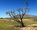
| no partners | | I wanted to look around another section of flat desert between Phoenix and Tucson. There are some primitive roads crisscrossing this area but I wasn't sure about access so I decided to walk from near Picacho Dairy Queen.
No problem getting across the train tracks but the barbed wire fence on the far side was tricky. (State trust fences were annoying all day but this one was the worst). A moat as well, but soon I hit open desert. Archaeologists studied this area ~40 years ago when surveying the CAP project and noted a lot of Hohokam signs. I saw not very much but I think a lot of the desert had been scraped in recent years.
I found one area with a lot of plain pottery and a few smaller areas on the way back. When I reached the canal I found a raised hump with some exposed bedrock with large round grinding holes. But that was about it. DQ was open but I social distanced. Got out of the house anyway. |
| _____________________
| | |
|
|
|
|
|
| |
 Route Editor


