username
X
password
register
for free!
help
ArticlesGuidesRoutes
 
Photosets
 
 Comments
triplogs   photosets   labels comments more
Levee Trail - MSP - 16 members in 97 triplogs have rated this an average 1.9 ( 1 to 5 best )
1, 2, 3, 4, 5  Next
97 triplogs
login for filter options
Dec 31 2024
avatar

 Routes 93
 Photos 7,758
 Triplogs 1,691

64 male
 Joined Mar 11 2003
 AZ
Quartz Trail - MSPPhoenix, AZ
Phoenix, AZ
Hiking avatar Dec 31 2024
wallyfrackTriplogs 1,691
Hiking8.20 Miles 954 AEG
Hiking8.20 Miles   2 Hrs   22 Mns   3.46 mph
954 ft AEG
 no routes
1st trip
Linked   linked  
Partners none no partners
A quick morning hike to get a few extra miles. Never had been to the Quartz Trail. The trails are good but close to housing so not a wilderness feel at all. Nice weather and easy hiking.
_____________________
  2 archives
Mar 08 2024
avatar

 Guides 59
 Routes 1,100
 Photos 1,191
 Triplogs 1,290

male
 Joined Jan 01 2023
 Arizona
Gateway Loop Trail - MSPPhoenix, AZ
Phoenix, AZ
Hiking avatar Mar 08 2024
pseudalpineTriplogs 1,290
Hiking6.17 Miles 898 AEG
Hiking6.17 Miles   1 Hour   59 Mns   3.22 mph
898 ft AEG      4 Mns Break
 
no photosets
1st trip
  2 archives
Feb 26 2024
avatar

 Guides 41
 Routes 1,626
 Photos 14,983
 Triplogs 2,760

69 male
 Joined Jan 20 2009
 Far NE Phoenix,
Thompson Peak Loop, AZ 
Thompson Peak Loop, AZ
 
Hiking avatar Feb 26 2024
The_EagleTriplogs 2,760
Hiking13.28 Miles 2,684 AEG
Hiking13.28 Miles   5 Hrs   14 Mns   2.68 mph
2,684 ft AEG      17 Mns Break6 LBS Pack
 
1st trip
Route Scout Route Recorded  on Route Scout | Pop | Map | Popup | MapDEX
A gorgeous overcast day with perfect temperatures all day, and some of the virga transformed to light drizzle for the 2nd half. Busy on the gateway loop, one MTB'er on the Prospector, and four descending Thompson Peak. After that, nobody.

The climb to the saddle where I went down off-trail was steep as always. Slow going on the steep downhill off-trail section to get to the Quartz Trail. I'm not a big fan of the Paradise Trail, but it helped me complete my loop.
_____________________
There is a very fine line between "hobby" and "mental illness."
Dave Barry 🦅
 
Dec 03 2023
avatar

 Guides 2
 Routes 207
 Photos 93
 Triplogs 204

male
 Joined Aug 08 2020
 Phx az
Bell Pass - Bell / 104th THPhoenix, AZ
Phoenix, AZ
 Hiking avatar Dec 03 2023
ScaredyCatTriplogs 204
 Hiking8.13 Miles 1,807 AEG
 Hiking8.13 Miles   3 Hrs   39 Mns   2.59 mph
1,807 ft AEG      31 Mns Break
 
no photosets
1st trip
Linked   linked  
Partners none no partners
Route Scout Route Recorded  on Route Scout | Pop | Map | Popup | MapDEX
Woah, strong Meetup turnouts 2 weeks in a row. That's a new one for me. This trek had been on my wish list for 2 years. Parked in neighborhood since this outing played a role in putting parking lot into overflow.

Stayed on Levee Trail for a while to avoid crowds. Briefly saw the masses but they quickly turned left where we continued up Bell Pass. Rocky and steep helps keep others away.

Continued past Bell Pass to the Prospector jct. This addition is all downhill and then back up on the way out. Strong group enabled us to finish early. Ball of right foot painful during late portion of hike and afterward. 😖
 
Oct 14 2023
avatar

 Routes 137
 Photos 1
 Triplogs 105

44 female
 Joined Oct 21 2016
 Tempe, AZ
Thompson Peak Rd - MSPPhoenix, AZ
Phoenix, AZ
Hiking avatar Oct 14 2023
MAPTriplogs 105
Hiking11.91 Miles 3,594 AEG
Hiking11.91 Miles   6 Hrs   17 Mns   1.93 mph
3,594 ft AEG      6 Mns Break
 
no photosets
1st trip
Thompson Peak Road is harrrrd. Holy moly that road is steep. We were pumped to get to see the solar eclipse but apparently we didn't know anything about how a solar eclipse works. :doh: We thought the sun would be gradually blocked over a period of time, giving us some relief (like clouds covering the sun) during our hike. Nope. We noticed maybe a little change of light around 9:30 am and that's it.

It was actually a pretty nice day but hot during our last few flat miles. We started from the 104th Street trailhead since all the other trailheads are gated and open later than we needed to start to be safe. Saw one runner returning from his run as we were going up toward Bell Pass. A bunch of people were going up Thompson Peak Road just ahead of us. Even kids. Impressive. Surprisingly, there were also a handful of people coming up as we came down and even more people hiking around Bell Pass & Gateway Loop. It was not a comfortable temperature to be starting a hike but maybe they were soaking up the 100 deg temps before they're gone for the winter. :)
_____________________
 
Jan 20 2023
avatar

 Guides 59
 Routes 1,100
 Photos 1,191
 Triplogs 1,290

male
 Joined Jan 01 2023
 Arizona
Adero Super Loop via 104th St, AZ 
Adero Super Loop via 104th St, AZ
 
Hiking avatar Jan 20 2023
pseudalpineTriplogs 1,290
Hiking22.44 Miles 4,328 AEG
Hiking22.44 Miles   6 Hrs   37 Mns   3.53 mph
4,328 ft AEG      16 Mns Break
 
1st trip
Route Scout Route Recorded  on Route Scout | Pop | Map | Popup | MapDEX
Not too shabby of a route. :| However, going CCW, once cresting onto the Sunrise saddlepoint, all that could be heard from below is the sounds of destruction! The traverse north on Andrew - Kinsey stays dispiriting until past the Adero Canyon junction. The sound of jet engine rumbling is also ever-present when climbing west back towards Bell Pass. This almost constant annoyance of sonic booms isn't as bad on this hike as when one hikes Windgate Pass or the western sections of the Tom's Thumb Trail. Three of five stars if I was to rate this as a standalone guide.
 Named place
 Named place [ checklist ]
[ checklist ]  East End
  14 archives
Jul 02 2022
avatar

 Guides 41
 Routes 1,626
 Photos 14,983
 Triplogs 2,760

69 male
 Joined Jan 20 2009
 Far NE Phoenix,
Bell Pass-Gateway Loop, AZ 
Bell Pass-Gateway Loop, AZ
 
Hiking avatar Jul 02 2022
The_EagleTriplogs 2,760
Hiking9.33 Miles 1,999 AEG
Hiking9.33 Miles   3 Hrs   23 Mns   2.84 mph
1,999 ft AEG      6 Mns Break5 LBS Pack
 
1st trip
Route Scout Route Recorded  on Route Scout | Pop | Map | Popup | MapDEX
Started from the 104th Street TH at 6am to cloudy, 88°, and sprinkles. The clouds held on for most of the hike, but it was a sweatfest working my way up to Bell Pass. At the top, with a slight breeze, it was comfortably cool.

A smattering of people out today enjoying the cloudy day. Including a heavyset, shirtless guy that was bragging to his buddy on his diet yesterday. "7 beers and a salad". A salad, really?

From the pass, back down and then CCW on the Gateway Loop.

I ran into @Sun_Ray /Brian and introduced myself. Quite a nice guy. It turned out to be his doppelganger in a, MMC blue shirt. ](*,)

92 and filtered sun to finish.
_____________________
There is a very fine line between "hobby" and "mental illness."
Dave Barry 🦅
 
May 15 2022
avatar

 Guides 1
 Routes 14
 Photos 7,202
 Triplogs 5,208

68 male
 Joined Mar 16 2008
 chandler,az
McDowell's Hike, AZ 
McDowell's Hike, AZ
 
Hiking avatar May 15 2022
johnlpTriplogs 5,208
Hiking13.93 Miles 3,360 AEG
Hiking13.93 Miles   4 Hrs   46 Mns   2.97 mph
3,360 ft AEG      5 Mns Break
 no routes
1st trip
Got an early start from the trailhead at Bell & 104th St. Lots of whippoorwills and owls calling out in the early dawn. Orange moon. Hiked up to Bell Pass then on to East End and up to Tom's Thumb trail. Didn't see anyone before Tom's Thumb.
There are still a few wildflowers around at higher elevation. Saw about ten different kinds.
I continued down Tom's Thumb trail west towards Gateway. The pipe from Mountain Spring is still dry. Maybe someday I'll try to repair it. By this point the gnats became very annoying.
After connecting with Windgate Pass trail, I took Gateway across and hooked back up with the Bell Pass trail, then Paradise, Levee and back to the TH.
Good to get back out in the McDowells. :)
wildflower observationwildflower observationwildflower observationwildflower observationwildflower observation
Wildflowers Observation Isolated
_____________________
“Good people drink good beer.” Hunter S Thompson
  2 archives
Mar 22 2022
avatar

 Guides 2
 Routes 2
 Photos 774
 Triplogs 70

66 male
 Joined Dec 02 2020
 Phoenix, AZ
Bell Pass - Bell / 104th THPhoenix, AZ
Phoenix, AZ
 Hiking avatar Mar 22 2022
TheHikingGolferTriplogs 70
 Hiking6.11 Miles 1,084 AEG
 Hiking6.11 Miles   2 Hrs   57 Mns   2.46 mph
1,084 ft AEG      28 Mns Break
 no routes
1st trip
Linked   linked  
Partners none no partners
Started from 104th St/Bell TH around 8:15am. Windy for most of the hike, clear views, warmed up as I hiked. I hadn't done Bell Pass before but had been in the Gateway area more than a few times. Took Levee Trail to Paradise and then to Bell Pass. Steady but gentle uphill climb. Lots of brittlebush with yellow flowers, plenty of chollas and saguaros. Lizards and a velvet ant sighting.

Light traffic on most of the route. Only passed about 6-7 people on Bell Pass. More when I came back on Paradise. Ran into a couple of older women who were Preserve stewards at the Bell Pass/Paradise junction and chatted with them for several minutes.
 Flora
 Flora [ checklist ]
[ checklist ]  Brittlebush
 Fauna
 Fauna [ checklist ]
[ checklist ]  Velvet Ant
wildflower observationwildflower observationwildflower observationwildflower observationwildflower observation
Wildflowers Observation Substantial
Brittlebush
 
Jan 10 2022
avatar

 Guides 2
 Routes 251
 Photos 4,593
 Triplogs 3,212

63 male
 Joined Feb 26 2008
 Scottsdale, AZ
Bell Pass - Bell / 104th THPhoenix, AZ
Phoenix, AZ
 Hiking avatar Jan 10 2022
BobPTriplogs 3,212
 Hiking8.50 Miles 2,275 AEG
 Hiking8.50 Miles
2,275 ft AEG
 
_____________________
https://www.seeitourway.org
Always pronounce Egeszsegedre properly......
If you like this triplog you must be a friend of BrunoP
 
Nov 08 2021
avatar

 Guides 21
 Routes 1,182
 Photos 36,858
 Triplogs 1,570

69 female
 Joined Feb 26 2004
 Phoenix, AZ
Gateway Loop Trail - MSPPhoenix, AZ
Phoenix, AZ
 Hiking avatar Nov 08 2021
tibberTriplogs 1,570
 Hiking5.17 Miles 767 AEG
 Hiking5.17 Miles   1 Hour   56 Mns   2.79 mph
767 ft AEG      5 Mns Break
 
Partners none no partners
Route Scout Route Recorded  on Route Scout | Pop | Map | Popup | MapDEX
got my new, as of April, three-crown bridge re-cemented for the third time... now they're talking root canal and post to hold the bridge on to my tiny teeth and you can't believe what I've already spent :o . Oh ya, the dentist is off of Mtn View in Scottsdale so I automatically plan to do a hike in the area.

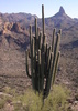
The appt went quickly so I was on the trail by 9:30ish. I started from 104th St where there was only 1 other car. I headed up the Levee Trail with a bit of a breeze. I saw three other hikers. When I got on the Gateway Loop, it was a highway :o and it was a Monday. I kept wondering if it was a holiday. The trail is much rockier in spots than I remembered. In fact, it gets down right annoying. I guess I'm spoiled with my Phx Preserve trails. Next time I'll do the further north or east Scottsdale trails. I did not enjoy this at all.

I struggled somewhat as my legs were still sore and the two week layoff was obvious. I hate having to work my way back up to my hiking comfort level. Oh well. And there were so many people; most said hello which was, at least, nice. It seems you can sure tell the difference between hiking in Phx vs Scottsdale as most people almost seemed dressed up. I started feeling out of place :lol: .

The people traffic continued until a little past the junction with the VC and then I had the trail to myself. I was glad to be done and like I said, I didn't remember it being that rocky so don't have any desire to come back here for awhile; especially with all the other options.

I just realized I've hiked the most miles I've ever hiked in a year. How 'bout that! Now I can officially say, "ain't retirement grand" :y:

WATCH: 5.12 miles (1711 low, 2420 high) 133 avg bpm, 169 max (28% at Max, 46% at Anaerobic, 25% at Aerobic) burning 783 calories (1.22 ascent, 1.3 descent) starting at 69.8 degrees and 31% humidity
_____________________
For me, sometimes it's just as much about the journey as the destination.
Oh, and once in awhile, don't forget to look back at the trail you've traveled.
  1 archive
Sep 20 2021
avatar

 Routes 175
 Photos 2,335
 Triplogs 191

44 female
 Joined Jan 21 2019
 Pine, AZ
McDowell sunset stroll, AZ 
McDowell sunset stroll, AZ
 
Hiking avatar Sep 20 2021
jillyonanadventureTriplogs 191
Hiking3.00 Miles 344 AEG
Hiking3.00 Miles   1 Hour      3.00 mph
344 ft AEG
 no routes
1st trip
Partners none no partners
Quick sunset loop hike in the McDowells. Took Levee trail to gateway then looped back to the 104th street trail. Stunning sunset tonight!
_____________________
Restless between adventures...
  1 archive
Jul 05 2021
avatar

 Guides 1
 Routes 14
 Photos 7,202
 Triplogs 5,208

68 male
 Joined Mar 16 2008
 chandler,az
Windgate Bell LoopPhoenix, AZ
Phoenix, AZ
Hiking avatar Jul 05 2021
johnlpTriplogs 5,208
Hiking10.80 Miles 2,375 AEG
Hiking10.80 Miles   3 Hrs   50 Mns   2.89 mph
2,375 ft AEG      6 Mns Break
 no routes
Early start from 104th St. No headlamp necessary. Got up to Bell Pass a little after sunrise to find clouds to the east, so we got to hike without direct sunlight pretty much the whole hike. Humid but once we got to Bell Pass there was a breeze to dry us off. The trails are dust free and compacted from recent rain. Good hike. Thanks for breakfast after Kelly. :)
_____________________
“Good people drink good beer.” Hunter S Thompson
 
Jul 05 2021
avatar

 Guides 10
 Routes 673
 Photos 7,281
 Triplogs 4,660

67 female
 Joined Nov 17 2008
 phoenix, az
Windgate Bell LoopPhoenix, AZ
Phoenix, AZ
Hiking avatar Jul 05 2021
trekkin_geckoTriplogs 4,660
Hiking10.80 Miles 2,375 AEG
Hiking10.80 Miles   3 Hrs   50 Mns   2.89 mph
2,375 ft AEG      6 Mns Break
 
john and i decided to hike in the mcdowells this morning
did the bell windgate loop from 104th street
actually had to park across the street since the trailhead was still blocked off from july 4th
got going around 0415
levee and connector trails to gateway loop, then bell pass, windgate pass, back on gateway loop, paradise and levee
no one else on the trails until coming down from windgate pass
had cloud cover the entire hike
highlight of the morning was breakfast at butters :)
good find, john
double digits with good company
_____________________
hazhole
 
Mar 21 2021
avatar

 Routes 174
 Photos 471
 Triplogs 184

51 male
 Joined Mar 16 2019
 Phoenix
Windgate Bell LoopPhoenix, AZ
Phoenix, AZ
Hiking avatar Mar 21 2021
AugustWestTriplogs 184
Hiking10.74 Miles 2,277 AEG
Hiking10.74 Miles   4 Hrs   4 Mns   2.77 mph
2,277 ft AEG      11 Mns Break
 
1st trip
Route Scout Route Recorded  on Route Scout | Pop | Map | Popup | MapDEX
Met a group of friends at 6 AM at the dirt lot just off 104th. Still a few spots at that hour. It is still in the upper 50's before sunrise and it was pretty darn nice all day. This was my first trip in this part of the McDowell's and we traveled CCW.

Altogether this was a pretty, but uneventful loop. Very few flowers except some Brittlebush that didn't look too healthy. We didn't see people until about 3/4 of the way through the loop and then it was a deluge. Everyone was nice and happy to be out on such a pleasant day.

I think my preference is for something involving Sunrise Mountain and Canyon for a McDowell Mountains trip, but this was a nice way to spend a Sunday.
wildflower observationwildflower observationwildflower observationwildflower observationwildflower observation
Wildflowers Observation Isolated
_____________________
Wildflower seed in the sand and wind
May the four winds blow you home again
 
Feb 14 2021
avatar

 Guides 1
 Routes 14
 Photos 7,202
 Triplogs 5,208

68 male
 Joined Mar 16 2008
 chandler,az
Thompson Peak, AZ 
Thompson Peak, AZ
 
Hiking avatar Feb 14 2021
johnlpTriplogs 5,208
Hiking14.91 Miles 3,780 AEG
Hiking14.91 Miles
3,780 ft AEG      9 Mns Break
 no routes
I haven't hiked up to Thompson Peak in quite a few years. Nice day for it.
Got going at first light from 104th St TH. Beat the crowds on Gateway and up to Bell Pass. Only saw 6 people until I returned to Bell Pass on the way back.
One trail runner I saw three times. Once when he passed me going up Bell Pass, once when I was ascending Thompson Peak (he was descending), and finally as I was descending Thompson Peak he was making his second ascent!
The McDowells got some rain last night. A little petrichor in the air. Looked Like Mt Ord and Four Peaks got a little snow. Great workout. :)
_____________________
“Good people drink good beer.” Hunter S Thompson
 
Jan 31 2021
avatar

 Guides 4
 Photos 2,275
 Triplogs 128

male
 Joined Jan 16 2004
 Chandler, AZ
Thompson Peak-East End via 104th St AZ, AZ 
Thompson Peak-East End via 104th St AZ, AZ
 
Hiking avatar Jan 31 2021
AZOutdoorsmanTriplogs 128
Hiking20.40 Miles 5,398 AEG
Hiking20.40 Miles   7 Hrs   23 Mns   3.11 mph
5,398 ft AEG      50 Mns Break18 LBS Pack
 no routes
1st trip
Another training hike (with some light jogging). I borrowed the name and stats from Bifrost who did this same loop+ and posted a GPS route on 10/21/17. Looks as though he enjoys big loops too - thank you sir. Started at the 104/Bell TH - Levee - Bell Pass - Prospector - Thompson/Towers - Dixie Mine - Coachwhip - Windmill - East End - Tom's Thumb - Windgate - Gateway Loop - 104th St Spur.

Anyway, was a nice day to be in the McDowells - albeit a little warm. Was surprised by the number of people on the short section we shared near Tom's Thumb. One guy coming down the trail even through his hands up in the air and stopped in the middle as I was coming at him, as if to say WTF. Without breaking stride as I cleanly skirted around him, I nicely explained that, "you yield to hikers going uphill, that is how you hike." I got a, "yes, that's what I thought" from a group behind him. I accept that many on these short, popular, urban trails are ignorant to the concept of hiking etiquette, and I wouldn't have said anything had he not thrown up his hands - oh well. The few that I did encounter more than a few miles from a TH were nice and knew proper etiquette. All in all, another great day in the "wilds" of AZ! : )
_____________________
 
Jan 31 2021
avatar

 Guides 13
 Photos 15,617
 Triplogs 323

male
 Joined Oct 23 2010
 mesa
Windgate Bell LoopPhoenix, AZ
Phoenix, AZ
Hiking avatar Jan 31 2021
gummoTriplogs 323
Hiking10.60 Miles 1,967 AEG
Hiking10.60 Miles   4 Hrs   28 Mns   2.47 mph
1,967 ft AEG      11 Mns Break4 LBS Pack
 no routes
Partners none no partners
It wasn't as crowded as I thought. Car issues kept me local this weekend. I would have preferred to hike in snow. Lots of side-blotched lizards though. No photos.
_____________________
  1 archive
Jan 28 2021
avatar

 Routes 175
 Photos 2,335
 Triplogs 191

44 female
 Joined Jan 21 2019
 Pine, AZ
McDowell mines, AZ 
McDowell mines, AZ
 
Hiking avatar Jan 28 2021
jillyonanadventureTriplogs 191
Hiking3.52 Miles 544 AEG
Hiking3.52 Miles   2 Hrs   8 Mns   1.75 mph
544 ft AEG      7 Mns Break
 
1st trip
Route Scout Route Recorded  on Route Scout | Pop | Map | Popup | MapDEX
I don’t have as much time to adventure on weekdays anymore, so I’ve been creating my own little mini adventures 5 minutes away. I headed up to check out the mine I spotted on my prior hike this week. Surprisingly, there was a pretty decent path heading up there. The mine was huge and very interesting. There was a date (July 30, 1917) on a foundation area next to the mine. Past the mine, the faint path continued and headed right up to a mini peak that I’ve enjoyed chips n salsa on before! I decided to head up to the other mini peak above that one and it had a great view. I did see spray paint {explicit} up there and that wasn’t cool...don’t bring your kids! It was way too windy on that peak to watch sunset, so I started heading down and passed the other mine on the way back. The skies were amazing, and I was away from the masses and very content. I found my next target, which is a numbered peak above the other two. Gotta love finding new things to see in your backyard.
 Culture
 Culture [ checklist ]
[ checklist ]  Old Rusty Stuff
_____________________
Restless between adventures...
 
Jan 26 2021
avatar

 Routes 175
 Photos 2,335
 Triplogs 191

44 female
 Joined Jan 21 2019
 Pine, AZ
Mcdowell stroll, AZ 
Mcdowell stroll, AZ
 
Hiking avatar Jan 26 2021
jillyonanadventureTriplogs 191
Hiking3.64 Miles 369 AEG
Hiking3.64 Miles   1 Hour   39 Mns   2.21 mph
369 ft AEG
 
Partners none no partners
Route Scout Route Recorded  on Route Scout | Pop | Map | Popup | MapDEX
I carved out a little time to check out the snowy Mcdowells. Although it was more prime Monday, I was happy to see that some remained. Started at 104th street, to levee, then popped on gateway for a hot second. I immediately saw loud hikers and a shirtless runner :roll: , so I headed up the start of bell pass (mostly to get a better look at Thompson peak). I didn’t have enough time for a longer hike, so I kinda created my own loop with some off trail areas to have more solitude. Spotted another mine I want to check out soon!
_____________________
Restless between adventures...
 
average hiking speed 2.59 mph
1, 2, 3, 4, 5  Next

WARNING! Hiking and outdoor related sports can be dangerous. Be responsible and prepare for the trip. Study the area you are entering and plan accordingly. Dress for the current and unexpected weather changes. Take plenty of water. Never go alone. Make an itinerary with your plan(s), route(s), destination(s) and expected return time. Give your itinerary to trusted family and/or friends.

helpcommentissue

end of page marker