|
| | | |
| |
|
| Hiking | 5.50 Miles |
1,175 AEG |
| | Hiking | 5.50 Miles | 5 Hrs | | 1.57 mph |
| 1,175 ft AEG | 1 Hour 30 Mns Break | 15 LBS Pack | | |
|
|
| |
| Partners |
|
none
[ show ]
| no partners | | Started on this Hike around noon. Was enjoying my campsite at Grand View too much in the morning and got a late start. By the time I hit the TH it was pretty overcast and seemed like it was threatening to rain. At the Columbine Campground where both the Webb Peak and Ash Creek Th's are, I ran into a couple that had been getting ready to backpack Ash Creek Trail. According to the Bulletin Board at the Campsite, the Ash Creek Trail was closed, due to the Fire that had been burning the week before. It was the couple's first time in the Pinalenos, and they had found the Hike through HAZ and the recent Triplogs from the Bartel/Eagle/Tortoise Expedition. They decided to cancel that Hike due to the closure and we talked for a few minutes about other Backpack and Camping options for them. They decided that the Webb Peak Hike that I was going to do sounded good for a day hike. My plan was to do the Big Loop, Ash Creek Trail to the Webb Peak Trail, up to the Peak, down the Service Road and back to the car via the Swift Trail.
I started down the Ash Creek Trail, making pretty good time until I got to the bottom of the hill. Then the "tibber mode" kicked in and I slowed considerably. The couple from the Campground caught up to me, passed me, and I never saw them again....  The Ash Creek Trail at the bottom, once you leave the heavily wooded area, is the epitome of Lush!!! Wow! Once you hit the Creeks, the vegetation is very thick, green and the wildflowers were really starting to kick it into gear. It was so lush, most of the time you couldn't even hardly see the Creeks themselves. And the blooms! Many different varieties of flowers were now blooming, creating an amazing pallet of colors.... The Ash Creek Trail at the bottom, once you leave the heavily wooded area, is the epitome of Lush!!! Wow! Once you hit the Creeks, the vegetation is very thick, green and the wildflowers were really starting to kick it into gear. It was so lush, most of the time you couldn't even hardly see the Creeks themselves. And the blooms! Many different varieties of flowers were now blooming, creating an amazing pallet of colors.... 
I came to the intersection with the Webb Peak Trail and took off down it. Now I was in virgin territory and it was a very pretty and scenic Hike. Of course, the AEG you lost going down Ash Creek was made up here in the first 3/4 of a mile, but then it flattened out for a little ways and you were strolling through meadows of wildflowers with an occasional peek at the Overlook views to come....Of course with all of the Wildflowers blooming, I had many a Butterfly to keep me company as well....
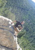
I took a small break before the last big ascent up to the Peak and just enjoyed the surroundings. The last 3/4 mile up to the Peak is a pretty steep ascent, but I managed it, despite the rough time the elevation sometimes gives me. It kept threatening to rain, but so far I was getting lucky in that regard, and then, there I was, at the Peak!!! There is a Cabin, what looked to be an Outhouse, and a Fire Tower here. The Cabin didn't look too inhabitable, but I called out anyway, in case there was someone working the Tower. No one answered, and after taking a few pics, it was up to the Tower. No one appeared to be there either, but the door to the Tower was open and there were no signs saying No Entry, so up I went. My first time in a Fire Tower!!!
It was a very small Tower and I made the mistake of climbing it with my Pack on. I had to take off my Pack just to fit through the door!!  And then I was in! Very small and from what I could see, it appeared that this Tower, along with the Cabin, are no longer in use. And it looked like everyone who showed up here used the inside of the Tower as their Summit Log. It was full of grafitti and etched names everywhere. I never did find a "true" Summit Log, in the Tower, or at the bottom, but I didn't feel comfortable leaving a mark in the Tower, so I skipped that step completely. I spent a little time up there, taking pics and sending a few picture texts to my friends, since it was the first time I had had Cell Phone Service in the last 24 hours. Enjoyed the views immensely, even though with the Clouds, the distant views were hazy.... And then I was in! Very small and from what I could see, it appeared that this Tower, along with the Cabin, are no longer in use. And it looked like everyone who showed up here used the inside of the Tower as their Summit Log. It was full of grafitti and etched names everywhere. I never did find a "true" Summit Log, in the Tower, or at the bottom, but I didn't feel comfortable leaving a mark in the Tower, so I skipped that step completely. I spent a little time up there, taking pics and sending a few picture texts to my friends, since it was the first time I had had Cell Phone Service in the last 24 hours. Enjoyed the views immensely, even though with the Clouds, the distant views were hazy....
I climbed down from the Tower, rested a little and ate some lunch, then proceeded to start down the Service Road back to the car. I got to the end of the Service Road at the Swift Trail, and became a little confused and got a little turned around. I was thinking that the Road came out right at the Soldier Creek Campground, but instead it came out at the Soldier Camp Campground turnoff. I couldn't remember where this intersection was in relation with Soldier Creek and Columbine. I was in a bowl, so either way, right or left, was going to be uphill.... I had forgotten to put the map in my pack, so I ended up flipping a coin in my head and went right. After about 1/2 mile uphill, I came to Big Rock and knew that I had lost the coin toss...  Soooo, I turned around, went back down the hill and proceeded to climb the next hill, going the other way, which was correct, and that got me back to the Columbine Campground and my car. Soooo, I turned around, went back down the hill and proceeded to climb the next hill, going the other way, which was correct, and that got me back to the Columbine Campground and my car.
Nice workout Hike, great Trails, and awesome Scenery!! And to top it off, Mother Nature was kind and I never did get rained on even though she threatened just about all day. Went back to my Campsite at Grand View Peak and a little later, enjoyed a gorgeous Sunset. It was a very good day!!! |
|
Wildflowers Observation Moderate
|
|
| _____________________
| Life is not a journey to the grave with the intention of arriving safely in a pretty & well preserved body, but rather to skid in broadside, totally worn out & proclaiming, "Wow What a Ride!" |
| | |
|
|
|
 Route Editor


 A good portion of Moonshine is torn up from a tree trimming project, however, I was able to get to the falls area and found it to be a nice little side trip. I saw a few cars during the road walk from Grant to Goudy, but no other hikers or runners the rest of the day. With Graham being illegal I settled for Webb. It was nice to hit 10,000 feet after starting the day at 5400. I considered "Chestley" Flats on my way down from Webb, but had to keep Cup and mind and just decided to head for the Xterra.