|
| | | Chiricahua traverse loopy thing, AZ | | | |
|
|
Chiricahua traverse loopy thing, AZ
| | |
| |
|
| Backpack | 24.96 Miles |
5,755 AEG |
| | Backpack | 24.96 Miles | 52 Hrs 40 Mns | | 0.65 mph |
| 5,755 ft AEG | | 28 LBS Pack | | |
|
|
| |
| Partners |
|
none
[ show ]
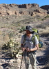
| no partners | | For months I'd wanted to do this loop around the Chiricahuas. Well, years really. About 25 years ago I had my first backpacking trip ever, and it was up Saulsbury Trail during Spring Break with a couple college friends. We had ridiculously heavy packs by today's standards, were woefully unprepared and out of shape, started late, didn't get a weather report, got caught in a snowstorm on a windy saddle for the first night, and generally had a blast. On that trip we barely made it to Round Park on a quest to a fabled place called Booger Spring, and I don't even remember if we made it there. But that trip is what kindled my love of the Chiricahuas and of backpacking in general, and I finally had the opportunity to do a nostalgic trip up Saulsbury.
The Drive
The drive to the trailhead is mostly pretty good; Turkey Creek Road is unpaved but well-graded. It does get rocky in places with a couple creek crossings that will have water in wet times of year, but nothing a brave driver in a Honda Fit can't handle. The spur road to Saulsbury Trailhead, however, is definitely high-clearance mandatory. No trouble in my trusty old '98 CR-V (I have a 1" lift and all-terrain tires, but I think a stock Subaru and skilled driver would make it fine). I did pass an ATVer who looked very surprised to see me, which is always fun. It was very bumpy, and if it wasn't so short I'd have aired my tires down.
Saulsbury Trail
I had my friend Lisa as a partner, and we started at Saulsbury around 9am. It was pretty cloudy, and stayed cloudy all day, which was nice to keep temperatures down and mitigate the risk of a thunderstorm.
Saulsbury is a really beautiful trail and largely clear and easy to follow, with only short sections through old burn scars. The drainage in Saulsbury Canyon had a few pools and trickles here and there for the length of the canyon, though we had brought plenty of water to get us to the Crest. There were lots of ripe raspberries, too! So many, something just had to be done about them...
We did have two issues on this trail. The first was at a broad creek crossing about halfway to Saulsbury Saddle, where the trail was a bit faint and we took a wrong turn up the drainage. It took us a while to realize we were off-trail and some bushwhacking to get back on. This was more hiker error than an issue with the trail, but I did go back down to where we messed up and put up a cairn.
The second issue was higher up, above the saddle in a burn scar. The trail abruptly ended at a huge fallen tree that had slid down the mountain and taken the trail with it. There was a faint workaround that ended in a gully that had flooded and also taken the trail with it. Across the gully you could faintly see what might have been the original trail, but it was completely choked with Locust trees (which are thorny buggers). The trail conditions were so bad that we at first thought the trail may have been rerouted and we somehow missed it, but after some scouting around we realized the trail did indeed go through the thicket of Locust trees. Fortunately it wasn't a great distance before we were back in pristine old-growth pines, but we actually had to crawl on our hands and knees in places to get through. I really should bring some clippers every time I hike in the Chiricahuas, but they are so darn heavy!
Shortly after that obstacle we came to the place where I'm 90% sure I and my college friends had camped 25 years ago and got snowed on. Saulsbury is a relentless uphill slog in a heavy pack, and we had started late and pooped out before getting to the Crest that day.
The trail had changed a fair amount from my memories. When I first went it was just after the Rattlesnake Fire, and I remember seeing a lot of devastation in stretches above Saulsbury Saddle. I thought of it as "The Desolation of Smaug". Now those burned areas have largely recovered and the pine forest is returning. The trail doesn't seem to have been as badly affected by the Horseshoe II fire as other parts of the Chiricahuas.
The rest of the hike to the Crest was remarkable for its scenery and fantastic views, but not for poor trail conditions.
Round Park
The Saulsbury Trail takes you to the Crest through pine forest just north of Round Park, which is an open grassy meadow with wildflowers. It is recovering from the Horseshoe II fire, so there are some dense thickets of aspens and lots of young pines on the periphery. It looks like a beautiful camping area now, with great views to the west and proximity to Booger Spring, though I wouldn't camp here if there was a lot of wind or storms. This section of Crest is also pretty heavily used (by Chiricahua standards).
We came to Round Park about 3 in the afternoon. We considered a side trip to Booger Spring to tank up, but we were planning to camp at Cima Cabin not far away and expecting water there. So we pressed on, snacking on raspberries the whole way.
Cima Saddle
The next big junction on the Crest south of Round Park is Cima Park, which had been heavily wooded by old growth trees before the big fire. Now it is a carpet of downed trees, a few snags, and a lot of young pines and aspens. There is a lovely camping spot just south of the junction with the Greenhouse Trail. For the most part it is a lovely area despite the evidence of the fire, and is recovering beautifully.
We turned down Greenhouse to head to Cima Cabin, a Forest Service cabin built in the 30s and still used today by fire and trail crews.
Cima Cabin
The cabin is about a quarter mile (ish) from the saddle. I'm not sure how often it gets used, but I've never seen anyone there before and we didn't on this trip, either. When we arrived, we noticed some roof damage. A huge tree on the west side of it had come down, landed on the roof, and rolled off the side of the building. There was quite a bit of damage including branches sticking out of the roof; it looked like a big repair job. The Forest Service is undoubtedly aware as the massive trunk had been limbed and there was a large slash pile nearby. We hope the building will be repaired as it is historically significant.
There is a very well-kept outhouse at the cabin, and Cima Creek is a reliable water source. There's also plenty of room for tents. There are also mice, so mind your food and other smelly items.
We enjoyed the evening at camp and were off to bed at sunset. It rained lightly shortly after we retired, and we were roused by more light rain in the morning. It was completely overcast and cool.
Friday we rose, had breakfast, and put together our day packs for some exploring. We decided to check out Anita Park, summit Chiricahua Peak, check out Aspen Saddle, and visit Eagle Spring. At some point in the day we expected to rendezvous with our friend Keith somewhere around the cabin.
We headed south on Crest. This section of trail had seen very recent tread work, and it was like hiking on a superhighway. We deeply appreciated the hard work that trail crews have done to make the Chiricahuas more accessible!
Anita Park
Heading south on Crest from Cima is Anita Park, which back in the day was an idyllic backpacking destination. It was a beautiful meadow amongst old-growth pine, with easy access to water at Anita Spring, and close to Chiricahua Peak. Alas the Horseshoe II fire obliterated it, and the pines are almost all gone, either snags or burnt logs on the ground. The sign marking where the Anita Spring trail leaves the Crest trail is lying on the ground in pieces, and the Anita Spring trail itself is faint and easy to miss. It is followable and we took it to see what we could see.
Anita Park itself is actually recovering, with a beautiful meadow ringed with aspens and young pines. A few snags still stand as reminders of horrors past. The trail passes the meadow and enters the old forest, which is still a sea of devastation. Many standing dead trees and almost none alive. The trail is cairned but there is still a bit of deadfall to traverse, with much more to come in time. I had hopes the spring would be serviceable, as there were good reports as recently as May of this year, but what we found was disappointing. The drainage has water in it, but it seems new deadfall has covered the catchment, or it has silted in completely, or it simply was concealed by rampant overgrowth. Regardless, we couldn't find it. The pools were so shallow that Lisa couldn't use her pump filter, and it wasn't practical to use a water bottle or scoop. Overall the water source was kind of depressing.
As we hiked out, the cloud decks lowered and shrouded the landscape in mist, making the fields of standing dead trees look ghostly.
Junction Saddle
Not far past Anita Park is Junction Saddle at the base of Chiricahua Peak. From here the Crest trail splits; Crest #270B heads west to Chiricahua Saddle, Crest #270C heads south to Aspen Saddle. There is also the Chiricahua Peak trail that heads to the summit, which we took. This trail was also clear and easy to follow, with no deadfall and great tread. It does traverse a significant burn scar but it is thick with aspens and quite lovely.
Chiricahua Peak
You can't see much at the peak on a clear day as it is densely forested, and today it was shrouded in cloud as well. We sat down at the peak, signed the log, and ate some snacks.
Maps show the Chiricahua Peak trail descending to Aspen Saddle as well as Junction Saddle. However, the segment to Aspen Saddle appears to be completely abandoned and there is barely any evidence of it left. So we just walked down the mountain to the saddle as best we could, and it was a pretty easy bushwhack.
Aspen Saddle
This is a favorite camping area with a few token old-growth trees still standing in a small grove with young pines on either side. We've camped here several times. The nearest good water source is Ojo Agua Fria, though the last time I was there it wasn't much better than Anita Spring. It's in a badly burned area and prone to silting in and getting choked with deadfall. It's also a steep climb down and back out. We've found at times Eagle Spring is easier to access. It's further away but with no appreciable elevation change.
Eagle Spring
We decided to check out Eagle Spring, which is a ways south of Aspen Saddle. The Crest from Aspen south hasn't been maintained in a while so the tread is faint, but there's no deadfall or major obstacles. The views along this segment of the Crest are spectacular, some of the best in the range. As we progressed the clouds broke and revealed Rucker Canyon, with clouds spilling over Chiricahua Peak. It was glorious.
Eagle Spring is signed and just off the trail, with a steep trail down to it. It consists of a concrete box with lid, and an overflow basin. The lid was mostly buried despite a check dam constructed above it, and the overflow was mostly silted in and slimy, so the spring is in need of a little TLC. I tried to clear the dirt to get the lid open but was not successful at getting the lid unstuck. I did discover that a corner of the lid had broken off in the past, exposing a hole large enough for Lisa to drop her pump into the spring box. She easily filled up and the water was great.
We returned to Cima Cabin more or less the way we came, the only exception was taking Crest from Aspen to Junction Saddle. That stretch of trail is densely wooded with aspens punctuated by standing old-growth pines, and a joy to walk.
Keith arrived at Cima Saddle just after we did, and we all went down Greenhouse to the cabin together. Keith set up his hammock and we had a pleasant rest in the afternoon as the clouds dissipated and brought some sunshine into the day.
Saturday was departure day. Keith and Lisa were to hike out to Rustler Park together, while I would return to my car solo along Crest #270B to Pole Bridge. It was a clear, sunny day. Keith had gotten a weather report on his Garmin which suggested afternoon thunderstorms were likely.
Crest #270B
Keith and Lisa accompanied me to Junction Saddle, where we parted ways. I saw three turkeys take flight in front of me as I rounded Chiricahua Peak. As I approached Chiricahua Saddle I spotted an empty tin can recently dropped by another hiker, so I collected it.
As I approached Paint Rock I passed a couple enthusiastic young hikers who were enjoying their first time in the Chiricahuas. They warned me there was a rattlesnake ahead, but I never saw it.
At Paint Rock I observed some rather dark cumulous clouds forming over Rucker Canyon. I had a few miles ahead of me so it motivated me to keep moving.
Between Paint Rock and Raspberry Peak I came across a crime scene that made me livid. Someone had built a campfire in the middle of the trail, and it was full of trash: empty cans of beans, half-burnt styrofoam and plastic meat packaging, a full container of burnt stovetop popcorn, and even a pizza pan.   The offenders had pathetically covered the mess with large pieces of tree bark, which wildlife had scattered while investigating all the food residue. I will never understand what sort of inconsiderate stupidity that some people are capable of. I considered trying to clean up the mess but had no realistic way to pack it all out. I felt guilty the whole way down the mountain. The offenders had pathetically covered the mess with large pieces of tree bark, which wildlife had scattered while investigating all the food residue. I will never understand what sort of inconsiderate stupidity that some people are capable of. I considered trying to clean up the mess but had no realistic way to pack it all out. I felt guilty the whole way down the mountain.
Update: I reported the crime scene to the Forest Service, who forwarded the report to law enforcement. They suggested it was a migrant resupply.
I was marginally cheered by impressively-sized ripe raspberries along the trail as it approached aptly-named Raspberry Peak.
Monte Vista Lookout
I took the spur trail to the Monte Vista fire lookout when I came to it. There is a cabin and outhouse there along with the metal lookout tower. It was still clear, but the puffy clouds over Rucker Canyon were getting bigger. I observed the elaborate lightning rod and ground wires on the cabin, and imagined what it might be like to be staying at the cabin during monsoon season. Sign me up... not!
There was an old-timey scale hanging on the porch for weighing packs, so I weighed mine. It was 24 pounds, which meant I ate about 6 pounds of food over the last couple days.
Morse Saddle
This saddle appeared to have a lot of blown down trees blocking the trail for anyone continuing west to Pole Bridge trail. A large live tree had blown over recently; at first glance it looked like over a dozen trees were over the trail, but after traversing the big one it was evident the others had already been cut.
The trails past Morse Saddle are less maintained and a bit in need of a haircut and a little tread work, but they are quite followable.
Pole Bridge Trail
This is now one of my favorite trails in the Chiricahuas, if only because of its variety. It can roughly be divided into an upper and lower part, separated by the junction with John Long trail at Pole Bridge Saddle. I'd done a loop in the past, going up Pole Bridge from Turkey Creek and returning via Morse Canyon trail. At that time it was very wet and there was a lot of water in Pole Bridge Canyon, making for a marvelous riparian hike in the lower section. This time I was descending Pole Bridge, which is quite steep, and the canyon was bone dry except for two or three very shallow stagnant pools. That was unfortunate as I'd hoped there was water. I had very little left at this point.
Heading Home
I reached the road and started to make my way back to the car. There's no established connector to Saulsbury Trailhead from any of the other trails originating in Turkey Creek, other than walking the road, so I bushwhacked. As I approached my car I heard the first peals of thunder for the afternoon storms, which were by now substantial but moving east off the Crest and no threat to me.
On the trip home I had to drive through two major thunderstorms, one outside of Pearce and the other just past Benson on the I-10. On that stretch the rain was coming down so hard that traffic slowed to about 40mph and some cars even pulled off completely. When I put my wipers on high, the linkage broke and then I had no wipers.  Fortunately the water was beading up on the windshield and flying off enough that I could still see. I made it home by 4, which also happened to be beer-o'clock. Fortunately the water was beading up on the windshield and flying off enough that I could still see. I made it home by 4, which also happened to be beer-o'clock. 
Another fantastic trip in the Chiricahuas, my happy place in the world. I'm already thinking about the next one! |
|
Wildflowers Observation Moderate
Flowers pretty much everywhere there is a little sun. |
|
 |
Pole Bridge Canyon |
Dry |
Dry |
| |  Well there were two or three stagnant pools but not useful, which is too bad because I was quite thirsty. Well there were two or three stagnant pools but not useful, which is too bad because I was quite thirsty. |
  |
Saulsbury Canyon |
Pools to trickle |
Pools to trickle |
| | | Pools all along the trail, easy to collect and filter. | | | |
|
|
|
 Route Editor


 . Cool. The summits were all nice but the better views were actually on the trails along the way. Linda had 4 peak options but I only had 3 in me. Still a nice outing and the conversation and banter were quite enjoyable!

 Thanks to Linda for planning and driving and Wally for getting up so early and joining us! Like HAZ , you two rock!!


